|
Gouwestreek
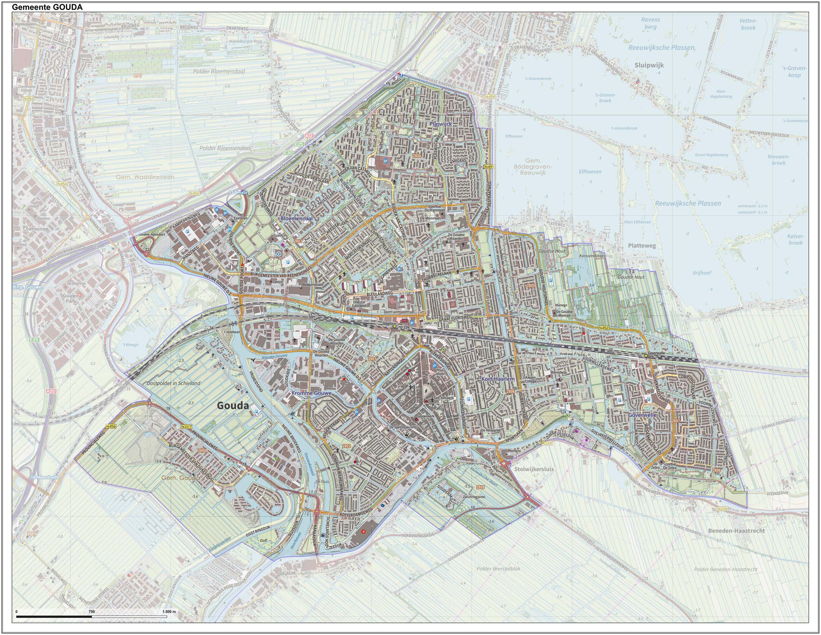
The ''Gouwestreek'' (, a Dutch word meaning the "Gouwe area") is the area around Gouda in the province of South Holland in the Netherlands. "Gouwe" refers to the (now canalised) river Gouwe, which runs through Gouda. The Gouwestreek is not an official or precisely defined region, but generally speaking it includes the following municipalities: * Bodegraven-Reeuwijk * BoskoopSince 2014 part of Alphen aan den Rijn. * Gouda * Waddinxveen * Zuidplas Zuidplas () is a municipality in the Netherlands located in the province of South Holland. It was established on 1 January 2010 by the joining of Moordrecht, Nieuwerkerk aan den IJssel, and Zevenhuizen-Moerkapelle. It had a population of 41,753 as ... References External links Map of Gouwestreek on Google Maps Regions of the Netherlands Regions of South Holland Gouda, South Holland {{SouthHolland-geo-stub ... [...More Info...] [...Related Items...] OR: [Wikipedia] [Google] [Baidu] |
South Holland
South Holland ( nl, Zuid-Holland ) is a province of the Netherlands with a population of over 3.7 million as of October 2021 and a population density of about , making it the country's most populous province and one of the world's most densely populated areas. Situated on the North Sea in the west of the Netherlands, South Holland covers an area of , of which is water. It borders North Holland to the north, Utrecht and Gelderland to the east, and North Brabant and Zeeland to the south. The provincial capital is the Dutch seat of government The Hague, while its largest city is Rotterdam. The Rhine-Meuse-Scheldt delta drains through South Holland into the North Sea. Europe's busiest seaport, the Port of Rotterdam, is located in South Holland. History Early history Archaeological discoveries in Hardinxveld-Giessendam indicate that the area of South Holland has been inhabited since at least c. 7,500 years before present, probably by nomadic hunter-gatherers. Agriculture and perman ... [...More Info...] [...Related Items...] OR: [Wikipedia] [Google] [Baidu] |
Gouda, South Holland
Gouda () is a city and municipality in the west of the Netherlands, between Rotterdam and Utrecht, in the province of South Holland. Gouda has a population of 75,000 and is famous for its Gouda cheese, stroopwafels, many grachten, smoking pipes, and its 15th-century city hall. Its array of historic churches and other buildings makes it a very popular day trip destination. In the Middle Ages, a settlement was founded at the location of the current city by the Van der Goude family, who built a fortified castle alongside the banks of the Gouwe River, from which the family and the city took its name. The area, originally marshland, developed over the course of two centuries. By 1225, a canal was linked to the Gouwe and its estuary was transformed into a harbour. City rights were granted in 1272. History Around the year 1100, the area where Gouda now is located was swampy and covered with a peat forest, crossed by small creeks such as the Gouwe. Along the shores of this st ... [...More Info...] [...Related Items...] OR: [Wikipedia] [Google] [Baidu] |
Netherlands
) , anthem = ( en, "William of Nassau") , image_map = , map_caption = , subdivision_type = Sovereign state , subdivision_name = Kingdom of the Netherlands , established_title = Before independence , established_date = Spanish Netherlands , established_title2 = Act of Abjuration , established_date2 = 26 July 1581 , established_title3 = Peace of Münster , established_date3 = 30 January 1648 , established_title4 = Kingdom established , established_date4 = 16 March 1815 , established_title5 = Liberation Day (Netherlands), Liberation Day , established_date5 = 5 May 1945 , established_title6 = Charter for the Kingdom of the Netherlands, Kingdom Charter , established_date6 = 15 December 1954 , established_title7 = Dissolution of the Netherlands Antilles, Caribbean reorganisation , established_date7 = 10 October 2010 , official_languages = Dutch language, Dutch , languages_type = Regional languages , languages_sub = yes , languages = , languages2_type = Reco ... [...More Info...] [...Related Items...] OR: [Wikipedia] [Google] [Baidu] |
Gouwe (river)
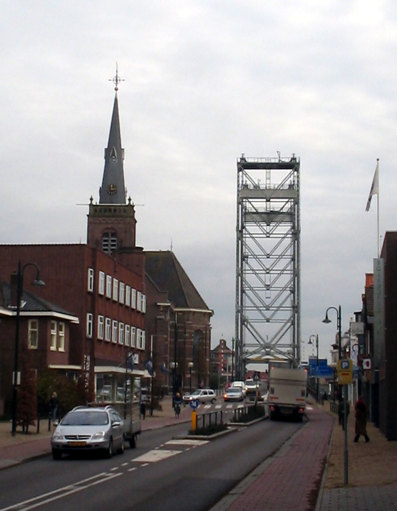
The Gouwe is a channelized river in South Holland, the Netherlands. It runs in a north–south direction from the Oude Rijn to the Hollandse IJssel. From Alphen aan den Rijn, where the Gouwe begins at the Gouw Locks, it flows through Boskoop and Waddinxveen to Gouda. Here it splits into the old stream through the city and into the Gouwe Canal on the city's west side. The Gouwe was historically part of the primary (and prescribed) shipping route in Holland, connecting Dordrecht with Haarlem and later on Amsterdam. These cities, together with the Counts of Holland who collected toll at Gouda and Spaarndam, maintained this arrangement to the dissatisfaction of the cities Delft and Leiden which were bypassed by this route. Today the Gouwe is still an important shipping route. At the Oude Rijn, river travel can be continued north over the Aar Canal. It also functions as the main water outlet for the Rijnland region. Three striking vertical lift bridge A vertical-lift bridg ... [...More Info...] [...Related Items...] OR: [Wikipedia] [Google] [Baidu] |
Bodegraven-Reeuwijk
Bodegraven-Reeuwijk () is a municipality in the western Netherlands, in the province of South Holland with a population of in . It was established by a merger of Bodegraven and Reeuwijk on 1 January 2011. The municipality covers of which is water. Population centres The new merger also includes the historic municipalities of Waarder, Middelburg, Oukoop, Sluipwijk, Wiltenburg, Vrijhoef en Kalverbroek, parts of Zwammerdam, Lange Ruige Weide, Hekendorp, Land van Stein, Rietveld and Barwoutswaarder, as well as the communities of Driebruggen, Hogebrug, Langeweide, Meije, Nieuwerbrug, Oud-Reeuwijk, Platteweg, Randenburg, Reeuwijk-Brug, Reeuwijk-Dorp, Tempel, Oud-Bodegraven (Vrijenes), Weijpoort and Reeuwijk-Westeinde. Topography ''Dutch Topographic map of the municipality of Bodegraven-Reeuwijk, June 2015.'' Paedophilia rumours In 2020, false allegations were circulated online, that in the 1980s the town had been the site of the sexual abuse and murder of a number of ch ... [...More Info...] [...Related Items...] OR: [Wikipedia] [Google] [Baidu] |
Boskoop
Boskoop () is a town in the province of South Holland. It was a separate municipality until it merged into Alphen aan den Rijn in 2014. The town had a population of 15,050 in 2012 and covers an area of of which is water. It's the world's biggest joined floriculture area. Boskoop is famous for its nurseries, particularly woody plant and perennial nurseries, of which some 774 are situated on long stretches of land, divided by narrow canals. Before World War II almost all transport was conducted using narrow boats. A few exceptionally high footbridges crossing some of the broader (main) canals remain from these days. Between the World Wars the transition was made from fruit culture to decorative garden plants and trees. As a source of technical knowledge about the art of growing decorative plants, Boskoop remains world-renowned and unique. The name "Boskoop" has been given to an apple cultivar (Belle de Boskoop) which is widely distributed in the Low Countries, to a grape variety ... [...More Info...] [...Related Items...] OR: [Wikipedia] [Google] [Baidu] |
Alphen Aan Den Rijn
Alphen aan den Rijn (; en, "Alphen upon Rhine" or "Alphen on the Rhine") is a city and municipality in the western Netherlands, in the province of South Holland. The city is situated on the banks of the river Oude Rijn (Old Rhine), where the river Gouwe branches off. The municipality had a population of in , and covers an area of of which is water. The municipality of Alphen aan den Rijn also includes the communities of Aarlanderveen, Zwammerdam, and Boskoop. The city is located in what is called the ' Green Heart' of the Netherlands, which is a somewhat less densely populated centre area of the Randstad. The name "Alphen" is probably derived from the name of the Roman fort '' Albaniana'', meaning "settlement at the white water". Its remains still lie underneath the city centre. History The area around Alphen aan den Rijn has been inhabited for 2000 years. In the Roman era, the Oude Rijn was the main branch of the Rhine River and formed the north border of the Roma ... [...More Info...] [...Related Items...] OR: [Wikipedia] [Google] [Baidu] |
Waddinxveen
Waddinxveen () is a town and municipality along the Gouwe (river), Gouwe river in the western Netherlands in the province of South Holland near Gouda, South Holland, Gouda. The municipality had a population of in and covers an area of of which is water. A small piece of artwork named ''De Vergeten Plek'' (Dutch for 'The Forgotten Place') marks the lowest point on the Dutch polders, 7.01 meters below Amsterdam Ordnance Datum. History The first reference to the area is from 1233, when on April 20, Floris IV, Count of Holland, sold an area of peat lands along the Gouwe River for 200 Dutch pounds to Nicolas of Gnepwijk, Lord of Aalsmeer and Woubrecht. The area was given the name "Waddinxvene". Because of this event, Waddinxveen celebrated its 750-year anniversary in 1983. Between 1817 and 1870, Waddinxveen was dissolved and its area split into the municipalities of Noord-Waddinxveen and Zuid-Waddinxveen.Ad van der Meer and Onno Boonstra, ''Repertorium van Nederlandse gemeenten'', ... [...More Info...] [...Related Items...] OR: [Wikipedia] [Google] [Baidu] |
Zuidplas
Zuidplas () is a municipality in the Netherlands located in the province of South Holland. It was established on 1 January 2010 by the joining of Moordrecht, Nieuwerkerk aan den IJssel, and Zevenhuizen-Moerkapelle. It had a population of 41,753 as of August 2017. Topography ''Dutch Topographic map of the municipality of Zuidplas, September 2014'' Notable people * Claes Michielsz Bontenbal (1575–1623) Secretary of Zevenhuizen and conspirator * Lia van Rhijn (born 1953) ceramist and sculptor * Arie Slob (born 1961) politician and history teacher * Angela Visser (born 1966) actress, model and beauty queen, Miss Universe 1989 retrieved 2 May 2019 * (born 1966) politician * |
Regions Of The Netherlands
The regions of the Netherlands provides links to both regions and subregions of the Netherlands. Regions The regions of the Netherlands are divided in the North, South, West and East Netherlands. Opposed to common practise in other countries, the Dutch regularly do not define the areas of their country according to position, but on the overall position of the province—the most western tip of Gelderland is clearly positioned south to the centre, yet because the province is considered East this area is too. Official regions Many regions in the Netherlands are officially defined by certain regulations of organizations. First level NUTS of the European Union First level NUTS of the European Union, NUTS-1 Regional divisions as used by the European Union: * Region NL1 (North Netherlands): Groningen, Friesland, Drenthe * Region NL2 (East Netherlands): Overijssel, Gelderland, Flevoland * Region NL3 (West Netherlands): Utrecht, North Holland, South Holland, Zeeland * Region NL4 (So ... [...More Info...] [...Related Items...] OR: [Wikipedia] [Google] [Baidu] |
Regions Of South Holland
In geography, regions, otherwise referred to as zones, lands or territories, are areas that are broadly divided by physical characteristics (physical geography), human impact characteristics (human geography), and the interaction of humanity and the environment (environmental geography). Geographic regions and sub-regions are mostly described by their imprecisely defined, and sometimes transitory boundaries, except in human geography, where jurisdiction areas such as national borders are defined in law. Apart from the global continental regions, there are also hydrospheric and atmospheric regions that cover the oceans, and discrete climates above the land and water masses of the planet. The land and water global regions are divided into subregions geographically bounded by large geological features that influence large-scale ecologies, such as plains and features. As a way of describing spatial areas, the concept of regions is important and widely used among the many branches of ... [...More Info...] [...Related Items...] OR: [Wikipedia] [Google] [Baidu] |


_-_Johan_Arnold_Zoutman.jpg)


.jpg)