|
Goulds, Florida
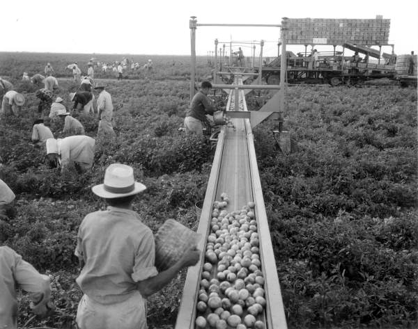
Goulds is a census-designated place (CDP) in Miami-Dade County, within the U.S. state of Florida. The area was originally populated as the result of a stop on the Florida East Coast Railroad. The railroad depot was located near the current Southwest 224th Street. The community was named after its operator, Lyman Gould, who cut trees for railroad ties. As of the 2020 census, the population stood at 11,446. Geography Goulds is located at (25.560885, -80.383353). According to the United States Census Bureau, the CDP has a total area of , all of it land. History The area that became Goulds was settled in 1900 by homesteaders. It received its name when the Florida East Coast Railway built a siding in 1903, operated by an employee of the railroad named Lyman Goulds. It was first known as Gould's Siding, and later shortened to Goulds. Many packing houses were built along Old Dixie Highway. Early on, Goulds had a reputation as a rough town, with several saloons serving itinerant field ... [...More Info...] [...Related Items...] OR: [Wikipedia] [Google] [Baidu] |
Census-designated Place
A census-designated place (CDP) is a concentration of population defined by the United States Census Bureau for statistical purposes only. CDPs have been used in each decennial census since 1980 as the counterparts of incorporated places, such as self-governing cities, towns, and villages, for the purposes of gathering and correlating statistical data. CDPs are populated areas that generally include one officially designated but currently unincorporated community, for which the CDP is named, plus surrounding inhabited countryside of varying dimensions and, occasionally, other, smaller unincorporated communities as well. CDPs include small rural communities, edge cities, colonias located along the Mexico–United States border, and unincorporated resort and retirement communities and their environs. The boundaries of any CDP may change from decade to decade, and the Census Bureau may de-establish a CDP after a period of study, then re-establish it some decades later. Most unin ... [...More Info...] [...Related Items...] OR: [Wikipedia] [Google] [Baidu] |
Siding (rail)
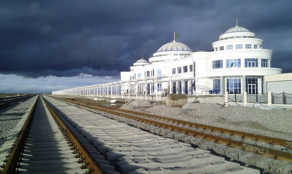
A siding, in rail terminology, is a low-speed track section distinct from a running line or through route such as a main line, branch line, or spur. It may connect to through track or to other sidings at either end. Sidings often have lighter rails, meant for lower speed or less heavy traffic, and few, if any, signals. Sidings connected at both ends to a running line are commonly known as loops; those not so connected may be referred to as single-ended or dead-end sidings, or (if short) stubs. Functions Sidings may be used for marshalling (classifying), stabling, storing, loading, and unloading vehicles. Common sidings store stationary rolling stock, especially for loading and unloading. Industrial sidings (also known as spurs) go to factories, mines, quarries, wharves, warehouses, some of them are essentially links to industrial railways. Such sidings can sometimes be found at stations for public use; in American usage these are referred to as team tracks (after the use ... [...More Info...] [...Related Items...] OR: [Wikipedia] [Google] [Baidu] |
Native Americans In The United States
Native Americans, also known as American Indians, First Americans, Indigenous Americans, and other terms, are the Indigenous peoples of the mainland United States ( Indigenous peoples of Hawaii, Alaska and territories of the United States are generally known by other terms). There are 574 federally recognized tribes living within the US, about half of which are associated with Indian reservations. As defined by the United States Census, "Native Americans" are Indigenous tribes that are originally from the contiguous United States, along with Alaska Natives. Indigenous peoples of the United States who are not listed as American Indian or Alaska Native include Native Hawaiians, Samoan Americans, and the Chamorro people. The US Census groups these peoples as " Native Hawaiian and other Pacific Islanders". European colonization of the Americas, which began in 1492, resulted in a precipitous decline in Native American population because of new diseases, wars, ethni ... [...More Info...] [...Related Items...] OR: [Wikipedia] [Google] [Baidu] |
Non-Hispanic Or Latino African Americans
African Americans (also referred to as Black Americans and Afro-Americans) are an ethnic group consisting of Americans with partial or total ancestry from sub-Saharan Africa. The term "African American" generally denotes descendants of enslaved Africans who are from the United States. While some Black immigrants or their children may also come to identify as African-American, the majority of first generation immigrants do not, preferring to identify with their nation of origin. African Americans constitute the second largest racial group in the U.S. after White Americans, as well as the third largest ethnic group after Hispanic and Latino Americans. Most African Americans are descendants of enslaved people within the boundaries of the present United States. On average, African Americans are of West/Central African with some European descent; some also have Native American and other ancestry. According to U.S. Census Bureau data, African immigrants generally do not self-ide ... [...More Info...] [...Related Items...] OR: [Wikipedia] [Google] [Baidu] |
Non-Hispanic Or Latino Whites
Non-Hispanic whites or Non-Latino whites are Americans who are classified as "white", and are not of Hispanic (also known as "Latino") heritage. The United States Census Bureau defines ''white'' to include European Americans, Middle Eastern Americans, and North African Americans. Americans of European ancestry represent ethnic groups and more than half of the white population are German, Irish, Scottish, English , Italian , French and Polish Americans. In the United States, this population was first derived from English (and, to a lesser degree, French) settlement of the America, as well as settlement by other Europeans such as the Germans and Dutch that began in the 17th century (see History of the United States). Continued growth since the early 19th century is attributed to sustained very high birth rates alongside relatively low death rates among settlers and natives alike as well as periodically massive immigration from European countries, especially Germany, Ireland, ... [...More Info...] [...Related Items...] OR: [Wikipedia] [Google] [Baidu] |
Princeton, Florida
Princeton is a census-designated place (CDP) and unincorporated community in Miami-Dade County, Florida, United States. The population was 39,208 at the 2020 census, up from 22,038 at the 2010 census. History As a small town and depot along the Florida East Coast Railroad in the 1900s, the community was named by Gaston Drake after his alma mater, Princeton University. Many of the town buildings were even painted the school's colors: black and orange. Drake operated a saw mill and lumber company in Princeton supplying Miami, the Florida Keys and Cuba until the local timber gave out in 1923. Geography Princeton is located southwest of downtown Miami and northeast of Homestead at (25.535634, -80.397485). It is bordered to the north by Goulds and to the southwest by Naranja, both unincorporated. U.S. Route 1 (Dixie Highway) runs northeast to southwest through Princeton, and the Homestead Extension of Florida's Turnpike forms the eastern edge of the community, with access ... [...More Info...] [...Related Items...] OR: [Wikipedia] [Google] [Baidu] |
Redland, Florida
Redland, long known also as the Redlands or the Redland, is a historic unincorporated community and agricultural area in Miami-Dade County, Florida, located about southwest of downtown Miami and just northwest of Homestead, Florida. It is unique in that it constitutes a large farming belt directly adjoining what is now the seventh most populous major metropolitan area in the United States. Named for the pockets of red clay that cover a layer of oolitic limestone, Redland produces a variety of tropical fruits, many of which do not grow elsewhere in the continental United States. The area also contains a large concentration of ornamental nurseries. The landscape is dotted with u-pick'em fields, coral rock (oolite) walls, and the original clapboard homes of early settlers and other historic early twentieth century structures. Etymology Through the early part of the 20th century, what was known as the "Redland District" – frequently also called "the Redlands" or just "the Redlan ... [...More Info...] [...Related Items...] OR: [Wikipedia] [Google] [Baidu] |
Cutler Bay
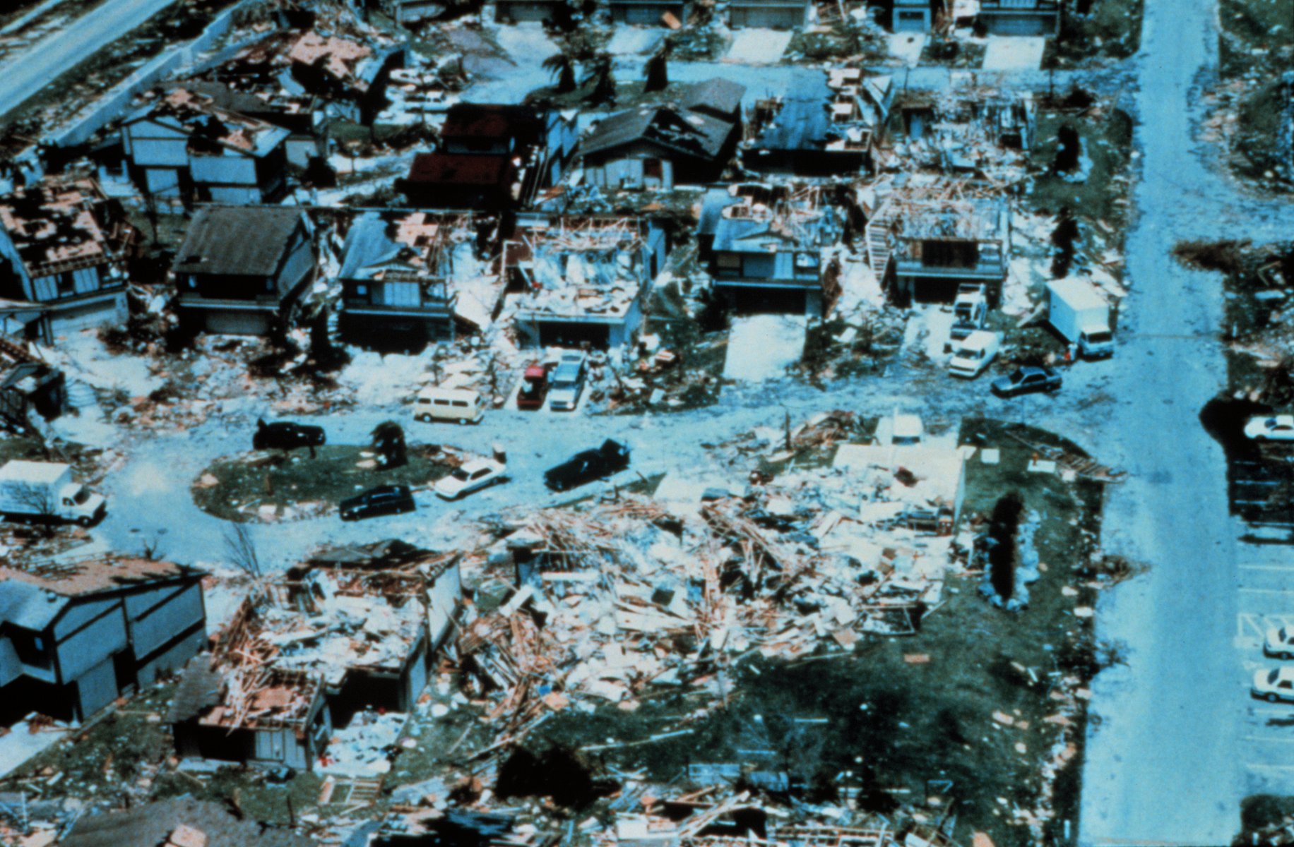
Cutler Bay is an incorporated town in Miami-Dade County, Florida established in 2005, with a population of approximately 45,425 as of 2020. With 45,425 people, Cutler Bay is in 9th place of the top 10 most populous municipalities of the 34 municipalities that make up Miami's urban core, it is the 33rd most populous municipality out of the 163 municipalities that up Miami Metropolitan Area and Cutler Bay is also the 88th most populated city in the state of Florida out of 919 cities. The borders were established as running from SW 184th Street (Eureka Dr) east of US 1 to the coast, and north of Black Point Marina, at . The town's boundaries include the northeast section of Biscayne National Park, areas formerly known as Cutler Ridge to the west, as well as the neighborhood and former CDP of Lakes by the Bay to the east. In August 1992, Hurricane Andrew made landfall near the area and caused extensive destruction. Lakes by the Bay was one of the areas of Miami most affected ... [...More Info...] [...Related Items...] OR: [Wikipedia] [Google] [Baidu] |
South Miami Heights
South Miami Heights is a census-designated place (CDP), originally known as Eureka, in Miami-Dade County, within the U.S. state of Florida. The population was 35,696 as of the 2010 census. Geography South Miami Heights is located at (25.588784, -80.385209). According to the United States Census Bureau, the CDP has a total area of 4.9 square miles (12.8 km), all of it land. Demographics 2020 census As of the 2020 United States census, there were 36,770 people, 10,589 households, and 8,319 families residing in the CDP. 2010 census As of the census in 2010, there were 35,696 people, 10,706 households, and 8,358 families living in the CDP. The population density was . There were 10,364 housing units at an average density of . The racial makeup of the CDP was 67.2% White (11.2% Non-Hispanic White,) 24.3% African American, 0.28% Native American, 1.5% Asian, 0.02% Pacific Islander, 6.85% from other races, and 5.23% from two or more races. Hispanic or Latino of any race ... [...More Info...] [...Related Items...] OR: [Wikipedia] [Google] [Baidu] |
African-Americans
African Americans (also referred to as Black Americans and Afro-Americans) are an ethnic group consisting of Americans with partial or total ancestry from sub-Saharan Africa. The term "African American" generally denotes descendants of enslaved Africans who are from the United States. While some Black immigrants or their children may also come to identify as African-American, the majority of first generation immigrants do not, preferring to identify with their nation of origin. African Americans constitute the second largest racial group in the U.S. after White Americans, as well as the third largest ethnic group after Hispanic and Latino Americans. Most African Americans are descendants of enslaved people within the boundaries of the present United States. On average, African Americans are of West/Central African with some European descent; some also have Native American and other ancestry. According to U.S. Census Bureau data, African immigrants generally do not self-i ... [...More Info...] [...Related Items...] OR: [Wikipedia] [Google] [Baidu] |
Railway Town
A railway town, or railroad town, is a settlement that originated or was greatly developed because of a railway station or junction at its site. North America During the construction of the First transcontinental railroad in the 1860s, temporary, "Hell on wheels" towns, made mostly of canvas tents, accompanied the Union Pacific Railroad as construction headed west. Most faded away but some became permanent settlements. In the 1870s successive boomtowns sprung up in Kansas, each prospering for a year or two as a railhead, and withering when the rail line extended further west and created a new endpoint for the Chisholm Trail. Becoming rail hubs made Chicago and Los Angeles grow from small towns to large cities. Sayre, Pennsylvania and Atlanta, Georgia were among the American company towns created by railroads in places where no settlement already existed. In western Canada, railway towns became associated with brothels and prostitution, and concerned railway companies started ... [...More Info...] [...Related Items...] OR: [Wikipedia] [Google] [Baidu] |
Cauley Square
Cauley Square Historic Village, often shortened to Cauley Square, is a former railway town located in Goulds, Florida, in the United States. Originally built in 1903 by William H. Cauley, it was declared a historic site by Miami-Dade County in 1994. History In 1903, the Florida East Coast Railway, created by Henry Flagler, reached the town of Goulds, Florida. William H. Cauley owned of land in the area; he built Cauley Square in the same year in an attempt to expand the population of Goulds. The buildings were then used to house Flagler's railway employees, as the railways that they worked on passed through the town. Cauley used the village as a shipping hub for his tomatoes, sending them north along the railway when winter came. In 1926, Cauley Square was abandoned due to the effects of the Great Miami Hurricane. It remained vacant for over 20 years and the buildings were condemned for demolition. In 1949, Mary Anne Ballard bought the property and restored it. In 1992, whe ... [...More Info...] [...Related Items...] OR: [Wikipedia] [Google] [Baidu] |
.jpg)


