|
Glomar Challenger
''Glomar Challenger'' was a deep sea research and scientific drilling vessel for oceanography and marine geology studies. The drillship was designed by Global Marine Inc. (now Transocean Inc.) specifically for a long term contract with the American National Science Foundation and University of California Scripps Institution of Oceanography and built by Levingston Shipbuilding Company in Orange, Texas. Launched on March 23, 1968, the vessel was owned and operated by the Global Marine Inc. corporation. ''Glomar Challenger'' was given its name as a tribute to the accomplishments of the oceanographic survey vessel . Glomar is a truncation of ''Global Marine''. Accomplishments Starting from August 1968, the ship was embarked on a 15-year-long scientific expedition, the Deep Sea Drilling Program, criss-crossing the Mid-Atlantic Ridge between South America and Africa and drilling core samples at specific locations. When the age of the samples was determined by paleontologic and isotopi ... [...More Info...] [...Related Items...] OR: [Wikipedia] [Google] [Baidu] |
Seafloor Spreading
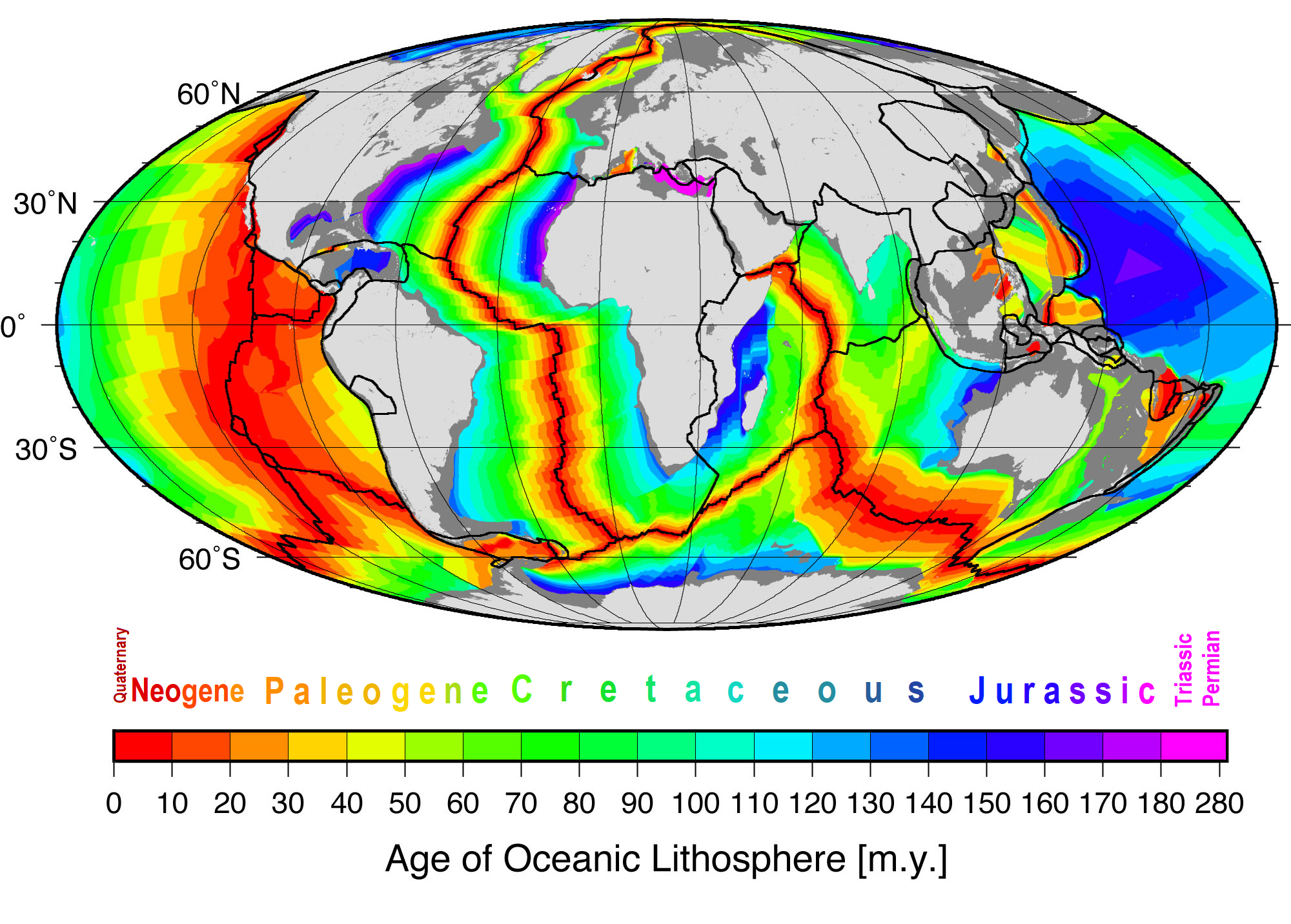
Seafloor spreading or Seafloor spread is a process that occurs at mid-ocean ridges, where new oceanic crust is formed through volcanic activity and then gradually moves away from the ridge. History of study Earlier theories by Alfred Wegener and Alexander du Toit of continental drift postulated that continents in motion "plowed" through the fixed and immovable seafloor. The idea that the seafloor itself moves and also carries the continents with it as it spreads from a central rift axis was proposed by Harold Hammond Hess from Princeton University and Robert Dietz of the U.S. Naval Electronics Laboratory in San Diego in the 1960s. The phenomenon is known today as plate tectonics. In locations where two plates move apart, at mid-ocean ridges, new seafloor is continually formed during seafloor spreading. Significance Seafloor spreading helps explain continental drift in the theory of plate tectonics. When oceanic plates diverge, tensional stress causes fractures to occu ... [...More Info...] [...Related Items...] OR: [Wikipedia] [Google] [Baidu] |
Scientific Drilling
Scientific drilling into the Earth is a way for scientists to probe the Earth's sediments, crust, and upper mantle. In addition to rock samples, drilling technology can unearth samples of connate fluids and of the subsurface biosphere, mostly microbial life, preserved in drilled samples. Scientific drilling is carried out on land by the International Continental Scientific Drilling Program (ICDP) and at sea by the Integrated Ocean Drilling Program (IODP). Scientific drilling on the continents includes drilling down into solid ground as well as drilling from small boats on lakes. Sampling thick glaciers and ice sheets to obtain ice cores is related but will not be described further here. Like probes sent into outer space, scientific drilling is a technology used to obtain samples from places that people cannot reach. Human beings have descended as deep as 2,212 m (7,257 ft) in Veryovkina Cave, the world's deepest known cave, located in the Caucasus mountains of the count ... [...More Info...] [...Related Items...] OR: [Wikipedia] [Google] [Baidu] |
Mid-ocean Ridge
A mid-ocean ridge (MOR) is a seafloor mountain system formed by plate tectonics. It typically has a depth of about and rises about above the deepest portion of an ocean basin. This feature is where seafloor spreading takes place along a divergent plate boundary. The rate of seafloor spreading determines the morphology of the crest of the mid-ocean ridge and its width in an ocean basin. The production of new seafloor and oceanic lithosphere results from mantle upwelling in response to plate separation. The melt rises as magma at the linear weakness between the separating plates, and emerges as lava, creating new oceanic crust and lithosphere upon cooling. The first discovered mid-ocean ridge was the Mid-Atlantic Ridge, which is a spreading center that bisects the North and South Atlantic basins; hence the origin of the name 'mid-ocean ridge'. Most oceanic spreading centers are not in the middle of their hosting ocean basis but regardless, are traditionally called mid-ocean ... [...More Info...] [...Related Items...] OR: [Wikipedia] [Google] [Baidu] |
Seafloor Spreading
Seafloor spreading or Seafloor spread is a process that occurs at mid-ocean ridges, where new oceanic crust is formed through volcanic activity and then gradually moves away from the ridge. History of study Earlier theories by Alfred Wegener and Alexander du Toit of continental drift postulated that continents in motion "plowed" through the fixed and immovable seafloor. The idea that the seafloor itself moves and also carries the continents with it as it spreads from a central rift axis was proposed by Harold Hammond Hess from Princeton University and Robert Dietz of the U.S. Naval Electronics Laboratory in San Diego in the 1960s. The phenomenon is known today as plate tectonics. In locations where two plates move apart, at mid-ocean ridges, new seafloor is continually formed during seafloor spreading. Significance Seafloor spreading helps explain continental drift in the theory of plate tectonics. When oceanic plates diverge, tensional stress causes fractures to occu ... [...More Info...] [...Related Items...] OR: [Wikipedia] [Google] [Baidu] |
Harry Hammond Hess
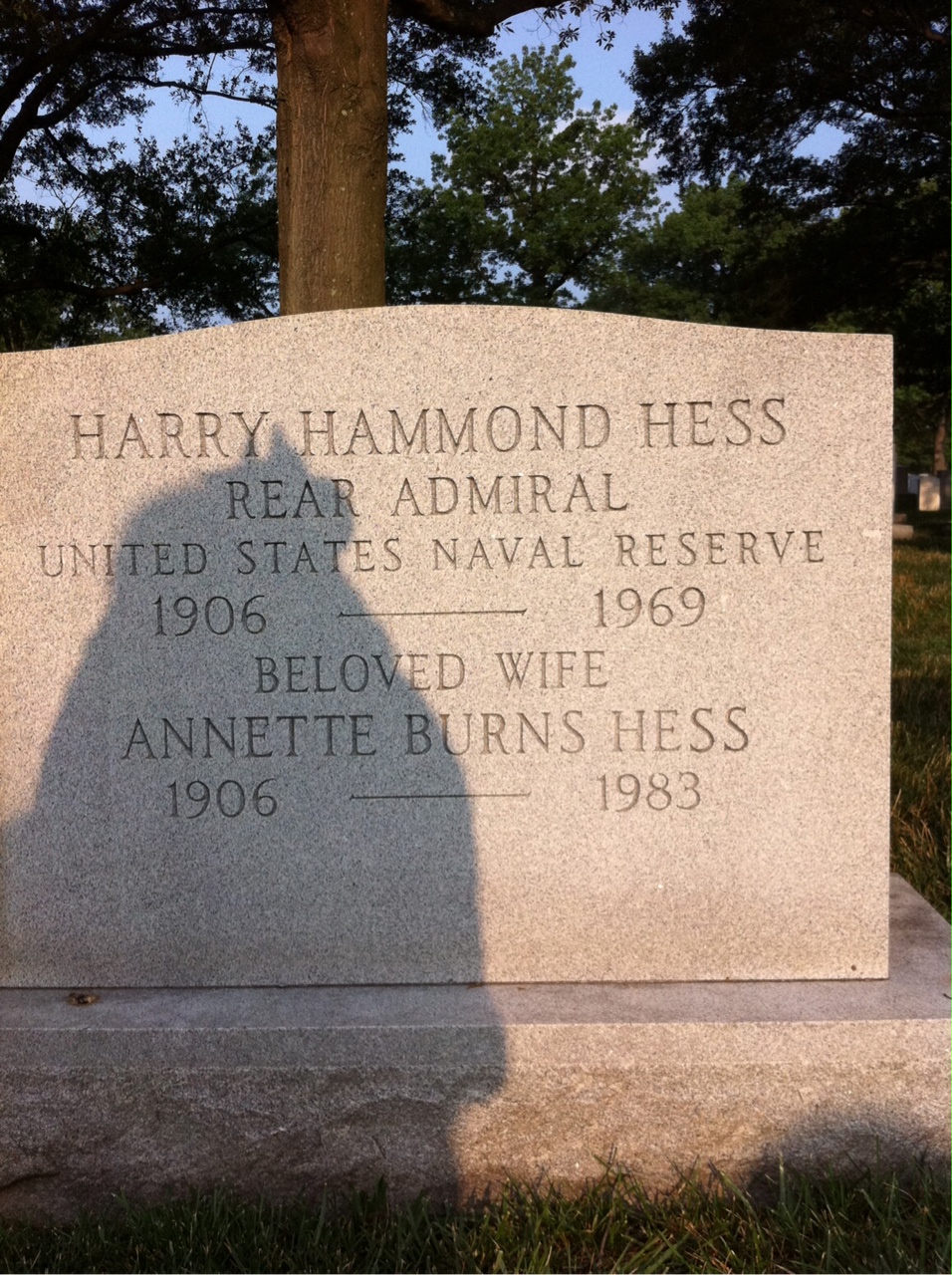
Harry Hammond Hess (May 24, 1906 – August 25, 1969) was an American geologist and a United States Navy officer in World War II who is considered one of the "founding fathers" of the unifying theory of plate tectonics. He is best known for his theories on sea floor spreading, specifically work on relationships between island arcs, seafloor gravity anomalies, and serpentinized peridotite, suggesting that the convection of the Earth's mantle was the driving force behind this process. Early life and education Harry Hammond Hess was born on May 24, 1906, in New York City to Julian S. Hess, a member of the New York Stock Exchange, and Elizabeth Engel Hess. He attended Asbury Park High School in Asbury Park, New Jersey. In 1923, he entered Yale University, where he intended to study electrical engineering but ended up graduating with a Bachelor of Science degree in geology. He spent two years as an exploration geologist in Northern Rhodesia. In 1934 he married Annette Burns. Teachi ... [...More Info...] [...Related Items...] OR: [Wikipedia] [Google] [Baidu] |
JOIDES Resolution
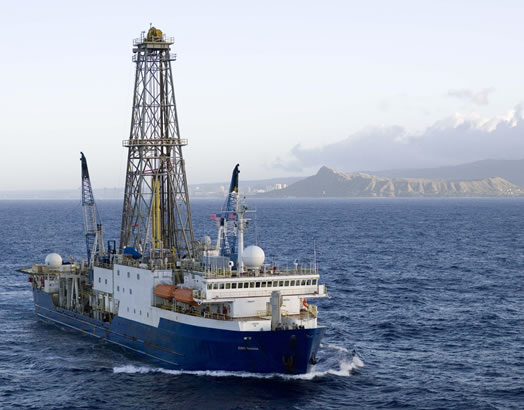
295px, Drillship ''JOIDES Resolution'' in 1988 The riserless research vessel ''JOIDES Resolution'' (Joint Oceanographic Institutions for Deep Earth Sampling), often referred to as the JR, is one of the scientific drilling ships used by the International Ocean Discovery Program (IODP), an international, multi-drilling platform research program. The JR was previously the main research ship used during the Ocean Drilling Program (ODP) and was used along with the Japanese drilling vessel ''Chikyu'' and other mission-specific drilling platforms throughout the Integrated Ocean Drilling Program. She is the successor of ''Glomar Challenger''. The ship was first launched in 1978 as ''Sedco/BP 471'', an oil exploration vessel. It was converted for scientific use 6 years later in 1984 and began working as the main research ship for ODP in January 1985. The JR was modernized during 2007–2008 and returned to active service in February 2009 following an extensive renovation of her laboratory f ... [...More Info...] [...Related Items...] OR: [Wikipedia] [Google] [Baidu] |
Messinian Salinity Crisis
The Messinian salinity crisis (MSC), also referred to as the Messinian event, and in its latest stage as the Lago Mare event, was a geological event during which the Mediterranean Sea went into a cycle of partial or nearly complete desiccation (drying-up) throughout the latter part of the Messinian age of the Miocene epoch, from 5.96 to 5.33 Ma (million years ago). It ended with the Zanclean flood, when the Atlantic reclaimed the basin. Sediment samples from below the deep seafloor of the Mediterranean Sea, which include evaporite minerals, soils, and fossil plants, show that the precursor of the Strait of Gibraltar closed tight about 5.96 million years ago, sealing the Mediterranean off from the Atlantic. This resulted in a period of partial desiccation of the Mediterranean Sea, the first of several such periods during the late Miocene. After the strait closed for the last time around 5.6 Ma, the region's generally dry climate at the time dried the Mediterranean basin out ne ... [...More Info...] [...Related Items...] OR: [Wikipedia] [Google] [Baidu] |
Desiccation
Desiccation () is the state of extreme dryness, or the process of extreme drying. A desiccant is a hygroscopic (attracts and holds water) substance that induces or sustains such a state in its local vicinity in a moderately sealed container. Industry Desiccation is widely employed in the oil and gas industry. These materials are obtained in a hydrated state, but the water content leads to corrosion or is incompatible with downstream processing. Removal of water is achieved by cryogenic condensation, absorption into glycols, and absorption onto desiccants such as silica gel. Laboratory A desiccator is a heavy glass or plastic container, now somewhat antiquated, used in practical chemistry for drying or keeping small amounts of materials very dry. The material is placed on a shelf, and a drying agent or ''desiccant'', such as dry silica gel or anhydrous sodium hydroxide, is placed below the shelf. Often some sort of humidity indicator is included in the desiccator to s ... [...More Info...] [...Related Items...] OR: [Wikipedia] [Google] [Baidu] |
Evaporite
An evaporite () is a water- soluble sedimentary mineral deposit that results from concentration and crystallization by evaporation from an aqueous solution. There are two types of evaporite deposits: marine, which can also be described as ocean deposits, and non-marine, which are found in standing bodies of water such as lakes. Evaporites are considered sedimentary rocks and are formed by chemical sediments. Formation of evaporite rocks Although all water bodies on the surface and in aquifers contain dissolved salts, the water must evaporate into the atmosphere for the minerals to precipitate. For this to happen, the water body must enter a restricted environment where water input into this environment remains below the net rate of evaporation. This is usually an arid environment with a small basin fed by a limited input of water. When evaporation occurs, the remaining water is enriched in salts, and they precipitate when the water becomes supersaturated. Evaporite depo ... [...More Info...] [...Related Items...] OR: [Wikipedia] [Google] [Baidu] |
Anhydrite
Anhydrite, or anhydrous calcium sulfate, is a mineral with the chemical formula CaSO4. It is in the orthorhombic crystal system, with three directions of perfect cleavage parallel to the three planes of symmetry. It is not isomorphous with the orthorhombic barium ( baryte) and strontium ( celestine) sulfates, as might be expected from the chemical formulas. Distinctly developed crystals are somewhat rare, the mineral usually presenting the form of cleavage masses. The Mohs hardness is 3.5, and the specific gravity is 2.9. The color is white, sometimes greyish, bluish, or purple. On the best developed of the three cleavages, the lustre is pearly; on other surfaces it is glassy. When exposed to water, anhydrite readily transforms to the more commonly occurring gypsum, (CaSO4·2H2O) by the absorption of water. This transformation is reversible, with gypsum or calcium sulfate hemihydrate forming anhydrite by heating to around under normal atmospheric conditions. Anhydrite is c ... [...More Info...] [...Related Items...] OR: [Wikipedia] [Google] [Baidu] |
Gypsum
Gypsum is a soft sulfate mineral composed of calcium sulfate dihydrate, with the chemical formula . It is widely mined and is used as a fertilizer and as the main constituent in many forms of plaster, blackboard or sidewalk chalk, and drywall. Alabaster, a fine-grained white or lightly tinted variety of gypsum, has been used for sculpture by many cultures including Ancient Egypt, Mesopotamia, Ancient Rome, the Byzantine Empire, and the Nottingham alabasters of Medieval England. Gypsum also crystallizes as translucent crystals of selenite. It forms as an evaporite mineral and as a hydration product of anhydrite. The Mohs scale of mineral hardness defines gypsum as hardness value 2 based on scratch hardness comparison. Etymology and history The word '' gypsum'' is derived from the Greek word (), "plaster". Because the quarries of the Montmartre district of Paris have long furnished burnt gypsum ( calcined gypsum) used for various purposes, this dehydrated gyp ... [...More Info...] [...Related Items...] OR: [Wikipedia] [Google] [Baidu] |


