|
Glen Oaks, New York
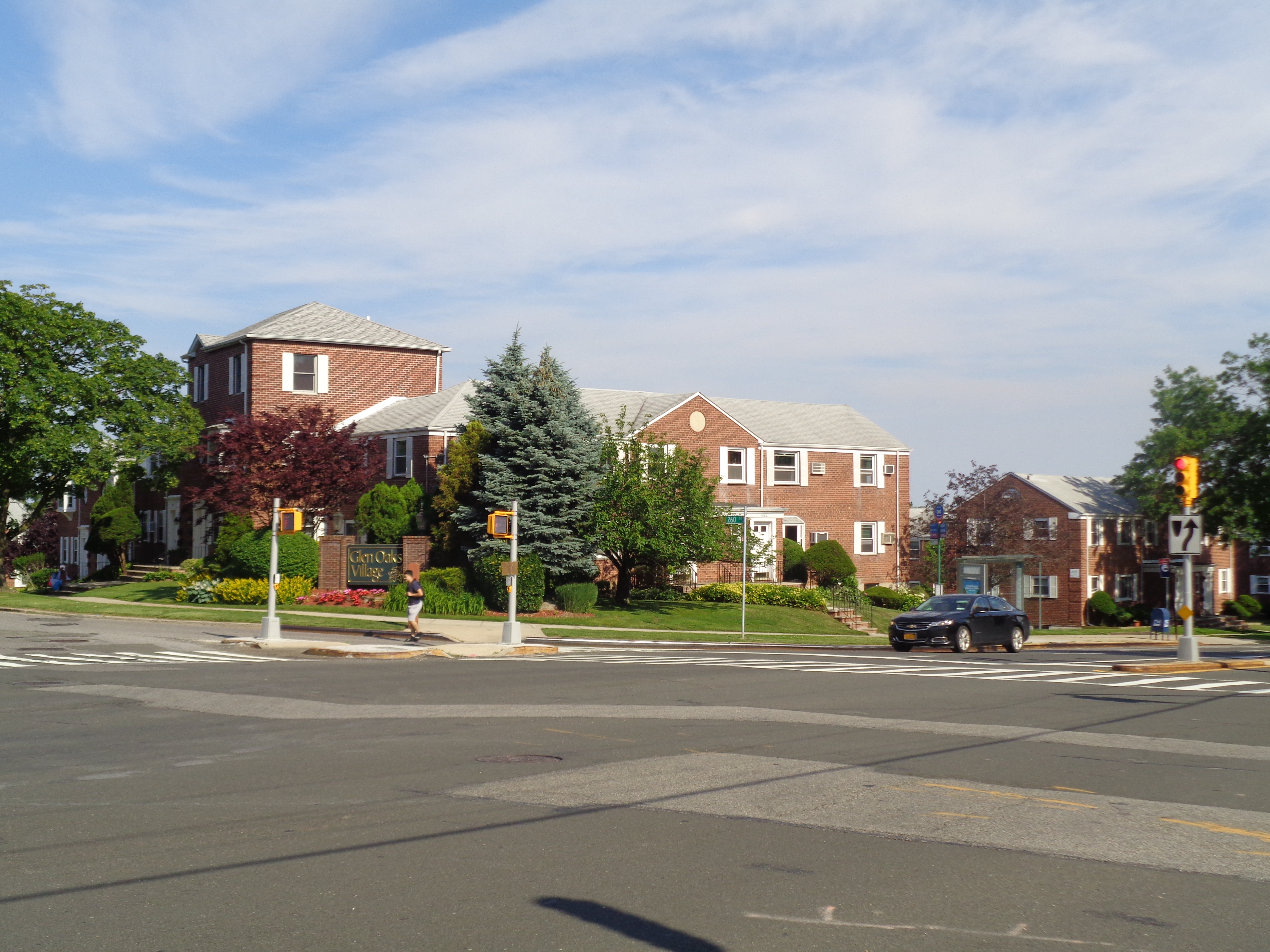
Glen Oaks is a neighborhood in the easternmost part of the New York City borough of Queens. The neighborhood is part of Queens Community Board 13. Location Glen Oaks lies between Grand Central Parkway and Nassau County to the north, Union Turnpike to the south, the Queens/Nassau border (Lakeville Road) to the east, and the Cross Island Parkway to the west. In this area, the Queens/Nassau border separates New York City from the Village of Lake Success to the north. The Queens/Nassau border is referred to locally as "the city line" and is so designated on New York City buses. Union Turnpike is the main commercial road in the area. The northern edge of Glen Oaks is a line of hills which are part of the terminal moraine of the last glacial period. These hills include the highest point in Queens: above sea level. The southern part of Glen Oaks is a glacial outwash plain. The postal ZIP Code zones for this area do not follow political boundaries, even crossing the city line. The ... [...More Info...] [...Related Items...] OR: [Wikipedia] [Google] [Baidu] |
Neighborhoods Of Queens
This is a list of neighborhoods in Queens, one of the five political subdivisions of New York State#Borough, boroughs of New York City. Northwestern Queens * Astoria, Queens, Astoria ** Astoria Heights, Queens, Astoria Heights ** Ditmars, Queens, Ditmars *** Steinway, Queens, Steinway ** Little Egypt, Astoria, Little Egypt * Jackson Heights, Queens, Jackson Heights * Long Island City ** Blissville, Queens, Blissville ** Hunters Point, Queens, Hunters Point ** Dutch Kills, Queens, Dutch Kills ** Queensbridge, Queens, Queensbridge (housing development) ** Queensview (housing development) ** Queens West ** Ravenswood, Queens, Ravenswood (housing development) * Sunnyside, Queens, Sunnyside ** Sunnyside Gardens, Queens, Sunnyside Gardens * Woodside, Queens, Woodside Southwestern Queens * The Hole, New York, The Hole * Howard Beach, Queens, Howard Beach ** Hamilton Beach, Queens, Hamilton Beach ** Howard Park, Queens, Howard Park ** Lindenwood, Queens, Lindenwood (housing devel ... [...More Info...] [...Related Items...] OR: [Wikipedia] [Google] [Baidu] |
Lake Success, New York
Lake Success is a village in the Town of North Hempstead in Nassau County, on the North Shore of Long Island, in New York. The population was 2,897 at the 2010 census. The Incorporated Village of Lake Success was the temporary home of the United Nations from 1946 to 1951, occupying the headquarters of the Sperry Gyroscope Company on Marcus Avenue. It is also the former home of Canon U.S.A., Inc. before it moved its corporate headquarters to Melville (in neighboring Suffolk County) in the early 21st century. History Lake Success derives its name from a kettle lake of the same name which according to village lore had a Native American name of "Sucut." William K. Vanderbilt II bought land around the lake in the early 20th century for a home. The village was incorporated in 1927. In 1939, the United States government bought a large tract between Marcus Avenue, Lakeville Road and Union Turnpike, to be the home to the Sperry Gyroscope Company which built a variety of maritime, ... [...More Info...] [...Related Items...] OR: [Wikipedia] [Google] [Baidu] |
Long Island Motor Parkway
The Long Island Motor Parkway, also known as the Vanderbilt Parkway, Vanderbilt Motor Parkway, or Motor Parkway, was a roadway on Long Island, New York, in the United States. It was the first roadway designed for automobile use only. The parkway was privately built by William Kissam Vanderbilt II with overpasses and bridges to remove most intersections. It officially opened on October 10, 1908. It closed in 1938 when it was taken over by the state of New York in lieu of back taxes. Parts of the parkway survive today, used as sections of other roadways or as a bicycle trail. Origins and construction William Kissam Vanderbilt II, the great-grandson of Cornelius Vanderbilt, was an auto-racing enthusiast and created the Vanderbilt Cup, the first major road racing competition, in 1904. He ran the races on local roads in Nassau County during the first decade of the 20th century, but the deaths of two spectators and injury to many others showed the need to eliminate racing on resi ... [...More Info...] [...Related Items...] OR: [Wikipedia] [Google] [Baidu] |
New Hyde Park, New York
New Hyde Park is a village (New York), village in the Towns of Hempstead, New York, Hempstead and North Hempstead, New York, North Hempstead in Nassau County, New York, Nassau County, on Long Island, in New York (state), New York, United States. It is the anchor community of the Greater New Hyde Park area. The population was 9,712 at the 2010 census. History Thomas Dongan, the fourth royal governor of New York, was granted an 800-acre parcel of land in 1683 that included New Hyde Park. It was known as "Dongan's Farm." Dongan built a mansion on what is now Lakeville Road. In 1691 Dongan fled to New England and then Ireland, as James II of England, King James II and his Catholic forces failed to regain power in England and Ireland.Aronson, Harvey, ed. ''Home Town Long Island''. (Newsday, 1999). .Weidman, Bette S. and Linda B. Martin. ''Nassau County Long Island in Early Photographs: 1869–1940''. Dover Publications, Dover Publications Inc., 1981. In 1715, Dongan's estate was sold ... [...More Info...] [...Related Items...] OR: [Wikipedia] [Google] [Baidu] |
North New Hyde Park, New York
North New Hyde Park is a Hamlet (New York), hamlet and census-designated place (CDP) in the North Hempstead, New York, Town of North Hempstead in Nassau County, New York, Nassau County, on Long Island, in New York (state), New York, United States. The population was 14,899 at the 2010 census. Portions of the area are also known as Floral Park Centre and Lakeville Estates. History The hamlet's name reflects the fact that it is located immediately north of New Hyde Park, New York, New Hyde Park. Geography According to the United States Census Bureau, North New Hyde Park has a total area of , all land. As aforementioned, the areas known as Floral Park Centre and Lakeville Estates are located within the boundaries of North New Hyde Park. Demographics 2010 census As of the census of 2010, there were 14,889 people residing in the CDP. The racial makeup of the CDP was 65.67% White (U.S. Census), White, 0.72% African American (U.S. Census), African American, 0.26% Native American ... [...More Info...] [...Related Items...] OR: [Wikipedia] [Google] [Baidu] |
Floral Park, New York
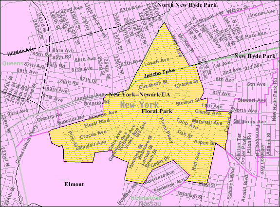
Floral Park is an incorporated village in Nassau County, New York, United States, on Long Island. The population as of the US Census of 2010 is 15,863. The Incorporated Village of Floral Park is at the western border of Nassau County, and is located mainly in the Town of Hempstead, while the section north of Jericho Turnpike is within the Town of North Hempstead. The area was formerly known as East Hinsdale. The neighborhood of Floral Park in the New York City borough of Queens is adjacent to the village. History The area that is now Floral Park once marked the western edge of the great Hempstead Plains, and by some reports was initially known as Plainfield. Farms and tiny villages dominated the area through the 1870s when the development of the Long Island Rail Road Hempstead Branch and Jericho Turnpike cut through the area. Hinsdale had more than two dozen flower farms after the Civil War. The present-day village of Floral Park was once called East Hinsdale. In 1874, John ... [...More Info...] [...Related Items...] OR: [Wikipedia] [Google] [Baidu] |
Bellerose, New York
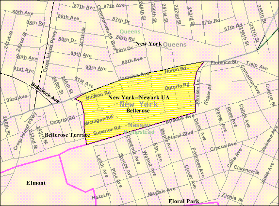
Bellerose is a village in the Town of Hempstead in Nassau County, on Long Island, in New York, United States. The population was 1,173 at the 2020 census. History The village was founded by Helen Marsh of Williamsburg, Brooklyn. In 1907, planning to build a model community, Marsh purchased of Floral Park gladiola fields. The first Bellerose home was completed, under Marsh's supervision, in 1910. Marsh persuaded the Long Island Rail Road to place a station in the new village, and she named the station Bellerose. Though it has been suggested that she named the station for the Rose farm, south of the railroad, and her daughter Belle, she said that she simply found the name "euphonious". A vote of the homeowners made the name official in 1917. Bellerose incorporated itself as a village in 1924 in order to gain home rule. The Bellerose Village Hall, Fire House and Police Booth are on the National and State registries of Historic Places; the complex is known as the Bellerose V ... [...More Info...] [...Related Items...] OR: [Wikipedia] [Google] [Baidu] |
Floral Park, Queens
Floral Park is an incorporated village in Nassau County, New York, United States, on Long Island. The population as of the US Census of 2010 is 15,863. The Incorporated Village of Floral Park is at the western border of Nassau County, and is located mainly in the Town of Hempstead, while the section north of Jericho Turnpike is within the Town of North Hempstead. The area was formerly known as East Hinsdale. The neighborhood of Floral Park in the New York City borough of Queens is adjacent to the village. History The area that is now Floral Park once marked the western edge of the great Hempstead Plains, and by some reports was initially known as Plainfield. Farms and tiny villages dominated the area through the 1870s when the development of the Long Island Rail Road Hempstead Branch and Jericho Turnpike cut through the area. Hinsdale had more than two dozen flower farms after the Civil War. The present-day village of Floral Park was once called East Hinsdale. In 1874, Jo ... [...More Info...] [...Related Items...] OR: [Wikipedia] [Google] [Baidu] |
Bellerose, Queens
Bellerose is a middle class neighborhood on the eastern edge of the New York City borough of Queens, along the border of Queens and Nassau County, Long Island. It is adjacent to Bellerose Village and Bellerose Terrace in Nassau County, from which it is separated by Jericho Turnpike. The northern edge of Bellerose is separated from another part of the Nassau border by the neighborhood of Floral Park, Queens to the east, divided by Little Neck Parkway. The neighborhood consists predominantly of detached houses with mostly Indian American, European American, and working and middle class populations. While the northeastern section of Queens Village is sometimes referred to as part of Bellerose, it is also called Bellerose Manor, which is recognized by the U.S. Postal Service as an "acceptable alternate" to Queens Village and Jamaica in postal addresses. Bellerose is located in Queens Community District 13 and its ZIP Code is 11426. It is patrolled by the New York City Police Depa ... [...More Info...] [...Related Items...] OR: [Wikipedia] [Google] [Baidu] |
Little Neck, Queens
Little is a synonym for small size and may refer to: Arts and entertainment * ''Little'' (album), 1990 debut album of Vic Chesnutt * ''Little'' (film), 2019 American comedy film *The Littles, a series of children's novels by American author John Peterson ** ''The Littles'' (TV series), an American animated series based on the novels Places *Little, Kentucky, United States *Little, West Virginia, United States Other uses *Clan Little, a Scottish clan *Little (surname), an English surname *Little (automobile), an American automobile manufactured from 1912 to 1915 *Little, Brown and Company, an American publishing company * USS ''Little'', multiple United States Navy ships See also * * *Little Mountain (other) *Little River (other) Little River may refer to several places: Australia Streams New South Wales *Little River (Dubbo), source in the Dubbo region, a tributary of the Macquarie River * Little River (Oberon), source in the Oberon Shire, a tributary of Cox ... [...More Info...] [...Related Items...] OR: [Wikipedia] [Google] [Baidu] |
North Shore Towers
The North Shore Towers and Country Club is a three-building residential cooperative located in the Glen Oaks neighborhood in the New York City borough of Queens, near the city's border with Nassau County. The complex is located next to the Long Island Jewish Medical Center. The three constituent residential buildings—Amherst, Beaumont, and Coleridge Towers—which sit on a property, are some of the tallest structures in Queens with 34 floors each. The towers are constructed on the highest point of land in Queens County, a hill located above sea level. This hill is part of the terminal moraine of the last glacial period. The hill is ranked 61 of 62 on the list of New York County High Points. The North Shore Towers complex contains 1,844 apartments ranging from studios to three-bedroom apartments. The North Shore Towers complex has an 18-hole golf course and its own power plant that produces electricity independent of local power companies. The community also has an indoor s ... [...More Info...] [...Related Items...] OR: [Wikipedia] [Google] [Baidu] |


.jpg)