|
Glashedy
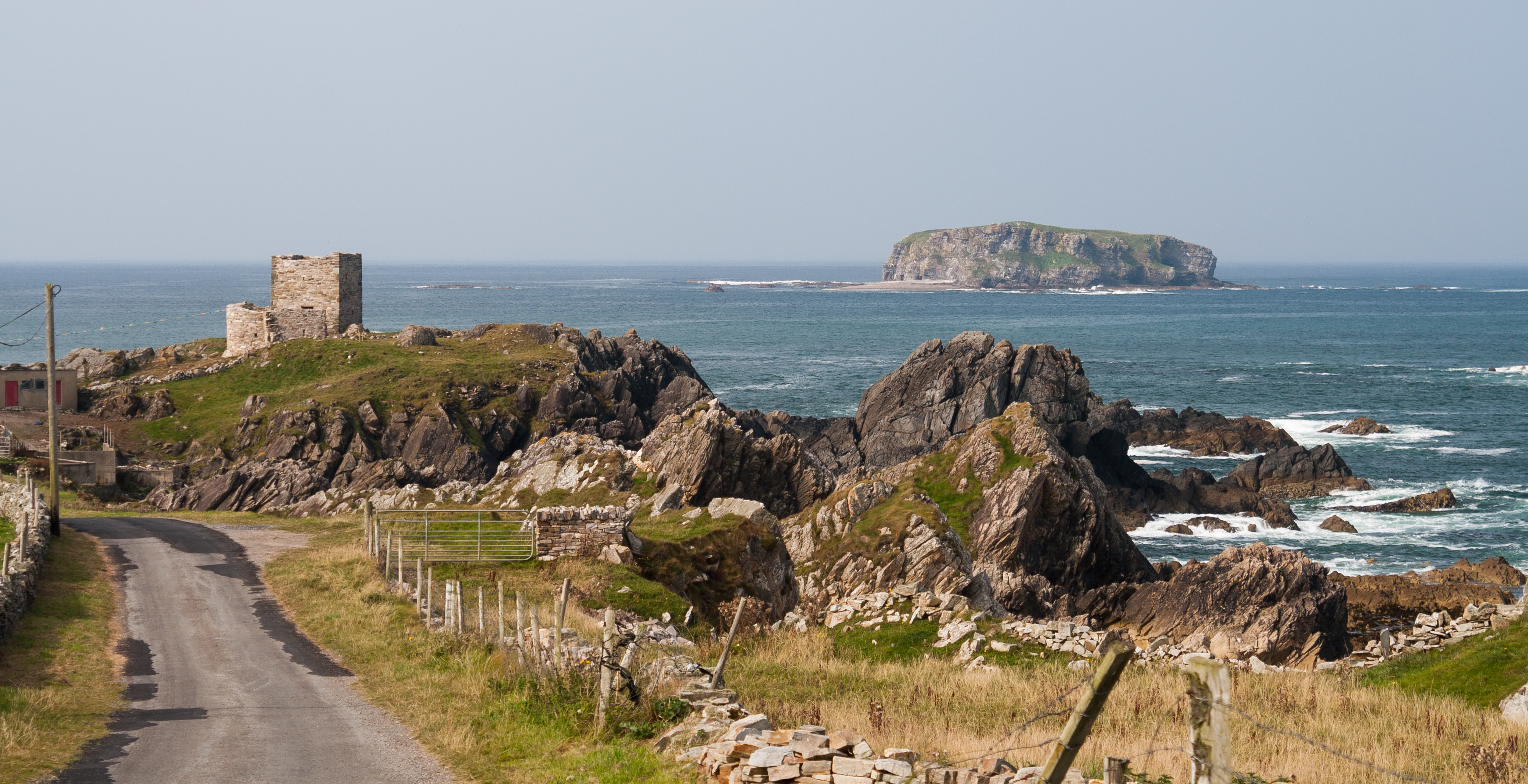
Glashedy Island ( ga, Glaiséidí) is an uninhabited island approximately off Pollan strand, west of Trawbreaga Bay, and about south of Malin Head, Donegal, Ireland. Glashedy Island has an area of 22,548 m² which is equivalent to 2.25 hectares (5.57 acres / 5 acres, 2 roods, 11 perches). At its highest point, it is 119 ft high. The sea around the island is potentially very dangerous for shipping and unsafe for anchorage. Rocks and breakers extend up to a 1,000 meters from all sides of the Island. The waters are relatively shallow at between 4 and 5 fathoms. The shoals to the north of the island are particularly treacherous, lying at a depth of just 3 fathoms. Glashedy Sound is the channel between the island and the shore. It is also shallow. The island contains a number of caves. The island principally comprises quartzite. Etymology Its former name until the early 17th century was Seale Island. The English translation of the name is the ''Island of the Green Clo ... [...More Info...] [...Related Items...] OR: [Wikipedia] [Google] [Baidu] |
County Donegal
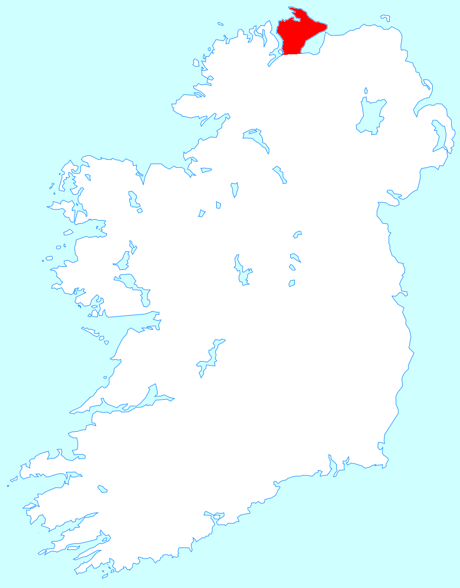
County Donegal ( ; ga, Contae Dhún na nGall) is a county of Ireland in the province of Ulster and in the Northern and Western Region. It is named after the town of Donegal in the south of the county. It has also been known as County Tyrconnell (), after the historic territory of the same name, on which it was based. Donegal County Council is the local council and Lifford the county town. The population was 166,321 at the 2022 census. Name County Donegal is named after the town of Donegal () in the south of the county. It has also been known by the alternative name County Tyrconnell, Tirconnell or Tirconaill (, meaning 'Land of Conall'). The latter was its official name between 1922 and 1927. This is in reference to the kingdom of Tír Chonaill and the earldom that succeeded it, which the county was based on. History County Donegal was the home of the once-mighty Clann Dálaigh, whose best-known branch was the Clann Ó Domhnaill, better known in English as the O'Don ... [...More Info...] [...Related Items...] OR: [Wikipedia] [Google] [Baidu] |
Ballyliffin
Ballyliffin () is a small village located at the north-western tip of Inishowen, County Donegal, Ireland. The surrounding landscape includes Pollan Strand, Binion Hill and Crockaughrim hill. History Local history of the area is covered in Charles McGlinchey's publication, ‘The Last of the Name’. It includes accounts of feuds between landlords and tenants, battles and other nuances. Places of interest A small island off Pollan Bay called Glashedy is located roughly one mile off the coast. The English translation of the name is the ''Island of the Green Cloak'' derived from the layer of grass present on the top. Throughout the ages various ships have become wrecked near to the island, which provide rich fishing grounds and also contributed the rat population to the island. Isle of Doagh is also nearby, though no longer separate from the mainland. Transport Ballyliffin railway station opened on 1 July 1901, but finally closed on 2 December 1935. It is now a private residence ... [...More Info...] [...Related Items...] OR: [Wikipedia] [Google] [Baidu] |
Inishowen
Inishowen () is a peninsula in the north of County Donegal in Ireland. Inishowen is the largest peninsula on the island of Ireland. The Inishowen peninsula includes Ireland's most northerly point, Malin Head. The Grianan of Aileach, a ringfort that served as the royal seat of the over-kingdom of Ailech, stands at the entrance to the peninsula. Towns and villages The main towns and villages of Inishowen are: * Ballyliffin, Buncrana, Bridgend, Burnfoot, Burt * Carndonagh, Carrowmenagh, Clonmany, Culdaff * Dunaff * Fahan * Glengad, Gleneely, Greencastle * Malin, Malin Head, Moville, Muff * Redcastle * Shrove * Quigley's Point * Urris Geography Inishowen is a peninsula of 884.33 square kilometres (218,523 acres), situated in the northernmost part of the island of Ireland. It is bordered to the north by the Atlantic Ocean, to the east by Lough Foyle, and to the west by Lough Swilly. It is joined at the south to the rest of the island and is mostly in County Donegal in ... [...More Info...] [...Related Items...] OR: [Wikipedia] [Google] [Baidu] |
Griffith's Valuation
Griffith's Valuation was a boundary and land valuation survey of Ireland completed in 1868. Griffith's background Richard John Griffith started to value land in Scotland, where he spent two years in 1806-1807 valuing terrain through the examination of its soils. He used 'the Scotch system of valuation' and it was a modified version of this that he introduced into Ireland when he assumed the position of Commissioner of Valuation. Tasks in Ireland In 1825 Griffith was appointed by the British Government to carry out a boundary survey of Ireland. He was to mark the boundaries of every county, barony, civil parish and townland in preparation for the first Ordnance Survey. He completed the boundary work in 1844. He was also called upon to assist in the preparation of a Parliamentary bill to provide for the general valuation of Ireland. This Act was passed in 1826, and he was appointed Commissioner of Valuation in 1827, but did not start work until 1830 when the new 6" maps, became av ... [...More Info...] [...Related Items...] OR: [Wikipedia] [Google] [Baidu] |
Irish Book Awards
The Irish Book Awards are Irish literary awards given annually to books and authors in various categories. In 2018 An Post took over sponsorship of the awards from Bord Gais Energy. It is the only literary award supported by all-Irish bookstores. First awarded in 2006, they grew out of the Hughes & Hughes bookstore's Irish Novel of the Year Prize which was inaugurated in 2003. Since 2007 the Awards have been an independent not-for-profit company funded by sponsorship. The primary sponsor is An Post, the state owned postal service in Ireland. There are currently nine categories, seven of which are judged by the Irish Literary Academy, two by a public vote. There is also a lifetime achievement award. Awards Current Awards *Novel of the Year *Crime Fiction Book of the Year *Best Irish Published Book of the Year *Non-Fiction Book of the Year *Cookbook of the Year *Popular Fiction Book of the Year *Children's Book of the Year, Junior *Children's Book of the Year, Senior *Teen & You ... [...More Info...] [...Related Items...] OR: [Wikipedia] [Google] [Baidu] |
Bord Gais Energy
Cucerdea ( hu, Oláhkocsárd, Hungarian pronunciation: ) is a commune in Mureș County, Transylvania, Romania. It is composed of three villages: Bord (''Bord''), Cucerdea, and Șeulia de Mureș (''Oláhsályi''). The commune is located in the southwestern part of the county, in the center of the Transylvanian Plateau, between the rivers Mureș and Târnava Mică. Cucerdea is situated north of Târnăveni and south of Iernut, at a distance of from the county seat, Târgu Mureș. According to the 2011 Census, the commune has a population of 1,525, of which 97.18% are ethnic Romanians. See also *List of Hungarian exonyms (Mureș County) This is a list of Hungarian names for towns and communes in Mureș County, Transylvania, Romania. {{DEFAULTSORT:List of Hungarian exonyms (Mures County) Mures County Hungarian exonyms in Mures Hungarian Hungarian Exonyms An endonym ... References Communes in Mureș County Localities in Transylvania {{Mureş-ge ... [...More Info...] [...Related Items...] OR: [Wikipedia] [Google] [Baidu] |
Poitín
Poitín (), anglicized as poteen () or potcheen, is a traditional Irish distilled beverage (40–90% ABV). Former common names for Poitín were "Irish moonshine" and "mountain dew". It was traditionally distilled in a small pot still and the term is a diminutive of the Irish word ''pota'', meaning "pot". The Irish word for a hangover is ''póit''. In accordance with the Irish Poteen/Irish Poitín technical file, it can only be made from cereals, grain, whey, sugar beet, molasses and potatoes. Legal status To authorise the distillation of spirits a requirement was introduced at the parliament at Drogheda in 1556 which necessitated a licence under the great seal. Today in Ireland there are a number of commercially produced spirits labelled as poitín, poteen or potcheen. In 2008, Irish poitín was accorded (GI) Geographical Indicative Status by the EU Council and Parliament. In 2015, in consultation with producers and stakeholders, the Irish Government adopted the Geographica ... [...More Info...] [...Related Items...] OR: [Wikipedia] [Google] [Baidu] |
Urris
Urris ( ga, Iorras) is a valley to the west of the parish of Clonmany, in County Donegal, Republic of Ireland, Ireland. It comprises the townlands of Crossconnell, Dunaff, Kinnea, Leenan, Letter, and Urrismenagh. It sits on the eastern side of Lough Swilly, Loch Swilly and it is bounded to the south-east by the Urris hills, and to the east by Binion hill. To the north, there is Rockstown bay and Tullagh peninsula. There are two entrances to Urris; the Gap of Mamore, and Crossconnell. Urris has some local tourist attractions, such the Dunaff cliffs, Tullagh beach, Rockstown Harbor, Leenan pier and Gap of Mamore. There are a number of traditional thatched cottages in good condition within Urris. History Mesolithic period Dunaff bay is the site of Ireland's oldest neolithic campsite. The bay lies at the mouth of Lough Swilly, between the cliffs of Dunaff Head to the north and Leenan Head to the south. The site contained a large number of early Irish Mesolithic artifacts, inc ... [...More Info...] [...Related Items...] OR: [Wikipedia] [Google] [Baidu] |
Clonmany
Clonmany () is a village in north-west Inishowen, in County Donegal, Ireland. The area has a number of local beauty spots, while the nearby village of Ballyliffin is known for its golf course. The Urris valley to the west of Clonmany village was the last outpost of the Irish language in Inishowen. In the 19th century, the area was an important location for poitín distillation. Name The name of the town in Irish - ''Cluain Maine'' has been translated as both "The Meadow of St Maine" and "The Meadow of the Monks", with the former being the more widely recognized translation. The village is known locally as "The Cross", as the village was initially built around a crossroads. History The parish was home to a monastery that was founded by St Columba. It was closely associated with the Morrison family, who provided the role of erenagh. The monastery possessed the '' Míosach'', an 11th century copper and silver shrine, now located in the National Museum of Ireland in Dublin. Det ... [...More Info...] [...Related Items...] OR: [Wikipedia] [Google] [Baidu] |
Patent Roll
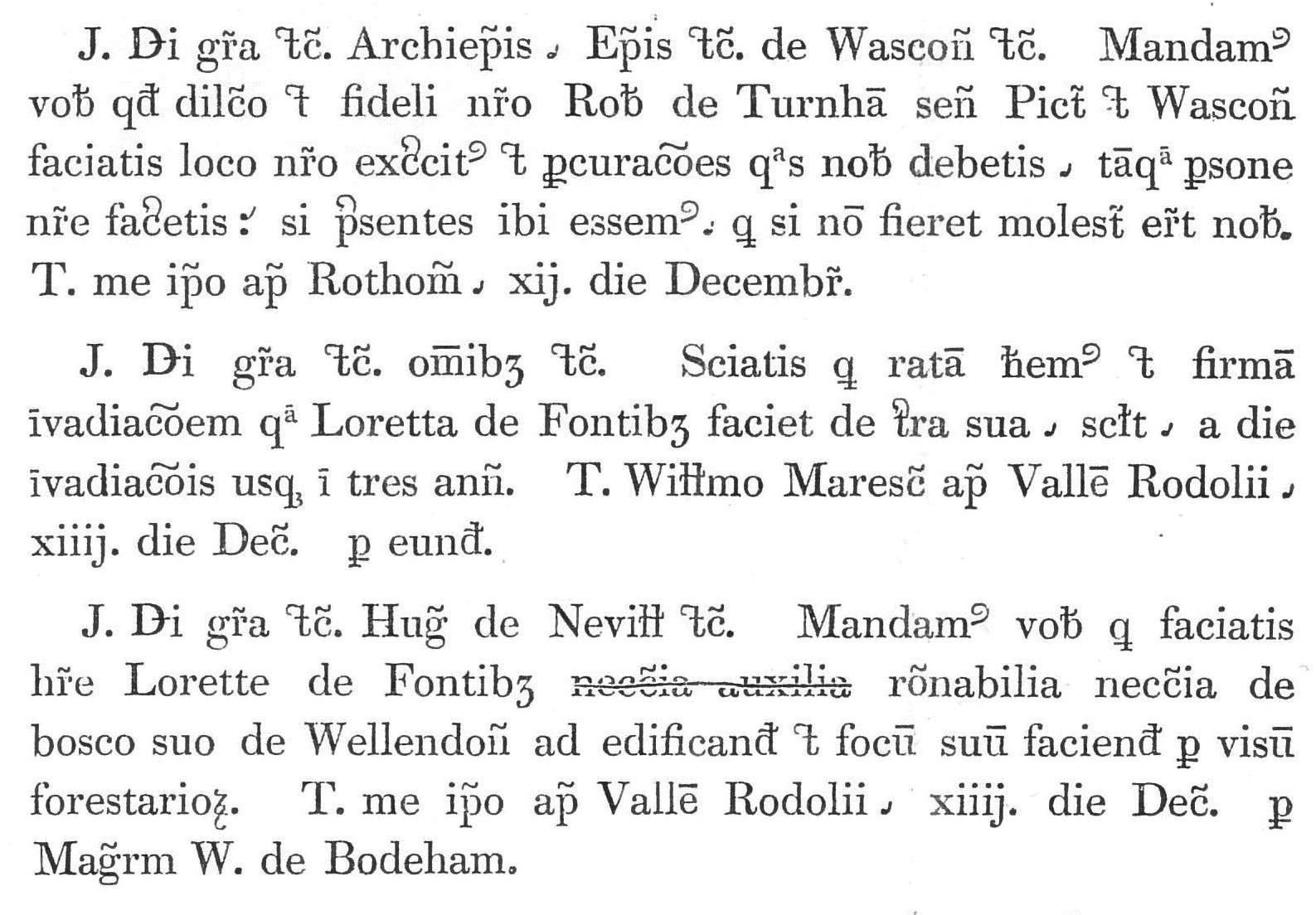
The patent rolls (Latin: ''Rotuli litterarum patentium'') are a series of administrative records compiled in the English, British and United Kingdom Chancery, running from 1201 to the present day. Description The patent rolls comprise a register of the letters patent issued by the Crown, and sealed "open" with the Great Seal pendent, expressing the sovereign's will on a wide range of matters of public interest, including – but not restricted to – grants of official positions, lands, commissions, privileges and pardons, issued both to individuals and to corporations. The rolls were started in the reign of King John, under the Chancellorship of Hubert Walter. The texts of letters patent were copied onto sheets of parchment, which were stitched together (head-to-tail) into long rolls to form a roll for each year. As the volume of business grew, it became necessary to compile more than one roll for each year. The most solemn grants of lands and privileges were issued, not as l ... [...More Info...] [...Related Items...] OR: [Wikipedia] [Google] [Baidu] |
Civil Survey
The Civil Survey was a cadastral survey of landholdings in Ireland carried out in 1654–56. It was separate from the Down Survey, which began while the Civil Survey was in progress, and made use of Civil Survey data to guide its progress. Whereas the Down Survey was a cartographic survey based on measurements in the field, the Civil Survey was an inquisition which visited each barony and took depositions from landholders based on parish and townland, with written descriptions of their boundaries. The Civil Survey covered 27 of Ireland's 32 counties, excluding 5 counties in Connacht which had been covered in the 1630s by the Strafford survey commissioned by Thomas Wentworth, 1st Earl of Strafford. The original Civil Survey records were destroyed by fire in 1711, but a set of copies for 10 counties was discovered in the 19th century. References Sources *Irish Manuscripts Commission The Irish Manuscripts Commission was established in 1928 by the newly founded Irish Free State wit ... [...More Info...] [...Related Items...] OR: [Wikipedia] [Google] [Baidu] |


.jpg)
