|
Glarus Alps
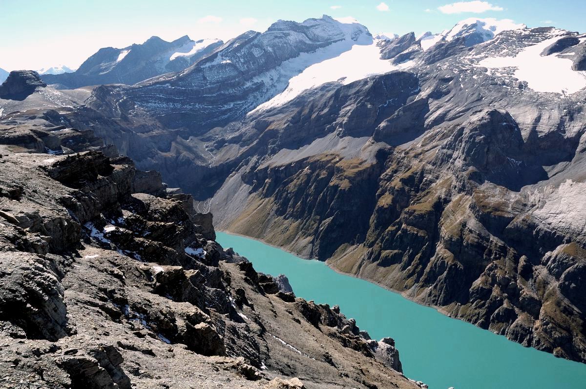
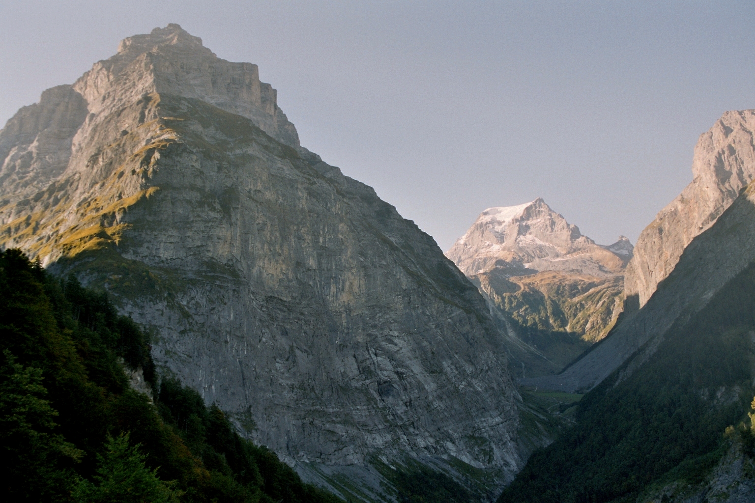
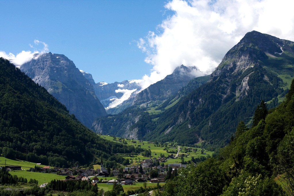
The Glarus Alps (german: Glarner Alpen) are a mountain range in central Switzerland. They are bordered by the Uri Alps and the Schwyz Alps to the west, the Lepontine Alps to the south, the Appenzell Alps to the northeast. The eastern part of the Glarus Alps contains a major thrust fault that was declared a geologic UNESCO World Heritage Site (the Swiss Tectonic Arena Sardona). The Glarus Alps extend well beyond the canton of Glarus, including parts of the cantons of Uri, Graubünden, and St Gallen. Conversely, not all the mountains in the canton of Glarus are part of the Glarus Alps, with those to the north of the Urner Boden and to the west of the valley of the river Linth considered to be part of the Schwyz Alps. Geography The main chain of the Glarus Alps can be divided into six minor groups, separated from each other by passes, the lowest of which exceeds 7,500 ft. The westernmost of these is the Crispalt, a rugged range including many peaks of nearly equal heigh ... [...More Info...] [...Related Items...] OR: [Wikipedia] [Google] [Baidu] |
Swisstopo
Swisstopo is the official name for the Swiss Federal Office of Topography (in German language, German: ''Bundesamt für Landestopografie''; French language, French: ''Office fédéral de topographie''; Italian language, Italian: ''Ufficio federale di topografia''; Romansh language, Romansh: ''Uffizi federal da topografia''), Switzerland's national mapping agency. The current name was made official in 2002. It had been in use as the domain name for the institute's homepage, swisstopo.ch, since 1997. Maps The main class of products produced by Swisstopo are topographical maps on seven different Scale (map), scales. Swiss maps have been praised for their accuracy and quality. Regular maps * 1:25.000. This is the most detailed map, useful for many purposes. Those are popular with tourists, especially for famous areas like Zermatt and St. Moritz. These maps cost CHF 13.50 each (2004). 208 maps on this scale are published at regular intervals. The first map published on this scale ... [...More Info...] [...Related Items...] OR: [Wikipedia] [Google] [Baidu] |
Swiss Tectonic Arena Sardona
The Glarus thrust (german: Glarner Überschiebung) is a major thrust fault in the Alps of eastern Switzerland. Along the thrust the Helvetic nappes were thrust more than 100 km to the north over the external Aarmassif and Infrahelvetic complex. The thrust forms the contact between older (Helvetic) Permo-Triassic rock layers of the Verrucano group and younger (external) Jurassic and Cretaceous limestones and Paleogene flysch and molasse. The Glarus thrust crops out over a relatively large area in the cantons Glarus, St. Gallen and Graubünden, due to its horizontal orientation and the high local relief. Famous outcrops include those at Lochsite near Glarus (the town) and in a mountain cliff called ''Tschingelhörner'' between Elm and Flims (in the same cliff is a natural hole called the Martinsloch). World Heritage Thrust faults of this kind are not uncommon in many mountain chains around the world, but the Glarus thrust is a well accessible example and has as such p ... [...More Info...] [...Related Items...] OR: [Wikipedia] [Google] [Baidu] |
Tödi
The Tödi (), is a mountain massif and with the mountain peak Piz Russein the highest mountain in the Glarus Alps and the highest summit in the canton of Glarus, Switzerland. It is located on the border between the cantons of Graubünden, to the south, and Glarus, to the north, close to the point where those two cantons meet the canton of Uri, to the west. Although not the culminating point of Graubünden, it is its highest peak outside the Bernina range. Geography The Tödi lies in the west part of the Glarus Alps, between Linthal on the north and Disentis on the south. The Tödi is a vast mountain massif projecting as a promontory to the north from the range that divides the basin of the Linth from that of the Rhine. There are three principal peaks. The lowest, and northernmost, which is that seen from the Ober Sand Alp, is called ''Sandgipfel'' (). The ''Glarner Tödi'' (), long supposed to be the highest, and most conspicuous from Stachelberg and other points of view to ... [...More Info...] [...Related Items...] OR: [Wikipedia] [Google] [Baidu] |
John Ball (naturalist)
John Ball (20 August 1818 – 21 October 1889) was an Irish politician, naturalist and Alpine traveller. Background and education Ball was born in Dublin, the eldest son of Nicholas Ball, judge of the Court of Common Pleas (Ireland) and his wife Jane Sherlock. He was educated at Oscott College near Birmingham, and at Christ's College, Cambridge, where he was 41st Wrangler but as a Roman Catholic could not be admitted to a BA degree. He showed in his early years a taste for natural science, particularly botany; and after leaving Cambridge he travelled in Switzerland and elsewhere in Europe and North Africa, studying his favourite pursuits, and contributing papers on botany and the Swiss glaciers to scientific periodicals. Political career In 1846 Ball was made an assistant poor-law commissioner, but resigned in 1847, and in 1848 stood unsuccessfully as a parliamentary candidate for Sligo. In 1849 he was appointed second poor-law commissioner, but resigned in 1852 and success ... [...More Info...] [...Related Items...] OR: [Wikipedia] [Google] [Baidu] |
Oberalpstock
The Oberalpstock or Piz Tgietschen is a mountain in the Glarus Alps between the cantons of Uri and Graubünden. Its massif separates the valleys of Maderanertal (Uri) and Surselva near Sedrun (Graubündnen). The Oberalpstock is the highest summit of the Glarus Alps west of the Tödi, and also the highest mountain in the canton of Uri east of the Reuss. See also *List of mountains of Graubünden *List of mountains of Uri *List of most isolated mountains of Switzerland References * Swisstopo Swisstopo is the official name for the Swiss Federal Office of Topography (in German language, German: ''Bundesamt für Landestopografie''; French language, French: ''Office fédéral de topographie''; Italian language, Italian: ''Ufficio fed ... maps External links Oberalpstock on Summitpost Mountains of Switzerland Mountains of the Alps Alpine three-thousanders Mountains of Graubünden Mountains of the canton of Uri Graubünden–Uri border Tujetsch {{Uri-mountain-s ... [...More Info...] [...Related Items...] OR: [Wikipedia] [Google] [Baidu] |
Chrüzli Pass
The Chrüzli Pass (, Swiss German for ''Small Cross'' (as a diminutive) ''Pass'') is a historic high mountain pass of the Glarus Alps, located on the border between the Swiss cantons of Uri and Graubünden (GR). It is also known as the Kreuzli Pass or Chrüxli Pass. It connects the Maderanertal (UR) and the Tujetsch (e.g. Sedrun) in Surselva (GR). It is one of the lowest passes between the two cantons and is traversed by a trail. The pass is overlooked by the Witenalpstock and the Chrüzlistock. Below the Chrüzlipass, or more precisely between it and the Chrüzlistock, runs the Gotthard Base Tunnel , rm, Tunnel da basa dal Sogn Gottard , image = 20141120 gotthard-basistunnel02-wikipedia-hannes-ortlieb.jpg , image_size = 250 , caption = Turnout at Faido multifunction station , line = Gotthard Line , location = Switzerland (Uri, Grisons and .... References External linksChrüzlipass on Hikr Mountain passes of Switzerland Mountain passes of the Alps Mountain passes ... [...More Info...] [...Related Items...] OR: [Wikipedia] [Google] [Baidu] |
Bristen
The Bristen (3,073 m) is a mountain in the Glarus Alps, overlooking the valley of the Reuss and located to the south of Amsteg in the canton of Uri, Switzerland. The mountain is located about four kilometres north of Piz Giuv and the border with Graubünden. The Bristen is considered one of the main landmarks of the Canton of Uri. Geographic setting and description The Bristen is located about three kilometers to the south of the village also called Bristen in the Maderanertal and about four kilometers north of Piz Giuv, with the Portlilücke (2'506 m) in between. An arête on the north side of the mountain is divided after 200 meters into the northern arête and the northeastern arête. Located below the northern arête on 2'095 m is the Bristensee - two hectare wide and 6,5 meters deep. On the western side of the mountain a steep arête leads down to the Fellital, the southern side is marked by another arête leading to the Zwächten (2'853 m), which goes further to the Port ... [...More Info...] [...Related Items...] OR: [Wikipedia] [Google] [Baidu] |
Piz Nair (Glarus Alps)
Piz Nair (3,059 m) is a mountain of the Glarus Alps, located on the border between the Swiss cantons of Uri and Graubünden. Together with Piz Giuv (3,096 m) on the west, it overlooks the end of the Etzli valley in the canton of Uri. The south-west and the south-east sides overlook respectively the small valleys of Val Giuv and Val Milà, both converging to the Rhine valley west of Sedrun (Graubünden). The mountain is politically divided between the municipalities of Silenen (Uri) and Tujetsch (Graubünden). On the northern side of Piz Nair lies a small glacier, the Fellelifirn. Large lateral moraine A moraine is any accumulation of unconsolidated debris (regolith and rock), sometimes referred to as glacial till, that occurs in both currently and formerly glaciated regions, and that has been previously carried along by a glacier or ice shee ...s can be seen below the glacier. References Mountains of Graubünden Mountains of the canton of Uri Mountains of the Alps ... [...More Info...] [...Related Items...] OR: [Wikipedia] [Google] [Baidu] |
Piz Giuv
Piz Giuv (or Schattig Wichel) is a mountain of the Glarus Alps, located on the border between the cantons of Uri and Graubünden. At 3,096 metres above sea level, it is the highest mountain of the Glarus Alps lying west of the Oberalpstock. Its summit is situated between three valleys: the Fellital and Etzlital on the north side and the Val Giuv (Surselva) on the south side. The slightly lower Piz Nair Piz Nair () is a mountain of the Albula Alps in Switzerland, overlooking St. Moritz in the Cantons of Switzerland, canton of Graubünden. The peak is easily accessible from the village with a funicular and a Aerial lift, cable car; the upper sta ... lies on its east side References External linksPiz Giuv on Summitpost [...More Info...] [...Related Items...] OR: [Wikipedia] [Google] [Baidu] |
Bifertenstock2
, photo= Bifertenstock3.jpg , photo_size= 285 , elevation_m= 3419 , elevation_ref= , prominence_m= 385 , prominence_ref=Swisstopo maps , listing= Alpine mountains above 3000 m , parent_peak= Tödi , map= Switzerland , map_caption= Location in Switzerland , subdivision2_type= Cantons , subdivision2= , country= Switzerland , parent= Glarus Alps , coordinates= , range_coordinates= , coordinates_ref= , topo_map= Swiss Federal Office of Topography swisstopo , mountain_type= , age= , first_ascent= , easiest_route= The Bifertenstock ( rm, Piz Durschin) is a mountain in the Glarus Alps, located at an elevation of on the border between the cantons of Glarus (north) and Graubünden (south), its peak, however, is located about 25 metres south of the border. It overlooks four valleys: the valley of the Biferten Glacier to the north-west, the Griess Glacier to the north-east, the Val Punteglias to the south, which leads down to Trun, and the Val Frisal on th ... [...More Info...] [...Related Items...] OR: [Wikipedia] [Google] [Baidu] |
Linth
The Linth (pronounced "lint") is a Swiss river that rises near the village of Linthal in the mountains of the canton of Glarus, and eventually flows into the Obersee section of Lake Zurich. It is about in length. The water power of the Linth was a main factor in the creation of the textile industry of the canton Glarus, and is today used to drive the Linth–Limmern power stations in its upper reaches. The river and its upper valley forms the boundary between the mountain ranges of the Glarus Alps, to its east and south, and the Schwyzer Alps, to its west. Course of the river The river rises to the south-west of the village of Linthal, at the foot the Tödi mountain (elevation ). It collects the water from several glaciers, including the Clariden Glacier and the Biferten Glacier, as well as various tributary streams, including the ''Oberstafelbach'', the ''Bifertenbach'', the ''Sandbach'', the ''Walenbach'' and the ''Limmerenbach''. The last of these is dammed to create t ... [...More Info...] [...Related Items...] OR: [Wikipedia] [Google] [Baidu] |


