|
Glan (Nahe)
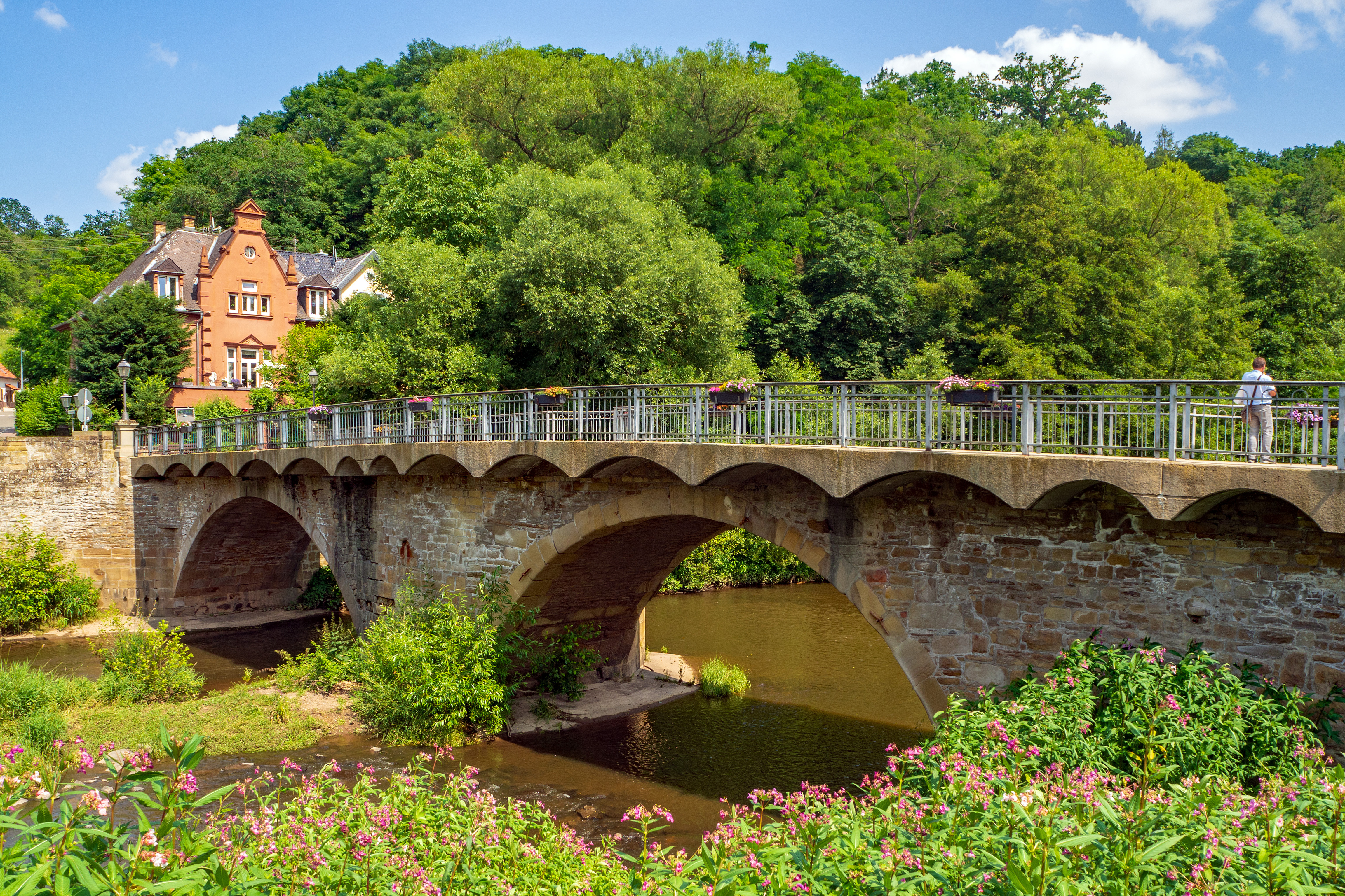
The Glan () is a river in southwestern Germany, right tributary of the Nahe. It is approximately long. It rises in the Saarland, northwest of Homburg. It flows generally north, through Rhineland-Palatinate, and empties into the Nahe near Odernheim am Glan, at Staudernheim, across the Nahe from Bad Sobernheim. Other towns along the Glan are Altenglan, Glan-Münchweiler, Lauterecken and Meisenheim. Etymology The Celtic root of the name comes either from ''glann'' (shining) or from '' glen'' (U-shaped valley). See also *List of rivers of Saarland *List of rivers of Rhineland-Palatinate A list of rivers of Rhineland-Palatinate, Germany: A * Aar * Adenauer Bach * Ahr * Alf * Alfbach *Appelbach *Asdorf * Aubach B * Birzenbach *Blattbach * Breitenbach * Brexbach * Brohlbach, tributary of the Moselle * Brohlbach, tributary of the ... References Rivers and lakes of Western Palatinate Rivers of Saarland North Palatinate Rivers of Germany {{RhinelandPalatinate- ... [...More Info...] [...Related Items...] OR: [Wikipedia] [Google] [Baidu] |
Germany
Germany,, officially the Federal Republic of Germany, is a country in Central Europe. It is the second most populous country in Europe after Russia, and the most populous member state of the European Union. Germany is situated between the Baltic and North seas to the north, and the Alps to the south; it covers an area of , with a population of almost 84 million within its 16 constituent states. Germany borders Denmark to the north, Poland and the Czech Republic to the east, Austria and Switzerland to the south, and France, Luxembourg, Belgium, and the Netherlands to the west. The nation's capital and most populous city is Berlin and its financial centre is Frankfurt; the largest urban area is the Ruhr. Various Germanic tribes have inhabited the northern parts of modern Germany since classical antiquity. A region named Germania was documented before AD 100. In 962, the Kingdom of Germany formed the bulk of the Holy Roman Empire. During the 16th ce ... [...More Info...] [...Related Items...] OR: [Wikipedia] [Google] [Baidu] |
Odenbach (Glan)
The Odenbach is a orographically right bank tributary of the Glan in the counties of Kaiserslautern and Kusel in the German state of Rhineland-Palatinate. Geography Course The Odenbach rises about north of Kaiserslautern in the North Palatine Uplands near the hamlet of Sonnenhof. It flows – mainly in a north-northwesterly direction – through the municipalities of Schneckenhausen, Schallodenbach and Niederkirchen in the county of Kaiserslautern and through Hefersweiler, Reipoltskirchen, Ginsweiler and Adenbach in the county of Kusel, before emptying into the Glan in the eponymous village of Odenbach after a distance of just under 23 kilometres. Catchment The catchment of the Odenbach covers an area of and consist of 50% arable land, 25.6% pasture, 20.2% woodland and 4.2% settlements. [...More Info...] [...Related Items...] OR: [Wikipedia] [Google] [Baidu] |
Glen
A glen is a valley, typically one that is long and bounded by gently sloped concave sides, unlike a ravine, which is deep and bounded by steep slopes. Whittow defines it as a "Scottish term for a deep valley in the Highlands" that is "narrower than a strath".. The word is Goidelic in origin: ''gleann'' in Irish and Scottish Gaelic, ''glion'' in Manx. The designation "glen" also occurs often in place names. Etymology The word is Goidelic in origin: ''gleann'' in Irish and Scottish Gaelic, ''glion'' in Manx. In Manx, ''glan'' is also to be found meaning glen. It is cognate with Welsh ''glyn''. Examples in Northern England, such as Glenridding, Westmorland, or Glendue, near Haltwhistle, Northumberland, are thought to derive from the aforementioned Cumbric cognate, or another Brythonic equivalent. This likely underlies some examples in Southern Scotland. As the name of a river, it is thought to derive from the Irish word ''glan'' meaning clean, or the Welsh word ''gleindid' ... [...More Info...] [...Related Items...] OR: [Wikipedia] [Google] [Baidu] |
Glan-Münchweiler
Glan-Münchweiler is an '' Ortsgemeinde'' – a municipality belonging to a ''Verbandsgemeinde'', a kind of collective municipality – in the Kusel district in Rhineland-Palatinate, Germany. It belongs to the ''Verbandsgemeinde'' of Oberes Glantal. Geography Location The municipality lies in a hollow in the Glan valley in the uplands in the Western Palatinate, with peaks such as the Galgenberg, the Klopfberg, the Eckertsberg and the Wingertsberg. On the Glan’s right bank, at the foot of the Hochwald (“High Forest”) lies the outlying centre of Bettenhausen. The bottom of the dale has an elevation of 215 m above sea level. The highest elevation within municipal limits lies in the Eichenwald (“Oak Forest”) at 388 m above sea level. Glan-Münchweiler lies roughly 8 km southeast of Kusel and 25 km west of Kaiserslautern. The municipal area measures 464 ha, of which 112 ha is wooded. Neighbouring municipalities Glan-Münchweiler borders in the ... [...More Info...] [...Related Items...] OR: [Wikipedia] [Google] [Baidu] |
Altenglan
Altenglan is an ''Ortsgemeinde'' – a municipality belonging to a ''Verbandsgemeinde'', a kind of collective municipality – in the Kusel district in Rhineland-Palatinate, Germany. It belongs to the ''Verbandsgemeinde'' of Kusel-Altenglan. Altenglan is a recognized tourism community. Also, named after the municipality is the Altenglan Formation, a lithostratigraphic entity, and by extension, so is ''Altenglanerpeton'', a microsaur whose fossil remains were found therein. Geography Location The municipality lies in the uplands in the Western Palatinate on the river Glan, which is the village's namesake, at an elevation in the valley of some 200 m above sea level, although the elevations within municipal limits reach almost 400 m (Bistersberg 387 m on the Glan's left bank; Kalmet 390 m on the Glan's right bank), and on the slopes of the Potzberg within the formerly self-administering municipality of Mühlbach almost 500 m. Altenglan lies roughly 5 k ... [...More Info...] [...Related Items...] OR: [Wikipedia] [Google] [Baidu] |
Bad Sobernheim
Bad Sobernheim is a town in the Bad Kreuznach district in Rhineland-Palatinate, Germany. It belongs to the like-named ''Verbandsgemeinde'', and is also its seat. It is a state-recognized spa town, and is well known for two fossil discovery sites and for the naturopath Emanuel Felke. Bad Sobernheim is also a winegrowing town. Geography Location Bad Sobernheim lies on the middle Nahe about halfway between the district seat of Bad Kreuznach (roughly 20 km southwest of that town) and the gemstone town of Idar-Oberstein. Looming to the north is the Hunsrück, and to the south, the North Palatine Uplands. The municipal area stretches as far as the Soonwald. One notable feature of Bad Sobernheim's municipal area is that it is split geographically into two non-contiguous pieces. The part to the southeast containing the main town holds most of the population, whereas the part to the northwest is only thinly populated, but nevertheless makes up more than half the town's area. This ... [...More Info...] [...Related Items...] OR: [Wikipedia] [Google] [Baidu] |
Homburg, Saarland
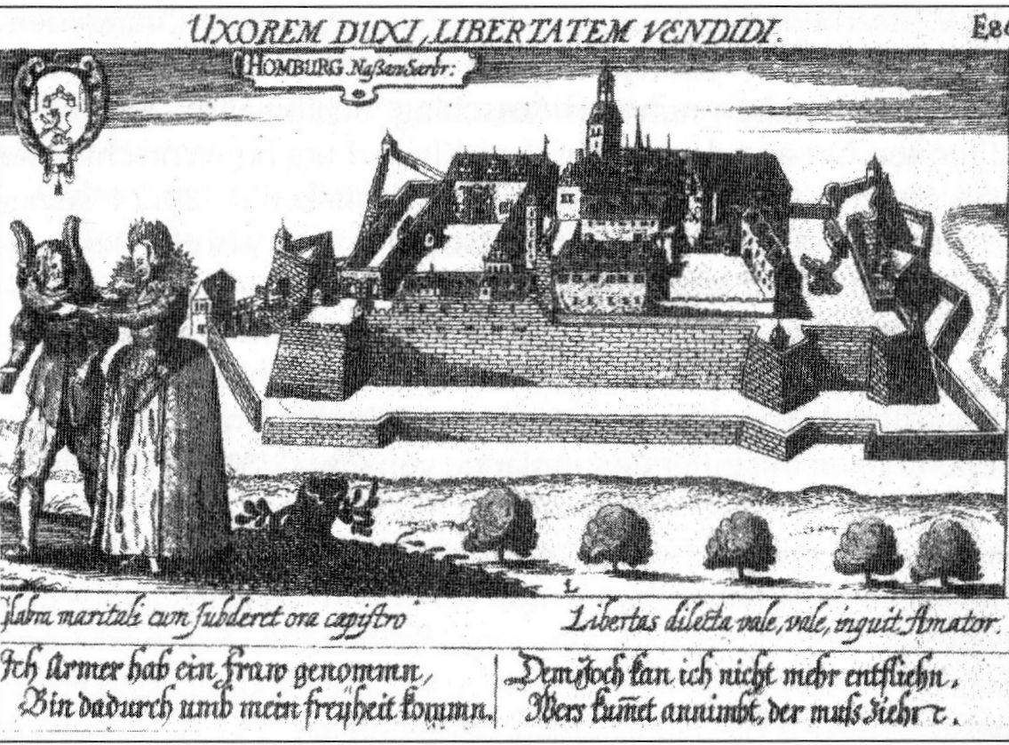
Homburg (; french: Hombourg, pfl, Humborch) is a town in Saarland, Germany and the administrative seat of the Saarpfalz district. With a population of 43,029 inhabitants (2022), it is the third largest town in the state. The city offers over 30,000 workplaces. The medical department of the University of Saarland is situated here. The city is also home to the Karlsberg beer brewery. Major employers include Robert Bosch GmbH, Schaeffler Group and Michelin. Geography Homburg is located in the northern part of the Saarpfalz district, bordering Rhineland-Palatinate. It is 16 km from Neunkirchen and 36 km from Saarbrücken. The city districts are situated in the Blies valley or on its tributaries Erbach, Lambsbach and Schwarzbach. Homburg is composed of Homburg center and nine city districts: Beeden, Bruchhof-Sanddorf, Einöd, Erbach, Jägersburg, Kirrberg, Reiskirchen, Schwarzenbach and Wörschweiler. Einöd includes: Einöd, Ingweiler and Schwarzenacker; ... [...More Info...] [...Related Items...] OR: [Wikipedia] [Google] [Baidu] |
River
A river is a natural flowing watercourse, usually freshwater, flowing towards an ocean, sea, lake or another river. In some cases, a river flows into the ground and becomes dry at the end of its course without reaching another body of water. Small rivers can be referred to using names such as Stream#Creek, creek, Stream#Brook, brook, rivulet, and rill. There are no official definitions for the generic term river as applied to Geographical feature, geographic features, although in some countries or communities a stream is defined by its size. Many names for small rivers are specific to geographic location; examples are "run" in some parts of the United States, "Burn (landform), burn" in Scotland and northeast England, and "beck" in northern England. Sometimes a river is defined as being larger than a creek, but not always: the language is vague. Rivers are part of the water cycle. Water generally collects in a river from Precipitation (meteorology), precipitation through a ... [...More Info...] [...Related Items...] OR: [Wikipedia] [Google] [Baidu] |
Glan NSG Disibodenberg
The word Glan meaning derives from Celtic (Noric) glanos meaning "bright, clear", cf. Glanis, Glanum, Glen and English "clean". Glan (Nahe) * Glan, Sarangani, a municipality in Sarangani, Philippines * Glan (Gurk), a river in Carinthia, Austria, tributary of the Gurk * Glan (Nahe), a river in Rhineland-Palatinate, Germany, tributary of the Nahe * Glan Cattle, a traditional cattle breed from the same area * Glan (lake), a lake in Sweden near Norrköping * Pentti Glan (1946–2017), Finnish-Canadian rock drummer See also * Glan Valley Railway The Glan Valley Railway (german: Glantalbahn) is a non-electrified line along the Glan river, in the German state of Rhineland-Palatinate. It consists of the Glan-Münchweiler–Altenglan section, which was built as part of the Landstuhl–Kuse ..., Rhineland-Palatinate, Germany * Glane (other) {{disambig, geo, surname ... [...More Info...] [...Related Items...] OR: [Wikipedia] [Google] [Baidu] |
Meisenheim Untertorbrücke
Meisenheim () is a town in the Bad Kreuznach district in Rhineland-Palatinate, Germany. It belongs to the like-named ''Verbandsgemeinde'', and is also its seat. Meisenheim is a state-recognized recreational resort (''Erholungsort'') and it is set out as a middle centre in state planning. Geography Location Meisenheim lies in the valley of the River Glan at the northern edge of the North Palatine Uplands. The municipal area measures 1 324 ha. Neighbouring municipalities Clockwise from the north, Meisenheim's neighbours are Raumbach, Rehborn, Callbach, Reiffelbach, Odenbach, Breitenheim and Desloch, all of which likewise lie within the Bad Kreuznach district, except for Odenbach, which lies in the neighbouring Kusel district. Constituent communities Also belonging to Meisenheim are the outlying homesteads of Hof Wieseck, Keddarterhof and Röther Hof. History Meisenheim is believed to have arisen in the 7th century AD, and its name is often derived from the town's ... [...More Info...] [...Related Items...] OR: [Wikipedia] [Google] [Baidu] |
Jeckenbach (Glan)
Jeckenbach is an ''Ortsgemeinde'' – a municipality belonging to a ''Verbandsgemeinde'', a kind of collective municipality – in the Bad Kreuznach district in Rhineland-Palatinate, Germany. It belongs to the ''Verbandsgemeinde'' of Meisenheim, whose seat is in the like-named town. Geography Location Jeckenbach is a linear village (by some definitions, a "thorpe") that lies in the North Palatine Uplands west of the Glan. Neighbouring municipalities Clockwise from the north, Jeckenbach's neighbours are the municipalities of Bärweiler, Lauschied, Desloch, Breitenheim, Löllbach, Schweinschied and Hundsbach, all of which likewise lie within the Bad Kreuznach district. Geology Jeckenbach is an important site for fossil finds from the Rotliegend (Permian) some 290,000,000 years ago. It was here that amateur palaeontologist Arnulf Stapf from Nierstein am Rhein unearthed the oldest mayflies ('' Misthodotes stapfi'') ever found in Central Europe. Further fossils that were brough ... [...More Info...] [...Related Items...] OR: [Wikipedia] [Google] [Baidu] |


