|
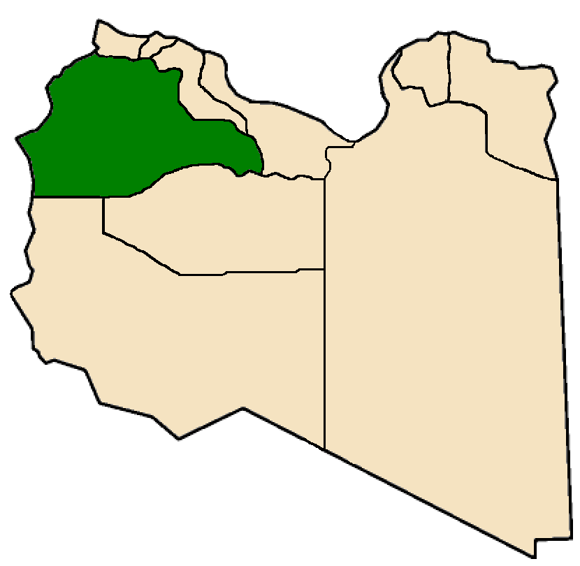
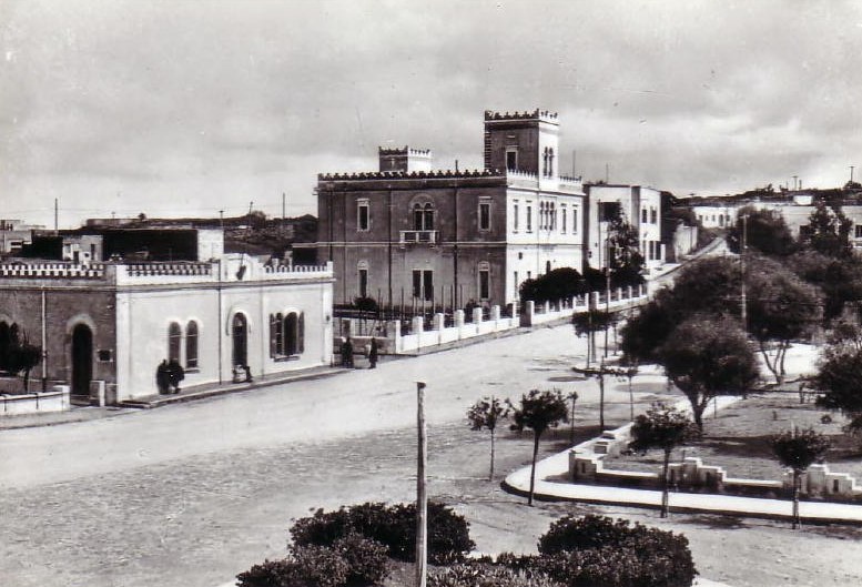
Gharian Governorate
Jabal al Gharbi Governorate or Jebal al Gharbi Governorate was one of the governorates (muhafazah) of Libya from 1963 to 1983. Its capital was Gharian.Fisher, Morris (1985) ''Provinces and provincial capitals of the world'' (second edition) Scarecrow Press, Metuchen, New jersey, page 88, Other important towns in the governorate were Yafran, Nalut, Ghadames and Mizda Mizda or Mesdah (Tamazight: ⵎⵉⵣⴷⴰ, ''Mizda'') is a town in the Nafusa Mountains in Libya. It was the capital of the former Mizda District. Just to the west of Mizda is the Mizda Army Base at See also * List of cities in Libya .... It was created out of the southwestern part of Tripolitania province. In 1970 the governorate was renamed Gharyan Governorate, but the boundaries remained unchanged. In 1972 the governorate had 5 districts named after the main towns: Gharyan, Yafran, Nalut, Ghadames and Mizda. The governorate's population was 180,883 in 1964 and had risen to 245,018 by 1972.United ... [...More Info...] [...Related Items...] OR: [Wikipedia] [Google] [Baidu] |
Governorates Of Libya
The governorates of Libya (''muhafazah'') were a tenfold top-level Subdivisions of Libya, administrative division of Libya from 1963 until 1983. They came into being on 27 April 1963. In 1970, after the 1 September 1969 History of Libya under Muammar Gaddafi#Coup d'état of 1969, Free Officers Movement coup, there was an administrative reorganization which gave local authorities more power to implement policies of the national government, and redesignated some of the names and boundaries of the ten governorates.Zeidan, Shawky S. (1987) "Chapter 4 – Government and Politics: Internal Politics: Subnational Government and Administration''A Country Study: Libya''Federal Research Division, Library of Congress In February 1975, Libya issued a law that abolished the governorates and their service directorates,Zeidan, Shawky S. (1987) "Chapter 4 – Government and Politics: Internal Politics: Subnational Government and Administration: The Cultural Revolution and People's Committ ... [...More Info...] [...Related Items...] OR: [Wikipedia] [Google] [Baidu] |
Libya
Libya (; ar, ليبيا, Lībiyā), officially the State of Libya ( ar, دولة ليبيا, Dawlat Lībiyā), is a country in the Maghreb region in North Africa. It is bordered by the Mediterranean Sea to the north, Egypt to Egypt–Libya border, the east, Sudan to Libya–Sudan border, the southeast, Chad to Chad–Libya border, the south, Niger to Libya–Niger border, the southwest, Algeria to Algeria–Libya border, the west, and Tunisia to Libya–Tunisia border, the northwest. Libya is made of three historical regions: Tripolitania, Fezzan, and Cyrenaica. With an area of almost 700,000 square miles (1.8 million km2), it is the fourth-largest country in Africa and the Arab world, and the List of countries and outlying territories by total area, 16th-largest in the world. Libya has the List of countries by proven oil reserves, 10th-largest proven oil reserves in the world. The largest city and capital, Tripoli, Libya, Tripoli, is located in western Libya and contains over ... [...More Info...] [...Related Items...] OR: [Wikipedia] [Google] [Baidu] |
Helen Chapin Metz
Helen Chapin Metz (April 12, 1928 – May 13, 2011) was an American editor and Middle East analyst. Life Helen Chapin was born on April 12, 1928, in Peking, China. She was the daughter of diplomat Selden Chapin and Mary Paul Noyes. Her brother, Frederic L. Chapin, would also become a diplomat. She was educated at the Potomac School, the Madeira School, Vassar College, graduating in 1949, and the American University of Beirut. She married Rev. Ronald Irvin Metz on July 14, 1951, in The Hague, Netherlands. The couple settled in Washington, D. C., as they both had jobs in the federal government. Metz worked for the Federal Research Division of the Library of Congress, editing 15 Library of Congress Country Study handbooks. She died in Washington, D.C. ) , image_skyline = , image_caption = Clockwise from top left: the Washington Monument and Lincoln Memorial on the National Mall, United States Capitol, Logan Circle, Jefferson Memorial, White Ho ... [...More Info...] [...Related Items...] OR: [Wikipedia] [Google] [Baidu] |
Gharian
Gharyan is a city in northwestern Libya, in Jabal al Gharbi District, located 80 km south of Tripoli. Prior to 2007, it was the administrative seat of Gharyan District. Gharyan is one of the largest towns in the Western Mountains. In 2005, the population of Gharyan was estimated at 170,000. History Gharyan was on the trade routes both south to Fezzan and over the Nafusa Mountains. By 1884 the Ottomans had established a mayor and town council in Gharyan. It was considered the center of Libyan resistance against the Italian invasion in the early 20th century. 2011 Libyan Civil War In early 2011, the city became involved in the nationwide anti-Gaddafi uprising. Initially successful, on 2 March, government forces retook it. In April, rebels succeeded in occupying several nearby towns and establishing a second territory on the focal town and the first town demonstrate their will against regime on the 16 Feb. ZENTAIN Libya besides Misrata that is no longer under the co ... [...More Info...] [...Related Items...] OR: [Wikipedia] [Google] [Baidu] |
Yafran
Yafran ( Berber: ⵢⴼⵔⴰⵏ ''Ifran'', ar, يفرن, links=https://www.temehu.com/Cities_sites/Yefren.htm ', it, Iefren), also spelled ''Jefren'', ''Yefren'', ''Yifran'', ''Yifrin'' or ''Ifrane'', is a city in northwestern Libya, in the Jabal al Gharbi District in the western Nafusa Mountains. Before 2007, Yafran was the administrative seat of the Yafran District. Libyan civil war Yafran people, as in other cities of Libya, have demonstrated against Gaddafi. Subsequently, Yafran was exposed to bombardment and siege by Gaddafi forces. As of May 2011, Gaddafi's forces had shut down the water system and blocked food supplies and held the western part of the town with some 500 rebels in the eastern section of Yafran still resisting. Yafran fell to Gaddafi's forces sometime in late May or early June. The centre of the town was used as a position for "government tanks, artillery guns and snipers". On 2 June, rebel forces retook the city center and started to clear the area of ... [...More Info...] [...Related Items...] OR: [Wikipedia] [Google] [Baidu] |
Nalut
Nalut (sometimes Lalút) ( ar, نالوت) is the capital of the Nalut District in Libya. Nalut lies approximately halfway between Tripoli and Ghadames, at the western end of the Nafusa Mountains coastal range, in the Tripolitania region. The town is a long-time Berber community and a cultural centre for them, with a festival held in the spring to revive and promote the local culture, traditions, industries and art of the Amazigh people. History Name The name Nalut and its alternate Lalut may derive from the pagan Berber goddess of springs, Tala. As Nalut is only 60 km from the Tunisian border and lies close to some oases it played an important part in the caravan trade. Architecture Nalut is home to the Qasr Nalut ⵣⴰⵙⵔⵓ ⵏ ⵏⴰⵍⵓⵜ, which is a granary fortified by a ksour (castle). The facility has been abandoned but is a tourist destination. The fortress was a communal building where the local families could store their grain in times of conflict. The A ... [...More Info...] [...Related Items...] OR: [Wikipedia] [Google] [Baidu] |
Ghadames
Ghadames or Ghadamis ( Berber: ''ʕadémis''; ar, غدامس, Libyan vernacular: ''ɣdāməs'', Latin: ''Cidamus, Cydamus'', it, Gadames) is an oasis Berber town in the Nalut District of the Tripolitania region in northwestern Libya. The indigenous language of Ghadames is Ghadamès, a Berber language. Ghadamès, known as 'the pearl of the desert', stands in an oasis. It is one of the oldest pre-Saharan cities and an outstanding example of a traditional settlement. Its domestic architecture is characterized by a vertical division of functions: the ground floor used to store supplies; then another floor for the family, overhanging covered alleys that create what is almost an underground network of passageways; and, at the top, open-air terraces reserved for the women. Geography Ghadames lies roughly to the southwest of Tripoli, near the borders with Algeria and Tunisia. Ghadames borders Illizi Province, Algeria and Tataouine Governorate, Tunisia. The oasis has a populati ... [...More Info...] [...Related Items...] OR: [Wikipedia] [Google] [Baidu] |
Mizda
Mizda or Mesdah (Tamazight: ⵎⵉⵣⴷⴰ, ''Mizda'') is a town in the Nafusa Mountains in Libya. It was the capital of the former Mizda District. Just to the west of Mizda is the Mizda Army Base at See also * List of cities in Libya This is a list of the 100 largest populated places in Libya. Some places in the list could be considered suburbs or neighborhoods of some large cities in the list, so this list is not definitive. ''Source:Amraja M. el Khajkhaj, "Noumou ... Notes External links "Mizda Map — Satellite Images of Mizda" Populated places in Jabal al Gharbi District {{Libya-geo-stub ... [...More Info...] [...Related Items...] OR: [Wikipedia] [Google] [Baidu] |
Tripolitania (province Of Libya)
Tripolitania province is one of the three traditional Provinces of Libya. It was a formal province from 1934 until 1963, when it was subdivided into the Governorates of Libya. Its capital was the city of Tripoli. Between 1911 and 1934 it had been the separately governed colony of Italian Tripolitania. In 1963 the province was split into: * Al Khums Governorate * Az Zawiyah Governorate *Gharian Governorate *Misrata Governorate *Tarabulus Governorate Demographics Population Tripolitania is Libya's most populous region (compared to Fezzan and Cyrenaica). Tripolitania's population has grown throughout years, as has the population of Libya as a whole. Libya's overall population, however, has grown at a rate slightly greater. Because of this, the percentage of Libya's population living within Tripolitania has decreased. ''Source: Gathered from bulletins of censuses 1964, 1973, 1995 and 2006.'' Ethnicity The majority of the population in Tripolitania is of Arab ancestry. Communiti ... [...More Info...] [...Related Items...] OR: [Wikipedia] [Google] [Baidu] |
Jabal Al Gharbi District
Jabal al Gharbi or The Western Mountain ( ar, الجبل الغربي ''Al Ǧabal al Gharbi'', en, The Western Mountains) is one of the districts of Libya. It is named after the Nafusa Mountains. It was formed in 2007 from the former districts of Yafran, Gharyan and Mizda. From 1995 to 1998 Jabal al Gharbi also existed as a ''Baladiyah''. Jabal al Gharbi borders Sirte and Misrata to the east, Murqub to the northeast, Jafara and Zawiya to the north, Nuqat al Khams to the northwest, Nalut to the west, Tripoli to the north, Wadi al Shatii to the south and Jufra to the southeast. Per the census of 2012, the total population in the region was 157,747 with 150,353 Libyans. The average size of the household in the country was 6.9, while the average household size of non-Libyans being 3.7. There were totally 22,713 households in the district, with 20,907 Libyan ones. The population density of the district was 1.86 persons per km2. Per 2006 census, there were totally 104,584 econo ... [...More Info...] [...Related Items...] OR: [Wikipedia] [Google] [Baidu] |


