|
George Gill Range
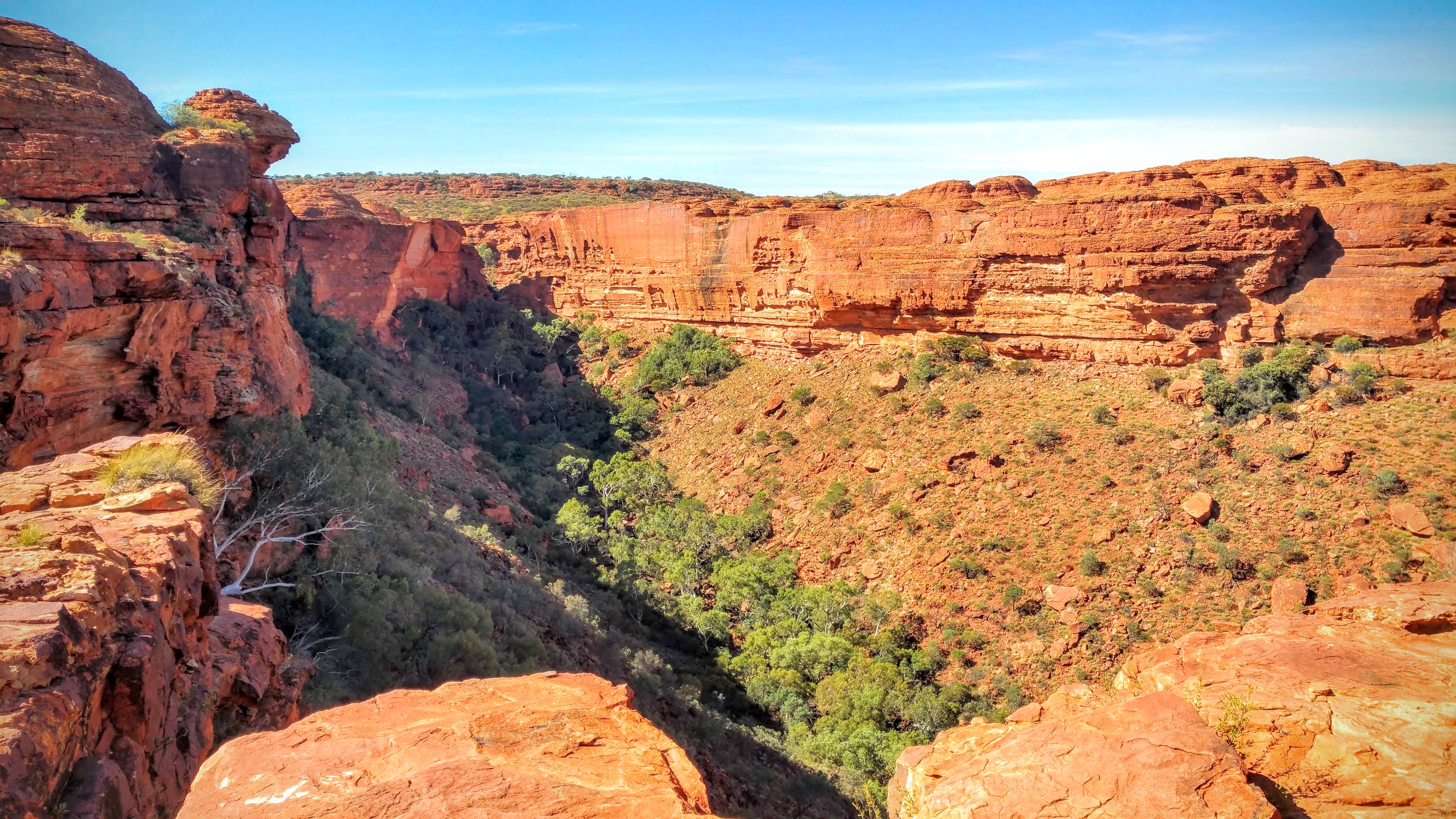
George Gill Range is a mountain range in the southern part of Australia's Northern Territory, southwest of Alice Springs. It is an extension of the MacDonnell Ranges and consists mainly of sandstone. In the southern part of the range there are some springs and water holes. Among other things, the Kings Creek flows here, which at the western end created the Kings Canyon over millions of years. This canyon offers over 100 meter high rock walls in various colors, a permanently water-bearing billabong with lush vegetation and is surrounded by a plateau with spectacular stone formations. This natural beauty makes it one of the main tourist attractions in the region. About 36% of the range is located in Watarrka National Park. The first European to visit the area was Ernest Giles William Ernest Powell Giles (20 July 1835 – 13 November 1897), best known as Ernest Giles, was an Australian explorer who led five major expeditions to parts of South Australia and Western Australia ... [...More Info...] [...Related Items...] OR: [Wikipedia] [Google] [Baidu] |
Northern Territory
The Northern Territory (commonly abbreviated as NT; formally the Northern Territory of Australia) is an states and territories of Australia, Australian territory in the central and central northern regions of Australia. The Northern Territory shares its borders with Western Australia to the west (129th meridian east), South Australia to the south (26th parallel south), and Queensland to the east (138th meridian east). To the north, the territory looks out to the Timor Sea, the Arafura Sea and the Gulf of Carpentaria, including Western New Guinea and other islands of the Indonesian archipelago. The NT covers , making it the third-largest Australian federal division, and List of country subdivisions by area, the 11th-largest country subdivision in the world. It is sparsely populated, with a population of only 249,000 – fewer than half as many people as in Tasmania. The largest population center is the capital city of Darwin, Northern Territory, Darwin. The archaeological hist ... [...More Info...] [...Related Items...] OR: [Wikipedia] [Google] [Baidu] |
Alice Springs
Alice Springs ( aer, Mparntwe) is the third-largest town in the Northern Territory of Australia. Known as Stuart until 31 August 1933, the name Alice Springs was given by surveyor William Whitfield Mills after Alice, Lady Todd (''née'' Alice Gillam Bell), wife of the telegraph pioneer Sir Charles Todd. Known colloquially as 'The Alice' or simply 'Alice', the town is situated roughly in Australia's geographic centre. It is nearly equidistant from Adelaide and Darwin. The area is also known locally as Mparntwe to its original inhabitants, the Arrernte, who have lived in the Central Australian desert in and around what is now Alice Springs for tens of thousands of years. Alice Springs had an urban population of 26,534 Estimated resident population, 30 June 2018. in June 2018, having declined an average of 1.16% per year the preceding five years. The town's population accounts for approximately 10 per cent of the population of the Northern Territory. The town straddles th ... [...More Info...] [...Related Items...] OR: [Wikipedia] [Google] [Baidu] |
MacDonnell Ranges
The MacDonnell Ranges, or Tjoritja in Arrernte, is a mountain range located in southern Northern Territory. MacDonnell Ranges is also the name given to an interim Australian bioregion broadly encompassing the mountain range, with an area of .IBRA Version 6.1 data The range is a long series of mountains in central , consisting of parallel ridges running to the east and west of . The mountain range contains many spectacular gaps and gorges as well as areas of A ... [...More Info...] [...Related Items...] OR: [Wikipedia] [Google] [Baidu] |
Kings Canyon (Northern Territory)
Kings Canyon is a canyon in the Northern Territory of Australia located at the western end of the George Gill Range about southwest of Alice Springs and about south of Darwin within the Watarrka National Park. Description The walls of Kings Canyon are over 100 metres high, with Kings Creek at the bottom. Part of the gorge is a sacred Aboriginal site and visitors are discouraged from leaving the walking tracks. Three walks exist at Kings Canyon. The two km (return) and approximately one-hour Kings Creek Walk traces the bottom of the gorge. At the end of the walk is a platform, with views of the canyon walls above. The six km (loop) Kings Canyon Rim Walk traces the top of the canyon and takes three to four hours to complete. A steep climb at the beginning of the walk, which locals call "Heartbreak Hill" (or "Heart Attack Hill", due to its steepness), takes visitors up to the top, with views of the gorge below and of the surrounding landscape. About hal ... [...More Info...] [...Related Items...] OR: [Wikipedia] [Google] [Baidu] |
Watarrka National Park
Watarrka National Park is a protected area in the Northern Territory of Australia located about 1,316 kilometres (817 miles) south of the territory capital of Darwin and southwest of Alice Springs. It contains the much visited Kings Canyon at the western end of the George Gill Range and Kathleen Springs — to the southeast of Kings Canyon. Watarrka National Park was established in 1989 and gets its name from the Aboriginal name of the land. In 1986, the national park was described by the Department of Environment as follows:One of the most spectacular canyons in Central Australia. Kings Canyon contains some 60 rare or relict plant species and a total of 572 different plant species and 80 species of birds. It is a 'living plant museum' and is notable for its stands of cycads & permanent rock pools. There are some well-preserved Aboriginal paintings and engravings in the area... The national park is categorised as an IUCN Category II protected area. On 25 March 1986, it wa ... [...More Info...] [...Related Items...] OR: [Wikipedia] [Google] [Baidu] |
Ernest Giles
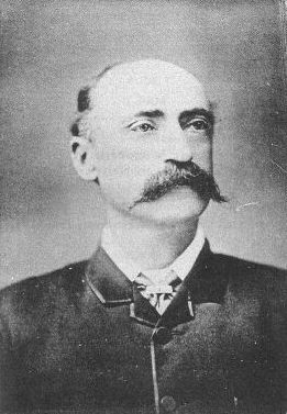
William Ernest Powell Giles (20 July 1835 – 13 November 1897), best known as Ernest Giles, was an Australian explorer who led five major expeditions to parts of South Australia and Western Australia. Early life Ernest Giles was born in Bristol, England, the eldest son of William Giles ( – 28 May 1860), a merchant, and Jane Elizabeth Giles, ''née'' Powell ( – 15 March 1879). Their family had been in comfortable circumstances but fell on hard times and emigrated to Australia. William Giles was living in North Adelaide by 1850 and Melbourne by 1853. William was later employed by Customs in Victoria, and his wife founded a successful school for girls in that colony. Giles was educated at Christ's Hospital school, Newgate, London. In 1850, at the age of 15, he emigrated to Australia, joining his parents in Adelaide. In 1852 Giles went to the Victorian goldfields, then became a clerk at the Post Office in Melbourne, and later at the County Court. Soon tiring of town life Gi ... [...More Info...] [...Related Items...] OR: [Wikipedia] [Google] [Baidu] |


