|
Geological Survey
A geological survey is the systematic investigation of the geology beneath a given piece of ground for the purpose of creating a geological map or model. Geological surveying employs techniques from the traditional walk-over survey, studying outcrops and landforms, to intrusive methods, such as hand augering and machine-driven boreholes, to the use of geophysical techniques and remote sensing methods, such as aerial photography and satellite imagery. Such surveys may be undertaken by state, province, or national geological survey organizations to maintain the geological inventory and advance the knowledge of geosciences for the benefit of the nation. A geological survey map typically superimposes the surveyed extent and boundaries of geological units on a topographic map, together with information at points (such as measurements of orientation of bedding planes) and lines (such as the intersection of faults with the land surface). The maps and reports created by geological surv ... [...More Info...] [...Related Items...] OR: [Wikipedia] [Google] [Baidu] |
Geology
Geology () is a branch of natural science concerned with Earth and other astronomical objects, the features or rocks of which it is composed, and the processes by which they change over time. Modern geology significantly overlaps all other Earth sciences, including hydrology, and so is treated as one major aspect of integrated Earth system science and planetary science. Geology describes the structure of the Earth on and beneath its surface, and the processes that have shaped that structure. It also provides tools to determine the relative and absolute ages of rocks found in a given location, and also to describe the histories of those rocks. By combining these tools, geologists are able to chronicle the geological history of the Earth as a whole, and also to demonstrate the age of the Earth. Geology provides the primary evidence for plate tectonics, the evolutionary history of life, and the Earth's past climates. Geologists broadly study the properties and processes of E ... [...More Info...] [...Related Items...] OR: [Wikipedia] [Google] [Baidu] |
China Geological Survey
The China Geological Survey (CGS) () is a government-owned, not-for-profit, Chinese organization researching China's mineral resources. It is a public institution managed by the State Council’s ministries and commissions responsible for geological and mineral exploration under the State Council of the People’s Republic of China. It is the largest Geoscience agency in China since being reinstated in 1999. History The China Geological Survey originated in the early days of the Republic of China (when it had control over mainland China). Many prominent geologists and paleontologists worked with the Survey in the early days, such as Davidson Black or Teilhard de Chardin. It was disbanded after the People's Republic of China gained control over mainland China and reinstated in 1999. See also *Cenozoic Research Laboratory * Geology of China *Geological Museum of China *History of Chinese archaeology Chinese archaeology has been practiced since the Song dynasty (960-1279) wit ... [...More Info...] [...Related Items...] OR: [Wikipedia] [Google] [Baidu] |
Geoscience Australia
Geoscience Australia is an agency of the Australian Government. It carries out geoscientific research. The agency is the government's technical adviser on all aspects of geoscience, and custodian of the geographic and geological data and knowledge of the nation. On a user pays basis it produces geospatial products such as topographic maps and satellite imagery. It is also a major contributor to the Australian Government's free, open data collections such as data.gov.au. Strategic priorities The agency has six strategic priority areas: # building Australia's resource wealth in order to maximise benefits from Australia's minerals and energy resources, now and into the future; # ensuring Australia's community safety so that Australian communities are more resilient to natural hazards; # securing Australia's water resources in order to optimise and sustain the use of Australia's water resources; # managing Australia's marine jurisdictions in order to maximise benefits from the sus ... [...More Info...] [...Related Items...] OR: [Wikipedia] [Google] [Baidu] |
Geological Survey Of Sweden
Geological Survey of Sweden ( sv, Sveriges geologiska undersökning, SGU) is a Swedish government agency that was founded in 1858 dealing with questions about the nature of the geological and mineral management in Sweden. The institution has the right to issue instructions regarding groundwater Groundwater is the water present beneath Earth's surface in rock and Pore space in soil, soil pore spaces and in the fractures of stratum, rock formations. About 30 percent of all readily available freshwater in the world is groundwater. A unit ... administration in Sweden. References External links * Government agencies of Sweden Organizations established in 1858 1858 establishments in Sweden {{Sweden-org-stub ... [...More Info...] [...Related Items...] OR: [Wikipedia] [Google] [Baidu] |
Geological Survey Of Slovenia
The Geological Survey of Slovenia ( sl, Geološki zavod Slovenije, abbreviated GeoZS) is the primary geological research institute of Slovenia. It was founded on May 7, 1946. History While Slovenia was part of Austro-Hungary Austria-Hungary, often referred to as the Austro-Hungarian Empire,, the Dual Monarchy, or Austria, was a constitutional monarchy and great power in Central Europe Central Europe is an area of Europe between Western Europe and Eastern ..., geological studies were carried out by the Imperial Geological Office (''K. K. Geologischen Reichsanstalt''), which is now the Federal Geological Office (''Geologische Bundesanstalt'') of Austria. References {{Reflist External linksOfficial website of the Geological Survey of Slovenia Geology of Slovenia Geological surveys ... [...More Info...] [...Related Items...] OR: [Wikipedia] [Google] [Baidu] |
Geological Survey Of Pakistan
Geological Survey of Pakistan (GSP) is an independent executive scientific agency to explore the natural resources of Pakistan. Main tasks GSP perform are Geological, Geophysical and Geo-chemical Mapping of Pakistan. Target of these mapping are resources exploration, Geo-Engineering assessment, Geo-hazard prediction/prevention and addressing environmental issue. Apart from studying geology, it has various major science disciplines, concerning biology, engineering, hydrology, chemistry and physics. Due to its reputation and studies on fact-finding research, it has undertaken various efforts and studies on mineral exploration. Headquartered in Quetta and other regional offices in all over the country, and as of current, Dr. Tanveer Ahmed Qureshi is the current and designated director-general of the Geological Survey of Pakistan. History As early as 1836–51, the British crown government decided to set up the geological survey to explore the British Indian Empire under the Bri ... [...More Info...] [...Related Items...] OR: [Wikipedia] [Google] [Baidu] |
Geological Survey Of Norway
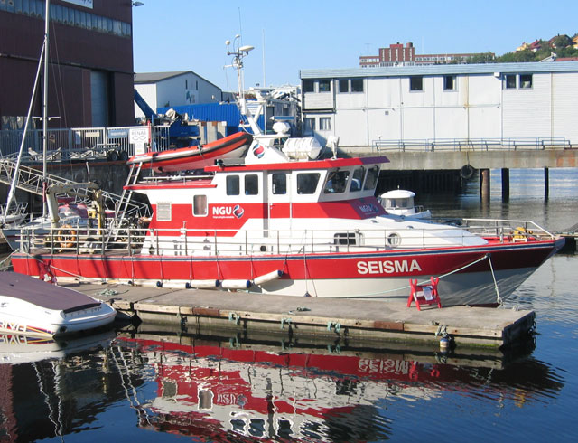
Geological Survey of Norway ( no, Norges geologiske undersøkelse), abbreviation: ''NGU'', is a Norwegian government agency responsible for geologic mapping and research. The agency is located in Trondheim with an office in Tromsø, with about 200 employees. It is subordinate to the Norwegian Ministry of Trade, Industry and Fisheries.Government.no: Subordinate agencies and institutions2012-07-11. Mission NGU's main work is related to collecting, processing and impart knowledge related to the physical, chemical and mineralogical characteristics of the countries bedrock, mineral resources, deposits and groundwater.Geological Survey of NorwayAbout NGU 2008-01-27. Important areas include the Arctic, Antarctica, Svalbard and the continental shelf. With the motto "Geology for the Society", NGU provides maps and geological information in national databases. The activity is organized after five key principles:NGU - Annual report 20082008-01-27. # Long-term value creation from geolog ... [...More Info...] [...Related Items...] OR: [Wikipedia] [Google] [Baidu] |
Geological Survey Of Ireland
Geological Survey Ireland or Geological Survey of IrelandS.I. No. 300/2002 - Communications, Energy and Geological Survey of Ireland (Transfer of Departmental Administration and Ministerial Functions) Order 2002 ( ga, Suirbhéireacht Gheolaíochta Éireann), founded in 1845, is the National Earth Science agency of Ireland. Overview Geological Survey Ireland is a division of the Department of Communications, Climate Action and Environment and is based in Beggars Bush Barracks in Dublin. Its multidisciplinary staff work in sections such as groundwater, bedrock mapping (consisting of bedrock and quaternary/geotechnical), information management, heritage, marine and minerals. It is responsible for providing geological advice and information, and for the acquisition of data for this purpose. Geological Survey Ireland produces maps, reports and databases, and acts as a knowledge centre and project partner in a number of aspects of Irish geology. The organisation managed the Irish Nation ... [...More Info...] [...Related Items...] OR: [Wikipedia] [Google] [Baidu] |
Geological Survey Of India
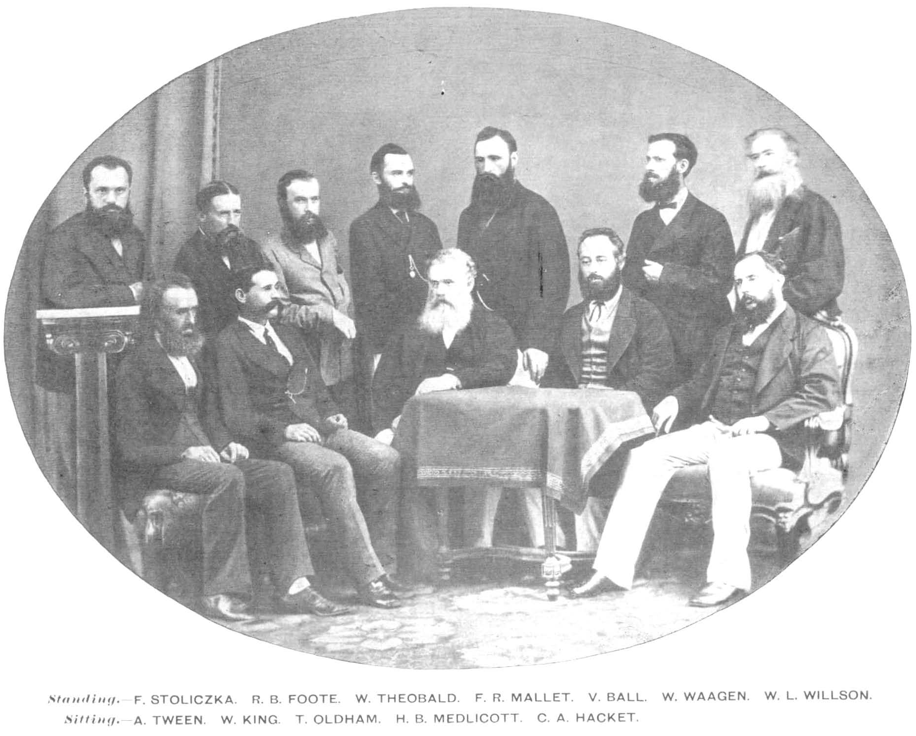
The Geological Survey of India (GSI) is a scientific agency of India. It was founded in 1851, as a Government of India organization under the Ministry of Mines, one of the oldest of such organisations in the world and the second oldest survey in India after Survey of India (founded in 1767), for conducting geological surveys and studies of India, and also as the prime provider of basic earth science information to government, industry and general public, as well as the official participant in steel, coal, metals, cement, power industries and international geoscientific forums. History Formed in 1851 by East India Company, the organization's roots can be traced to 1836 when the "Coal Committee", followed by more such committees, was formed to study and explore the availability of coal in the eastern parts of India. David Hiram Williams, one of the first surveyors for the British Geological Survey, was appointed 'Surveyor of coal districts and superintendent of coal works, ... [...More Info...] [...Related Items...] OR: [Wikipedia] [Google] [Baidu] |
Geological Survey Of Finland
The Geological Survey of Finland ( fi, Geologian tutkimuskeskus abbreviated GTK, sv, Geologiska forskningscentralen) is the geological survey of Finland. The organization was founded in 1885 when Emperor Alexander III decreed that the Geological Survey of Finland (Suomen geologinen tutkimus) be established. The survey produces impartial and objective research data and services in support of decision-making in industry, academia, and wider society. provides solutions to accelerate the transition to sustainable and carbon-neutral world. GTK employs more than 400 experts specialising in the mineral economy, circular economy, solutions related to energy, water and the environment, as well as digital solutions. GTK is a research institution governed by the Finnish Ministry of Employment and the Economy, operating in Finland and globally. Publications The Geological Survey of Finland publishes the ''Geological Survey of Finland, Bulletin'' since 1895. Before 1971 this publication was n ... [...More Info...] [...Related Items...] OR: [Wikipedia] [Google] [Baidu] |
Geological Survey Of Denmark And Greenland
The Geological Survey of Denmark and Greenland ( da, Danmarks og Grønlands Geologiske Undersøgelse, GEUS) is the independent sector research institute under the Danish Ministry of Climate and Energy. GEUS is an advisory, research and survey institute in hydrogeology, geophysics, geochemistry, stratigraphy, glaciology, ore geology, marine geology, mineralogy, climatology, environmental history, air photo interpretation, geothermal energy fields concerning Denmark and Greenland. GEUS works in close corporation with Geologisk Institut and Geologisk Museum, both part of University of Copenhagen. It publishes a service paper called ''Greenland Hydrocarbon Exploration Information Service'' (GHEXIS) and a newsletter called Greenland Mineral Exploration Newsletter (MINEX) in co-operation with the Bureau of Minerals and Petroleum (Råstofdirektoratet), a secretariat for the Joint Committee on Mineral Resources under Greenland's home rule. History In 1888 (DGU) was founded. In ... [...More Info...] [...Related Items...] OR: [Wikipedia] [Google] [Baidu] |
Geological Survey Of Canada
The Geological Survey of Canada (GSC; french: Commission géologique du Canada (CGC)) is a Canadian federal government agency responsible for performing geological surveys of the country, developing Canada's natural resources and protecting the environment. A branch of the Earth Sciences Sector of Natural Resources Canada, the GSC is the country's oldest scientific agency and was one of its first government organizations. History In September 1841, the Province of Canada legislature passed a resolution that authorized the sum of £1,500 sterling be granted to the government for the estimated expense of performing a geological survey of the province. In 1842, the Geological Survey of Canada was formed to fulfill this request.Christy Vodden (1992)No Stone Unturned: The First 150 years of the Geological Survey of Canada Geological Survey of Canada Web site William Edmond Logan was in Montreal at the time and made it known that he was interested in participating in this survey. ... [...More Info...] [...Related Items...] OR: [Wikipedia] [Google] [Baidu] |

.jpg)
%2C_entré.png)


