|
Geography Of Samoa
The Samoan archipelago is a chain of 16 islands and numerous seamounts covering in the central South Pacific, south of the equator, about halfway between Hawaii and New Zealand, forming part of Polynesia and of the wider region of Oceania. The islands are Savaiʻi, Upolu, Tutuila, ’Uvea, Taʻū, Ofu, Olosega, Apolima, Manono, Nuʻutele, Niulakita, Nuʻulua, Namua, Fanuatapu, Rose Atoll, Nu'ulopa, as well as the submerged Vailuluʻu, Pasco banks, and Alexa Bank. Tectonics The Samoan archipelago has many features that are consistent with a plume-driven hotspot model, including the currently active submarine volcano Vailuluʻu that anchors the eastern extremity. However, the chain's proximity to the northern end of the Tonga trench, and the presence of voluminous young volcanism on what should be the oldest (~5 my) western island Savaiʻi has induced controversy regarding a simple plume/hotspot model. The Samoan archipelago was most likely created by the Pacific Te ... [...More Info...] [...Related Items...] OR: [Wikipedia] [Google] [Baidu] |
Nuʻutele
Nuutele is an island that consists of a volcanic tuff ring. It lies 1.3 km off the eastern end of Upolu island, Samoa. It is the largest of the four Aleipata Islands, with an area of . Nuutele, together with Nuulua, a smaller island in the Aleipata group, are significant conservation areas for native species of bird life. Nuutele features steep terrain, with vertical marine cliffs up to 180 m high. Pacific Cooperative Islands Initiative. Retrieved 26 October 2009 Nuutele is famous as a highly appreciated scenic landmark when viewed in the distance from the popular Lalomanu beach area on nearby Upolu Island, across the water. See also * Samoa Islands * List of islands * Desert islandNotes * (includes Nu'utele)[...More Info...] [...Related Items...] OR: [Wikipedia] [Google] [Baidu] |
Samoa Hotspot
The Samoa hotspot is a volcanic hotspot located in the south Pacific Ocean. The hotspot model describes a hot upwelling plume of magma through the Earth's crust as an explanation of how volcanic islands are formed. The hotspot idea came from J. Tuzo Wilson in 1963 based on the Hawaiian Islands volcanic chain. In theory, the Samoa hotspot is based on the Pacific Tectonic Plate traveling over a fixed hotspot located deep underneath the Samoan Islands. The Samoa hotspot includes the Samoan Islands (American Samoa and Samoa), and extends to the islands of Uvea or Wallis Island (Wallis and Futuna) and Niulakita (Tuvalu), as well as the submerged Pasco banks and Alexa Bank. As the Pacific Plate moves slowly over the hotspot, thermal activity builds up and is released in magma plume spewing through the Earth's crust, forming each island in a chain. The Samoa islands generally lie in a straight line, east to west, in the same direction of the tectonic plate 'drifting' over the h ... [...More Info...] [...Related Items...] OR: [Wikipedia] [Google] [Baidu] |
Pacific Plate
The Pacific Plate is an oceanic tectonic plate that lies beneath the Pacific Ocean. At , it is the largest tectonic plate. The plate first came into existence 190 million years ago, at the triple junction between the Farallon, Phoenix, and Izanagi Plates. The Pacific Plate subsequently grew to where it underlies most of the Pacific Ocean basin. This reduced the Farallon Plate to a few remnants along the west coast of North America and the Phoenix Plate to a small remnant near the Drake Passage, and destroyed the Izanagi Plate by subduction under Asia. The Pacific Plate contains an interior hot spot forming the Hawaiian Islands. Boundaries The north-eastern side is a divergent boundary with the Explorer Plate, the Juan de Fuca Plate and the Gorda Plate forming respectively the Explorer Ridge, the Juan de Fuca Ridge and the Gorda Ridge. In the middle of the eastern side is a transform boundary with the North American Plate along the San Andreas Fault, and a boundary with the ... [...More Info...] [...Related Items...] OR: [Wikipedia] [Google] [Baidu] |
Hotspot (geology)
In geology, hotspots (or hot spots) are volcanic locales thought to be fed by underlying mantle that is anomalously hot compared with the surrounding mantle. Examples include the Hawaii, Iceland, and Yellowstone hotspots. A hotspot's position on the Earth's surface is independent of tectonic plate boundaries, and so hotspots may create a chain of volcanoes as the plates move above them. There are two hypotheses that attempt to explain their origins. One suggests that hotspots are due to mantle plumes that rise as thermal diapirs from the core–mantle boundary. The alternative plate theory is that the mantle source beneath a hotspot is not anomalously hot, rather the crust above is unusually weak or thin, so that lithospheric extension permits the passive rising of melt from shallow depths. Origin The origins of the concept of hotspots lie in the work of J. Tuzo Wilson, who postulated in 1963 that the formation of the Hawaiian Islands resulted from the slow movement of a tecton ... [...More Info...] [...Related Items...] OR: [Wikipedia] [Google] [Baidu] |
Alexa Bank
Alexa Bank is a seamount in Samoa, northwest of Rotuma. The seamount reaches a depth of below sea level and has the appearance of an atoll with a flat top and steep slopes. Some active coral growth takes place at its top, but if it ever was an active atoll it has now drowned. It was probably formed by the Samoa hotspot 24 million years ago, although older volcanism about 40 million years ago has also been identified. Geology and geomorphology Local Alexa Bank rises to depths of , has an eastward elongated flat top and is long and wide, widening towards the west; such dimensions resemble these of Savaii and Upolu in Samoa. The flat top has some features of an atoll including a raised rim, and it may indeed once have been an atoll. The rim is surrounded by a narrow terrace and in turn encloses a much wider terrace, that surrounds the flat top at an average depth of . The northern and southern flanks are formed by steep scarps, with the eastern slope featuring a terrace at ... [...More Info...] [...Related Items...] OR: [Wikipedia] [Google] [Baidu] |
Pasco Banks
{{short description, Long ridge-like seamount in the south Pacific The Pasco Banks refers to a naturally occurring geological and marine formation in the south Pacific Ocean. The Pasco Banks is a long ridge-like seamount that rises from about 200 m to within 30 m of the ocean's surface. Covered in patchy coral reef, it attracts large schools of baitfish, mainly rainbow runner, which in turn are preyed upon by larger predatory fishes. This abundance of fish has made the Pasco Banks a popular and reliable fishing location for hundreds of years. Location The Pasco Banks seamount formation is located 13° 05' 00" S latitude and 174° 25' 00" W longitude in the South Pacific Ocean, roughly halfway between the Polynesian islands of Samoa and Uvea. The seamount that includes the Pasco Banks is part of the Samoan volcanic chain which extends from Tuvalu, Uvea, and Futuna eastward to the submarine volcano Vailulu'u east of the Manu'a islands of American Samoa. The Samoan volcani ... [...More Info...] [...Related Items...] OR: [Wikipedia] [Google] [Baidu] |
Vailuluʻu
Vailuluu is a volcano, volcanic seamount discovered in 1975. It rises from the sea floor to a depth of and is located between Tau, American Samoa, Tau and Rose Atoll, Rose islands at the eastern end of the Samoa hotspot chain. The basaltic seamount is considered to mark the current location of the Samoa hotspot. The summit of Vailuluu contains a 2 km wide, 400 m deep oval-shaped caldera. Two principal rift zones extend east and west from the summit, parallel to the trend of the Samoan hotspot. A third less prominent rift extends southeast of the summit. Eruptions at Vailuluu were recorded in 1973. An earthquake swarm in 1995 may have been related to an eruption from the seamount. Turbid water above the summit shows evidence of ongoing hydrothermal plume activity. Vailuluʻu may breach the surface of the ocean and officially become an island if a high rate of eruptions continue. Name and research history The seamount was first discovered in 1975 after seismic activ ... [...More Info...] [...Related Items...] OR: [Wikipedia] [Google] [Baidu] |
Manono Island
Manono is an island of Samoa, situated in the Apolima Strait between the main islands of Savai'i and Upolu, 3.4 km west-northwest off Lefatu Cape, the westernmost point of Upolu. There are four villages on the island with a total population of 889 (2006 Census). Electricity was only introduced in 1995 and there are several shops with beach fale accommodation for visitors. The boat trip from Upolu island takes about 20 minutes. The neighbouring islands are Apolima, which has a small village settlement and the islet Nu'ulopa. Manono Island is part of the political district Aiga-i-le-Tai. The majority of people in the Aiga-i-le-Tai district live on the 'mainland' at the west end of Upolu island. Dogs of any kind are prohibited on Manono island. Villages The four villages and their populations on Manono Island are # Apai, west (111) # Faleu, south (354) #Lepuia'i, southwest (223) #Salua, north (201) Out of the four inhabited islands of Samoa, Manono Island has the third lar ... [...More Info...] [...Related Items...] OR: [Wikipedia] [Google] [Baidu] |
Rose Atoll
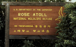
Rose Atoll, sometimes called Rose Island or Motu O Manu ("Bird Island") by people of the nearby Manu'a Islands, is an oceanic atoll within the U.S. territory of American Samoa. An uninhabited wildlife refuge, it is the southernmost point belonging to the United States. The land area is just at high tide. The total area of the atoll, including lagoon and reef flat amounts to . Just west of the northernmost point is a channel into the lagoon, about 40 m wide. There are two islets on the northeastern rim of the reef, larger Rose Island in the east (3.5 m high) and the non-vegetated Sand Island in the north (1.5 m high). The Rose Atoll Marine National Monument that lies on the two outstanding islands of the Atoll is managed cooperatively between the U.S. Fish and Wildlife Service and the government of American Samoa. History The earliest Western sighting was June 13, 1722, during the voyage of Jacob Roggeveen, who called it ''Vuil Eiland'' "useless island." The name Rose Island ... [...More Info...] [...Related Items...] OR: [Wikipedia] [Google] [Baidu] |
Fanuatapu
Fanuatapu, an uninhabited island, is a volcanic tuff ring off the eastern tip of Upolu Island, Samoa. It is the smallest and easternmost of the four Aleipata Islands, with an area of 15 hectares. It has an automated lighthouse. See also * Samoa Islands * List of islands * Desert island A desert island, deserted island, or uninhabited island, is an island, islet or atoll that is not permanently populated by humans. Uninhabited islands are often depicted in films or stories about shipwrecked people, and are also used as stereot ... References * (includes Fanuatapu) Uninhabited islands of Samoa Volcanoes of Samoa Tuff cones Atua (district) {{Samoa-geo-stub ... [...More Info...] [...Related Items...] OR: [Wikipedia] [Google] [Baidu] |


