|
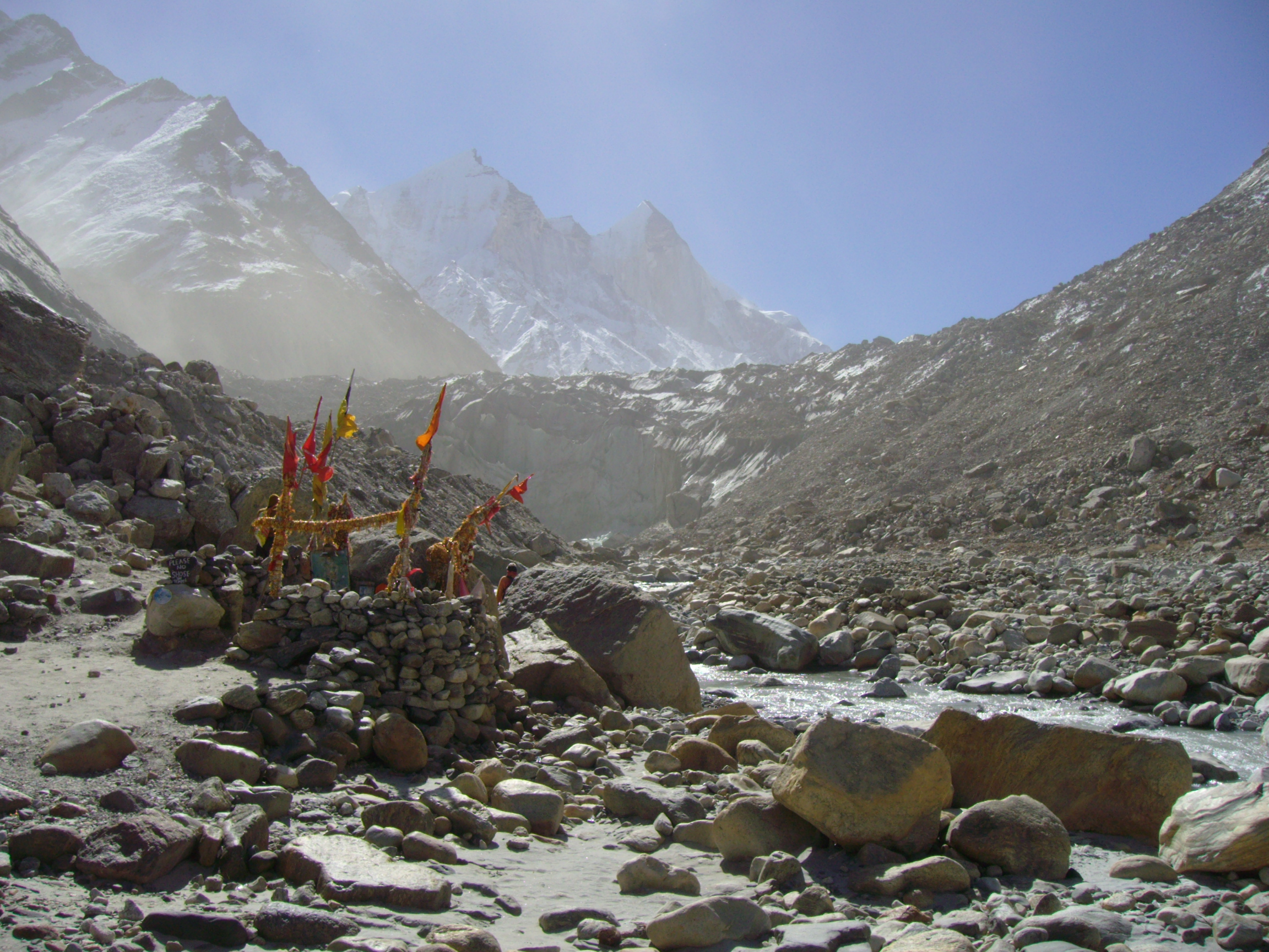
Gangotri Glacier
Gangotri (Sanskrit and hi, गंगोत्री) is located in Uttarkashi District, Uttarakhand, India in a region bordering Tibet. This glacier, one of the primary sources of the Ganges, has a volume of over 27 cubic kilometers. The glacier is about 30 kilometres (19 miles) long and 2 to 4 km (1 to 2 mi) wide. Around the glacier are the peaks of the Gangotri Group, including several peaks notable for extremely challenging climbing routes, such as Shivling, Thalay Sagar, Meru, and Bhagirathi III. It flows roughly northwest, originating in a cirque below Chaukhamba, the highest peak of the group. The terminus of the Gangotri Glacier is said to resemble a cow's mouth, and the place is called Gomukh or Gaumukh (''gou'', cow + ''mukh'', face). Gomukh, which is about from the town of Gangotri, is the precise source of the Bhagirathi river, an important tributary of the Ganges. Gomukh is situated near the base of Shivling; in between lies the Tapovan meadow. The Gango ... [...More Info...] [...Related Items...] OR: [Wikipedia] [Google] [Baidu] |
Gomukh
Gomukh, also known as "Gaumukh" or "Gomukhi" (Hindi: गौमुख or गौमुखी ; Assamese language, Assamese and Bengali language, Bengali: গোমুখ or গোমুখী), is the Glacier terminus, terminus or pout of the Gangotri Glacier and the source of the Bhagirathi River, one of the primary headstreams of the Ganga River. The word ''Gomukh/Gaumukh'' (''go/gau''=cow, ''mukh''= mouth) literally means "Mouth of a Cow." The place is situated at a height of 13,200 ft (4,023 m) in the Uttarkashi district in the state of Uttarakhand, India. It is one of the largest in the Himalayas with an estimated volume of over 27 cubic kilometers. It is a holy Hindu pilgrimage site, visited by many who visit Gangotri. It is around 20km away from Gangotri and can be reached by trekking. In 1972, Sir Seewoosagur Ramgoolam the then Prime Minister of Mauritius, brought the holy Ganga water from Gomukh and mixed it with the water of Ganga Talao, Grand Bassin in Mauritius and ... [...More Info...] [...Related Items...] OR: [Wikipedia] [Google] [Baidu] |
Ganges River
The Ganges ( ) (in India: Ganga ( ); in Bangladesh: Padma ( )). "The Ganges Basin, known in India as the Ganga and in Bangladesh as the Padma, is an international river to which India, Bangladesh, Nepal and China are the riparian states." is a trans-boundary river of Asia which flows through India and Bangladesh. The river rises in the western Himalayas in the Indian States and union territories of India, state of Uttarakhand. It flows south and east through the Gangetic Plain, Gangetic plain of North India, receiving the right-bank tributary, the Yamuna, which also rises in the western Indian Himalayas, and several left-bank tributaries from Nepal that account for the bulk of its flow. In West Bengal state, India, a feeder canal taking off from its right bank diverts 50% of its flow southwards, artificially connecting it to the Hooghly river. The Ganges continues into Bangladesh, its name changing to the Padma River, Padma. It is then joined by the Jamuna River (Bangladesh), ... [...More Info...] [...Related Items...] OR: [Wikipedia] [Google] [Baidu] |
