|
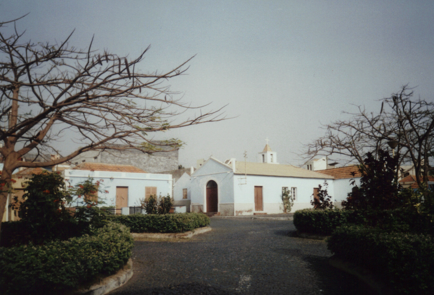
Galinheiro
Galinheiro is a settlement in the northwestern part of the island of Fogo, Cape Verde. In 2010 its population was 877. It is situated 2 km northeast of Ponta Verde Ponta Verde (Portuguese meaning "green tip") is a beach in Maceió, capital city of Alagoas, state with the most beautiful coastline in Brazil. A tip of land that rises out of the sea and is covered by green palm trees. This is the phenomenon tha ..., 2.5 km southwest of São Jorge and 13 km northeast of the island capital São Filipe. See also * List of villages and settlements in Cape Verde References {{CapeVerde-geo-stub Villages and settlements in Fogo, Cape Verde São Filipe, Cape Verde ... [...More Info...] [...Related Items...] OR: [Wikipedia] [Google] [Baidu] |
São Jorge, Cape Verde
São Jorge is a settlement in the northern part of the island of Fogo, Cape Verde. It is situated near the coast, 2 km west of Campanas Baixo, 2 km northeast of Galinheiro and 15 km northeast of the island capital São Filipe. Sights ''Ponta da Salina'' is a headland close to the village. There is a small natural harbour and a bay with basalt Basalt (; ) is an aphanitic (fine-grained) extrusive igneous rock formed from the rapid cooling of low-viscosity lava rich in magnesium and iron (mafic lava) exposed at or very near the surface of a rocky planet or moon. More than 90 ... rock formations, one of which looks like a natural arch. There are some natural swimming pools and a dark sand beach where swimming is possible if the sea is not too rough. There is a sightworthy old cemetery, which is surrounded by a wall, close to the beach.Lipps, Susanne: ''Kapverdische Inseln'', p.256. Ostfildern 2009. Most of the graves have very simple wooden crosses without any n ... [...More Info...] [...Related Items...] OR: [Wikipedia] [Google] [Baidu] |
List Of Villages And Settlements In Cape Verde
This is a list of villages and smaller settlements in Cape Verde: Boa Vista * Bofarreira * Cabeça dos Tarrafes * Curral Velho - abandoned settlement * Espingueira - abandoned settlement * Estância de Baixo * Fundo das Figueiras * João Galego * Povoação Velha * Prazeres - abandoned settlement Brava * Cachaço * Campo Baixo * Cova Joana * Cova Rodela * Fajã de Água * João da Noly * Lem * Mato * Mato Grande * Nossa Senhora do Monte * Santa Bárbara * Tantum * Tomé Barraz * Vinagre Fogo * Achada Furna * Achada Grande * Atalaia * Cabeça Fundão * Campanas Baixo * Chã das Caldeiras * Corvo * Curral Grande * Estância Roque * Fajãzinha * Feijoal * Figueira Pavão * Fonte Aleixo * Galinheiro * As Hortas * Lagariça * Lomba * Miguel Gonçalves * Monte Grande * Patim * Ponta Verde * Relva * Ribeira do Ilhéu * Salto * Santo António * São Filipe * São Jorge * Tinteira * Vicente Dias Maio * Alcatraz * Barreiro * Calheta * Cascabulho * Figueir ... [...More Info...] [...Related Items...] OR: [Wikipedia] [Google] [Baidu] |
Fogo, Cape Verde
Fogo (Portuguese for "fire") is an island in the Sotavento group of Cape Verde. Its population is 35,837 (2015),Cabo Verde, Statistical Yearbook 2015 Instituto Nacional de Estatística with an area of 476 km2. It reaches the highest altitude of all the islands in Cape Verde, rising to at the summit of its active volcano, |
Cape Verde
, national_anthem = () , official_languages = Portuguese , national_languages = Cape Verdean Creole , capital = Praia , coordinates = , largest_city = capital , demonym = Cape Verdean or Cabo Verdean , ethnic_groups_year = 2017 , government_type = Unitary semi-presidential republic , leader_title1 = President , leader_name1 = José Maria Neves , leader_title2 = Prime Minister , leader_name2 = Ulisses Correia e Silva , legislature = National Assembly , area_rank = 166th , area_km2 = 4033 , area_sq_mi = 1,557 , percent_water = negligible , population_census = 561,901 , population_census_rank = 172nd , population_census_year = 2021 , population_density_km2 = 123.7 , population_density_sq_mi = 325.0 , population_density_rank = 89th , GDP_PPP ... [...More Info...] [...Related Items...] OR: [Wikipedia] [Google] [Baidu] |
Ponta Verde, Cape Verde
Ponta Verde is a townCabo Verde, Statistical Yearbook 2015 Instituto Nacional de Estatística, p. 32-33 in the northwestern part of the island of Fogo, . In 2010 its population was 1,072. It is situated 11 km northeast of the island capital São Filipe. See also * |
São Filipe, Cape Verde
São Filipe (Portuguese for "Saint Philip") is a cityCabo Verde, Statistical Yearbook 2015 Instituto Nacional de Estatística, p. 32-33 on the west coast of the island of Fogo, . It is the capital of the island, and the seat of the São Filipe Municipality. The island's a ... [...More Info...] [...Related Items...] OR: [Wikipedia] [Google] [Baidu] |
Villages And Settlements In Fogo, Cape Verde
A village is a clustered human settlement or community, larger than a hamlet but smaller than a town (although the word is often used to describe both hamlets and smaller towns), with a population typically ranging from a few hundred to a few thousand. Though villages are often located in rural areas, the term urban village is also applied to certain urban neighborhoods. Villages are normally permanent, with fixed dwellings; however, transient villages can occur. Further, the dwellings of a village are fairly close to one another, not scattered broadly over the landscape, as a dispersed settlement. In the past, villages were a usual form of community for societies that practice subsistence agriculture, and also for some non-agricultural societies. In Great Britain, a hamlet earned the right to be called a village when it built a church. [...More Info...] [...Related Items...] OR: [Wikipedia] [Google] [Baidu] |


