|
Gale Crater
Gale is a crater, and probable dry lake, at in the northwestern part of the Aeolis quadrangle on Mars. It is in diameter and estimated to be about 3.5–3.8 billion years old. The crater was named after Walter Frederick Gale, an amateur astronomer from Sydney, Australia, who observed Mars in the late 19th century. Aeolis Mons is a mountain in the center of Gale and rises high. Aeolis Palus is the plain between the northern wall of Gale and the northern foothills of Aeolis Mons. Peace Vallis, a nearby outflow channel, 'flows' down from the hills to the Aeolis Palus below and seems to have been carved by flowing water. Several lines of evidence suggest that a lake existed inside Gale shortly after the formation of the crater. The NASA Mars rover ''Curiosity'', of the Mars Science Laboratory (MSL) mission, landed in "Yellowknife" ''Quad 51'' of Aeolis Palus in Gale at 05:32 UTC August 6, 2012. NASA named the landing location Bradbury Landing on August 22, 2012. ''Cu ... [...More Info...] [...Related Items...] OR: [Wikipedia] [Google] [Baidu] |
Aeolis Mons
Mount Sharp, officially Aeolis Mons (), is a mountain on Mars. It forms the central peak within Gale crater and is located around , rising high from the valley floor. Its ID in the United States Geological Survey's Gazetteer of Planetary Nomenclature is 15000. On August 6, 2012, ''Curiosity'' (the Mars Science Laboratory rover) landed in "Yellowknife" ''Quad 51'' of Aeolis Palus, next to the mountain. NASA named the landing site Bradbury Landing on August 22, 2012. Aeolis Mons is a primary goal for scientific study. On June 5, 2013, NASA announced that ''Curiosity'' would begin an journey from the Glenelg area to the base of Aeolis Mons. On November 13, 2013, NASA announced that an entryway the rover would traverse on its way to Aeolis Mons was to be named "Murray Buttes", in honor of planetary scientist Bruce C. Murray (1931–2013). The trip was expected to take about a year and would include stops along the way to study the local terrain. On September 11, 2014, NASA a ... [...More Info...] [...Related Items...] OR: [Wikipedia] [Google] [Baidu] |
Curiosity Rover
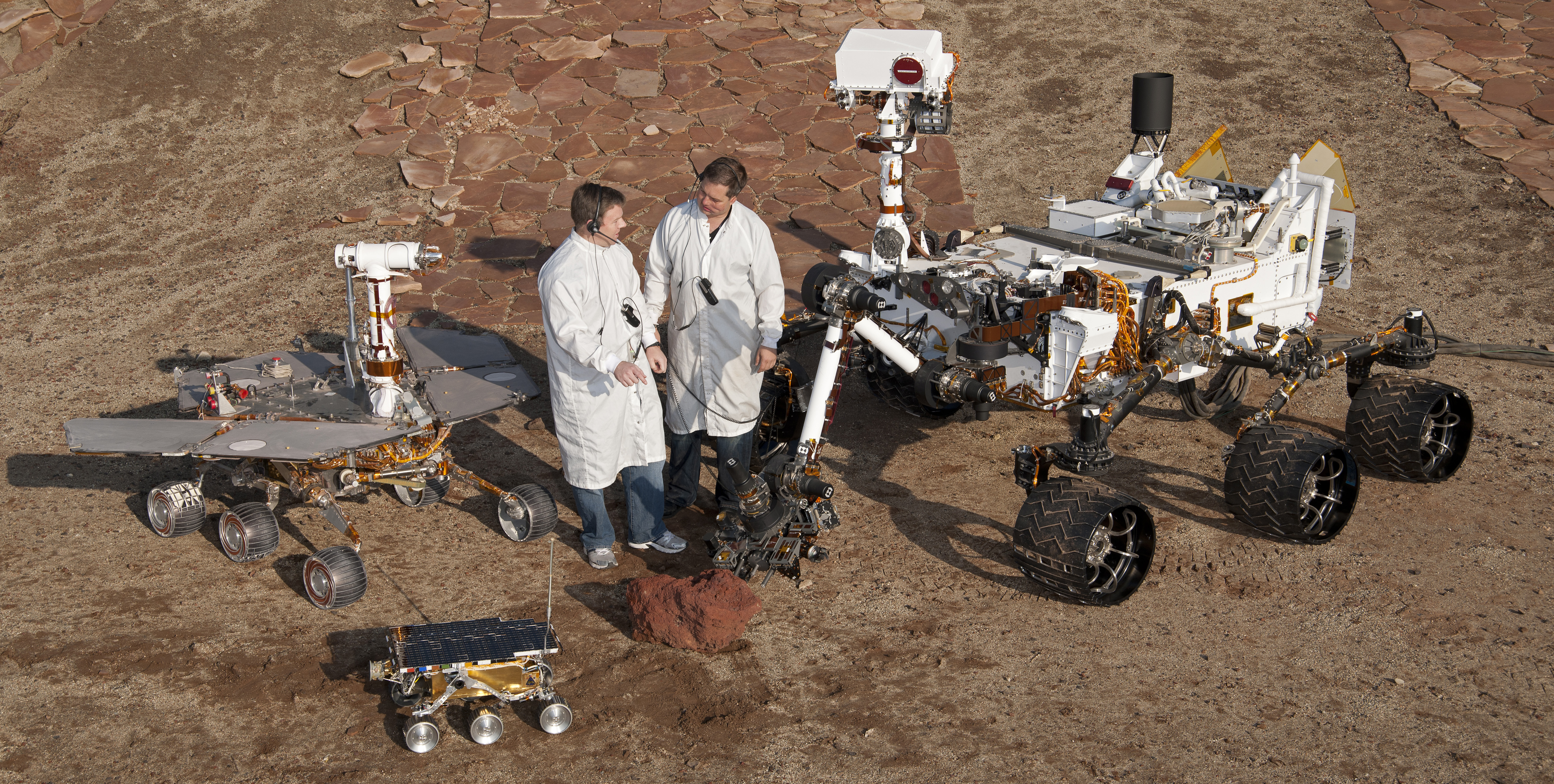
''Curiosity'' is a car-sized Mars rover designed to explore the Gale crater on Mars as part of NASA's Mars Science Laboratory (MSL) mission. ''Curiosity'' was launched from Cape Canaveral (CCAFS) on November 26, 2011, at 15:02:00 UTC and landed on Aeolis Palus inside Gale crater on Mars on August 6, 2012, 05:17:57 UTC. The Bradbury Landing site was less than from the center of the rover's touchdown target after a journey. Mission goals include an investigation of the Martian climate and geology, assessment of whether the selected field site inside Gale has ever offered environmental conditions favorable for microbial life (including investigation of the role of water), and planetary habitability studies in preparation for human exploration. In December 2012, ''Curiosity'' two-year mission was extended indefinitely, and on August 5, 2017, NASA celebrated the fifth anniversary of the ''Curiosity'' rover landing. On August 6, 2022, a detailed overview of accomplishm ... [...More Info...] [...Related Items...] OR: [Wikipedia] [Google] [Baidu] |
Geologic Map
A geologic map or geological map is a special-purpose map made to show various geological features. Rock units or geologic strata are shown by color or symbols. Bedding planes and structural features such as faults, folds, are shown with strike and dip or trend and plunge symbols which give three-dimensional orientations features. Stratigraphic contour lines may be used to illustrate the surface of a selected stratum illustrating the subsurface topographic trends of the strata. Isopach maps detail the variations in thickness of stratigraphic units. It is not always possible to properly show this when the strata are extremely fractured, mixed, in some discontinuities, or where they are otherwise disturbed. Symbols Lithologies Rock units are typically represented by colors. Instead of (or in addition to) colors, certain symbols can be used. Different geologic mapping agencies and authorities have different standards for the colors and symbols to be used for rocks of dif ... [...More Info...] [...Related Items...] OR: [Wikipedia] [Google] [Baidu] |
Near-infrared
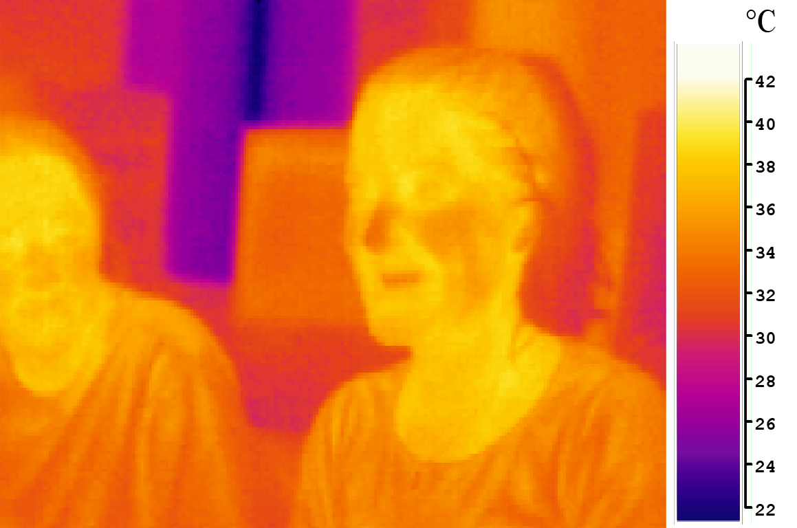
Infrared (IR), sometimes called infrared light, is electromagnetic radiation (EMR) with wavelengths longer than those of visible light. It is therefore invisible to the human eye. IR is generally understood to encompass wavelengths from around 1 millimeter (300 GHz) to the nominal red edge of the visible spectrum, around 700 nanometers (430 THz). Longer IR wavelengths (30 μm-100 μm) are sometimes included as part of the terahertz radiation range. Almost all black-body radiation from objects near room temperature is at infrared wavelengths. As a form of electromagnetic radiation, IR propagates energy and momentum, exerts radiation pressure, and has properties corresponding to both those of a wave and of a particle, the photon. It was long known that fires emit invisible heat; in 1681 the pioneering experimenter Edme Mariotte showed that glass, though transparent to sunlight, obstructed radiant heat. In 1800 the astronomer Sir William Herschel discovered tha ... [...More Info...] [...Related Items...] OR: [Wikipedia] [Google] [Baidu] |
Thermal Emission Imaging System
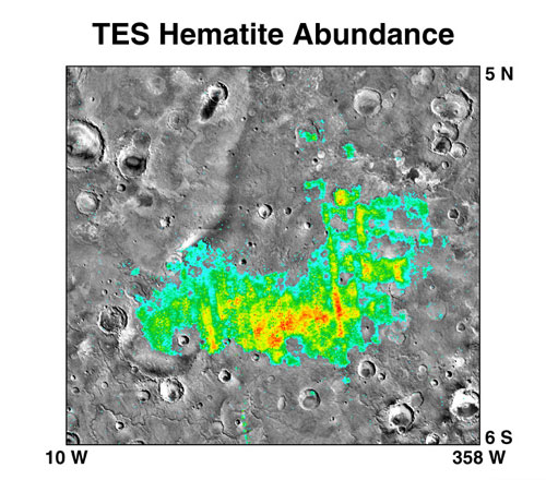
The Thermal Emission Imaging System (THEMIS) is a camera on board the 2001 Mars Odyssey orbiter. It images Mars in the visible and infrared parts of the electromagnetic spectrum in order to determine the thermal properties of the surface and to refine the distribution of minerals on the surface of Mars as determined by the Thermal Emission Spectrometer (TES). Additionally, it helps scientists to understand how the mineralogy of Mars relates to its landforms, and it can be used to search for thermal hotspots in the Martian subsurface. THEMIS is managed from the Mars Space Flight Facility at Arizona State University and was built by the Santa Barbara Remote Sensing division of Raytheon Technologies Corporation, an American multinational conglomerate headquartered in Waltham, Massachusetts. The instrument is named after Themis, the goddess of justice in ancient Greek mythology. Infrared camera THEMIS detects thermal infrared energy emitted by the Martian surface at nin ... [...More Info...] [...Related Items...] OR: [Wikipedia] [Google] [Baidu] |
Impact Event
An impact event is a collision between astronomical objects causing measurable effects. Impact events have physical consequences and have been found to regularly occur in planetary systems, though the most frequent involve asteroids, comets or meteoroids and have minimal effect. When large objects impact terrestrial planets such as the Earth, there can be significant physical and biospheric consequences, though atmospheres mitigate many surface impacts through atmospheric entry. Impact craters and structures are dominant landforms on many of the Solar System's solid objects and present the strongest empirical evidence for their frequency and scale. Impact events appear to have played a significant role in the evolution of the Solar System since its formation. Major impact events have significantly shaped Earth's history, and have been implicated in the formation of the Earth–Moon system. Impact events also appear to have played a significant role in the evolutionary h ... [...More Info...] [...Related Items...] OR: [Wikipedia] [Google] [Baidu] |
Comet
A comet is an icy, small Solar System body that, when passing close to the Sun, warms and begins to release gases, a process that is called outgassing. This produces a visible atmosphere or Coma (cometary), coma, and sometimes also a Comet tail, tail. These phenomena are due to the effects of solar radiation and the solar wind acting upon the nucleus of the comet. Comet nuclei range from a few hundred meters to tens of kilometers across and are composed of loose collections of ice, dust, and small rocky particles. The coma may be up to 15 times Earth's diameter, while the tail may stretch beyond one astronomical unit. If sufficiently bright, a comet may be seen from Earth without the aid of a telescope and may Subtended angle, subtend an arc of 30° (60 Moons) across the sky. Comets have been observed and recorded since ancient times by many cultures and religions. Comets usually have highly Orbital eccentricity, eccentric elliptical orbits, and they have a wide range of orbit ... [...More Info...] [...Related Items...] OR: [Wikipedia] [Google] [Baidu] |
Asteroid
An asteroid is a minor planet of the Solar System#Inner solar system, inner Solar System. Sizes and shapes of asteroids vary significantly, ranging from 1-meter rocks to a dwarf planet almost 1000 km in diameter; they are rocky, metallic or icy bodies with no atmosphere. Of the roughly one million known asteroids the greatest number are located between the orbits of Mars and Jupiter, approximately 2 to 4 astronomical unit, AU from the Sun, in the main asteroid belt. Asteroids are generally classified to be of three types: C-type asteroid, C-type, M-type asteroid, M-type, and S-type asteroid, S-type. These were named after and are generally identified with carbonaceous, metallic, and silicaceous compositions, respectively. The size of asteroids varies greatly; the largest, Ceres (dwarf planet), Ceres, is almost across and qualifies as a dwarf planet. The total mass of all the asteroids combined is only 3% that of Earth's Moon. The majority of main belt asteroids follow slig ... [...More Info...] [...Related Items...] OR: [Wikipedia] [Google] [Baidu] |
Mount Rainier
Mount Rainier (), indigenously known as Tahoma, Tacoma, Tacobet, or təqʷubəʔ, is a large active stratovolcano in the Cascade Range of the Pacific Northwest, located in Mount Rainier National Park about south-southeast of Seattle. With a summit elevation of , it is the highest mountain in the U.S. state of Washington and the Cascade Range, the most topographically prominent mountain in the contiguous United States, and the tallest in the Cascade Volcanic Arc. Due to its high probability of eruption in the near future, Mount Rainier is considered one of the most dangerous volcanoes in the world, and it is on the Decade Volcano list. The large amount of glacial ice means that Mount Rainier could produce massive lahars that could threaten the entire Puyallup River valley. According to the United States Geological Survey, "about 80,000 people and their homes are at risk in Mount Rainier's lahar-hazard zones." Between 1950 and 2018, 439,460 people climbed Mount Rainier. ... [...More Info...] [...Related Items...] OR: [Wikipedia] [Google] [Baidu] |
Robert P
The name Robert is an ancient Germanic given name, from Proto-Germanic "fame" and "bright" (''Hrōþiberhtaz''). Compare Old Dutch ''Robrecht'' and Old High German ''Hrodebert'' (a compound of '' Hruod'' ( non, Hróðr) "fame, glory, honour, praise, renown" and ''berht'' "bright, light, shining"). It is the second most frequently used given name of ancient Germanic origin. It is also in use as a surname. Another commonly used form of the name is Rupert. After becoming widely used in Continental Europe it entered England in its Old French form ''Robert'', where an Old English cognate form (''Hrēodbēorht'', ''Hrodberht'', ''Hrēodbēorð'', ''Hrœdbœrð'', ''Hrœdberð'', ''Hrōðberχtŕ'') had existed before the Norman Conquest. The feminine version is Roberta. The Italian, Portuguese, and Spanish form is Roberto. Robert is also a common name in many Germanic languages, including English, German, Dutch, Norwegian, Swedish, Scots, Danish, and Icelandic. It can ... [...More Info...] [...Related Items...] OR: [Wikipedia] [Google] [Baidu] |
Topographic Map Of Gale Crater
Topography is the study of the forms and features of land surfaces. The topography of an area may refer to the land forms and features themselves, or a description or depiction in maps. Topography is a field of geoscience and planetary science and is concerned with local detail in general, including not only relief, but also natural, artificial, and cultural features such as roads, land boundaries, and buildings. In the United States, topography often means specifically ''relief'', even though the USGS topographic maps record not just elevation contours, but also roads, populated places, structures, land boundaries, and so on. Topography in a narrow sense involves the recording of relief or terrain, the three-dimensional quality of the surface, and the identification of specific landforms; this is also known as geomorphometry. In modern usage, this involves generation of elevation data in digital form ( DEM). It is often considered to include the graphic representation of t ... [...More Info...] [...Related Items...] OR: [Wikipedia] [Google] [Baidu] |
Bradbury Landing
Bradbury Landing is the August 6, 2012, landing site within Gale crater on planet Mars of the Mars Science Laboratory (MSL) ''Curiosity'' rover. On August 22, 2012, on what would have been his 92nd birthday, NASA named the site for author Ray Bradbury, who had died on June 5, 2012. The coordinates of the landing site on Mars are: . The rover drove away from this specific landing location in the summer of 2012, but because of the nature of landing there is no actual lander there. The track prints and blast marks are slowly blowing away in the Martian wind, as recorded by Mars orbiters. Description Gale Crater was the MSL landing site in 2012. Within Gale Crater is a mountain, named Aeolis Mons ("Mount Sharp"), of layered rocks, rising about above the crater floor, that ''Curiosity'' will investigate. The landing site is a smooth region in "Yellowknife" ''Quad 51'' of Aeolis Palus inside the crater in front of the mountain. The target landing site location was an elliptical ... [...More Info...] [...Related Items...] OR: [Wikipedia] [Google] [Baidu] |


.jpg)


_-_HiRISE_-_20120814.jpg)