|
Gabriel Renville
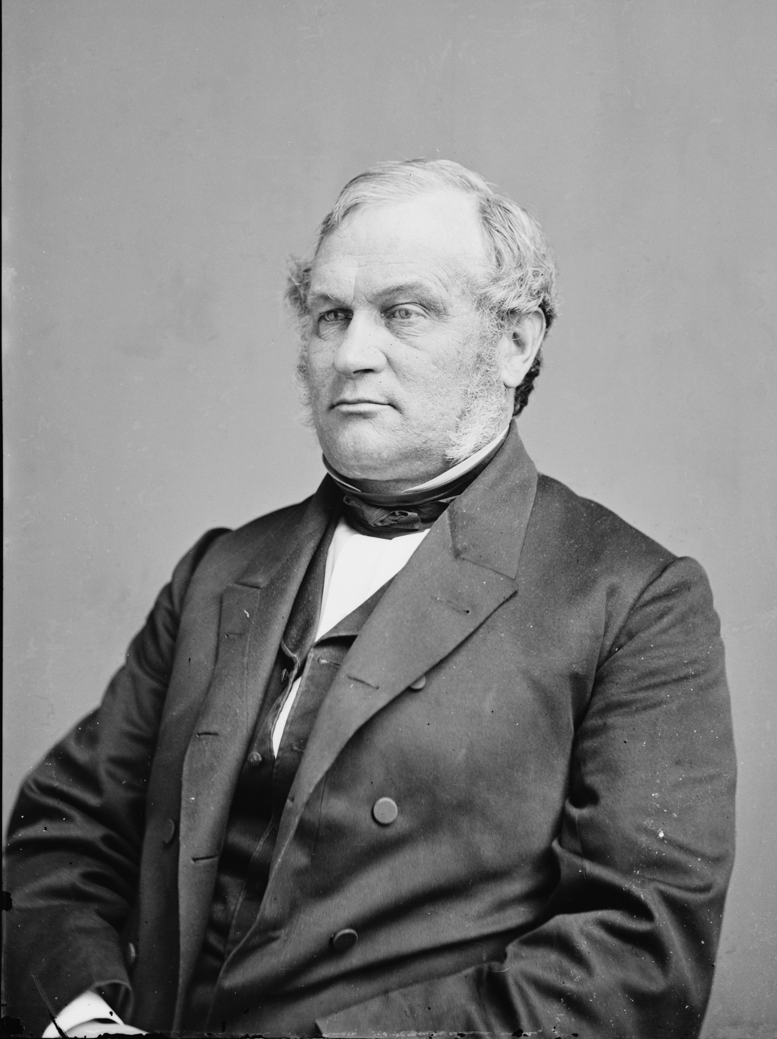
Gabriel Renville (April 1825 – August 26, 1892), also known as Ti'wakan (Sacred Lodge), was Chief of the Sisseton Wahpeton Oyate Sioux Tribe from 1866 until his death in 1892. He opposed conflict with the United States during the Dakota War of 1862 and was a driving force within the Dakota Peace Party. Gabrielle Renville's influence and political leadership were critical to the eventual creation of the Lake Traverse Indian Reservation, which lies mainly in present-day South Dakota. Early life and family Gabriel Renville was born in April 1825 to two "mixed-blood" parents –– Winona Abigail Crawford (1805–1897) and Victor Renville (Ohiya) (1780–1832) –– most likely in the village of Sweet Corn on the west shore of Lake Traverse. His father Victor was the son of Joseph Rainville, a French Canadian fur trader, and Miniyuhe, a Mdewakanton kinswoman of the Little Crow family, and was the younger brother of Joseph Renville of Lac qui Parle (1779–1846). His mother Wi ... [...More Info...] [...Related Items...] OR: [Wikipedia] [Google] [Baidu] |
Sisseton Wahpeton Oyate
The Sisseton Wahpeton Oyate of the Lake Traverse Reservation ( dak, Sisíthuŋwaŋ Waȟpéthuŋwaŋ oyáte), formerly Sisseton-Wahpeton Sioux Tribe/Dakota Nation, is a federally recognized tribe comprising two bands and two subdivisions of the ''Isanti'' or Santee Dakota people. They are on the Lake Traverse Reservation in northeast South Dakota. Lake Traverse Reservation The Lake Traverse Reservation and its boundaries were established by the Lake Traverse Treaty of 1867. From 1884 until the 1913, the tribal government was based upon the concept of the Soldier's Lodge. Due to external pressures from federal Indian agents and religious missionaries, as well as internal turmoil, in 1913 the tribe created an advisory committee. It served as the basis of government until 1946. In 1934 the federal government urged the tribe to adopt the provisions of the Wheeler-Howard Act, also known as the Indian Reorganization Act. By 1946 the tribe had reorganized, establishing the current syst ... [...More Info...] [...Related Items...] OR: [Wikipedia] [Google] [Baidu] |
Upper Sioux Agency State Park
Upper Sioux Agency State Park is a Minnesota state park on the Minnesota River, south of Granite Falls. It preserves the site of the historic Upper Sioux Agency (or Yellow Medicine Agency), which was destroyed in the Dakota War of 1862. The agency site was listed on the National Register of Historic Places in 1970 for having state-level significance under the themes of archaeology, architecture, education, and social history. Chief Walking Iron Mazomani, a leader of the Wahpetonwan (Dwellers in the Leaves) Dakota tribes who was killed during the 1862 Dakota War's Battle of Wood Lake, is buried at this location. See also * Upper Sioux Indian Reservation The Upper Sioux Indian Reservation, or Pezihutazizi in Dakota, is the reservation of the Upper Sioux Community, a federally recognized tribe of the Dakota people, that includes the Mdewakanton. The Upper Sioux Indian Reservation is located in M ... References External links Upper Sioux Agency State Park 1963 establis ... [...More Info...] [...Related Items...] OR: [Wikipedia] [Google] [Baidu] |
Minnesota River
The Minnesota River ( dak, Mnísota Wakpá) is a tributary of the Mississippi River, approximately 332 miles (534 km) long, in the U.S. state of Minnesota. It drains a watershed of in Minnesota and about in South Dakota and Iowa. It rises in southwestern Minnesota, in Big Stone Lake on the Minnesota–South Dakota border just south of the Laurentian Divide at the Traverse Gap portage. It flows southeast to Mankato, then turns northeast. It joins the Mississippi at Mendota south of the Twin Cities of Minneapolis and St. Paul, near the historic Fort Snelling. The valley is one of several distinct regions of Minnesota. The name Minnesota comes from the Dakota language phrase, "Mnisota Makoce" which is translated to "land where the waters reflect the sky", as a reference to the many lakes in Minnesota rather than the cloudiness of the actual river. At times, the native variant form "Minisota River" is used. For over a century prior to the organization of the Minnesota Territ ... [...More Info...] [...Related Items...] OR: [Wikipedia] [Google] [Baidu] |
Fort Ridgely
Fort Ridgely was a frontier United States Army outpost from 1851 to 1867, built 1853–1854 in Minnesota Territory. The Sioux called it Esa Tonka. It was located overlooking the Minnesota river southwest of Fairfax, Minnesota. Half of the fort's land was part of the south reservation in the Minnesota river valley for the Mdewakanton and Wahpekute tribes. Fort Ridgely had no defensive wall, palisade, or guard towers. The Army referred to the fort as the "New Post on the Upper Minnesota" until it was named for three Maryland Army Officers named Ridgely (Thomas, Randolph and Lott Henderson), who died during the Mexican–American War. History Construction The War Department hired Mr. Jessie H. Pomeroy of St. Paul to build both Fort Ridgely and Fort Ripley. At Ridgely there were two Companies of troops that assisted in quarrying the granite two miles away, transporting it to the site, and the erection of a 400-man stone barracks. The barracks formed the east side of the 90 ... [...More Info...] [...Related Items...] OR: [Wikipedia] [Google] [Baidu] |
Fourth Treaty Of Prairie Du Chien
The fourth Treaty of Prairie du Chien was negotiated between the United States and the Sac and Fox, the Mdewakanton, Wahpekute and Sisseton Sioux, Omaha, Ioway, Otoe and Missouria tribes. The treaty was signed on July 15, 1830, with William Clark and Willoughby Morgan representing the United States. Through additional negotiations conducted in St. Louis on October 13, 1830, Yankton Sioux and Santee Sioux agreed to abide by the 1830 Treaty of Prairie du Chien. The US government announced the treaty and its numerous adherents on February 24, 1831. In this treaty, the tribes agreed to land cession of three large tracts of land: two strips of land 20 miles wide each on either side of the boundary established by the first (1825) Treaty of Prairie du Chien (roughly from La Crosse, Wisconsin to Prairie du Chien, Wisconsin), extending from the Mississippi River to the Des Moines River in what today is southeastern Minnesota and northeastern Iowa; and a large triangular tract of land ... [...More Info...] [...Related Items...] OR: [Wikipedia] [Google] [Baidu] |
Treaty Of Traverse Des Sioux
The Treaty of Traverse des Sioux () was signed on July 23, 1851, at Traverse des Sioux in Minnesota Territory between the United States government and the Upper Dakota Sioux bands. In this land cession treaty, the Sisseton and Wahpeton Dakota bands sold 21 million acres of land in present-day Iowa, Minnesota and South Dakota to the U.S. for $1,665,000. The treaty was instigated by Alexander Ramsey, the first governor of Minnesota Territory, and Luke Lea, Commissioner of Indian Affairs in Washington, D.C. They were assisted by territorial Congressional delegate Henry Hastings Sibley and the traders who sought compensation for business losses which appeared on their books as "Indian debts." Governor Ramsey and Commissioner Lea justified the Treaty of Traverse des Sioux and the Treaty of Mendota to the United States Congress on the basis of an "overwhelming tide of migration...increasing and irresistible in its westward progress." In reality, they were responding to pressures from ... [...More Info...] [...Related Items...] OR: [Wikipedia] [Google] [Baidu] |
Dakota People
The Dakota (pronounced , Dakota language: ''Dakȟóta/Dakhóta'') are a Native American tribe and First Nations band government in North America. They compose two of the three main subcultures of the Sioux people, and are typically divided into the Eastern Dakota and the Western Dakota. The four bands of Eastern Dakota are the Bdewákaŋthuŋwaŋ, Waȟpéthuŋwaŋ, Waȟpékhute, and Sisíthuŋwaŋ and are sometimes referred to as the Santee (''Isáŋyathi'' or ''Isáŋ-athi''; "knife" + "encampment", "dwells at the place of knife flint"), who reside in the eastern Dakotas, central Minnesota and northern Iowa. They have federally recognized tribes established in several places. The Western Dakota are the Yankton, and the Yanktonai (''Iháŋktȟuŋwaŋ'' and ''Iháŋktȟuŋwaŋna''; "Village-at-the-end" and "Little village-at-the-end"), who reside in the Upper Missouri River area. The Yankton-Yanktonai are collectively also referred to by the endonym ''Wičhíyena'' ("Those Who ... [...More Info...] [...Related Items...] OR: [Wikipedia] [Google] [Baidu] |
Minnesota Territory
The Territory of Minnesota was an organized incorporated territory of the United States that existed from March 3, 1849, until May 11, 1858, when the eastern portion of the territory was admitted to the Union as the State of Minnesota and western portion to the unorganized territory then the land shortly became the Dakota territory. History The Minnesota Territory was formed on March 3, 1849, with present day states of Minnesota and a large portion of modern-day North and South Dakota. At the time of formation there were 5000 settlers living in the Territory. There were no roads from adjoining Wisconsin or Iowa. The easiest access to the region was via waterway of which the Mississippi River was primary. The primary mode of transport was the riverboat. Minnesota Territory had three significant pioneer settlements: St. Paul, St. Anthony/Minneapolis, and Stillwater plus two military reservations: Fort Snelling and Fort Ripley. All of these were located on a waterwa ... [...More Info...] [...Related Items...] OR: [Wikipedia] [Google] [Baidu] |
Martin McLeod
Martin McLeod (April 13, 1813 – November 20, 1860) was an American fur trader, pioneer, and territorial legislator in Minnesota. McLeod was born in Montreal, Quebec, Canada and had Scottish ancestry. He worked as a clerk in Montreal and then traveled to Fort Snelling, Wisconsin Territory in 1837. He worked as a trader for the American Fur Company, overseeing trade with the Sisseton and Wahpeton bands. McLeod served in the Minnesota Territorial Council from 1849 to 1851 and from 1852 to 1853. McLeod served as president of the territorial council. He also served as chairman of the town of Bloomington, Minnesota Territory and as a commissioner for Hennepin County, Minnesota Hennepin County ( ) is a county in the U.S. state of Minnesota. Its county seat is Minneapolis, the state's most populous city. The county is named in honor of the 17th-century explorer Father Louis Hennepin. The county extends from Minneapol .... Family McLeod married Mary Elizabeth Ortley in 183 ... [...More Info...] [...Related Items...] OR: [Wikipedia] [Google] [Baidu] |
Henry Hastings Sibley
Henry Hastings Sibley (February 20, 1811 – February 18, 1891) was a fur trader with the American Fur Company, the first U.S. Congressional representative for Minnesota Territory, the first governor of the state of Minnesota, and a U.S. military leader in the Dakota War of 1862 and a subsequent expedition into Dakota Territory in 1863. Numerous places are named after him, including Sibley County, Minnesota; Sibley, North Dakota; Sibley, Iowa; Hastings, Minnesota; Sibley Memorial Highway; and Sibley State Park. Early life and education Henry Hastings Sibley was born in Detroit, Michigan Territory. His father, Solomon Sibley (1769–1846), was a native of Sutton, Massachusetts, and a direct descendant of John Sibley, who had immigrated from England to America in 1629. Solomon had moved to Detroit from Marietta, Ohio, in 1798. Solomon Sibley was a prominent politician as well as a respected jurist. He served as the first mayor of Detroit and as a territorial delegate to th ... [...More Info...] [...Related Items...] OR: [Wikipedia] [Google] [Baidu] |
Coteau Des Prairies
The Coteau des Prairies is a plateau approximately 200 miles in length and 100 miles in width (320 by 160 km), rising from the prairie flatlands in eastern South Dakota, southwestern Minnesota, and northwestern Iowa in the United States. The southeast portion of the Coteau comprises one of the distinct regions of Minnesota, known as Buffalo Ridge. The flatiron-shaped plateau was named by early French explorers from New France (Quebec), ''coteau'' meaning "hill" in French; the general term ''coteau'' has since been used in English to describe any upland dividing ridge. The plateau is composed of thick glacial deposits, the remnants of many repeated glaciations, reaching a composite thickness of approximately 900 feet (275 m). They are underlain by a small ridge of resistant Cretaceous shale. During the last (Pleistocene) Ice Age, two lobes of the Laurentide glacier, the James lobe on the west and the Des Moines lobe on the east, appear to have parted around the pre-exist ... [...More Info...] [...Related Items...] OR: [Wikipedia] [Google] [Baidu] |


