|
Grave Of The Seven Daughters
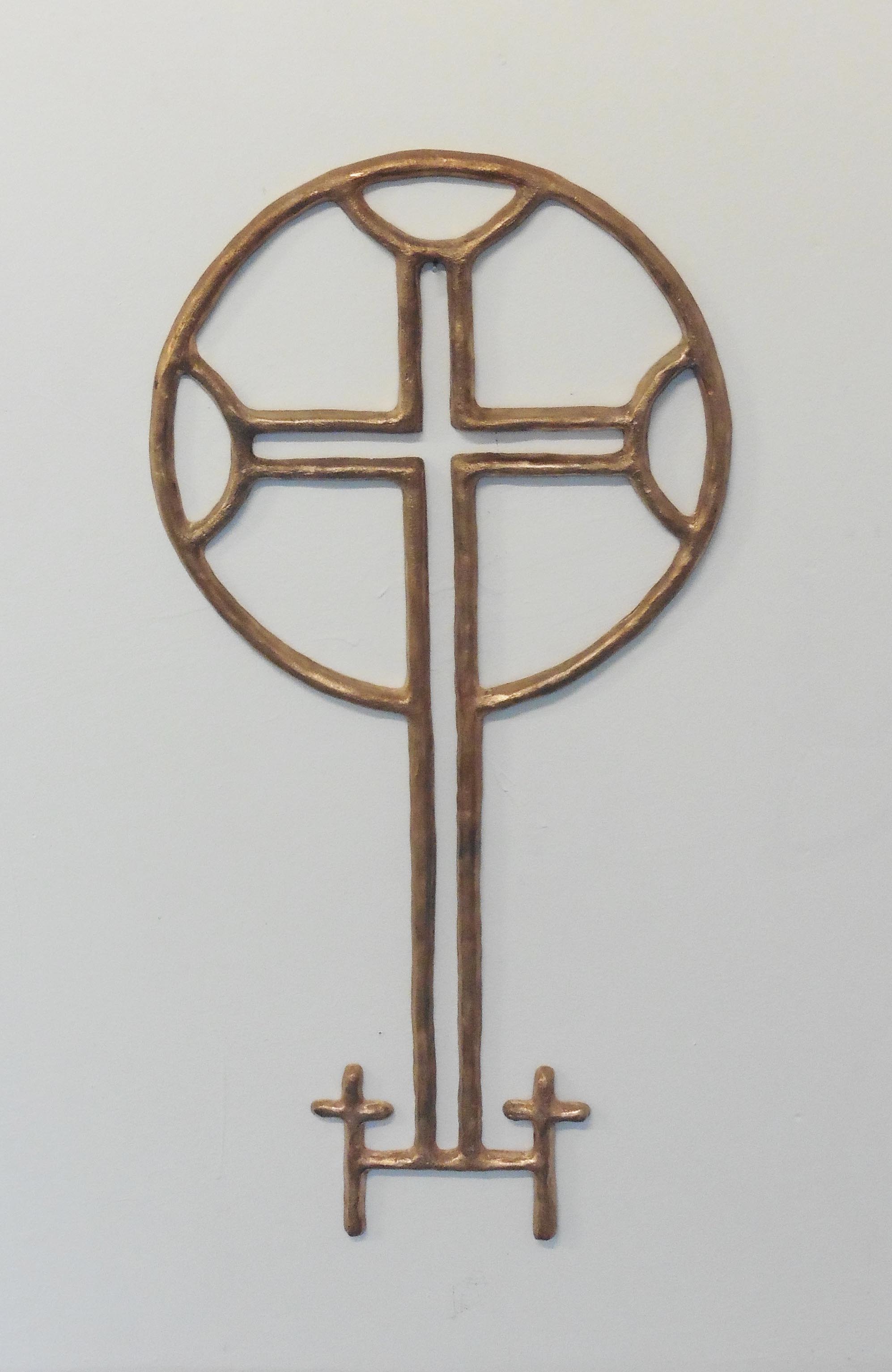
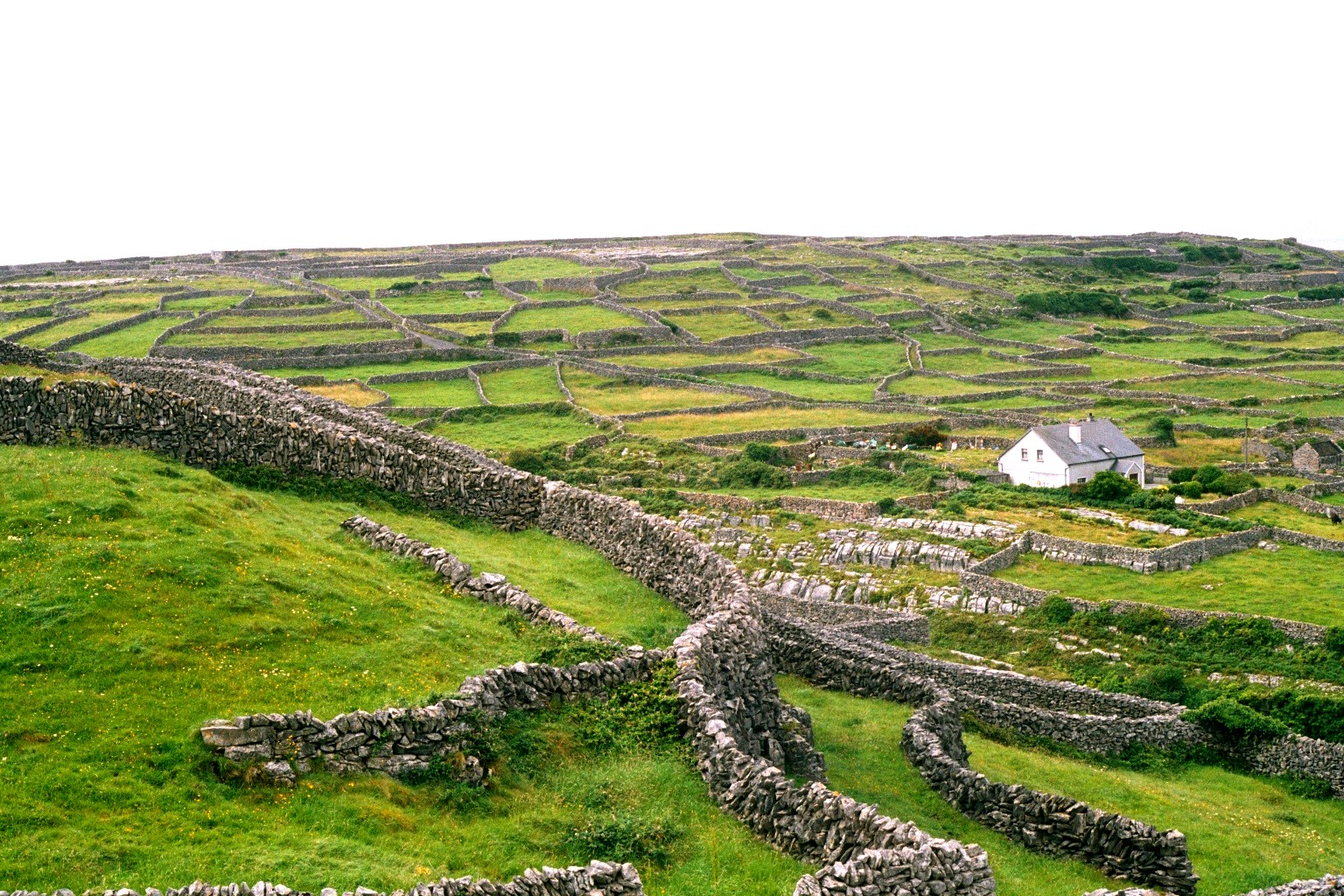
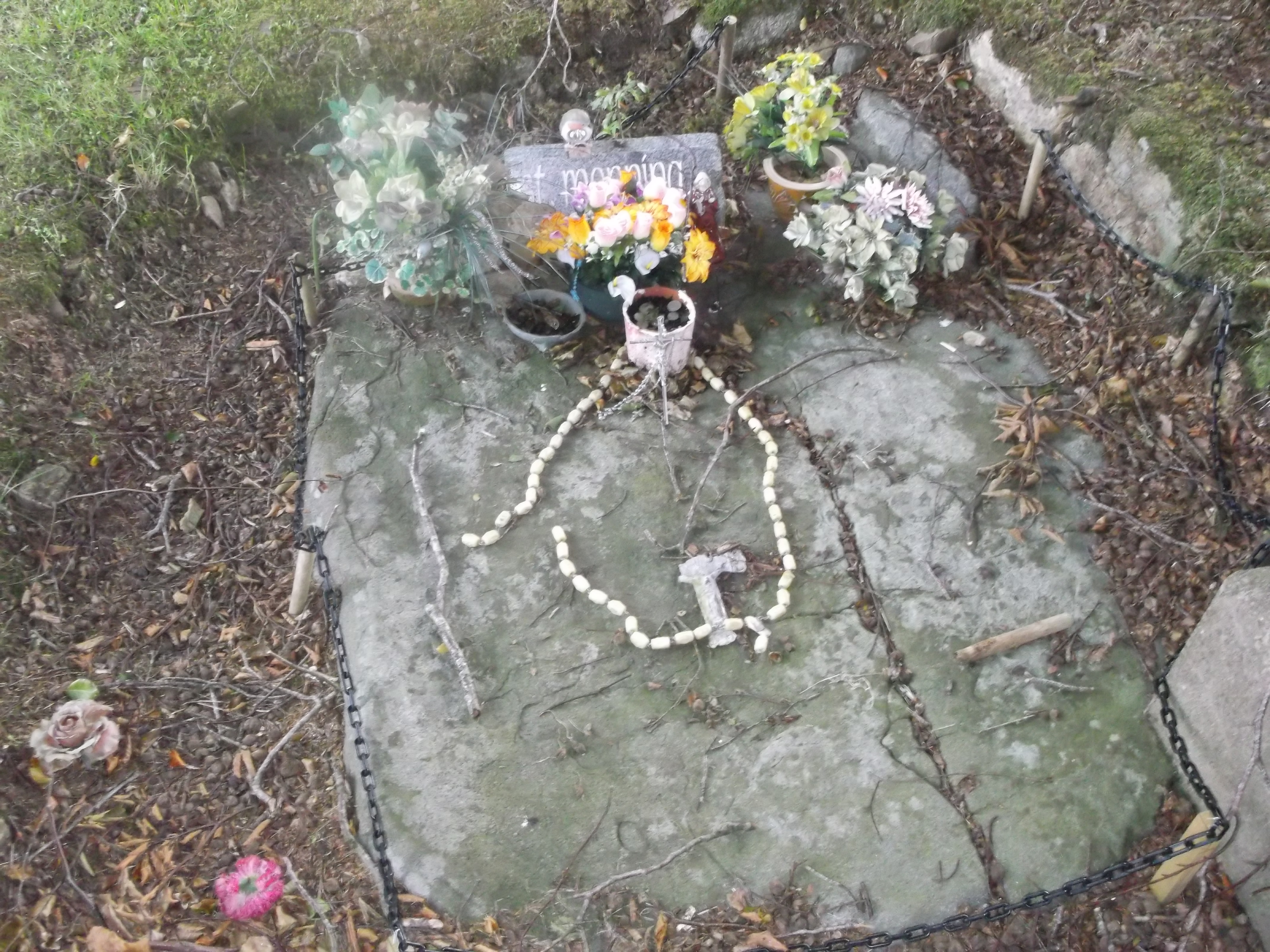
Creggankeel Fort is a stone fort and National Monument (Ireland), National Monument located on the island of Inisheer, Ireland. It also contains a later Christian site, the Grave of the Seven Daughters. Location Creggankeel Fort is located in the eastern part of Inisheer, overlooking An Loch Mór (the Great Lake, the only freshwater on the island). History The name Creggankeel derives from the Irish ''creagáin chaoil'', "narrow stony place." Stone forts ("cashels") of this type were mostly built in Ireland after the 1st century BC. The walls were reused in the 15th century as part of the outer walls of O'Brien's Castle (Inisheer), O'Brien's Castle. The Grave of the Seven Daughters (''Cill na Seacht nIníon''), also called ''An Chill Bheannaithe'' (the blessed graveyard) is an early Christian site associated with the female saint Moninne. It was established around the 5th or 6th century AD. Description The fort is formed from two square drystone walls with a cross inscribed ... [...More Info...] [...Related Items...] OR: [Wikipedia] [Google] [Baidu] |
Inisheer
Inisheer ( ga, Inis Oírr , or ) is the smallest and most easterly of the three Aran Islands in Galway Bay, Republic of Ireland, Ireland. With 281 residents as of the 2016 census, it is second-most populous of the Arans. Caomhán of Inisheer, Caomhán of Inis Oírr is the island's patron saint. There are five small settlements: Baile Thiar, Chapeltown (Baile an tSéipéil), Castle Village (Baile an Chaisleáin), Baile an Fhormna and Baile an Lorgain. Name The island was originally called ''Árainn Airthir'', and later ''Inis Oirthir'', which are thought to mean "eastern Aran" and "eastern island" respectively. (see scanned records) The second element is also found in the names Inishsirrer and Orior Lower, Orior. According to Séamas Ó Murchú, the current official name, , was brought into use by the Ordnance Survey Ireland. He says it may be a compromise between and the traditional local name . Geology and geography The island is geologically an extension of The Burre ... [...More Info...] [...Related Items...] OR: [Wikipedia] [Google] [Baidu] |
County Galway
"Righteousness and Justice" , anthem = () , image_map = Island of Ireland location map Galway.svg , map_caption = Location in Ireland , area_footnotes = , area_total_km2 = 6151 , area_rank = 2nd , seat_type = County town , seat = Galway , population_total = 276451 , population_density_km2 = auto , population_rank = 5th , population_as_of = 2022 , population_footnotes = , leader_title = Local authorities , leader_name = County Council and City Council , leader_title2 = Dáil constituency , leader_name2 = , leader_title3 = EP constituency , leader_name3 = Midlands–North-West , subdivision_type = Country , subdivision_name = Ireland , subdivision_type1 = Province , subdivision_name1 = Connacht , subdivision ... [...More Info...] [...Related Items...] OR: [Wikipedia] [Google] [Baidu] |
The Burren
The Burren (; ) is a karst/glaciokarst landscape centred in County Clare, on the west coast of Ireland. Burren National Park - Geology - "The Burren is one of the finest examples of a Glacio-Karst landscape in the world. At least two glacial advances are known in the Burren area." It measures around , within the circle made by the villages of , Corofin, and .< ... [...More Info...] [...Related Items...] OR: [Wikipedia] [Google] [Baidu] |
Aran Islands
The Aran Islands ( ; gle, Oileáin Árann, ) or The Arans (''na hÁrainneacha'' ) are a group of three islands at the mouth of Galway Bay, off the west coast of Republic of Ireland, Ireland, with a total area around . They constitute the historic barony (Ireland), barony of Aran in County Galway. From west to east, the islands are: Inishmore (''Árainn'' / ''Inis Mór''), which is the largest; Inishmaan (''Inis Meáin''), the second-largest; and Inisheer (''Inis Oírr''), the smallest. There are also several islets. The population of 1,226 (as of 2016) primarily speak Irish language, Irish, the language of local placenames, making the islands a part of the Gaeltacht. Most islanders are also fluent or proficient in Hiberno-English, English. The population has steadily declined from around 3,500 in 1841. Location and access The approaches to the bay between the Aran Islands and the mainland are: * North Sound''An Súnda ó Thuaidh'' (more accurately ''Bealach Locha Lurgan'') l ... [...More Info...] [...Related Items...] OR: [Wikipedia] [Google] [Baidu] |
Office Of Public Works
The Office of Public Works (OPW) ( ga, Oifig na nOibreacha Poiblí) (legally the Commissioners of Public Works in Ireland) is a major Irish Government agency, which manages most of the Irish State's property portfolio, including hundreds of owned and rented Government offices and police properties, oversees National Monuments and directly manages some heritage properties, and is the lead State engineering agency, with a special focus on flood risk management. It lies within the remit of the Minister for Public Expenditure and Reform, with functions largely delegated to a Minister of State at the Department of Public Expenditure and Reform with special responsibility for the Office. The OPW has a central role in driving the Government's property asset management reform process, both in respect of its own portfolio and that of the wider public service. The agency was initially known as Board of Works, a title inherited from a preceding body, and this term is still sometimes enco ... [...More Info...] [...Related Items...] OR: [Wikipedia] [Google] [Baidu] |
Ireland
Ireland ( ; ga, Éire ; Ulster Scots dialect, Ulster-Scots: ) is an island in the Atlantic Ocean, North Atlantic Ocean, in Northwestern Europe, north-western Europe. It is separated from Great Britain to its east by the North Channel (Great Britain and Ireland), North Channel, the Irish Sea, and St George's Channel. Ireland is the List of islands of the British Isles, second-largest island of the British Isles, the List of European islands by area, third-largest in Europe, and the List of islands by area, twentieth-largest on Earth. Geopolitically, Ireland is divided between the Republic of Ireland (officially Names of the Irish state, named Ireland), which covers five-sixths of the island, and Northern Ireland, which is part of the United Kingdom. As of 2022, the Irish population analysis, population of the entire island is just over 7 million, with 5.1 million living in the Republic of Ireland and 1.9 million in Northern Ireland, ranking it the List of European islan ... [...More Info...] [...Related Items...] OR: [Wikipedia] [Google] [Baidu] |
O'Brien's Castle (Inisheer)
O'Brien's Castle, also called Furmina Castle, is an early 15th century tower house and National Monument located on Inisheer, Ireland. Location O'Brien's Castle is located at one of the island's highest points, in the north of Inisheer. History A ringfort once stood on the site, named ''Dún Formna'' ("hillfort of the ridge/shoulder", referring to the "shoulder" of land) and dated to between the 5th century BC and 1st century AD. The castle was built by the Clann Teige, a branch of the powerful O'Brien (Uí Briain) family, in the early 15th century around 1400. It was taken by the Ó Flaithbheartaigh (O'Flahertys) around 1582. It was captured and slighted by Oliver Cromwell's army in 1652, during the Cromwellian conquest of Ireland. Building The castle is a rectangular donjon (keep). The original doorway was into the first floor, accessed by an external wooden stairs. The entire first floor was a great hall, with mural stairs up to the parapet. The ground floor was a basem ... [...More Info...] [...Related Items...] OR: [Wikipedia] [Google] [Baidu] |
Cill Na Seacht NInión - Inis Oírr 2
{{disambiguation ...
Cill or CILL may refer to: * Cill or sill, in water navigation, a horizontal ledge in a lock * Continental Indoor Lacrosse League, a senior men's box lacrosse league in the United States See also * Sill (other) Sill may refer to: * Sill (dock), a weir at the low water mark retaining water within a dock * Sill (geology), a subhorizontal sheet intrusion of molten or solidified magma * Sill (geostatistics) * Sill (river), a river in Austria * Sill plate ... [...More Info...] [...Related Items...] OR: [Wikipedia] [Google] [Baidu] |
Moninne
Saint Moninne or Modwenna of Killeavy was one of Ireland's early female saints. After instruction in the religious life, she founded a community, initially consisting of eight virgins and a widow with a baby, at Slieve Gullion, in what became County Armagh. They lived an eremitical life, based on that of Elijah and Saint John the Baptist. Moninne died in 517. Her feast day is 6 July. Life Moninne was born around 435 in the Donaghmore area of County Down. Her father was Machta, King of the territory stretching from Louth to Armagh and her mother was Comwi or Coman daughter of one of the northern kings. It was said that she was baptised and confirmed by Saint Patrick. When he was passing through the lands of Machta he stopped at her parents' house and predicted that Moninne's name would be remembered throughout time. It was said that she was veiled by Saint Patrick also. There are a couple of versions of the name Moninne, for example Darerca, Blinne or the spelling Moninna which m ... [...More Info...] [...Related Items...] OR: [Wikipedia] [Google] [Baidu] |
Cill Na Seacht NInion
{{disambiguation ...
Cill or CILL may refer to: * Cill or sill, in water navigation, a horizontal ledge in a lock * Continental Indoor Lacrosse League, a senior men's box lacrosse league in the United States See also * Sill (other) Sill may refer to: * Sill (dock), a weir at the low water mark retaining water within a dock * Sill (geology), a subhorizontal sheet intrusion of molten or solidified magma * Sill (geostatistics) * Sill (river), a river in Austria * Sill plate ... [...More Info...] [...Related Items...] OR: [Wikipedia] [Google] [Baidu] |
Drystone
Dry stone, sometimes called drystack or, in Scotland, drystane, is a building method by which structures are constructed from stones without any mortar to bind them together. Dry stone structures are stable because of their construction method, which is characterized by the presence of a load-bearing façade of carefully selected interlocking stones. Dry stone construction is best known in the context of stone walls, traditionally used for the boundaries of fields and churchyards, or as retaining walls for terracing, but dry stone sculptures, buildings, bridges, and other structures also exist. The term tends not to be used for the many historic styles which used precisely-shaped stone, but did not use mortar, for example the Greek temple and Inca architecture. The art of dry stone walling was inscribed in 2018 on the UNESCO representative list of the intangible cultural heritage of humanity, for dry stone walls in countries such as France, Greece, Italy, Slovenia, Cro ... [...More Info...] [...Related Items...] OR: [Wikipedia] [Google] [Baidu] |


