|
Graciosa Airport
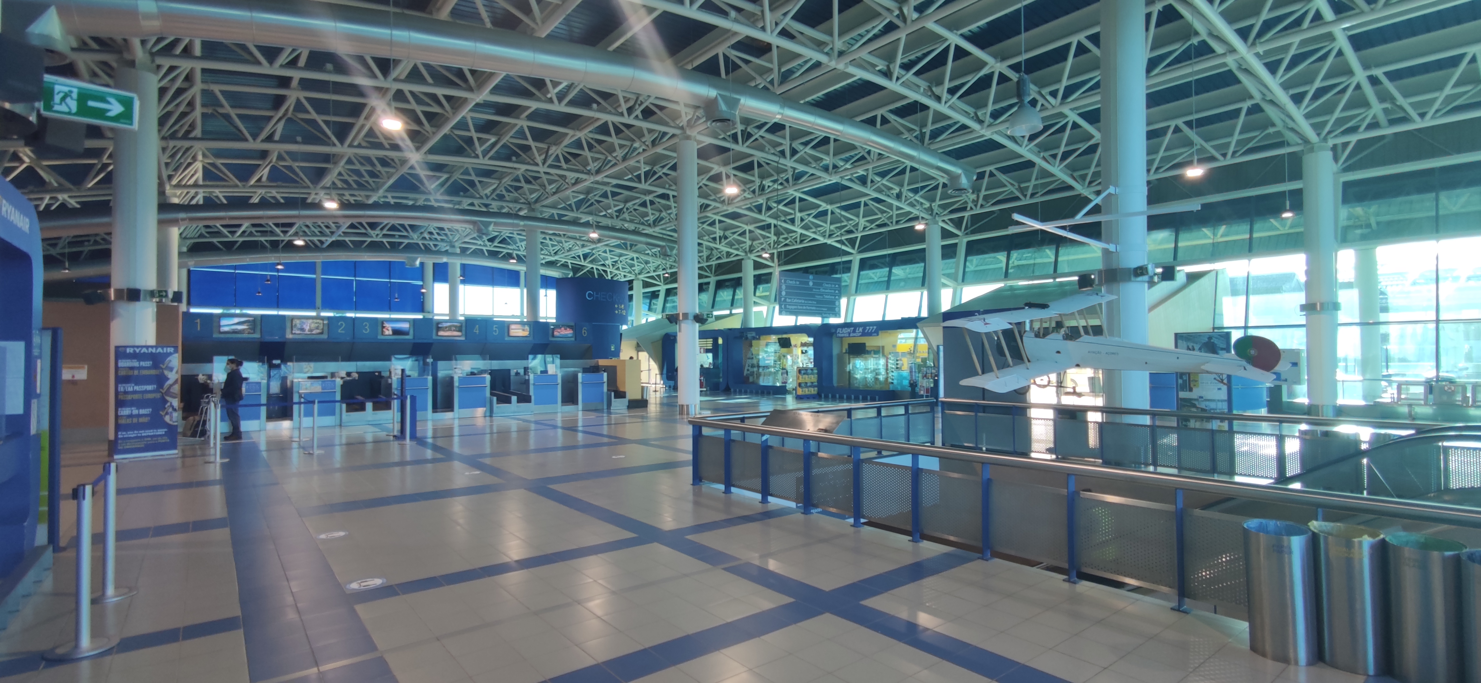
Graciosa Airport (Portuguese: ''Aérodromo da Graciosa'') is an airport located west northwest of Santa Cruz da Graciosa on Graciosa Island in the Azores . History Located at Barro Vermelho, between Dores and Ponta da Barca, it was projected in 1973, but only had the project and topographical surveys concluded in 1976, already by the regional authorities. Built by the Azorean Regional Government between September 1979 and July 1981, its runway, 1325 meters long, was inaugurated on July 11, 1981. The original small air terminal was replaced by a new one, inaugurated on October 1, 2001. Airlines and destinations The following airlines operate regular scheduled and charter flights at Graciosa Airport: Statistics See also Aviation in the Azores Aviation in the Azores is part of the greater history of aviation in Portugal, and involves the historical use of the archipelago of the Azores by North American, South American and European pioneers of aviation. The Azores is strate ... [...More Info...] [...Related Items...] OR: [Wikipedia] [Google] [Baidu] |
Asphalt Concrete
Asphalt concrete (commonly called asphalt, blacktop, or pavement in North America, and tarmac, bitumen macadam, or rolled asphalt in the United Kingdom and the Republic of Ireland) is a composite material commonly used to surface roads, parking lots, airports, and the core of embankment dams. Asphalt mixtures have been used in pavement construction since the beginning of the twentieth century. It consists of mineral aggregate bound together with asphalt, laid in layers, and compacted. The process was refined and enhanced by Belgian-American inventor Edward De Smedt. The terms ''asphalt'' (or ''asphaltic'') ''concrete'', ''bituminous asphalt concrete'', and ''bituminous mixture'' are typically used only in engineering and construction documents, which define concrete as any composite material composed of mineral aggregate adhered with a binder. The abbreviation, ''AC'', is sometimes used for ''asphalt concrete'' but can also denote ''asphalt content'' or ''asphalt cement'', ... [...More Info...] [...Related Items...] OR: [Wikipedia] [Google] [Baidu] |
Aeronautical Information Publication
In aviation, an Aeronautical Information Publication (or AIP) is defined by the International Civil Aviation Organization as a publication issued by or with the authority of a state and containing aeronautical information of a lasting character essential to air navigation. It is designed to be a manual containing thorough details of regulations, procedures and other information pertinent to flying aircraft in the particular country to which it relates. It is usually issued by or on behalf of the respective civil aviation administration. Overview The structure and contents of AIPs are standardized by international agreement through ICAO. AIPs normally have three parts – GEN (general), ENR (en route) and AD (aerodromes). The document contains many charts; most of these are in the AD section where details and charts of all public aerodromes are published. AIPs are kept up-to-date by regular revision on a fixed cycle. For operationally significant changes in information, the ... [...More Info...] [...Related Items...] OR: [Wikipedia] [Google] [Baidu] |
Santa Cruz Da Graciosa (Azores)
Santa Cruz da Graciosa () is a Portuguese municipality on the island of Graciosa, in the archipelago of the Azores. The population in 2011 was 4,391, in an area of 60.66 km². It includes four local parishes and one municipal government structure, which administers the entire island. History While the date of its first discovery is uncertain, it is known that its first settlers arrived from the island of Terceira around 1450. One of the first settlers was Vasco Gil Sodre. The early settlement was primarily agrarian, but by 1486 its population had grown sufficiently to warrant the founding of the ''vila'' (or town) of Santa Cruz in 1486, while Praia lost this role. Between the 16th-17th century, Graciosa was regularly attacked by pirates and privateers, which obliged the local government to construct fortifications along the island's coast for defense. Over the centuries Santa Cruz was visited by important travellers. The Jesuit António Vieira, who stopped in the village a ... [...More Info...] [...Related Items...] OR: [Wikipedia] [Google] [Baidu] |
Graciosa
Graciosa Island () (literally "graceful" or "enchanting" in Portuguese) is referred to as the ''White Island'', the northernmost of the Central Group of islands in the Azores. The ovular Portuguese island has an area of , a length of and a width of . It is a volcanic island, dominated by a central caldera (the Caldeira) located in the southeast. History In addition to the other islands of the Central Group, Graciosa was explored by Portuguese navigators during the first quarter of the 15th century, although there exist no accounts of the first sighting of the island. May 2, 1450 has frequently been referred to as the date of the island's "discovery", although there exists no documentation to support this date. Paradoxically, it is clear that in 1440, by order of Prince Henry the Navigator, cattle and swine were settled on the island in order to facilitate colonization. Similarly, it is unclear the names of the first settlers to colonize the island, although around 1450 th ... [...More Info...] [...Related Items...] OR: [Wikipedia] [Google] [Baidu] |
Azores
) , motto =( en, "Rather die free than subjected in peace") , anthem= ( en, "Anthem of the Azores") , image_map=Locator_map_of_Azores_in_EU.svg , map_alt=Location of the Azores within the European Union , map_caption=Location of the Azores within the European Union , subdivision_type=Sovereign state , subdivision_name=Portugal , established_title=Settlement , established_date=1432 , established_title3=Autonomous status , established_date3=30 April 1976 , official_languages=Portuguese , demonym= ( en, Azorean) , capital_type= Capitals , capital = Ponta Delgada (executive) Angra do Heroísmo (judicial) Horta (legislative) , largest_city = Ponta Delgada , government_type=Autonomous Region , leader_title1=Representative of the Republic , leader_name1=Pedro Manuel dos Reis Alves Catarino , leader_title2= President of the Legislative Assembly , leader_name2= Luís Garcia , leader_title3= President of the Regional Government , leader_name3=José Manuel Bolieiro , le ... [...More Info...] [...Related Items...] OR: [Wikipedia] [Google] [Baidu] |
SATA Air Açores
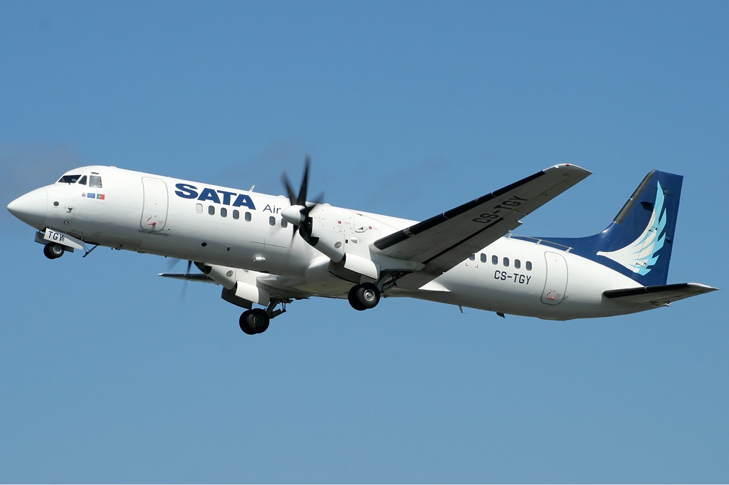
SATA Air Açores is a Portuguese airline based in São Sebastião, Ponta Delgada in the Azores, Portugal. It operates scheduled passenger, cargo and mail services around the Azores. It provides its own maintenance and handling services and manages four regional airports. Its main base is at João Paulo II Airport, Ponta Delgada. It also maintains a subsidiary for mid- and long-haul flights, Azores Airlines, the former ''SATA International''. History On August 21, 1941, a group of investors that included Augusto Rebelo Arruda, José Bensaude, Augusto d'Athayde, Corte Real Soares de Albergaria, Albano de Freitas da Silva and the company Bensaude & Co. Lda. (through its managing director António de Medeiros e Almeida) established Sociedade Açoreana de Estudos Aéreos Lda. (English: ''Azorean Aviation Studies Company, Ltd.'') to look into the feasibility of developing an inter-island airline that would link the Azorean archipelago and continental Portugal, and to obtain the g ... [...More Info...] [...Related Items...] OR: [Wikipedia] [Google] [Baidu] |
João Paulo II Airport
Ponta Delgada - João Paulo II Airport , named after Pope John Paul II, is an international airport located on the island of São Miguel, in the Portuguese archipelago of the Azores. Situated west of the city centre of Ponta Delgada, it is the primary (and busiest) airport in the Azores, as well as the fifth largest infrastructure managed by ANA Aeroportos de Portugal. The terminal was finished in 1995; by 2005 the airport served a total of 873,500 passengers. It has scheduled domestic flights to all islands of the Azores, plus Madeira and the mainland, namely (Lisbon, Porto and Faro). João Paulo II Airport also accommodates international flights to and from Europe and North America. The airport is the major hub for the SATA Group of airlines, which includes both inter-island SATA Air Açores and international Azores Airlines, and since April 2015 as a base for Ryanair. History The airport was inaugurated on 24 August 1969 by President Admiral Américo Tomás, after its cons ... [...More Info...] [...Related Items...] OR: [Wikipedia] [Google] [Baidu] |
Lajes Airport
Lajes Airport is located in the parish and Vila das Lajes, in the municipality of Praia da Vitória, on Terceira Island, in the Azores. Overview Lajes Airport not only serves Terceira but is also a hub providing international access to the Azores. It shares a runway and control and support structures with the military Lajes Field. Its runway is the most extensive among the airports of the Azores, measuring about 4,000 meters in length. Aerogare Civil das Lajes (ACL) has a capacity of 750,000 passengers per year and 360 passengers per hour as of the last requalification. Airlines and destinations Accidents *On August 24, 2001, Air Transat Flight 236 suffered from fuel exhaustion over the Atlantic Ocean The Atlantic Ocean is the second-largest of the world's five oceans, with an area of about . It covers approximately 20% of Earth's surface and about 29% of its water surface area. It is known to separate the " Old World" of Africa, Europe ... due to a fuel leak. The ... [...More Info...] [...Related Items...] OR: [Wikipedia] [Google] [Baidu] |
Aviation In The Azores
Aviation in the Azores is part of the greater history of aviation in Portugal, and involves the historical use of the archipelago of the Azores by North American, South American and European pioneers of aviation. The Azores is strategically located in the centre of the North Atlantic Ocean between the continents of North America and Europe, and has played a historical role in trans-Atlantic navigation. The three primary airfields of the Azores are: * Santa Maria Airport, the historical hub of commercial air transport. * Lajes Field, the primary military services field, also serving civilian aviation. * Ponta Delgada (Nordela) João Paulo II Airport, the current hub of commercial air transport. Due to the relative distance between the islands of the archipelago, aviation is in many instances more viable than boat transportation, with inter-island flights being a crucial part of the Azorean infrastructure. History First World War The city of Horta was bombarded in December 1916, ... [...More Info...] [...Related Items...] OR: [Wikipedia] [Google] [Baidu] |
Airports In The Azores
An airport is an aerodrome with extended facilities, mostly for commercial air transport. Airports usually consists of a landing area, which comprises an aerially accessible open space including at least one operationally active surface such as a runway for a airplane, plane to take off and to land or a helipad, and often includes adjacent utility buildings such as control towers, hangars and airport terminal, terminals, to maintain and monitor aircraft. Larger airports may have airport aprons, taxiway bridges, air traffic control centres, passenger facilities such as restaurants and Airport lounge, lounges, and emergency services. In some countries, the US in particular, airports also typically have one or more fixed-base operators, serving general aviation. Operating airports is extremely complicated, with a complex system of aircraft support services, passenger services, and aircraft control services contained within the operation. Thus airports can be major employers ... [...More Info...] [...Related Items...] OR: [Wikipedia] [Google] [Baidu] |

_(cropped).jpg)


