|
Fuscherkarkopf
The Fuscherkarkopf, sometimes also written ''Fuscher-Kar-Kopf'' in German and formerly also called the ''Fuschereiskarkopf'', is one of the twin peaks of a mountain in the Glockner Group in the centre of the main mountain chain (''Mittleren Tauernhauptkamm'') in the High Tauern, a range in the Austrian Central Alps. The mountain lies right on the border between the Austrian states of Salzburg and Carinthia. The main peak is 3,331 metres high, but the northwest summit is only 3,252 metres high. The two peaks are about 500 metres apart and linked by a curved firn-covered ridge. Further sharp, prominent ridges run away to the northwest and west, forming the main crest of the Tauern. To the southwest the Heiligenblut Open Face (''Heiligenbluter Freiwand'') branches off, a mighty side ridge that starts as the southeast ridge (''Südostgrat'') at the Fuscherkarkopf. The northwest summit has a great, West Face (''Westwand''), that used to be covered with firn, but today is covered with l ... [...More Info...] [...Related Items...] OR: [Wikipedia] [Google] [Baidu] |
Bratschen
''Bratschen'' are weathering products that occur as a result of frost and aeolian corrasion almost exclusively on the calc-schists of the Upper Slate Mantle (''Obere Schieferhülle'') in the High Tauern mountains of Austria. The term is German but is used untranslated in English sources. The calc-schist, which appears blue-gray when freshly broken, weathers to a yellow to brown colour and flakes off on the surface to form ''bratschen''. These form steep (up to 40°), rocky, almost unvegetated mountainsides with an odd and rough-textured surface, caused by wind erosion. ''Bratschen'' are found on the mountains such as the Fuscherkarkopf, the Großer Bärenkopf, the Kitzsteinhorn, the Schwerteck, or on the eponym An eponym is a person, a place, or a thing after whom or which someone or something is, or is believed to be, named. The adjectives which are derived from the word eponym include ''eponymous'' and ''eponymic''. Usage of the word The term ''epon ...ous Bratschenköp ... [...More Info...] [...Related Items...] OR: [Wikipedia] [Google] [Baidu] |
List Of Mountains Of The Alps Above 3000 M
This page tabulates only the most prominent mountains of the Alps, selected for having a topographic prominence of ''at least'' , and all of them exceeding in height. Although the list contains 537 summits, some significant alpine mountains are necessarily excluded for failing to meet the stringent prominence criterion. The list of these most prominent mountains is continued down to 2500 m elevation at List of prominent mountains of the Alps (2500–2999 m) and down to 2000 m elevation on List of prominent mountains of the Alps (2000–2499 m). All such mountains are located in either France, Italy, Switzerland, Liechtenstein, Austria, Germany or Slovenia, even in some lower regions. Together, these three lists include all 44 ultra-prominent peaks of the Alps, with 19 ultras over 3000m on this page. For a definitive list of all 82 the highest peaks of the Alps, as identified by the International Climbing and Mountaineering Federation (UIAA), and often referred to as the 'Alpi ... [...More Info...] [...Related Items...] OR: [Wikipedia] [Google] [Baidu] |
Hohe Tauern
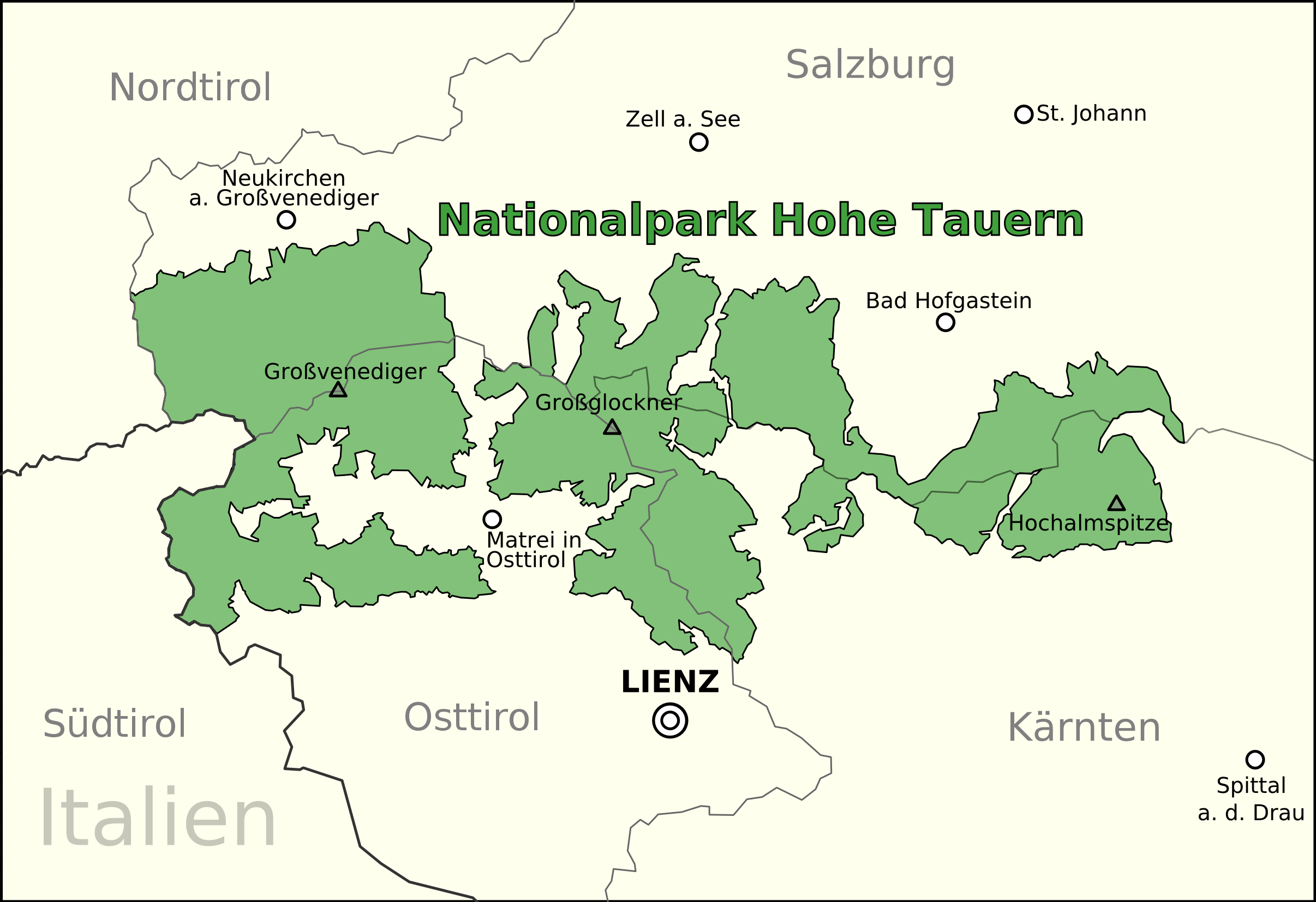
The High Tauern (plural, pl.; german: Hohe Tauern, it, Alti Tauri) are a mountain range on the Main chain of the Alps, main chain of the Central Eastern Alps, comprising the highest peaks east of the Brenner Pass. The crest forms the southern border of the Austrian states of Salzburg (state), Salzburg, Carinthia (state), Carinthia and East Tyrol, with a small part in the southwest belongs to the Italy, Italian province of South Tyrol. The range includes Austria's highest mountain, the Grossglockner at metres above the Adriatic, above the Adriatic. In the east, the range is adjoined by the Lower Tauern. For the etymology of the name, see Tauern. Geography According to the Alpine Club classification of the Eastern Alps, the range is bounded by the Salzach valley to the north (separating it from the Kitzbühel Alps), the Mur (river), Mur valley and the Murtörl Pass to the east (separating it from the Lower Tauern), the Drava valley to the south (separating it from the Southern Lim ... [...More Info...] [...Related Items...] OR: [Wikipedia] [Google] [Baidu] |
High Tauern
The High Tauern ( pl.; german: Hohe Tauern, it, Alti Tauri) are a mountain range on the main chain of the Central Eastern Alps, comprising the highest peaks east of the Brenner Pass. The crest forms the southern border of the Austrian states of Salzburg, Carinthia and East Tyrol, with a small part in the southwest belongs to the Italian province of South Tyrol. The range includes Austria's highest mountain, the Grossglockner at above the Adriatic. In the east, the range is adjoined by the Lower Tauern. For the etymology of the name, see Tauern. Geography According to the Alpine Club classification of the Eastern Alps, the range is bounded by the Salzach valley to the north (separating it from the Kitzbühel Alps), the Mur valley and the Murtörl Pass to the east (separating it from the Lower Tauern), the Drava valley to the south (separating it from the Southern Limestone Alps), and the Birnlücke Pass to the west (separating it from the Zillertal Alps). Its most important s ... [...More Info...] [...Related Items...] OR: [Wikipedia] [Google] [Baidu] |
Glockner Group
The Glockner Group Reynolds, Kev (2005). ''Walking in the Alps'', 2nd ed., Cicerone, Singapore, p.409, . (german: Glocknergruppe) is a sub-group of the Austrian Central Alps in the Eastern Alps, and is located in the centre section of the High Tauern on the main chain of the Alps. The Glockner Group lies in Austria in the federal states of Salzburg, Tyrol and Carinthia. The three states meet at a tripoint on the summit of the Eiskögele (). The highest summit of the Glockner Group and also the highest peak in Austria is the Großglockner (), which gives the mountain group its name. Considerable portions of the Glockner Group belong to the core zone of the High Tauern National Park. Also found in the Glockner Group is the Pasterze, the largest glacier in Austria. Boundaries The boundaries of the Glockner Group are defined as follows: the River Salzach from Uttendorf to Taxenbach; the Rauriser Tal to Wörth; Seidlwinkltal; Hochtor ( Großglockner High Alpine Road); Tauernba ... [...More Info...] [...Related Items...] OR: [Wikipedia] [Google] [Baidu] |
Carl Diener
Carl Diener (11 December 1862 in Vienna – 6 January 1928, Vienna) was an Austrian geographer, geologist and paleontologist. Biography In 1883 he received his doctorate from the University of Vienna, where his instructors included Eduard Suess and Melchior Neumayr. In 1893 he changed his venia legendi from geography to geology, a subject that he became an associate professor of in 1897. In 1906 he was named a full professor of paleontology at the University of Vienna.Diener, Carl Deutsche Biographie He is best remembered for his geological (including ) and faunistic investigations of the . H ... [...More Info...] [...Related Items...] OR: [Wikipedia] [Google] [Baidu] |
Klettersteig
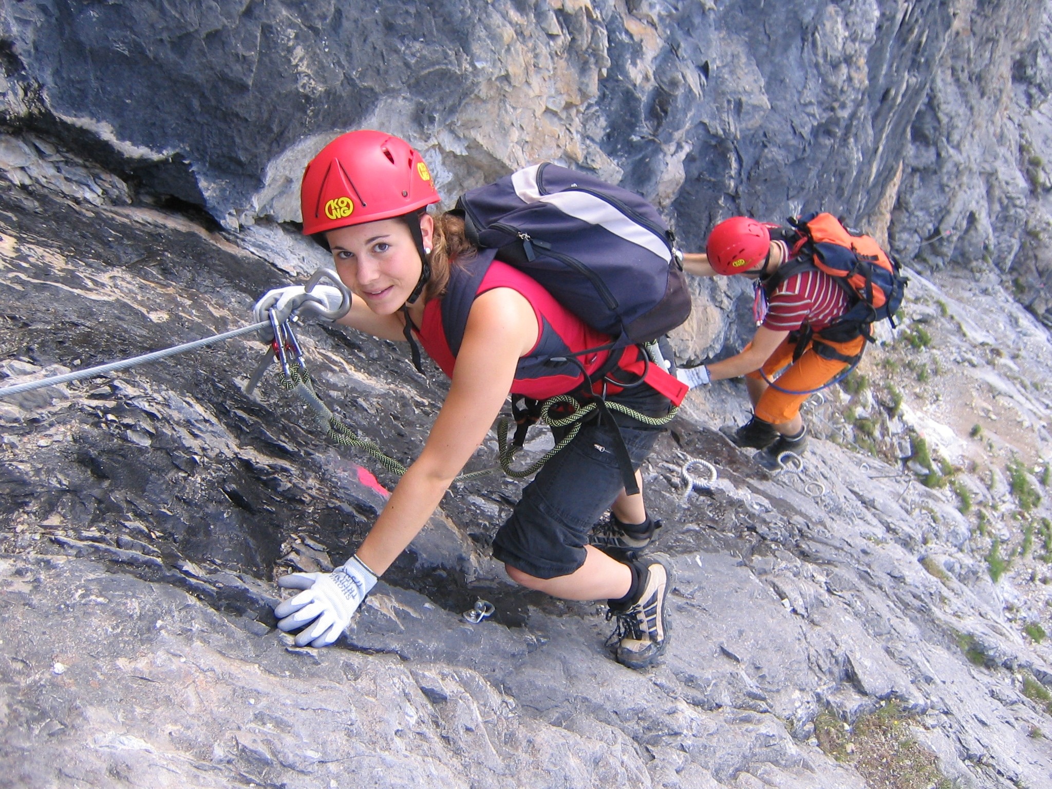
A via ferrata (Italian language, Italian for "iron path", plural ''vie ferrate'' or in English ''via ferratas'') is a protected climbing route found in the Alps and certain other locations. The term "via ferrata" is used in most countries and languages except notably in German-speaking regions, which use ''Klettersteig''—"climbing path" (plural ''Klettersteige''). Infrastructure A via ferrata is a climbing route that employs steel cables, rungs or ladders, fixed to the rock to which the climbers affix #Safety and equipment, a harness with two leashes, which allows the climbers to secure themselves to the metal fixture and limit any fall. The cable and other fixtures, such as iron rungs (stemples), pegs, carved steps, and ladders and bridges, provide both footings and handholds, as well. This allows climbing on otherwise dangerous routes without the risks of unprotected scrambling and climbing or the need for technical climbing equipment. They expand the opportunities for acce ... [...More Info...] [...Related Items...] OR: [Wikipedia] [Google] [Baidu] |
Hohe Dock
The Hohe Dock lies in the Austrian federal state of Salzburg and, at 3,348 metres, is one of the highest peaks in the Glockner Group. The mountain, with its striking trapezoidal shape, dominates the orographically left-hand side of the valley of the Fuscher Ache and the panorama above the northern ramp of the Großglockner High Alpine Road. Its secondary peak, the southeastern summit, reaches a height of . Climbing route The start point is the head of the valley at Fusch an der Großglocknerstraße Fusch an der Großglocknerstraße is a municipality, at the foot of Grossglockner mountain, in the district of Zell am See (district), Zell am See (Pinzgau region), in the state of Salzburg (state), Salzburg in Austria. See town website pages at ... (Ferleiten). The summit is ascended via the Schwarzenberg Hut (2,267 m) along a signed, high alpine path. References External links Climbing the Hohe Dock- (Czech / English) Gallery Image:Hohe_Dock.jpg, The Hohe Dock from t ... [...More Info...] [...Related Items...] OR: [Wikipedia] [Google] [Baidu] |
Schwierigkeitsskala (Klettern)
In rock climbing, mountaineering, and other climbing disciplines, climbers give a grade to a climbing route or boulder problem, intended to describe concisely the difficulty and danger of climbing it. Different types of climbing (such as sport climbing, bouldering or ice climbing) each have their own grading systems, and many nationalities developed their own, distinctive grading systems. There are a number of factors that contribute to the difficulty of a climb, including the technical difficulty of the moves, the strength, stamina and level of commitment required, and the difficulty of protecting the climber. Different grading systems consider these factors in different ways, so no two grading systems have an exact one-to-one correspondence. Climbing grades are inherently subjective.Reynolds Sagar, Heather, 2007, ''Climbing your best: training to maximize your performance'', Stackpole Books, UK, 9. They may be the opinion of one or a few climbers, often the first ascensi ... [...More Info...] [...Related Items...] OR: [Wikipedia] [Google] [Baidu] |


