|
Fresno, Texas
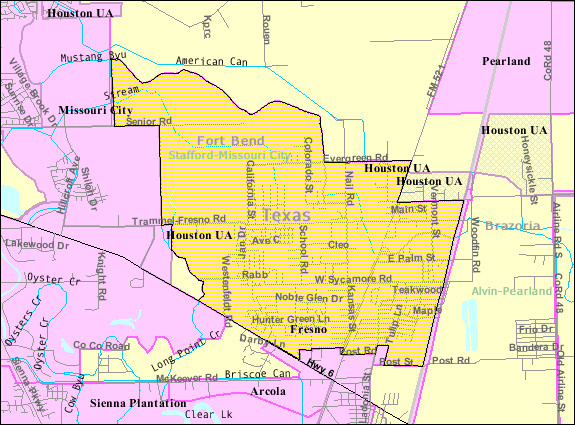
Fresno is an unincorporated community and census-designated place (CDP) in Fort Bend County, Texas, United States. The local population was 24,486 as of the 2020 census, up from 19,069 at the 2010 census, and 6,603 at the 2000 census. Fresno is located in the extra-territorial jurisdiction (ETJ) of Houston, which is the fourth largest city in the nation in population. Fresno is bordered by Houston to the north, the suburban Fort Bend County cities of Missouri City to the west and northwest, Arcola to the south and southwest, and the Brazoria County city of Pearland to the east. Geography Fresno is located in eastern Fort Bend County at (29.526728, -95.459849). The eastern edge of Fresno is the Brazoria County line. Downtown Houston is to the north, the center of Missouri City is to the northwest, the center of Pearland is to the east, and Manvel is to the southeast. According to the United States Census Bureau, the Fresno CDP has a total area of , of which of i ... [...More Info...] [...Related Items...] OR: [Wikipedia] [Google] [Baidu] |
Census-designated Place
A census-designated place (CDP) is a concentration of population defined by the United States Census Bureau for statistical purposes only. CDPs have been used in each decennial census since 1980 as the counterparts of incorporated places, such as self-governing cities, towns, and villages, for the purposes of gathering and correlating statistical data. CDPs are populated areas that generally include one officially designated but currently unincorporated community, for which the CDP is named, plus surrounding inhabited countryside of varying dimensions and, occasionally, other, smaller unincorporated communities as well. CDPs include small rural communities, edge cities, colonias located along the Mexico–United States border, and unincorporated resort and retirement communities and their environs. The boundaries of any CDP may change from decade to decade, and the Census Bureau may de-establish a CDP after a period of study, then re-establish it some decades later. Most unin ... [...More Info...] [...Related Items...] OR: [Wikipedia] [Google] [Baidu] |
Houston
Houston (; ) is the most populous city in Texas, the most populous city in the Southern United States, the fourth-most populous city in the United States, and the sixth-most populous city in North America, with a population of 2,304,580 in 2020. Located in Southeast Texas near Galveston Bay and the Gulf of Mexico, it is the seat and largest city of Harris County and the principal city of the Greater Houston metropolitan area, which is the fifth-most populous metropolitan statistical area in the United States and the second-most populous in Texas after Dallas–Fort Worth. Houston is the southeast anchor of the greater megaregion known as the Texas Triangle. Comprising a land area of , Houston is the ninth-most expansive city in the United States (including consolidated city-counties). It is the largest city in the United States by total area whose government is not consolidated with a county, parish, or borough. Though primarily in Harris County, small portions of the ... [...More Info...] [...Related Items...] OR: [Wikipedia] [Google] [Baidu] |
Loop 610
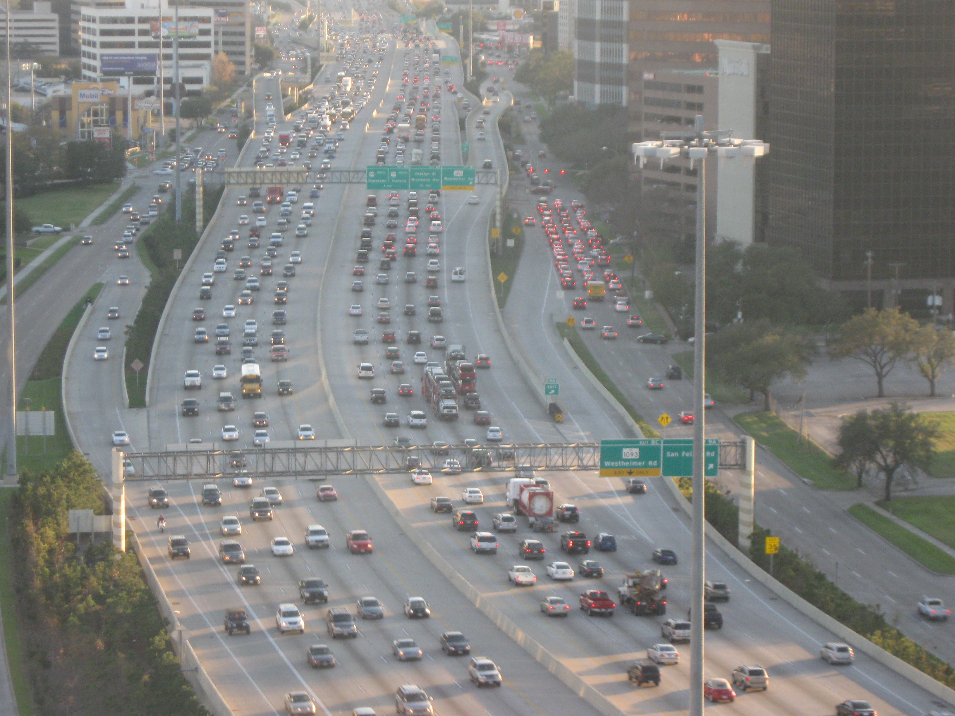
Interstate 610 (I-610) is a freeway that forms a loop around the inner city sector of the city of Houston, Texas. I-610, colloquially known as The Loop, Loop 610, The Inner Loop, or just 610, traditionally marks the border between the inner city of Houston ("inside the Loop") and its surrounding areas. It is the innermost of the three Houston beltways, the other two being Beltway 8 (Sam Houston Tollway) and State Highway 99 (SH 99, Grand Parkway), of which various segments are under construction or planning. In Houston, the area inside the 610 Loop is the urban core. Jeff Balke of the '' Houston Press'' wrote that the freeway "is as much a social and philosophical divide as a physical one". Mike Snyder in the '' Houston Chronicle'' wrote that as someone from the 610 Loop he historically felt "kind of special" due to being close to "the city’s historical core and its major business, educational and cultural institutions". Route description Major ... [...More Info...] [...Related Items...] OR: [Wikipedia] [Google] [Baidu] |
1980s Oil Glut
The 1980s oil glut was a serious surplus of crude oil caused by falling demand following the 1970s energy crisis. The world price of oil had peaked in 1980 at over US$35 per barrel (equivalent to $ per barrel in dollars, when adjusted for inflation); it fell in 1986 from $27 to below $10 ($ to $ in dollars). The glut began in the early 1980s as a result of slowed economic activity in industrial countries due to the crises of the 1970s, especially in 1973 and 1979, and the energy conservation spurred by high fuel prices. The inflation-adjusted real 2004 dollar value of oil fell from an average of $78.2 in 1981 to an average of $26.8 per barrel in 1986. In June 1981, ''The New York Times'' proclaimed that an "oil glut" had arrived and ''Time'' stated that "the world temporarily floats in a glut of oil". However, ''The New York Times'' warned the next week that the word "glut" was misleading, and that temporary surpluses had brought down prices somewhat, but prices were still we ... [...More Info...] [...Related Items...] OR: [Wikipedia] [Google] [Baidu] |
Democratic Party (United States)
The Democratic Party is one of the two major contemporary political parties in the United States. Founded in 1828, it was predominantly built by Martin Van Buren, who assembled a wide cadre of politicians in every state behind war hero Andrew Jackson, making it the world's oldest active political party.M. Philip Lucas, "Martin Van Buren as Party Leader and at Andrew Jackson's Right Hand." in ''A Companion to the Antebellum Presidents 1837–1861'' (2014): 107–129."The Democratic Party, founded in 1828, is the world's oldest political party" states Its main political rival has been the Republican Party since the 1850s. The party is a big tent, and though it is often described as liberal, it is less ideologically uniform than the Republican Party (with major individuals within it frequently holding widely different political views) due to the broader list of unique voting blocs that compose it. The historical predecessor of the Democratic Party is considered to be th ... [...More Info...] [...Related Items...] OR: [Wikipedia] [Google] [Baidu] |
Texas State Highway 6
State Highway 6 (SH 6) runs from the Red River, the Texas–Oklahoma state line, to northwest of Galveston, where it is known as the Old Galveston Highway. In Sugar Land and Missouri City, it is known as Alvin-Sugarland Road and runs perpendicular to Interstate 69/ U.S. Highway 59 (I-69/US 59). In the Houston area, it runs north to Farm to Market Road 1960 (FM 1960), then northwest along USS 290 to Hempstead, and south to Westheimer Road and Addicks, and is known as Addicks Satsuma Road. In the Bryan– College Station area, it is known as the Earl Rudder Freeway. In Hearne, it is known as Market Street. In Calvert, it is known as Main Street. For most of its length, SH 6 is not a limited-access road. In 1997, the Texas Legislature designated SH 6 as the Texas Korean War Veterans Memorial Highway. History Historic routes SH 6 was one of the original 25 state highways proposed on June 21, 1917, overlaying the King of Trails Hi ... [...More Info...] [...Related Items...] OR: [Wikipedia] [Google] [Baidu] |
Fresno, California
Fresno () is a major city in the San Joaquin Valley of California, United States. It is the county seat of Fresno County and the largest city in the greater Central Valley region. It covers about and had a population of 542,107 in 2020, making it the fifth-most populous city in California, the most populous inland city in California, and the 34th-most populous city in the nation. The Metro population of Fresno is 1,008,654 as of 2022. Named for the abundant ash trees lining the San Joaquin River, Fresno was founded in 1872 as a railway station of the Central Pacific Railroad before it was incorporated in 1885. It has since become an economic hub of Fresno County and the San Joaquin Valley, with much of the surrounding areas in the Metropolitan Fresno region predominantly tied to large-scale agricultural production. Fresno is near the geographic center of California, approximately north of Los Angeles, south of the state capital, Sacramento, and southeast of San Franc ... [...More Info...] [...Related Items...] OR: [Wikipedia] [Google] [Baidu] |
Manvel, Texas
Manvel is a city in Brazoria County, Texas, United States. As of the 2020 census the population was 9,992, up from 5,179 at the 2010 census. History The population increased from 5,179 to 9,992 from 2010 to 2020, and in November 2021 there were 12,000 lots in twelve housing complexes that were to be developed. Geography Manvel is located in northern Brazoria County at (29.479200, –95.356299). Iowa Colony is to the west, Pearland is to the north, and Alvin is to the east. According to the United States Census Bureau, the city has a total area of , of which is land and , or 0.12%, is water. Subdivisions within the City of Manvel consist of Rodeo Palms, Lakeland, Pomona, Meridianna, Del Bello Lakes, Blue Water Estates, Terra Estates, Yanni Palms, Fox Tail, Sedona Lakes. Demographics As of the 2020 United States census, there were 9,992 people, 3,881 households, and 2,954 families residing in the city. As of the census of 2000, Manvel had a population of 3,046, 1,0 ... [...More Info...] [...Related Items...] OR: [Wikipedia] [Google] [Baidu] |
Pearland, Texas
Pearland ( ) is a city in the U.S. state of Texas, within Brazoria County, with portions extending into Fort Bend and Harris counties. The city of Pearland is a principal city within the metropolitan statistical area. At the 2020 U.S. census, the city's population was 125,828, up from a population of 91,252 at the 2010 census. Pearland's population growth rate from 2000 to 2010 was 142 percent, which ranked Pearland as the 15th-fastest-growing city in the U.S. during that time period, compared to other cities with a population of 10,000 or greater in 2000. Pearland is the third-largest city in the Greater Houston area, and from 2000 to 2010, ranked as the fastest-growing city in Greater Houston and the second-fastest-growing city in Texas. Per the American Community Survey of 2019 the population had risen to an estimated 131,448. History Pearland had its beginnings near a siding switch on the Gulf, Colorado and Santa Fe Railway in 1882. When a post office was established in 1893 ... [...More Info...] [...Related Items...] OR: [Wikipedia] [Google] [Baidu] |


.jpg)
