|
Freeth Bay
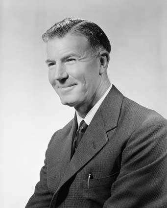
Freeth Bay is a 5 mi wide bay on the coast of Enderby Land, Antarctica, lying 12 mi west of Spooner Bay in Alasheyev Bight. Plotted from air photos taken by Australian National Antarctic Research Expeditions (ANARE) in 1956. First visited by the Australian National Antarctic Research Expeditions (ANARE) under D.F. Styles in February 1961 and named for the Hon. Gordon Freeth Sir Gordon Freeth, KBE (6 August 191427 November 2001) was an Australian politician and diplomat. He served in the House of Representatives from 1949 to 1969, including as a minister in the Coalition governments from 1958 to 1969. He lat ..., M.P., then Australian Minister for the Interior. References {{Reflist Bays of Antarctica ... [...More Info...] [...Related Items...] OR: [Wikipedia] [Google] [Baidu] |
Enderby Land
Enderby Land is a projecting landmass of Antarctica. Its shore extends from Shinnan Glacier at about to William Scoresby Bay at , approximately of the earth's longitude. It was first documented in western and eastern literature in February 1831 by John Biscoe aboard the whaling brig ''Tula'', and named after the Enderby Brothers of London, the ship's owners who encouraged their captains to combine exploration with sealing. Nation state claims Subject to the constraints of the Antarctic Treaty System, the longest-held nation-state claimant rights in the territory is Australia, being a large part of its claimed Australian Antarctic Territory up to various high latitudes towards the South Pole. Features Coastal features include Amundsen Bay, Casey Bay and Cape Monakov. Mountain ranges or sub-ranges being crests above pack ice (escarpments), are the Scott Mountains, the Tula Mountains, and the Napier Mountains. The highest peak is Mount Elkins at Above Ordnance Datum (convent ... [...More Info...] [...Related Items...] OR: [Wikipedia] [Google] [Baidu] |
Antarctica
Antarctica () is Earth's southernmost and least-populated continent. Situated almost entirely south of the Antarctic Circle and surrounded by the Southern Ocean, it contains the geographic South Pole. Antarctica is the fifth-largest continent, being about 40% larger than Europe, and has an area of . Most of Antarctica is covered by the Antarctic ice sheet, with an average thickness of . Antarctica is, on average, the coldest, driest, and windiest of the continents, and it has the highest average elevation. It is mainly a polar desert, with annual precipitation of over along the coast and far less inland. About 70% of the world's freshwater reserves are frozen in Antarctica, which, if melted, would raise global sea levels by almost . Antarctica holds the record for the lowest measured temperature on Earth, . The coastal regions can reach temperatures over in summer. Native species of animals include mites, nematodes, penguins, seals and tardigrades. Where vegetation o ... [...More Info...] [...Related Items...] OR: [Wikipedia] [Google] [Baidu] |
Spooner Bay
Spooner Bay is a 6-mile-wide bay on the coast of Enderby Land, lying 12 miles east of Freeth Bay in Alasheyev Bight. Plotted from air photos taken by Australian National Antarctic Research Expeditions (ANARE) in 1956. First visited by the Australian National Antarctic Research Expeditions (ANARE) (Thala Dan) under D.F. Styles in February 1961 and named for Sen. Bill Spooner William "Sputnik" Spooner (born August 16, 1949) is a musician, guitarist, singer and songwriter, and the founder of The Tubes, a theatrical rock band. His songwriting is known for its use of humor and satire. He has released three solo albums ..., then Australian Minister of National Development. See also * Fluted Rock References Bays of Antarctica {{EnderbyLand-geo-stub ... [...More Info...] [...Related Items...] OR: [Wikipedia] [Google] [Baidu] |
Alasheyev Bight
Alasheyev Bight is a bight in the western part of the coast of Enderby Land. Kirkby Head is a sheer coastal outcrop on Tange Promontory, at the east side of the entrance to Alasheyev Bight. Alasheyev Bight was photographed from the air by Australian National Antarctic Research Expeditions in 1956. Plotted in 1957 by the Soviet Antarctic Expedition The Soviet Antarctic Expedition (SAE or SovAE) (russian: Советская антарктическая экспедиция, САЭ, ''Sovetskaya antarkticheskaya ekspeditsiya'') was part of the Arctic and Antarctic Research Institute of the So ... and named for D.A. Alasheyev (''Дмитрий Александрович Алашеев''), Russian hydrographer. References * Bays of Antarctica Bodies of water of Enderby Land Bights (geography) {{EnderbyLand-geo-stub ... [...More Info...] [...Related Items...] OR: [Wikipedia] [Google] [Baidu] |
Gordon Freeth
Sir Gordon Freeth, KBE (6 August 191427 November 2001) was an Australian politician and diplomat. He served in the House of Representatives from 1949 to 1969, including as a minister in the Coalition governments from 1958 to 1969. He later served as Ambassador to Japan from 1970 to 1973 and High Commissioner to the United Kingdom from 1977 to 1980. Early life Freeth was born in Angaston, South Australia, the son of Robert Freeth (1886–1979) and Gladys Mary Snashall. He attended Sydney Church of England Grammar School and the Guildford Grammar School in Western Australia, where his father was Headmaster from 1928 to 1949. In 1937 he rowed in the bow seat of the Western Australian men's eight which contested the King's Cup at the Australian Interstate Regatta. He was awarded a Bachelor of Laws by the University of Western Australia in 1938. That same year he was selected to row for Australia and won a gold medal in the coxed fours in the 1938 British Empire Games in Sydne ... [...More Info...] [...Related Items...] OR: [Wikipedia] [Google] [Baidu] |

