|
Franklin Regional Transit Authority
The Franklin Regional Transit Authority (FRTA) is a regional transit authority which provides public transportation principally to Franklin County and the North Quabbin region, both in Massachusetts. The FRTA is based in the county seat of Greenfield, Massachusetts. History Prior to the FRTA, Greenfield and its surrounding areas were served by the intermunicipal Greenfield and Montague Transportation Area (GMTA), an authority created with the purchase of assets of the defunct Connecticut Valley Street Railway in 1924. The FRTA was established in 1978 with then implementation of Massachusetts General Laws Chapter 161B, which gave rise to several regional transit authorities throughout Massachusetts. FRTA is the largest public transit authority in Massachusetts by territory. In 1999, the FRTA and the Fitchburg-based Montachusett Regional Transit Authority (MART) cooperated to form a route to Athol and Orange, Massachusetts, linking Greenfield to the MART terminal in Gardner. ... [...More Info...] [...Related Items...] OR: [Wikipedia] [Google] [Baidu] |
Greenfield, Massachusetts
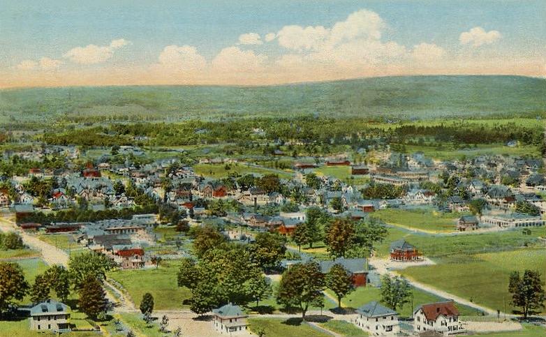
Greenfield is a city in and the county seat of Franklin County, Massachusetts, United States. Greenfield was first settled in 1686. The population was 17,768 at the 2020 census. Greenfield is home to Greenfield Community College, the Pioneer Valley Symphony Orchestra, and the Franklin County Fair. The city has a Main Street Historic District containing fine examples of Federal, Greek Revival, and Victorian architecture. Greenfield is part of the Springfield, Massachusetts, Metropolitan Statistical Area. History Pocumtuck Indians first settled and originally inhabited the Greenfield area. Native American artifacts found in the area have been dated between 7,000 and 9,000 years BCE. The Pocumtucks planted field crops and fished local rivers. Some sources claim that they were wiped out by the Mohawks in 1664 and that the land was left unoccupied. Other sources show that the Pocumtucks joined the Wampanoag chief Metacom in August 1675 in the fight against English encroachment, ... [...More Info...] [...Related Items...] OR: [Wikipedia] [Google] [Baidu] |
Montague, Massachusetts
Montague is a town in Franklin County, Massachusetts, United States. The population was 8,580 at the 2020 census. It is part of the Springfield, Massachusetts metropolitan statistical area. The villages of Montague Center, Montague City, Lake Pleasant, Millers Falls, and Turners Falls are located in the town of Montague; Turners Falls, comprising over half the population of the town and its main business district, is sometimes used as a metonym for the entire town of Montague. History Originally inhabited by the Pocomtuc tribe, the area was known as ''Peskeompskut''. Montague was first settled by Europeans in 1715 and was incorporated in 1754. The town has five villages within it: Montague Center, Montague City, Turners Falls, Millers Falls, and Lake Pleasant. Montague Center was the original European settlement and was originally a part of the town of Sunderland. Lake Pleasant was a prominent spiritualist campground. Turners Falls was a planned mill community (similar to ... [...More Info...] [...Related Items...] OR: [Wikipedia] [Google] [Baidu] |
Charlemont, Massachusetts
Charlemont is a town in Franklin County, Massachusetts, United States. The population was 1,185 at the 2020 census. It is part of the Springfield, Massachusetts Metropolitan Statistical Area. History Charlemont was first colonized by Moses Rice (1694–1755) who purchased on 23 April 1743 that been previously set off as Boston Township Number 1 in 1735 by the Great and General Court. The town was along the distant frontier at the time, and was the subject of several raids by Native Americans. While plowing in the fields one day, Rice was shot and wounded by Indians lying in ambush. They also shot and killed another man, Phineas Arms, at the same time and captured Moses' eight-year-old grandson Asa, who had been riding the plow horse. Moses was taken to the adjoining woods, scalped, and left for dead, but Asa was carried off to Canada. The town was incorporated as Charlemont in 1765, most likely named for the town in County Armagh, Ulster, Ireland. The town was mostly rural, ... [...More Info...] [...Related Items...] OR: [Wikipedia] [Google] [Baidu] |
Buckland, Massachusetts
Buckland is a town in Franklin County, Massachusetts, United States. The population was 1,816 at the 2020 census. The town shares the village of Shelburne Falls with neighboring Shelburne. The town center at Shelburne Falls is the western end of the Bridge of Flowers, a local tourist attraction. Buckland is part of the Springfield, Massachusetts Metropolitan Statistical Area. History Buckland was first settled in 1742 as "No Town", as it was not currently part of either the village of Charlemont or Ashfield, which the land belonged to as one large town. A sawmill was set up that year by Othneil Taylor and Asaph White, and eventually settlement occurred. However, the townspeople did not want to cross the Deerfield River or travel the long distance to Ashfield Village to attend services, so they petitioned the Massachusetts General Court for a separate incorporation. The town was incorporated on April 14, 1779, as Buckland, presumably named for the abundant hunting in th ... [...More Info...] [...Related Items...] OR: [Wikipedia] [Google] [Baidu] |
Shelburne Falls, Massachusetts
Shelburne Falls is a historic village in the towns of Shelburne and Buckland in Franklin County, Massachusetts, United States. The village is a census-designated place (CDP) with a population of 1,731 at the 2010 census. It is part of the Springfield, Massachusetts, Metropolitan Statistical Area. Notable features include the Bridge of Flowers, a former trolley bridge over the Deerfield River that is now maintained by the Shelburne Falls Women's Club as a floral display from April through October; the Shelburne Falls Trolley Museum; and the glacial potholes of the Deerfield River. The downtown includes an independently owned pharmacy with a soda fountain, one coffee shop, a trolley museum, several restaurants, two pizza parlors, three bookstores, a newsstand, a country doctor, a grocery store, a natural foods store, many artists' galleries, and the second oldest bowling alley in the country, the Shelburne Falls Bowling Alley candlepin. A community newspaper, the ''West Coun ... [...More Info...] [...Related Items...] OR: [Wikipedia] [Google] [Baidu] |
Shelburne, Massachusetts
Shelburne is a town in Franklin County, Massachusetts, United States. The population was 1,884 at the 2020 census. It is part of the Springfield, Massachusetts Metropolitan Statistical Area. The village of Shelburne Falls is located partly in Shelburne and neighboring Buckland. History Shelburne was first settled in 1756 as part of Deerfield, Massachusetts, known then as "Deerfield Northwest". It was initially organized as the district of Shelburne in 1768, named in honor of William Petty, 2nd Earl of Shelburne, an Irish-born British politician, who later served as Prime Minister during the American Revolutionary War. Shelburne was officially incorporated as a town in 1775. Its character has always been two-sided; the main body of town has farmland among the low hills, while the area around Shelburne Falls has mostly been a milling community. Geography According to the United States Census Bureau, the town has a total area of , of which is land and , or 0.96%, is water. S ... [...More Info...] [...Related Items...] OR: [Wikipedia] [Google] [Baidu] |
Erving, Massachusetts
Erving is a New England town, town in Franklin County, Massachusetts, Franklin County, Massachusetts, United States. The population was 1,665 at the 2020 census. It is part of the Springfield, Massachusetts Springfield metropolitan area, Massachusetts, metropolitan statistical area. History Erving is located along the Mohawk Trail. The area was part of the Pocomtuc Indian Nation, whose villages included Squawkeag in what is now Northfield, Massachusetts, Northfield, and Peskeompscut in what is now Turners Falls, Massachusetts, Turners Falls. Eventually, most of the native population was displaced and/or sold into slavery as a result of King Philip's War and a series of List of events named massacres, massacres of local Indian villages. Subsequently, Erving was first settled by white settlers in 1801 and officially incorporated—it being nearly the last unincorporated land in Massachusetts—in 1838. What is now Erving was once the farm of John Erving, the first colonial in the ... [...More Info...] [...Related Items...] OR: [Wikipedia] [Google] [Baidu] |
Academy Of Music Theatre
The Academy of Music Theatre is located in and owned by the City of Northampton, Massachusetts. History The Academy of Music was built by Edward H. R. Lyman in 1890. Lyman earned his wealth as a tea and silk merchant. He lived in New York City but was born in Northampton and kept a summer house there. On his travels abroad for business, particularly in Germany, he was struck by the impact of publicly-funded theaters on the communities he visited. The building was designed by architect William C. Brocklesby of Hartford, Connecticut in the Renaissance Revival Renaissance Revival architecture (sometimes referred to as "Neo-Renaissance") is a group of 19th century architectural revival styles which were neither Greek Revival nor Gothic Revival but which instead drew inspiration from a wide range o ... style. The reported cost was $100,000 for the 1,004 seat theater. The Academy was opened to the public on May 23, 1891. Lyman gave the theater to the city as a gift whic ... [...More Info...] [...Related Items...] OR: [Wikipedia] [Google] [Baidu] |
Hatfield, Massachusetts
Hatfield is a town in Hampshire County, Massachusetts, United States. The population was 3,352 at the 2020 census. It is part of the Springfield, Massachusetts Metropolitan Statistical Area. The census-designated place of Hatfield consists of the town center and surrounding areas. History Hatfield was founded in 1660 on land granted to General Daniel Dennison and Governor William Bradford. It was formally incorporated as a town in 1670 and has a board of selectmen and an annual town meeting. One of the theories of Hatfield's incorporation in 1670 was that during that time it was a colony of Hadley and Hadley's church was located across the Connecticut River on what is now West Street in present-day Hadley. The citizens living in what is now Hatfield asked the officials if they could build the church on the west side of the river, so that they could go to church and not have to cross the river, which was hard to cross every week, especially during the winter season when t ... [...More Info...] [...Related Items...] OR: [Wikipedia] [Google] [Baidu] |
Whately, Massachusetts
Whately (; ) is a town in Franklin County, Massachusetts, United States. The population was 1,607 at the 2020 census. It is part of the Springfield, Massachusetts Metropolitan Statistical Area. History Whately was first settled in 1672 as a northern section of Hatfield. The town peaceably petitioned for separation from the town because of its relatively long distance from the rest of Hatfield, and was officially incorporated in 1771, named by Governor Thomas Hutchinson for Thomas Whately, a Member of Parliament whose letter to Hutchinson would later be involved in the controversy which brought on Hutchinson's dismissal. Julian Whately, a descendant of Thomas, visited the town during the Bicentennial celebration in 1971. Whately was the site of the state's first gin distillery, as well as other small mills, including wool and furniture mills. The town also used the water in town for agricultural pursuits, including dairying and one of the few Sumatran tobacco fields outsid ... [...More Info...] [...Related Items...] OR: [Wikipedia] [Google] [Baidu] |
Deerfield, Massachusetts
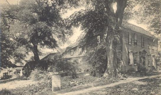
Deerfield is a New England town, town in Franklin County, Massachusetts, Franklin County, Massachusetts, United States. Settled near the Connecticut River in the 17th century during the colonial era, the population was 5,090 as of the 2020 census. Deerfield is part of the Springfield, Massachusetts Springfield, Massachusetts, metropolitan area, Metropolitan Statistical Area in western Massachusetts, lying north of the city of Springfield. Deerfield includes the villages of South Deerfield, Massachusetts, South Deerfield and Old Deerfield, which is home to two museums: Pocumtuck Valley Memorial Association and Historic Deerfield, Inc. Historic Deerfield is designated as a National Historic Landmark district, and the organization operates a museum with a focus on decorative arts, early American material culture, and history. Its eleven house museums offer interpretation of society, history, and culture from the colonial era through the late nineteenth century. The Pocumtuck Valley M ... [...More Info...] [...Related Items...] OR: [Wikipedia] [Google] [Baidu] |
Pioneer Valley Transit Authority
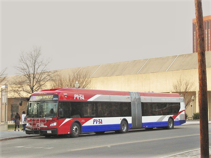
The Pioneer Valley Transit Authority (PVTA) oversees and coordinates public transportation in the Pioneer Valley of Western Massachusetts. Currently the PVTA offers fixed-route bus service as well as paratransit service for the elderly and disabled. The PVTA was created by Chapter 161B of the Massachusetts General Laws in 1974. It is based in Springfield, Massachusetts, serves Hampden and Hampshire counties, and provides connecting service to the FRTA in Franklin County. It is the largest regional transit authority, and second largest public transit system in Massachusetts after the Massachusetts Bay Transit Authority, providing service to over 11 million riders annually across 24 municipalities in the region, with about 70% of all riders using the system as their primary mode of transit. Organizational structure As per Section 25, Chapter 161B of the Massachusetts General Laws, regional transit authorities in Massachusetts are not permitted to directly operate their service, ... [...More Info...] [...Related Items...] OR: [Wikipedia] [Google] [Baidu] |


