|
Franklin County, Illinois
Franklin County is a county in Southern Illinois. At the 2020 census, it had a population of 37,804. The largest city is West Frankfort and the county seat is Benton. This area of Southern Illinois is known locally as "Little Egypt". History Franklin County was established on January 2, 1818 and formed from parts of Gallatin and White counties. It was named for Benjamin Franklin. File:Franklin County Illinois 1818.png, Franklin County at the time of its formation in 1818 File:Franklin County Illinois 1839.png, The creation of Williamson County in 1839 reduced Franklin to its current borders. Coal mining Coal was mined in Franklin County as early as 1889, at the King Coal Mine, located at Township 5 South, Range 3 East. The high levels of gas found in Franklin County's coal deposits have resulted in mining disasters and explosions over the years. Between 1905 and 1968, there were eleven mine disasters. In 1905, the Zeigler No. 1 mine, located in Zeigler, had an explo ... [...More Info...] [...Related Items...] OR: [Wikipedia] [Google] [Baidu] |
Franklin County Courthouse (Illinois)
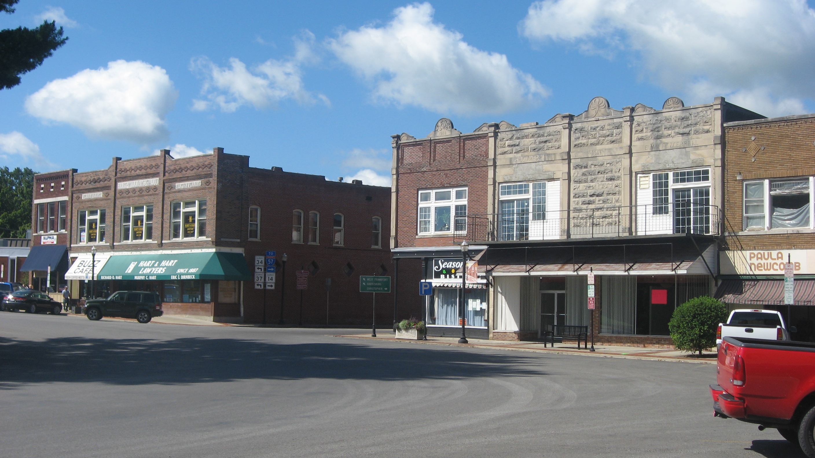
The Franklin County Courthouse is a government building located in Benton, Illinois. It took 620 days to complete from start to finish, costing around $13 million for the courthouse itself. A nearby government building also saw renovations so it could house the courtrooms and the Circuit Clerk's office while the courthouse was under construction. That brought the total cost to around $18 million. The courthouse was finished ahead of schedule and was reported to have been cheaper than fixing the previous courthouse. Early history Franklin County was settled slowly. Few squatters occupied public lands before the land office at Shawneetown opened in 1814, and as late as 1850, half of the public land remained in federal ownership; only after the Bit Act of 1854, which cut prices by 90%, did private men purchase most of the remaining lands.''History of Gallatin, Saline, Hamilton, Franklin, and Williamson counties, Illinois: from the earliest time to the present, together with sundry ... [...More Info...] [...Related Items...] OR: [Wikipedia] [Google] [Baidu] |
Hamilton County, Illinois
Hamilton County is a county located in the U.S. state of Illinois. At the 2020 census, its population was 7,993. Its county seat is McLeansboro. It is located in the southern portion of the state known locally as " Little Egypt". History Hamilton County was formed out of White County in 1821. It is named for Alexander Hamilton, Revolutionary War hero and the first United States Secretary of the Treasury. File:Hamilton County Illinois 1821.png, Hamilton County at the time of its creation in 1821 On March 18, 1925, the infamous Tri-State Tornado tore across the county, destroying dozens of homes and farms in Flannigan, Twigg, Mayberry and Crook townships, and killing 37 people. Geography According to the U.S. Census Bureau, the county has a total area of , of which is land and (0.3%) is water. Climate and weather In recent years, average temperatures in the county seat of McLeansboro have ranged from a low of in January to a high of in July, although a record low of ... [...More Info...] [...Related Items...] OR: [Wikipedia] [Google] [Baidu] |
Illinois Route 148
Illinois Route 148 is a north–south state road in southern Illinois. It runs from Illinois Route 37 at Pulleys Mill (near the intersection of Interstate 24 and Interstate 57) north to the western terminus of Illinois Route 142 and Illinois 37 south of downtown Mount Vernon. This is a distance of . Route description Illinois 148 is a western parallel of Illinois 37 from Pulleys Mill to Mount Vernon. It passes through the city of Herrin, a medium-sized city in Williamson County. It is a two-laned surface road for its entire length. History SBI Route 148 ran from Marion to Mount Vernon. In 1964 it was extended south to Pulleys Mill. There have been no changes to Illinois 148 since. Major Intersections References External links *{{ccat-inline 148 148 may refer to: *148 (number), a natural number *AD 148, a year in the 2nd century AD *148 BC, a year in the 2nd century BC *148 (album), an album by C418 *148 (Meiktila) Battery Royal Artillery *148 (New Je ... [...More Info...] [...Related Items...] OR: [Wikipedia] [Google] [Baidu] |
Illinois 148
Illinois Route 148 is a north–south state road in southern Illinois. It runs from Illinois Route 37 at Pulleys Mill (near the intersection of Interstate 24 and Interstate 57) north to the western terminus of Illinois Route 142 and Illinois 37 south of downtown Mount Vernon. This is a distance of . Route description Illinois 148 is a western parallel of Illinois 37 from Pulleys Mill to Mount Vernon. It passes through the city of Herrin, a medium-sized city in Williamson County. It is a two-laned surface road for its entire length. History SBI Route 148 ran from Marion to Mount Vernon. In 1964 it was extended south to Pulleys Mill. There have been no changes to Illinois 148 since. Major Intersections References External links *{{ccat-inline 148 148 may refer to: *148 (number), a natural number *AD 148, a year in the 2nd century AD *148 BC, a year in the 2nd century BC *148 (album), an album by C418 *148 (Meiktila) Battery Royal Artillery *148 (New Je ... [...More Info...] [...Related Items...] OR: [Wikipedia] [Google] [Baidu] |
Illinois Route 37
Illinois Route 37, Illinois 37 or IL 37, is a north–south state highway in southern Illinois. IL 37's southern terminus is at U.S. Route 51 (US 51) and IL 3 in Cairo and the northern terminus is at US 45 in Watson. Route description Between Effingham and a point near Watson, a segment in which it shared a route with U.S. Route 45, Illinois 37 has been decommissioned in favor of US 45. Between Watson and just north of Salem, it angles westward and toward the south before meeting US 50 at Salem, Illinois 15 and Illinois 142 at Mount Vernon, Interstate 64 south of Mount Vernon, Illinois 14 and Illinois 34 at Benton, Illinois 149 at West Frankfort, Illinois 13 at Marion, and US 51 and Illinois 3 at its current southern terminus at Urbandale. Both of Illinois Route 148's termini branch from Route 37, the north terminus at Mount Vernon, and the southern terminus just north of Pulley's Mill. It has no direct connection to Interstate 24, which is far better ... [...More Info...] [...Related Items...] OR: [Wikipedia] [Google] [Baidu] |
Illinois 37
Illinois Route 37, Illinois 37 or IL 37, is a north–south state highway in southern Illinois. IL 37's southern terminus is at U.S. Route 51 (US 51) and IL 3 in Cairo and the northern terminus is at US 45 in Watson. Route description Between Effingham and a point near Watson, a segment in which it shared a route with U.S. Route 45, Illinois 37 has been decommissioned in favor of US 45. Between Watson and just north of Salem, it angles westward and toward the south before meeting US 50 at Salem, Illinois 15 and Illinois 142 at Mount Vernon, Interstate 64 south of Mount Vernon, Illinois 14 and Illinois 34 at Benton, Illinois 149 at West Frankfort, Illinois 13 at Marion, and US 51 and Illinois 3 at its current southern terminus at Urbandale. Both of Illinois Route 148's termini branch from Route 37, the north terminus at Mount Vernon, and the southern terminus just north of Pulley's Mill. It has no direct connection to Interstate 24, which is far better ... [...More Info...] [...Related Items...] OR: [Wikipedia] [Google] [Baidu] |
Illinois Route 34
Illinois Route 34 (IL 34) is a north–south state road in southern Illinois. It runs from a former ferry crossing to Kentucky Route 297 across the Ohio River in Rosiclare to Illinois Routes 14/ 37 in Benton. This is a distance of . Route description Illinois 34 overlaps Illinois Route 146 and Illinois Route 145 between Rosiclare and Harrisburg. In Harrisburg, Illinois 34 formerly ran the length of Main Street where it at one time sharply turned at Raymond St, then crossed a five way stop between U.S. Route 45, Sloan St, and Illinois Route 145 where it overlapped. Congestion in this area was greatly reduced when the concurrent highway was re-routed farther south to connect and is now concurrent with U.S. Route 45, which it follows to the Bill Franks Bypass (Illinois Route 13). Route 34 then travels west with Route 13 to Main Street, where it then departs Harrisburg heading north. Illinois Route 34 serves as a main north–south road for towns located in the easter ... [...More Info...] [...Related Items...] OR: [Wikipedia] [Google] [Baidu] |
Illinois 34
Illinois Route 34 (IL 34) is a north–south state road in southern Illinois. It runs from a former ferry crossing to Kentucky Route 297 across the Ohio River in Rosiclare to Illinois Routes 14/ 37 in Benton. This is a distance of . Route description Illinois 34 overlaps Illinois Route 146 and Illinois Route 145 between Rosiclare and Harrisburg. In Harrisburg, Illinois 34 formerly ran the length of Main Street where it at one time sharply turned at Raymond St, then crossed a five way stop between U.S. Route 45, Sloan St, and Illinois Route 145 where it overlapped. Congestion in this area was greatly reduced when the concurrent highway was re-routed farther south to connect and is now concurrent with U.S. Route 45, which it follows to the Bill Franks Bypass (Illinois Route 13). Route 34 then travels west with Route 13 to Main Street, where it then departs Harrisburg heading north. Illinois Route 34 serves as a main north–south road for towns located in the easter ... [...More Info...] [...Related Items...] OR: [Wikipedia] [Google] [Baidu] |
Illinois Route 14
Illinois Route 14 (IL 14) is a major east–west highway in southern Illinois. It runs from U.S. Route 51 south of Du Quoin to the New Harmony Toll Bridge over the Wabash River to State Road 66 at the Indiana state line. This is a distance of . Route description Illinois 14 runs mostly east–west from Du Quoin to New Harmony, Indiana. IL 14 begins to travel eastward at US 51 in Du Quoin. The route then proceeds to intersect IL 184 in Mulkeytown, IL 148 in Christopher. It then traverses through Bruckner and West City. In West City, it then meets I-57 at a diamond interchange. After crossing over I-57, it then encounters IL 34 and IL 37 in Benton's public square around the Franklin County Courthouse. It then travels northward via IL 37 and soon branches off eastward. Continuing on, it then intersects IL 142 in McLeansboro. Also, it briefly runs concurrently with southbound IL 142. Continuing eastward from McLeansboro, IL ... [...More Info...] [...Related Items...] OR: [Wikipedia] [Google] [Baidu] |
Illinois 14
Illinois Route 14 (IL 14) is a major east–west highway in southern Illinois. It runs from U.S. Route 51 south of Du Quoin to the New Harmony Toll Bridge over the Wabash River to State Road 66 at the Indiana state line. This is a distance of . Route description Illinois 14 runs mostly east–west from Du Quoin to New Harmony, Indiana. IL 14 begins to travel eastward at US 51 in Du Quoin. The route then proceeds to intersect IL 184 in Mulkeytown, IL 148 in Christopher. It then traverses through Bruckner and West City. In West City, it then meets I-57 at a diamond interchange. After crossing over I-57, it then encounters IL 34 and IL 37 in Benton's public square around the Franklin County Courthouse. It then travels northward via IL 37 and soon branches off eastward. Continuing on, it then intersects IL 142 in McLeansboro. Also, it briefly runs concurrently with southbound IL 142. Continuing eastward from McLeansboro, IL ... [...More Info...] [...Related Items...] OR: [Wikipedia] [Google] [Baidu] |
Interstate 57
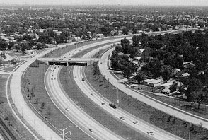
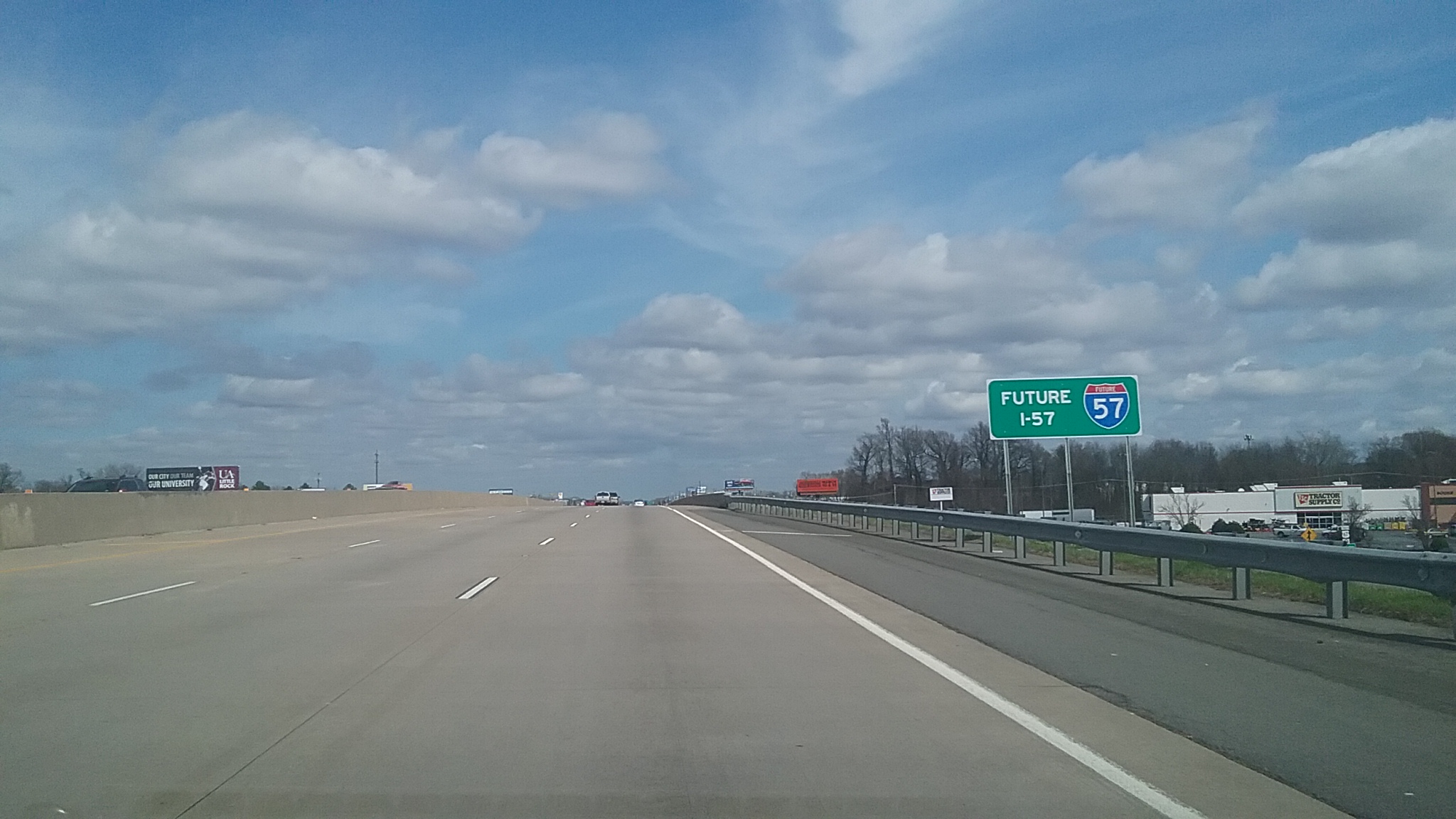
Interstate 57 (I-57) is a north–south Interstate Highway in Missouri and Illinois that parallels the old Illinois Central Railroad for much of its route. It runs from Sikeston, Missouri, at I-55 to Chicago, Illinois, at I-94. I-57 essentially serves as a shortcut route for travelers headed between the South (Memphis, New Orleans, etc.) and Chicago, bypassing St. Louis, Missouri and Springfield, Illinois. Between the junction of I-55 and I-57 in Sikeston and the junction of I-55 and I-90/I-94 in Chicago, I-55 travels for , while the combination of I-57 and I-94 is only long between the same two points. In fact, both the control cities on the overhead signs and the destination mileage signs reference Memphis along southbound I-57, even as far north as its northern origin at I-94 in Chicago. Likewise, at its southern end, Chicago is the control city listed for I-57 on signs on northbound I-55 south of Sikeston, even though I-55 also goes to Chicago. , I-57 has no spur rout ... [...More Info...] [...Related Items...] OR: [Wikipedia] [Google] [Baidu] |
I-57
Interstate 57 (I-57) is a north–south Interstate Highway in Missouri and Illinois that parallels the old Illinois Central Railroad for much of its route. It runs from Sikeston, Missouri, at I-55 to Chicago, Illinois, at I-94. I-57 essentially serves as a shortcut route for travelers headed between the South (Memphis, New Orleans, etc.) and Chicago, bypassing St. Louis, Missouri and Springfield, Illinois. Between the junction of I-55 and I-57 in Sikeston and the junction of I-55 and I-90/I-94 in Chicago, I-55 travels for , while the combination of I-57 and I-94 is only long between the same two points. In fact, both the control cities on the overhead signs and the destination mileage signs reference Memphis along southbound I-57, even as far north as its northern origin at I-94 in Chicago. Likewise, at its southern end, Chicago is the control city listed for I-57 on signs on northbound I-55 south of Sikeston, even though I-55 also goes to Chicago. , I-57 has no spur rout ... [...More Info...] [...Related Items...] OR: [Wikipedia] [Google] [Baidu] |


