|
Frank's Wood
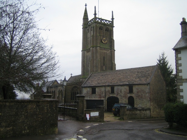
Frank's Wood is a woodland in Wiltshire, England, on the north-east edge of Colerne village. It covers an area of . It is owned and managed by the Woodland Trust. Formerly arable land, the wood was created in 2000 under the Woodland Trust's "Woods on Your Doorstep" scheme, and named in honour of Frank Entwistle of Colerne, one of the instigators of the project. It is planted with mixed native broadleaf trees and some woody shrubs. References {{Reflist Forests and woodlands of Wiltshire Woodland Trust ... [...More Info...] [...Related Items...] OR: [Wikipedia] [Google] [Baidu] |
Woodland Trust
The Woodland Trust is the largest woodland conservation charity in the United Kingdom and is concerned with the creation, protection, and restoration of native woodland Natural heritage, heritage. It has planted over 50 million trees since 1972. The Woodland Trust has three aims: to protect ancient woodland which is rare, unique and irreplaceable, to promote the restoration of damaged ancient woodland, and to plant native trees and woods to benefit people and wildlife. The Woodland Trust maintains ownership of over 1,000 sites covering over 24,700 hectares (247 km2). Of this, 8,070ha (33%) is ancient woodland. It ensures public access to its woods. History The charity was founded in Devon, England in 1972 by retired farmer and agricultural machinery dealer Kenneth Watkins. The Trust's first purchase was part of the Avon Valley Woods, near Kingsbridge, Devon. By 1977 it had 22 woods in six counties. In 1978 it relocated to Grantham in Lincolnshire and announced an expans ... [...More Info...] [...Related Items...] OR: [Wikipedia] [Google] [Baidu] |
Colerne
Colerne is a village and civil parish in north Wiltshire, England. The village is about west of the town of Corsham and northeast of the city of Bath. It has an elevated and exposed position, above sea level, and overlooks the Box valley to the south (where Brunel's Box Tunnel is). The parish includes the hamlets of Eastrip and Thickwood. It is bounded to the west by a stretch of the Fosse Way Roman road, which forms the county boundary with Gloucestershire, and to the east by the Bybrook River. Part of the northern boundary is the Doncombe Brook, a tributary of the Bybrook, and part of the southern boundary is the Lid Brook, another tributary. History Evidence of early settlement in the area includes three bowl barrows near Thickwood, overlooking the Bybrook valley, and an Iron Age hillfort from around 100 BC in the north of the parish, known as Bury Wood Camp, overlooking the Doncombe valley. A Roman villa has been found on the site of the present airfield. The 1086 D ... [...More Info...] [...Related Items...] OR: [Wikipedia] [Google] [Baidu] |
Arable Land
Arable land (from the la, arabilis, "able to be ploughed") is any land capable of being ploughed and used to grow crops.''Oxford English Dictionary'', "arable, ''adj''. and ''n.''" Oxford University Press (Oxford), 2013. Alternatively, for the purposes of agricultural statistics, the term often has a more precise definition: A more concise definition appearing in the Eurostat glossary similarly refers to actual rather than potential uses: "land worked (ploughed or tilled) regularly, generally under a system of crop rotation". In Britain, arable land has traditionally been contrasted with pasturable land such as heaths, which could be used for sheep-rearing but not as farmland. Arable land area According to the Food and Agriculture Organization of the United Nations, in 2013, the world's arable land amounted to 1.407 billion hectares, out of a total of 4.924 billion hectares of land used for agriculture. Arable land (hectares per person) Non-arable land ... [...More Info...] [...Related Items...] OR: [Wikipedia] [Google] [Baidu] |
Forests And Woodlands Of Wiltshire
A forest is an area of land dominated by trees. Hundreds of definitions of forest are used throughout the world, incorporating factors such as tree density, tree height, land use, legal standing, and ecological function. The United Nations' Food and Agriculture Organization (FAO) defines a forest as, "Land spanning more than 0.5 hectares with trees higher than 5 meters and a canopy cover of more than 10 percent, or trees able to reach these thresholds ''in situ''. It does not include land that is predominantly under agricultural or urban use." Using this definition, '' Global Forest Resources Assessment 2020'' (FRA 2020) found that forests covered , or approximately 31 percent of the world's land area in 2020. Forests are the predominant terrestrial ecosystem of Earth, and are found around the globe. More than half of the world's forests are found in only five countries (Brazil, Canada, China, Russia, and the United States). The largest share of forests (45 percent) are in t ... [...More Info...] [...Related Items...] OR: [Wikipedia] [Google] [Baidu] |


