|
France–Switzerland Border
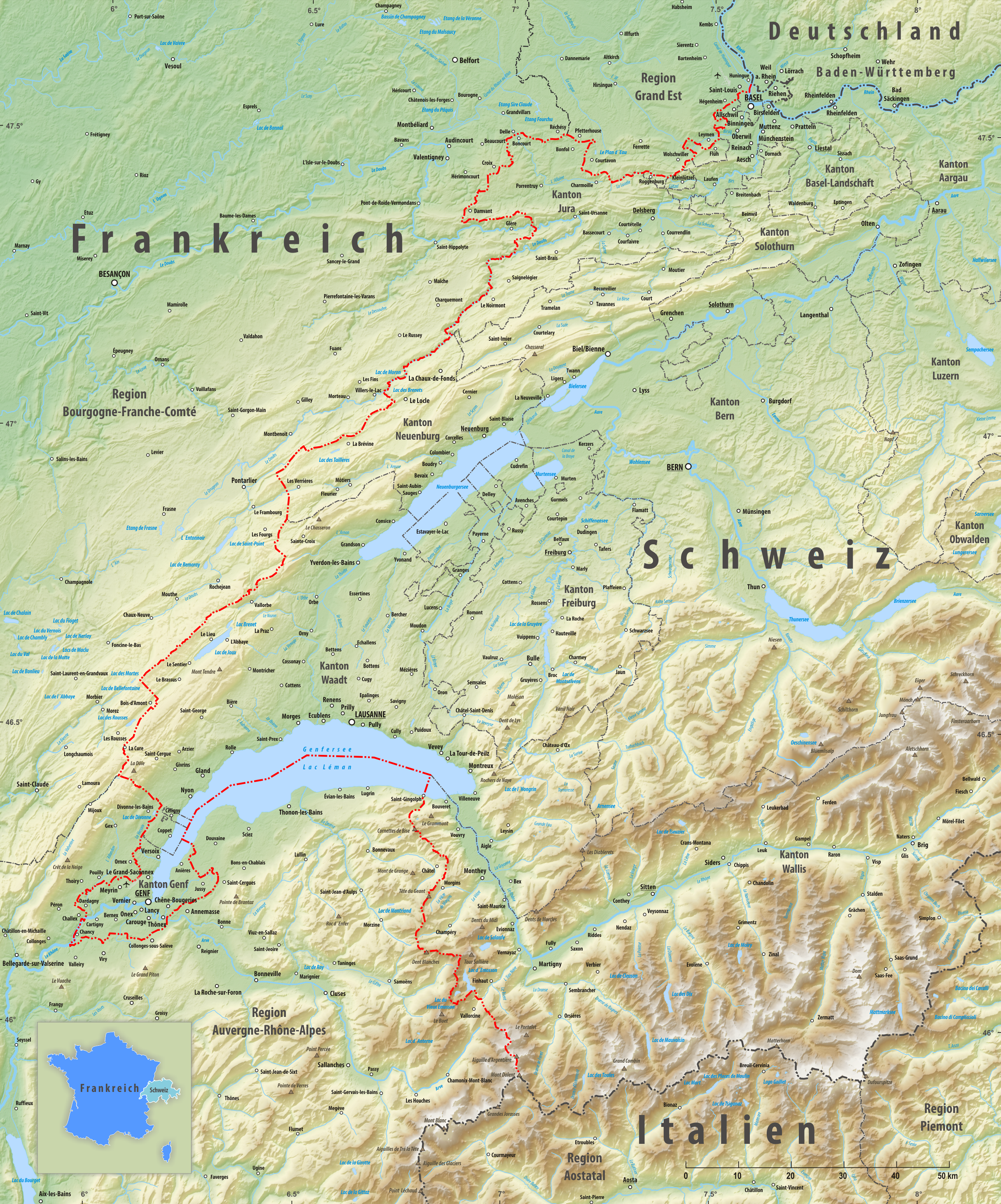
The France–Switzerland border is long. Its current path is mostly the product of the Congress of Vienna of 1815, with the accession of Geneva, Neuchâtel and Valais to the Swiss Confederation, but it has since been modified in detail, the last time being in 2002. Although most of the border, marked with border stones, is unguarded, several checkpoints remain staffed, most notably on busy roads. Detailed path The tripoint where the border meets the Germany–Switzerland border and France–Germany border is on the river Rhine (at ) north of Basel. A monument has been built near it, known as the Dreiländereck. The border runs south of EuroAirport Basel Mulhouse Freiburg and then towards the southwest, separating the villages of Schönenbuch (Switzerland), Neuwiller (France), Leymen (France) and Rodersdorf (Switzerland). It then enters the Jura chain, rising above 800 metres of altitude before meeting the La Lucelle river at 460 m, between Roggenburg, Basel-Country ... [...More Info...] [...Related Items...] OR: [Wikipedia] [Google] [Baidu] |
Doubs (river)
The Doubs (; frp, Dubs; german: Dub) is a river in far eastern France which strays into western Switzerland. It is a left-bank tributary of the Saône. It rises near Mouthe in the western Jura mountains, at and its mouth is at Verdun-sur-le-Doubs, a village and commune in Saône-et-Loire at about above sea level. It is the tenth-longest river in France. The most populous settlement of the basin lies on its banks, Besançon. Its course includes a small waterfall and a narrow lake. Course From its source in Mouthe it flows northeast: a few kilometers north of the French-Swiss border, then to form the border for less distance, about 40 km. North of the Swiss town of Saint-Ursanne it turns west then southwest. South-east of Montbéliard it adopts a southwest striation or fault of the Jura Mountains, flowing so over greater distance than the flow it has traced before. It then flows into the Saône at Verdun-sur-le-Doubs about northeast of Chalon-sur-Saône. The shape ... [...More Info...] [...Related Items...] OR: [Wikipedia] [Google] [Baidu] |
Clos Du Doubs
Clos du Doubs ( fc, Chôs di Doubs) is a municipality in the district of Porrentruy in the canton of Jura in Switzerland. It was founded on January 1, 2009 by the former municipalities of Epauvillers, Epiquerez, Montenol, Montmelon, Ocourt, Saint-Ursanne and Seleute.Amtliches Gemeindeverzeichnis der Schweiz published by the Swiss Federal Statistical Office accessed 19 July 2011 voted not to join the merger. ''Clos du Doubs'' can also refer to a range of the south-west of Saint-Ursanne. The new municipality took its n ... [...More Info...] [...Related Items...] OR: [Wikipedia] [Google] [Baidu] |
Brémoncourt
Brémoncourt () is a commune in the Meurthe-et-Moselle department in northeastern France. Population See also *Communes of the Meurthe-et-Moselle department The following is a list of the 591 communes of the Meurthe-et-Moselle department of France. The communes cooperate in the following intercommunalities (as of 2022):Communes of Meurthe-et-Moselle {{MeurtheMoselle-geo-stub ... [...More Info...] [...Related Items...] OR: [Wikipedia] [Google] [Baidu] |
Canton Of Jura
The Republic and Canton of Jura (french: République et canton du Jura), less formally the Canton of Jura or Canton Jura ( , ), is the newest (founded in 1979) of the 26 Swiss cantons, located in the northwestern part of Switzerland. The capital is Delémont. It shares borders with the canton of Basel-Landschaft, the canton of Bern, the canton of Neuchatel, the canton of Solothurn, and the French régions of Bourgogne-Franche-Comté and Grand Est. History The king of Burgundy donated much of the land that today makes up canton Jura to the bishop of Basel in 999. The area was a sovereign state within the Holy Roman Empire for more than 800 years. After the Treaty of Westphalia in 1648 the Jura had close ties with the Swiss Confederation. At the Congress of Vienna (1815), the Jura region became part of the canton of Bern. This act caused dissension. The Jura was French-speaking and Roman Catholic, whereas the canton of Bern was mostly German-speaking and Protestant. After ... [...More Info...] [...Related Items...] OR: [Wikipedia] [Google] [Baidu] |
Lucelle Abbey
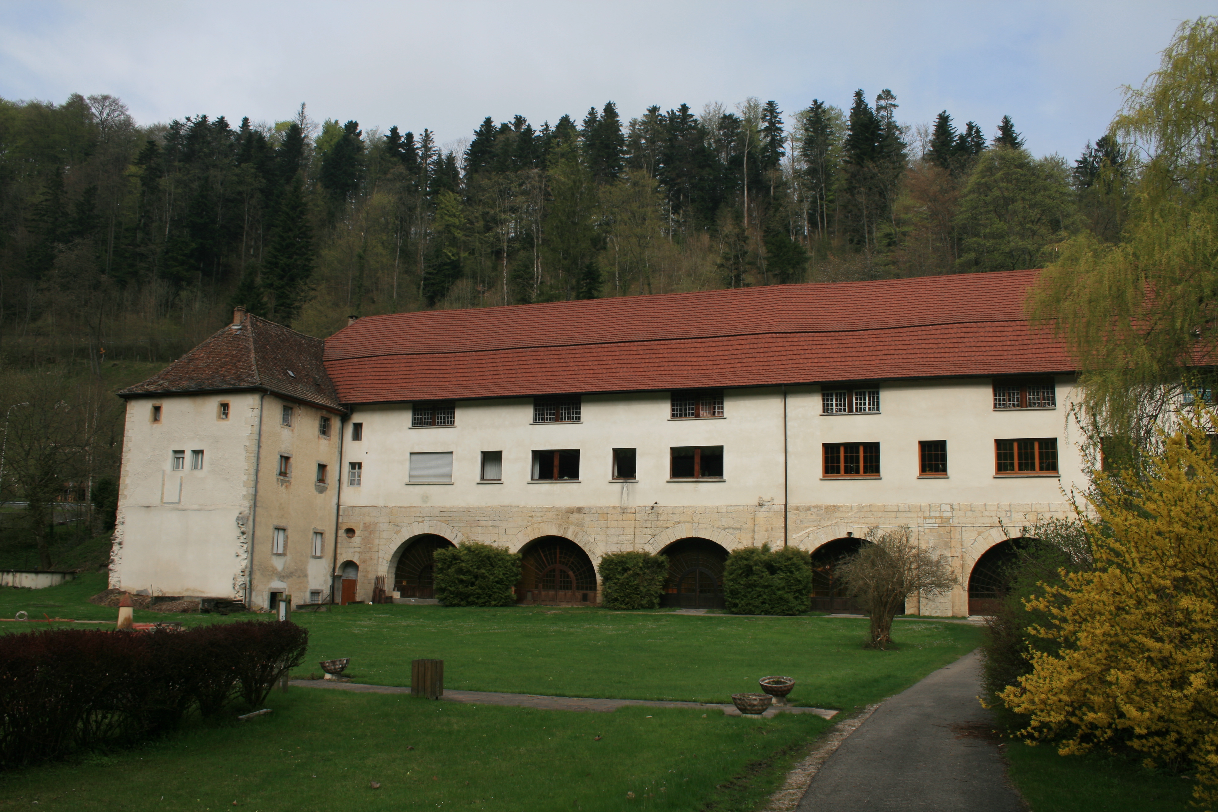
Lucelle Abbey or Lützel Abbey (french: Abbaye de Lucelle; german: Kloster Lützel) was a Cistercian monastery in the present village of Lucelle, in the Haut-Rhin department in Alsace, France France (), officially the French Republic ( ), is a country primarily located in Western Europe. It also comprises of overseas regions and territories in the Americas and the Atlantic, Pacific and Indian Oceans. Its metropolitan area ..., but located right on the Swiss border. The name of the original foundation was ''Lucis cella'', the "cell of light". Lucelle was founded in 1124 as a daughter house of Bellevaux Abbey, which in its turn was a daughter house of Morimond Abbey. It was dissolved in 1792 during the French Revolution. Daughter houses The following were daughter houses settled from Lucelle: * Neubourg Abbey (1130/1131) * Kaisheim Abbey (1133) * Lieu-Croissant Abbey (1134) * Salem Abbey (1134/1137 or 1138) * Frienisberg Abbey (1131/1138) * Pairis Abbey (1139) * ... [...More Info...] [...Related Items...] OR: [Wikipedia] [Google] [Baidu] |
Lucelle
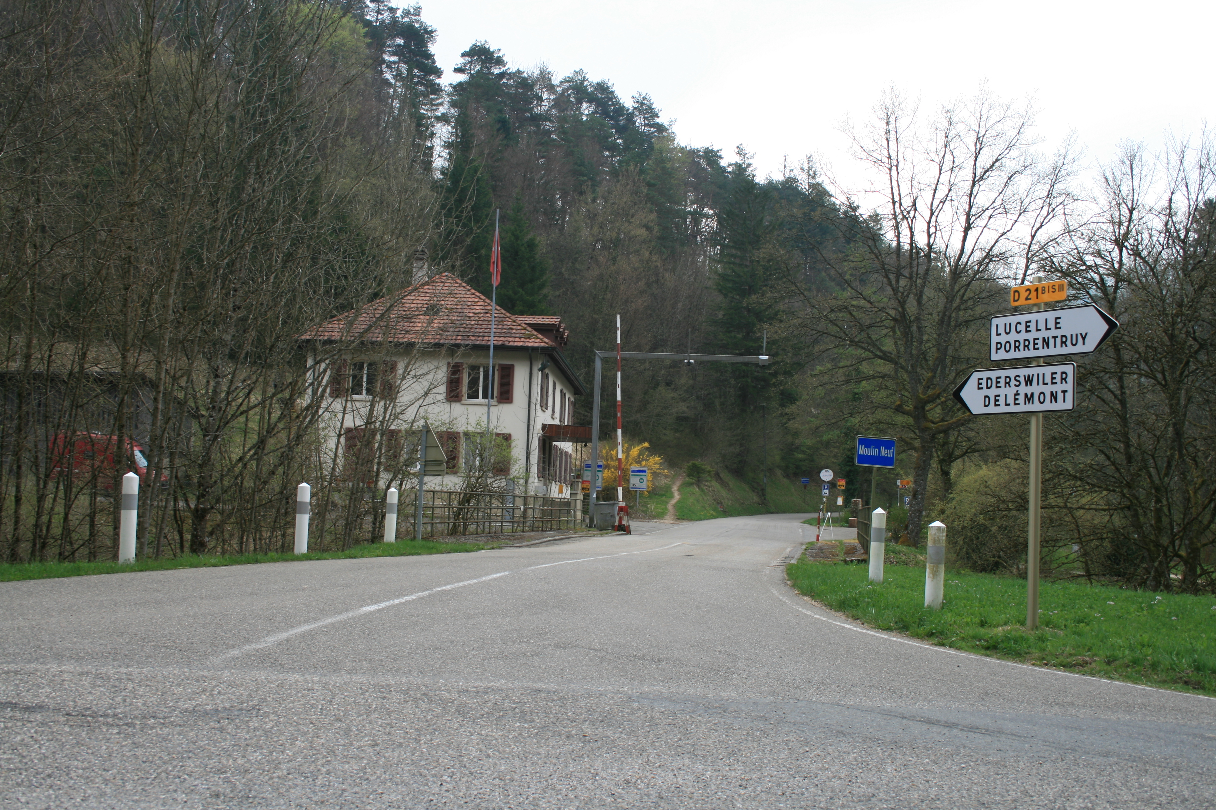
Lucelle (german: Lützel) is a village situated on the Franco- Swiss border. It is divided between the two countries, the northern half (47 inhabitants in 1999) being part of the commune of Lucelle, Haut-Rhin, in the Haut-Rhin department, the southern half being part of Pleigne, in the Swiss Canton of Jura. An important Cistercian monastery, Lucelle Abbey Lucelle Abbey or Lützel Abbey (french: Abbaye de Lucelle; german: Kloster Lützel) was a Cistercian monastery in the present village of Lucelle, in the Haut-Rhin department in Alsace, France France (), officially the French Republ ..., was located here from the early 12th to the late 18th century. Geography of Haut-Rhin France–Switzerland border crossings Villages in Grand Est {{JuraCH-geo-stub ... [...More Info...] [...Related Items...] OR: [Wikipedia] [Google] [Baidu] |
Kiffis
Kiffis () is a commune in the Haut-Rhin department in Alsace in north-eastern France. See also * Communes of the Haut-Rhin département The following is a list of the 366 communes of the French department of Haut-Rhin. The communes cooperate in the following intercommunalities (as of 2020):Communes of Haut-Rhin {{HautRhin-geo-stub ... [...More Info...] [...Related Items...] OR: [Wikipedia] [Google] [Baidu] |
Roggenburg, Basel-Country
Roggenburg is a municipality in the district of Laufen in the canton of Basel-Country in Switzerland. History Both Roman coins and the remains of a Roman watchtower have been discovered within the municipality. Roggenburg is first mentioned in 1162 as ''Rogenberc''. The name originates from the Latin word ''rogus'' (stake; funeral pyre; stack of logs). Roggenburg belonged to the Count of Thierstein and was then handed over to the Roman Catholic Diocese of Basel in 1454. From 1793 to 1815, it was part of France and was initially part of the département of Mont-Terrible, but it was incorporated with the département of Haut-Rhin in 1800. In 1815, the Congress of Vienna declared that the area would become part the district of Delémont within the Canton of Bern. As a German-speaking community, Roggenburg spoke out in the Plebiscite of Jura against the creation of the French-speaking canton of Jura. Because Roggenburg was a border municipality in Delémont District, it came into ... [...More Info...] [...Related Items...] OR: [Wikipedia] [Google] [Baidu] |
Jura Mountains
The Jura Mountains ( , , , ; french: Massif du Jura; german: Juragebirge; it, Massiccio del Giura, rm, Montagnas da Jura) are a sub-alpine mountain range a short distance north of the Western Alps and mainly demarcate a long part of the French–Swiss border. While the Jura range proper (" folded Jura", ''Faltenjura'') is located in France and Switzerland, the range continues as the Table Jura ("not folded Jura", ''Tafeljura'') northeastwards through northern Switzerland and Germany. Name The mountain range gives its name to the French department of Jura, the Swiss Canton of Jura, the Jurassic period of the geologic timescale, and the Montes Jura of the Moon. It is first attested as ''mons Iura'' in book one of Julius Caesar's ''Commentarii de Bello Gallico''. Strabo uses a Greek masculine form ''ὁ Ἰόρας'' ("through the Jura mountains", ''διὰ τοῦ Ἰόρα ὄρους'') in his ''Geographica'' (4.6.11). Based on suggestions by Ferdinand de Saussure, ea ... [...More Info...] [...Related Items...] OR: [Wikipedia] [Google] [Baidu] |
Rodersdorf
Rodersdorf is a municipality in the district of Dorneck in the canton of Solothurn in Switzerland, on the border to Alsace, France. History Rodersdorf is first mentioned in 1226 as ''Ratolsdorf''. In 1349 it was mentioned as ''Roderstorff''. Geography Rodersdorf has an area, , of . Of this area, or 54.3% is used for agricultural purposes, while or 30.5% is forested. Of the rest of the land, or 14.2% is settled (buildings or roads) and or 0.2% is unproductive land.Swiss Federal Statistical Office-Land Use Statistics 2009 data accessed 25 March 2010 Of the built up area, housing and buildings made up 8.8% and transportation infrastructure made up 3.7%. while parks, green belts and sports fields made up 1.5%. Out of the forested land, 28.7% of ... [...More Info...] [...Related Items...] OR: [Wikipedia] [Google] [Baidu] |
Leymen
Leymen (; german: Leimen) is a commune in the Haut-Rhin department in Alsace in north-eastern France. The commune is served by Leymen station, on line 10 of the Basel tramway between Rodersdorf and Flüh, and until December 2017 was the only such station to be located on French soil. See also * Communes of the Haut-Rhin département The following is a list of the 366 communes of the French department of Haut-Rhin. The communes cooperate in the following intercommunalities (as of 2020):Communes of Haut-Rhin {{HautRhin-geo-stub ... [...More Info...] [...Related Items...] OR: [Wikipedia] [Google] [Baidu] |


