|
Fowlsheugh
Fowlsheugh is a coastal nature reserve in Kincardineshire, northeast Scotland, known for its cliff formations and habitat supporting prolific seabird nesting colonies. Designated as a Site of Special Scientific Interest (SSSI) by Scottish Natural Heritage, the property is owned by the Royal Society for the Protection of Birds. Fowlsheugh can be accessed by a public clifftop trail, or by boats which usually emanate from the nearby harbour at the town of Stonehaven. Tens of thousands of pelagic birds return to the site every spring to breed, after wintering at sea or in more southern climates, principal species being puffins, razorbills, kittiwakes, fulmars and guillemots. Due to global warming, the planktonic species previously present that prefer cold water are not available in the quantity required to support the historically large sandeel population. Added to the problem has been overfishing of the Scottish sandeel, further reducing the numbers of this dietary staple for ... [...More Info...] [...Related Items...] OR: [Wikipedia] [Google] [Baidu] |
Craiglethy
Craiglethy (Scottish Gaelic: ''Creag Liathach'' - meaning grey rock) is a small island/skerry off Fowlsheugh on the east coast of Aberdeenshire, Scotland in the North Sea. As it is part of Fowlsheugh, it is an SSSI, with many seabirds and seals living on it. It is also one of the few islands on the east coast of Scotland, along with Mugdrum Island and Inchcape, apart from the Islands of the Forth. Area history There are numerous prehistoric and historic features in the general vicinity of Craiglethy. Somewhat to the north are Bronze Age archaeological sites at FetteressoC.Michael Hogan''Fetteresso Fieldnotes'', The Modern Antiquarian (2008)/ref> and Spurryhillock.Archibald Watt, ''Highways and Byways Around Kincardineshire'', The Stonehaven Heritage Society (1985) Notable historical features include Dunnottar Castle, Stonehaven Tolbooth and Muchalls Castle, Fiddes Castle and Spurryhillock Spurryhillock is a mesolithic archaeological site and modern industrial estate at Ston ... [...More Info...] [...Related Items...] OR: [Wikipedia] [Google] [Baidu] |
Kincardineshire
Kincardineshire, also known as the Mearns (from the Scottish Gaelic meaning "the Stewartry"), is a historic county, registration county and lieutenancy area on the coast of northeast Scotland. It is bounded by Aberdeenshire on the north and west, and by Angus on the south. The name "Kincardine" is also used in Kincardine and Mearns, a committee area of the Aberdeenshire Council, although this covers a smaller area than the county. History Anciently, the area was the Province of ''Mearns'', bordered on the north by Marr, and on the west by Angus. The name of the province simply refers to its status; the more important provinces were governed by a ''great steward'' (''Mormaer''), while the less important ones were governed by a mere ''steward'' (''Maer''). It included the burghs of Stonehaven, Banchory, Inverbervie and Laurencekirk, and other settlements included Drumoak, Muchalls, Newtonhill and Portlethen. ''Mearns'' extended to Hill of Fare north of the River Dee, but in ... [...More Info...] [...Related Items...] OR: [Wikipedia] [Google] [Baidu] |
Skerry
A skerry is a small rocky island, or islet, usually too small for human habitation. It may simply be a rocky reef. A skerry can also be called a low sea stack. A skerry may have vegetative life such as moss and small, hardy grasses. They are often used as resting places by animals such as seals and birds. Etymology The term ''skerry'' is derived from the Old Norse ', which means a rock in the sea (which in turn derives from the Proto-Indo-European root *''sker''-, "cut", in the sense of a rock cut off from the land). The Old Norse term ' was brought into the English language via the Scots language word spelled or . It is a cognate of the Scandinavian languages' words for ''skerry'' – Icelandic, fo, sker, da, skær, sv, skär, no, skjær / skjer, found also in german: Schäre, fi, kari, et, skäär, lv, šēra, lt, Šcheras and russian: шхеры (). In Scottish Gaelic, it appears as ', e.g. Sula Sgeir, in Irish as '','' in Welsh as '','' and in Manx as ''.'' ... [...More Info...] [...Related Items...] OR: [Wikipedia] [Google] [Baidu] |
Old Red Sandstone
The Old Red Sandstone is an assemblage of rocks in the North Atlantic region largely of Devonian age. It extends in the east across Great Britain, Ireland and Norway, and in the west along the northeastern seaboard of North America. It also extends northwards into Greenland and Svalbard. These areas were a part of the ancient continent of Euramerica, Euramerica/Laurussia. In Britain it is a lithostratigraphy, lithostratigraphic unit (a sequence of rock strata) to which Stratigraphy, stratigraphers accord Geological unit#Lithostratigraphic units, supergroup status and which is of considerable importance to early paleontology. For convenience the short version of the term, ORS is often used in literature on the subject. The term was coined to distinguish the sequence from the younger New Red Sandstone which also occurs widely throughout Britain. Sedimentology The Old Red Sandstone describes a suite of sedimentary rocks deposited in a variety of environments during the Devonian ... [...More Info...] [...Related Items...] OR: [Wikipedia] [Google] [Baidu] |
North Sea
The North Sea lies between Great Britain, Norway, Denmark, Germany, the Netherlands and Belgium. An epeiric sea on the European continental shelf, it connects to the Atlantic Ocean through the English Channel in the south and the Norwegian Sea in the north. It is more than long and wide, covering . It hosts key north European shipping lanes and is a major fishery. The coast is a popular destination for recreation and tourism in bordering countries, and a rich source of energy resources, including wind and wave power. The North Sea has featured prominently in geopolitical and military affairs, particularly in Northern Europe, from the Middle Ages to the modern era. It was also important globally through the power northern Europeans projected worldwide during much of the Middle Ages and into the modern era. The North Sea was the centre of the Vikings' rise. The Hanseatic League, the Dutch Republic, and the British each sought to gain command of the North Sea and access t ... [...More Info...] [...Related Items...] OR: [Wikipedia] [Google] [Baidu] |
Stonehaven
Stonehaven ( , ) is a town in Scotland. It lies on Scotland's northeast coast and had a population of 11,602 at the 2011 Census. After the demise of the town of Kincardine, which was gradually abandoned after the destruction of its royal castle in the Wars of Independence, the Scottish Parliament made Stonehaven the successor county town of Kincardineshire. It is currently administered as part of the unitary authority of Aberdeenshire. Stonehaven had grown around an Iron Age fishing village, now the "Auld Toon" ("old town"), and expanded inland from the seaside. As late as the 16th century, old maps indicate the town was called ''Stonehyve'', ''Stonehive'', Timothy Pont also adding the alternative ''Duniness''. It is known informally to locals as ''Stoney''. Pre-history and archaeology Stonehaven is the site of prehistoric events evidenced by finds at Fetteresso Castle and Neolithic pottery excavations from the Spurryhillock area. In 2004, archaeological work by CFA Archa ... [...More Info...] [...Related Items...] OR: [Wikipedia] [Google] [Baidu] |
Global Warming
In common usage, climate change describes global warming—the ongoing increase in global average temperature—and its effects on Earth's climate system. Climate change in a broader sense also includes previous long-term changes to Earth's climate. The current rise in global average temperature is more rapid than previous changes, and is primarily caused by humans burning fossil fuels. Fossil fuel use, deforestation, and some agricultural and industrial practices increase greenhouse gases, notably carbon dioxide and methane. Greenhouse gases absorb some of the heat that the Earth radiates after it warms from sunlight. Larger amounts of these gases trap more heat in Earth's lower atmosphere, causing global warming. Due to climate change, deserts are expanding, while heat waves and wildfires are becoming more common. Increased warming in the Arctic has contributed to melting permafrost, glacial retreat and sea ice loss. Higher temperatures are also causing m ... [...More Info...] [...Related Items...] OR: [Wikipedia] [Google] [Baidu] |
Sandstone
Sandstone is a clastic sedimentary rock composed mainly of sand-sized (0.0625 to 2 mm) silicate grains. Sandstones comprise about 20–25% of all sedimentary rocks. Most sandstone is composed of quartz or feldspar (both silicates) because they are the most resistant minerals to weathering processes at the Earth's surface. Like uncemented sand, sandstone may be any color due to impurities within the minerals, but the most common colors are tan, brown, yellow, red, grey, pink, white, and black. Since sandstone beds often form highly visible cliffs and other topographic features, certain colors of sandstone have been strongly identified with certain regions. Rock formations that are primarily composed of sandstone usually allow the percolation of water and other fluids and are porous enough to store large quantities, making them valuable aquifers and petroleum reservoirs. Quartz-bearing sandstone can be changed into quartzite through metamorphism, usually related to ... [...More Info...] [...Related Items...] OR: [Wikipedia] [Google] [Baidu] |
Puddingstone (rock)
Puddingstone, also known as either pudding stone or plum-pudding stone, is a popular name applied to a conglomerate that consists of distinctly rounded pebbles whose colours contrast sharply with the colour of the finer-grained, often sandy, matrix or cement surrounding them. The rounded pebbles and the sharp contrast in colour gives this type of conglomerate the appearance of a raisin or Christmas pudding.Neuendorf, K.E.K., J.P. Mehl, Jr., and J.A. Jackson (2005) ''Glossary of Geology.'' Springer-Verlag, New York, 779 pp., The McGraw-Hill Companies (2003) ''McGraw-Hill dictionary of geology and mineralogy'', 2nd ed. The McGraw-Hill Companies, Inc, New York, 420 pp., There are different types of puddingstone, with different composition, origin, and geographical distribution. Examples of different types of puddingstones include the Hertfordshire, Schunemunk, Roxbury, and St. Joseph Island (Drummond Island) puddingstones. Hertfordshire puddingstone Hertfordshire puddingstone is a ... [...More Info...] [...Related Items...] OR: [Wikipedia] [Google] [Baidu] |
Dunnottar Castle
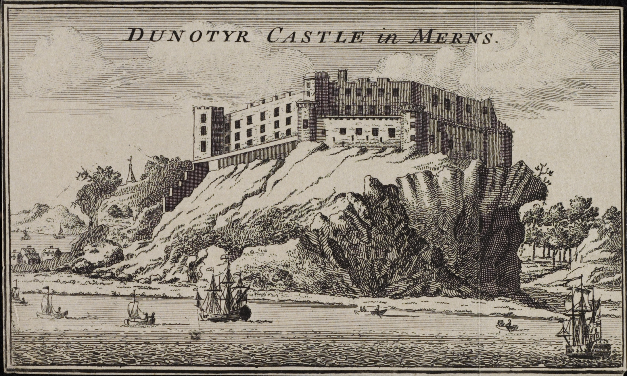
Dunnottar Castle ( gd, Dùn Fhoithear, "fort on the shelving slope") is a ruined medieval fortress located upon a rocky headland on the north-eastern coast of Scotland, about south of Stonehaven. The surviving buildings are largely of the 15th and 16th centuries, but the site is believed to have been fortified in the Early Middle Ages. Dunnottar has played a prominent role in the history of Scotland through to the 18th-century Jacobite risings because of its strategic location and defensive strength. Dunnottar is best known as the place where the Honours of Scotland, the Scottish crown jewels, were hidden from Oliver Cromwell's invading army in the 17th century. The property of the Keiths from the 14th century, and the seat of the Earl Marischal, Dunnottar declined after the last Earl forfeited his titles by taking part in the Jacobite rebellion of 1715. The castle was restored in the 20th century and is now open to the public. The ruins of the castle are spread over , su ... [...More Info...] [...Related Items...] OR: [Wikipedia] [Google] [Baidu] |
Cliff
In geography and geology, a cliff is an area of rock which has a general angle defined by the vertical, or nearly vertical. Cliffs are formed by the processes of weathering and erosion, with the effect of gravity. Cliffs are common on coasts, in mountainous areas, escarpments and along rivers. Cliffs are usually composed of rock that is resistant to weathering and erosion. The sedimentary rocks that are most likely to form cliffs include sandstone, limestone, chalk, and dolomite. Igneous rocks such as granite and basalt also often form cliffs. An escarpment (or scarp) is a type of cliff formed by the movement of a geologic fault, a landslide, or sometimes by rock slides or falling rocks which change the differential erosion of the rock layers. Most cliffs have some form of scree slope at their base. In arid areas or under high cliffs, they are generally exposed jumbles of fallen rock. In areas of higher moisture, a soil slope may obscure the talus. Many cliffs also fea ... [...More Info...] [...Related Items...] OR: [Wikipedia] [Google] [Baidu] |


Saunders_Quarry-1.jpg)

