|
Fort Worth Tornado
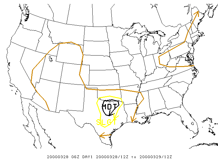
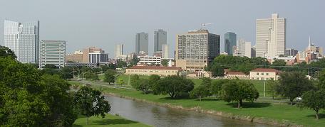
During the evening hours of March 28, 2000, a powerful F3 tornado struck Downtown Fort Worth, Texas, causing significant damage to numerous buildings and skyscrapers as well as two deaths. The tornado was part of a larger severe weather outbreak that caused widespread storms across Texas and Oklahoma in late-March, spurred primarily by the moist and unstable atmospheric environment over the South Central United States as a result of an eastward-moving upper-level low and shortwave trough. The tornado outbreak was well forecast by both computer forecast models and the National Weather Service, though the eventual focal point for the severe weather—North Texas—only came into focus on March 28 as the conditions favorable for tornadic development quickly took hold. The F3 Fort Worth tornado initially began as a relatively weak tornado in River Oaks, gradually strengthening as it tracked southeastward and then eastward towards Fort Worth's central business distri ... [...More Info...] [...Related Items...] OR: [Wikipedia] [Google] [Baidu] |
List Of Tallest Buildings In Fort Worth
Fort Worth, the 5th-most populous city in the U.S. state of Texas, is home to 50 high-rises, 21 of which stand taller than . The tallest building in the city is the 40-story Burnett Plaza, which rises in Downtown Fort Worth and was completed in 1983. The second-tallest skyscraper in the city is the Bank of America Tower (known until 2017 as the D.R. Horton Tower), which rises 547 feet (167 m). None of the buildings in Fort Worth are among the 30 tallest buildings in Texas. Fort Worth's history of skyscrapers began with the completion of the 7-story Flatiron Building in 1907. When built, it was the tallest building in North Texas. The Flatiron Building stood as Fort Worth's tallest structure until 1910, with the construction of the 10-story Baker Building (since renamed the Bob R. Simpson Building). Fort Worth went through a major growth in skyscrapers during the 1920s and 1930s, with the Farmers and Mechanics National Bank building (since renamed 714 Main) emerging as the t ... [...More Info...] [...Related Items...] OR: [Wikipedia] [Google] [Baidu] |
National Weather Service
The National Weather Service (NWS) is an Government agency, agency of the Federal government of the United States, United States federal government that is tasked with providing weather forecasts, warnings of hazardous weather, and other weather-related products to organizations and the public for the purposes of protection, safety, and general information. It is a part of the National Oceanic and Atmospheric Administration (NOAA) branch of the United States Department of Commerce, Department of Commerce, and is headquartered in Silver Spring, Maryland, Silver Spring, Maryland, within the Washington metropolitan area. The agency was known as the United States Weather Bureau from 1890 until it adopted its current name in 1970. The NWS performs its primary task through a collection of national and regional centers, and 122 local List of National Weather Service Weather Forecast Offices, Weather Forecast Offices (WFOs). As the NWS is an agency of the U.S. federal government, most o ... [...More Info...] [...Related Items...] OR: [Wikipedia] [Google] [Baidu] |
Severe Weather
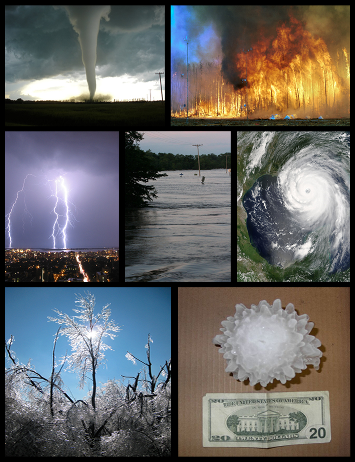
Severe weather is any dangerous meteorological phenomenon with the potential to cause damage, serious social disruption, or loss of human life. Types of severe weather phenomena vary, depending on the latitude, altitude, topography, and atmospheric conditions. High winds, hail, excessive precipitation, and wildfires are forms and effects of severe weather, as are thunderstorms, downbursts, tornadoes, waterspouts, tropical cyclones, and extratropical cyclones. Regional and seasonal severe weather phenomena include blizzards (snowstorms), ice storms, and duststorms. Extreme weather phenomena which cause extreme heat, cold, wetness or drought often will bring severe weather events. One of the principal effects of anthropogenic climate change is changes in severe and extreme weather patterns. Terminology Meteorologists have generally defined severe weather as any aspect of the weather that poses risks to life, property or requires the intervention of authorities. A narrower ... [...More Info...] [...Related Items...] OR: [Wikipedia] [Google] [Baidu] |
Red River Of The South
The Red River, or sometimes the Red River of the South, is a major river in the Southern United States. It was named for its reddish water color from passing through red-bed country in its watershed. It is one of several rivers with that name. Although once a tributary of the Mississippi River, the Red River is now a tributary of the Atchafalaya River, a distributary of the Mississippi that flows separately into the Gulf of Mexico. This confluence is connected to the Mississippi River by the Old River Control Structure. The south bank of the Red River formed part of the US–Mexico border from the Adams–Onís Treaty (in force 1821) until the Texas Annexation and the Treaty of Guadalupe Hidalgo. The Red River is the second-largest river basin in the southern Great Plains. It rises in two branches in the Texas Panhandle and flows east, where it serves as the border between the states of Texas and Oklahoma. It forms a short border between Texas and Arkansas before entering Ar ... [...More Info...] [...Related Items...] OR: [Wikipedia] [Google] [Baidu] |
Great Plains
The Great Plains (french: Grandes Plaines), sometimes simply "the Plains", is a broad expanse of flatland in North America. It is located west of the Mississippi River and east of the Rocky Mountains, much of it covered in prairie, steppe, and grassland. It is the southern and main part of the Interior Plains, which also include the tallgrass prairie between the Great Lakes and Appalachian Plateau, and the Taiga Plains and Boreal Plains ecozones in Northern Canada. The term Western Plains is used to describe the ecoregion of the Great Plains, or alternatively the western portion of the Great Plains. The Great Plains lies across both Central United States and Western Canada, encompassing: * The entirety of the U.S. states of Kansas, Nebraska, North Dakota and South Dakota; * Parts of the U.S. states of Colorado, Iowa, Minnesota, Missouri, Montana, New Mexico, Oklahoma, Texas and Wyoming; * The southern portions of the Canadian provinces of Alberta, Saskatchewan and Manitoba. ... [...More Info...] [...Related Items...] OR: [Wikipedia] [Google] [Baidu] |
Zonal And Meridional
Zonal and meridional flow are directions and regions of fluid flow on a globe. Zonal flow follows a pattern along latitudinal lines, latitudinal circles or in the west–east direction. Meridional flow follows a pattern from north to south, or from south to north, along the Earth's longitude lines, longitudinal circles (meridian) or in the north–south direction. These terms are often used in the atmospheric and earth sciences to describe global phenomena, such as "meridional wind", or "zonal average temperature". In the context of physics, zonal flow connotes a tendency of flux to conform to a pattern parallel to the equator of a sphere. In meteorological term regarding atmospheric circulation, zonal flow brings a temperature contrast along the Earth's longitude. Extratropical cyclones in zonal flows tend to be weaker, moving faster and producing relatively little impact on local weather. Extratropical cyclones in meridional flows tend to be stronger and move slower. ... [...More Info...] [...Related Items...] OR: [Wikipedia] [Google] [Baidu] |
Cold Front
A cold front is the leading edge of a cooler mass of air at ground level that replaces a warmer mass of air and lies within a pronounced surface trough of low pressure. It often forms behind an extratropical cyclone (to the west in the Northern Hemisphere, to the east in the Southern), at the leading edge of its cold air advection pattern—known as the cyclone's dry "conveyor belt" flow. Temperature differences across the boundary can exceed from one side to the other. When enough moisture is present, rain can occur along the boundary. If there is significant instability along the boundary, a narrow line of thunderstorms can form along the frontal zone. If instability is weak, a broad shield of rain can move in behind the front, and evaporative cooling of the rain can increase the temperature difference across the front. Cold fronts are stronger in the fall and spring transition seasons and are weakest during the summer. Development of cold fronts A cold front occurs wh ... [...More Info...] [...Related Items...] OR: [Wikipedia] [Google] [Baidu] |
Subtropical Jet
Jet streams are fast flowing, narrow, meandering air currents in the atmospheres of some planets, including Earth. On Earth, the main jet streams are located near the altitude of the tropopause and are westerly winds (flowing west to east). Jet streams may start, stop, split into two or more parts, combine into one stream, or flow in various directions including opposite to the direction of the remainder of the jet. Overview The strongest jet streams are the polar jets around the polar vortices, at above sea level, and the higher altitude and somewhat weaker subtropical jets at . The Northern Hemisphere and the Southern Hemisphere each have a polar jet and a subtropical jet. The northern hemisphere polar jet flows over the middle to northern latitudes of North America, Europe, and Asia and their intervening oceans, while the southern hemisphere polar jet mostly circles Antarctica, both all year round. Jet streams are the product of two factors: the atmospheric heating by ... [...More Info...] [...Related Items...] OR: [Wikipedia] [Google] [Baidu] |
Southern United States
The Southern United States (sometimes Dixie, also referred to as the Southern States, the American South, the Southland, or simply the South) is a geographic and cultural region of the United States of America. It is between the Atlantic Ocean and the Western United States, with the Midwestern and Northeastern United States to its north and the Gulf of Mexico and Mexico to its south. Historically, the South was defined as all states south of the 18th century Mason–Dixon line, the Ohio River, and 36°30′ parallel.The South . ''Britannica.com''. Retrieved June 5, 2021. Within the South are different subregions, such as the |
Storm Prediction Center Day 1 Outlook March 28 2000 0600 UTC
A storm is any disturbed state of the natural environment or the atmosphere of an astronomical body. It may be marked by significant disruptions to normal conditions such as strong wind, tornadoes, hail, thunder and lightning (a thunderstorm), heavy precipitation (snowstorm, rainstorm), heavy freezing rain (ice storm), strong winds (tropical cyclone, windstorm), wind transporting some substance through the atmosphere such as in a dust storm, among other forms of severe weather. Storms have the potential to harm lives and property via storm surge, heavy rain or snow causing flooding or road impassibility, lightning, wildfires, and vertical and horizontal wind shear. Systems with significant rainfall and duration help alleviate drought in places they move through. Heavy snowfall can allow special recreational activities to take place which would not be possible otherwise, such as skiing and snowmobiling. The English word comes from Proto-Germanic ''*sturmaz'' meaning "noise, tumu ... [...More Info...] [...Related Items...] OR: [Wikipedia] [Google] [Baidu] |
Hail
Hail is a form of solid precipitation. It is distinct from ice pellets (American English "sleet"), though the two are often confused. It consists of balls or irregular lumps of ice, each of which is called a hailstone. Ice pellets generally fall in cold weather, while hail growth is greatly inhibited during low surface temperatures. Unlike other forms of water ice precipitation, such as graupel (which is made of rime ice), ice pellets (which are smaller and translucent), and snow (which consists of tiny, delicately crystalline flakes or needles), hailstones usually measure between and in diameter. The METAR reporting code for hail or greater is GR, while smaller hailstones and graupel are coded GS. Hail is possible within most thunderstorms (as it is produced by cumulonimbus), as well as within of the parent storm. Hail formation requires environments of strong, upward motion of air within the parent thunderstorm (similar to tornadoes) and lowered heights of the freezing l ... [...More Info...] [...Related Items...] OR: [Wikipedia] [Google] [Baidu] |
Arlington Municipal Airport (Texas)
Arlington Municipal Airport is five miles south of Arlington, in Tarrant County, Texas. The airport is at the intersection of Interstate 20 and South Collins Road; it is a reliever airport for Dallas/Fort Worth International Airport and Dallas Love Field. Several companies operate aircraft services on the airport property, including the Bell Helicopter division of Textron. Most U.S. airports use the same three-letter location identifier for the FAA and IATA, but this airport GKY to the FAA and has no IATA code. Facilities The airport covers at an elevation of 628 feet (191 m). Its single runway, 16/34, is 6,080 by 100 feet (1,853 x 30 m) concrete. In 2006 the airport had 151,600 aircraft operations, average 415 per day: 97% general aviation, 3% air taxi and <1% military. 250 aircraft were then based at this airport: 70% single-engine, 22% multi-engine, 6% |


.jpg)


