|
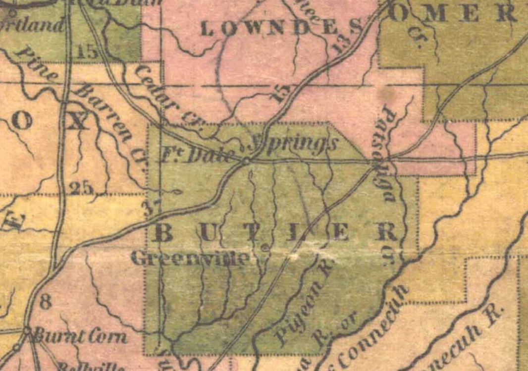
Fort Dale
Fort Dale was a stockade fort built in present-day Butler County, Alabama by Alabama Territory settlers. The fort was constructed in response to Creek Indian attacks on settlers in the surrounding area. Background After the Creek War, a number of hostile Creeks (known as Red Sticks) remained in the area surrounding present-day Butler County. The Red Sticks were indignant over the large number of settlers who began traveling down the Federal Road and soon began attacking them. Settlers in the area began building protective stockades such as the one built by Thomas Gary near present-day Greenville. Gary had built a blockhouse and charged residents a fee to stay in it. On March 13, 1818, members of the Ogly and Stroud families were killed by Red Stick warriors under the command of Uchee Tom in what became known as the Ogly-Stroud Massacre. After the massacre, settlers petitioned territorial governor William Wyatt Bibb over the fees Gary was charging. In response, Bibb dispatched C ... [...More Info...] [...Related Items...] OR: [Wikipedia] [Google] [Baidu] |
Greenville, Alabama
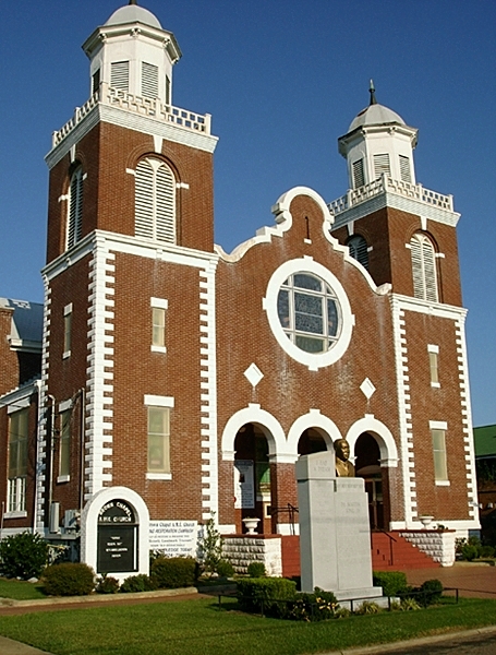
Greenville is a city and the county seat of Butler County, Alabama, United States. At the 2020 census, the population was 7,374. Greenville is known as the Camellia City, wherein originated the movement to change the official Alabama state flower from the goldenrod to the camellia with legislative sponsors LaMont Glass and H.B. Taylor. History Greenville was first settled in 1819. Its original name was Buttsville, but after becoming the county seat in 1822, its name was changed to Greenville, in remembrance of the former locale in South Carolina of many of the original settlers. The first county seat was at Fort Dale, a fortification that was named for Sam Dale, who fought to defend the area during the Creek War. The site of Fort Dale lies on the north of the city near the Fort Dale Cemetery, along what is now Alabama Highway 185. The namesake of the county, Captain William Butler, was killed during the Creek War. He is buried in the Pioneer Cemetery, which is across from the ... [...More Info...] [...Related Items...] OR: [Wikipedia] [Google] [Baidu] |
Fort Crawford (Alabama)
Fort Crawford was a fort that once provided defense for settlers in what is today East Brewton, Alabama. History After the Creek War, General Andrew Jackson ordered Major General Edmund P. Gaines and the 7th Infantry Regiment to construct a fort to protect settlers in the area from hostile Red Sticks. General Gaines instructed Major David E. Twiggs to set out from Fort Montgomery and establish a new post. The fort was placed at the border of the newly-formed Alabama Territory and Spanish West Florida on the bank of Murder Creek. Fort Crawford was named for either 2nd Lieutenant Joel Crawford or for former US Secretary of War and US Secretary of the Treasury William H. Crawford. Major John M. Davis described the fort as having two blockhouses located diagonally from each other, with the walls of the fort being made from multiple buildings. The fort also contained a medical building, artificer shop, and guard house. During the First Seminole War, Fort Crawford served as a base ... [...More Info...] [...Related Items...] OR: [Wikipedia] [Google] [Baidu] |
Buildings And Structures In Butler County, Alabama
A building, or edifice, is an enclosed structure with a roof and walls standing more or less permanently in one place, such as a house or factory (although there's also portable buildings). Buildings come in a variety of sizes, shapes, and functions, and have been adapted throughout history for a wide number of factors, from building materials available, to weather conditions, land prices, ground conditions, specific uses, prestige, and aesthetic reasons. To better understand the term ''building'' compare the list of nonbuilding structures. Buildings serve several societal needs – primarily as shelter from weather, security, living space, privacy, to store belongings, and to comfortably live and work. A building as a shelter represents a physical division of the human habitat (a place of comfort and safety) and the ''outside'' (a place that at times may be harsh and harmful). Ever since the first cave paintings, buildings have also become objects or canvasses of much artistic ... [...More Info...] [...Related Items...] OR: [Wikipedia] [Google] [Baidu] |
Alabama Register Of Landmarks And Heritage
The Alabama Register of Landmarks and Heritage, commonly referred to as the Alabama Register, is an official listing of buildings, sites, structures, objects, and districts deemed worthy of preservation in the U.S. state of Alabama. These properties, which may be of national, state, and local significance, are designated by the Alabama Historical Commission. The designation is honorary and carries no direct restrictions or incentives. The register includes properties such as cemeteries, churches, moved properties, reconstructed properties, and properties at least 40 years old which may not normally qualify for listing in the National Register of Historic Places. There are approximately 1421 properties and districts listed on the Alabama Register. Of these, approximately 196 are also listed on the National Register of Historic Places and 5 are designated as National Historic Landmarks. Nomination The Alabama Register was created by the Alabama Historical Commission to provide the ... [...More Info...] [...Related Items...] OR: [Wikipedia] [Google] [Baidu] |
Alabama State Route 185
State Route 185 (SR 185) is a state highway that serves as a north–south connection between Greenville and Fort Deposit. SR 185 intersects US 31 at both its southern and northern termini. Route description SR 185 begins at its intersection with US 31 south of Greenville. From this point, the route continues in a northerly track where it intersects SR 10 just west of the Greenville central business district. SR 185 continues north through the city and intersects both SR 245 and I-65 at Exit 130 prior to leaving the city limits. From this point, the route continues in its northerly track and intersects SR 263 en route to Fort Deposit. SR 185 then reorients in an easterly direction at Fort Deposit and continues its course where it again intersects I-65 (Exit 142) prior to reaching its northern terminus at US 31. Major intersections Greenville truck route Alabama State Route 185 Truck (SR 10 Truck) is a truck route of SR 185 around downtown Greenville. The hi ... [...More Info...] [...Related Items...] OR: [Wikipedia] [Google] [Baidu] |
Southern United States
The Southern United States (sometimes Dixie, also referred to as the Southern States, the American South, the Southland, or simply the South) is a geographic and cultural region of the United States of America. It is between the Atlantic Ocean and the Western United States, with the Midwestern and Northeastern United States to its north and the Gulf of Mexico and Mexico to its south. Historically, the South was defined as all states south of the 18th century Mason–Dixon line, the Ohio River, and 36°30′ parallel.The South . ''Britannica.com''. Retrieved June 5, 2021. Within the South are different subregions, such as the |
Bartram's Travels
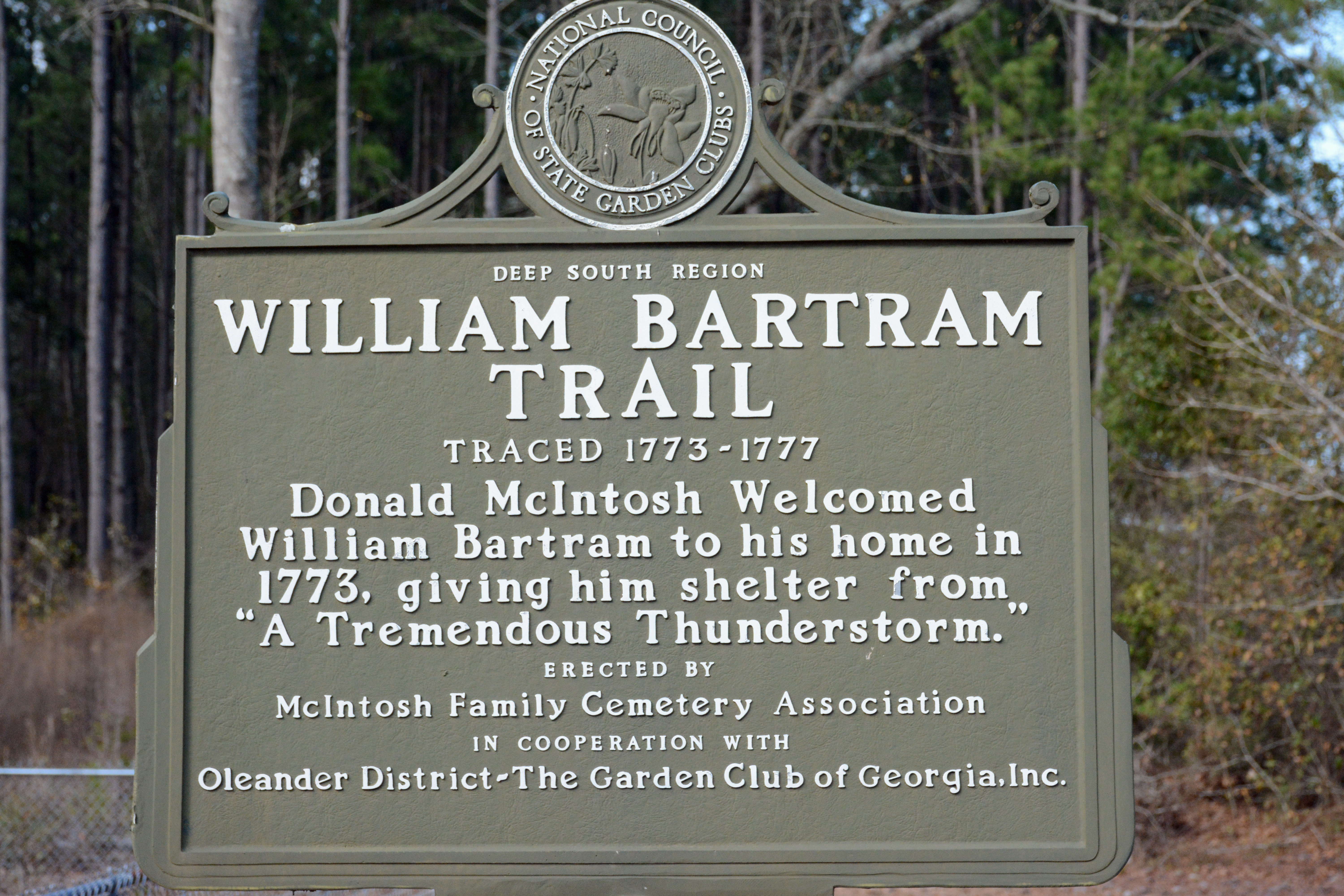
Bartram's ''Travels'' is the short title of naturalist William Bartram's book describing his travels in the American South and encounters with American Indians between 1773 and 1777. The book was published in Philadelphia, Pennsylvania in 1791 by the firm of James & Johnson. The book's full title is ''Travels through North and South Carolina, Georgia, East and West Florida, the Cherokee Country, the Extensive Territories of the Muscogulges or Creek Confederacy, and the Country of the Chactaws. Containing an Account of the Soil and Natural Productions of Those Regions; Together with Observations on the Manners of the Indians.'' The travels William Bartram was a Quaker and the son of naturalist John Bartram. In 1772, Dr. John Fothergill of London commissioned William Bartram to explore the Florida territories, collecting seeds, making drawings, and taking specimens of unfamiliar plants. Bartram sailed from Philadelphia in March 1773, explored Georgia, and began exploring East ... [...More Info...] [...Related Items...] OR: [Wikipedia] [Google] [Baidu] |
William Bartram
William Bartram (April 20, 1739 – July 22, 1823) was an American botanist, ornithologist, natural historian and explorer. Bartram was the author of an acclaimed book, now known by the shortened title ''Bartram's Travels'', which chronicled his explorations of the southern British colonies in North America from 1773 to 1777. Bartram has been described as "the first naturalist who penetrated the dense tropical forests of Florida". Bartram was one of the first ornithologists born in America. In 1756, at the age of 17, he collected the type specimens of 14 species of American birds, which were illustrated and described by the English naturalist George Edwards in ''Gleanings of Natural History'' vol. 2 (1760). These accounts formed the basis of the scientific descriptions of Linnaeus (1707–1778), Johann Friedrich Gmelin (1748–1804) and John Latham (1740–1837). Bartram also made significant contributions to botanical literature. Like his father, he was a member of the Amer ... [...More Info...] [...Related Items...] OR: [Wikipedia] [Google] [Baidu] |
Hayneville, Alabama
Hayneville is a town in Lowndes County, Alabama, United States and its county seat. At the 2010 census the population was 932, down from its record high of 1,177 in 2000. It is also part of the Montgomery Metropolitan Statistical Area. It initially incorporated in 1831, but lapsed, finally reincorporating in 1967. Before 1970, the town appeared only twice on the U.S. Census: in 1850 and 1890. The 1850 estimate of 800 residents ranked it as the largest town in the county at the time. Located in the fertile Black Belt region, Hayneville was the county seat in a plantation economy after Native Americans were removed that used slave labor for cotton production. The town was later a railway terminus and home to the Hayneville Railway Company, which was organized in 1903. Two years later, the company was reorganized as the Hayneville & Montgomery Railroad Company and provided connections for shipping with the L&N Railroad Company's tracks. History Settlement (1820-1831) Hayneville ... [...More Info...] [...Related Items...] OR: [Wikipedia] [Google] [Baidu] |
Fort Dale Map
A fortification is a military construction or building designed for the defense of territories in warfare, and is also used to establish rule in a region during peacetime. The term is derived from Latin ''fortis'' ("strong") and ''facere'' ("to make"). From very early history to modern times, defensive walls have often been necessary for cities to survive in an ever-changing world of invasion and conquest. Some settlements in the Indus Valley civilization were the first small cities to be fortified. In ancient Greece, large stone walls had been built in Mycenaean Greece, such as the ancient site of Mycenae (famous for the huge stone blocks of its 'cyclopean' walls). A Greek '' phrourion'' was a fortified collection of buildings used as a military garrison, and is the equivalent of the Roman castellum or English fortress. These constructions mainly served the purpose of a watch tower, to guard certain roads, passes, and borders. Though smaller than a real fortress, they acte ... [...More Info...] [...Related Items...] OR: [Wikipedia] [Google] [Baidu] |
Adam Hodgson
Adam Hodgson (1788–1862) was an English merchant in Liverpool, known also as a writer and abolitionist. Life He was the son of Thomas Hodgson, a Liverpool merchant, and his wife Elizabeth Lightbody (1758–1795). His father Thomas (1737–1817), from Caton, Lancashire, Caton, took part in the Atlantic slave trade, initially in Gambia as an agent for Miles Barber; then from his own fort on the Îles de Los, Isle de Los off Sierra Leone, and by investment in slaving ships. He then moved into cotton manufacturing, retiring from business in 1817 after losses.Brian Richard Howman, ''An Analysis of Slave Abolitionists in the North-West of England'', 2006 (PDF) at p. 74 Isaac Hodgson (abolitionist), Isaac Hodgson (1783–1847), merchant ... [...More Info...] [...Related Items...] OR: [Wikipedia] [Google] [Baidu] |


