|
Forsyth Street (Manhattan)
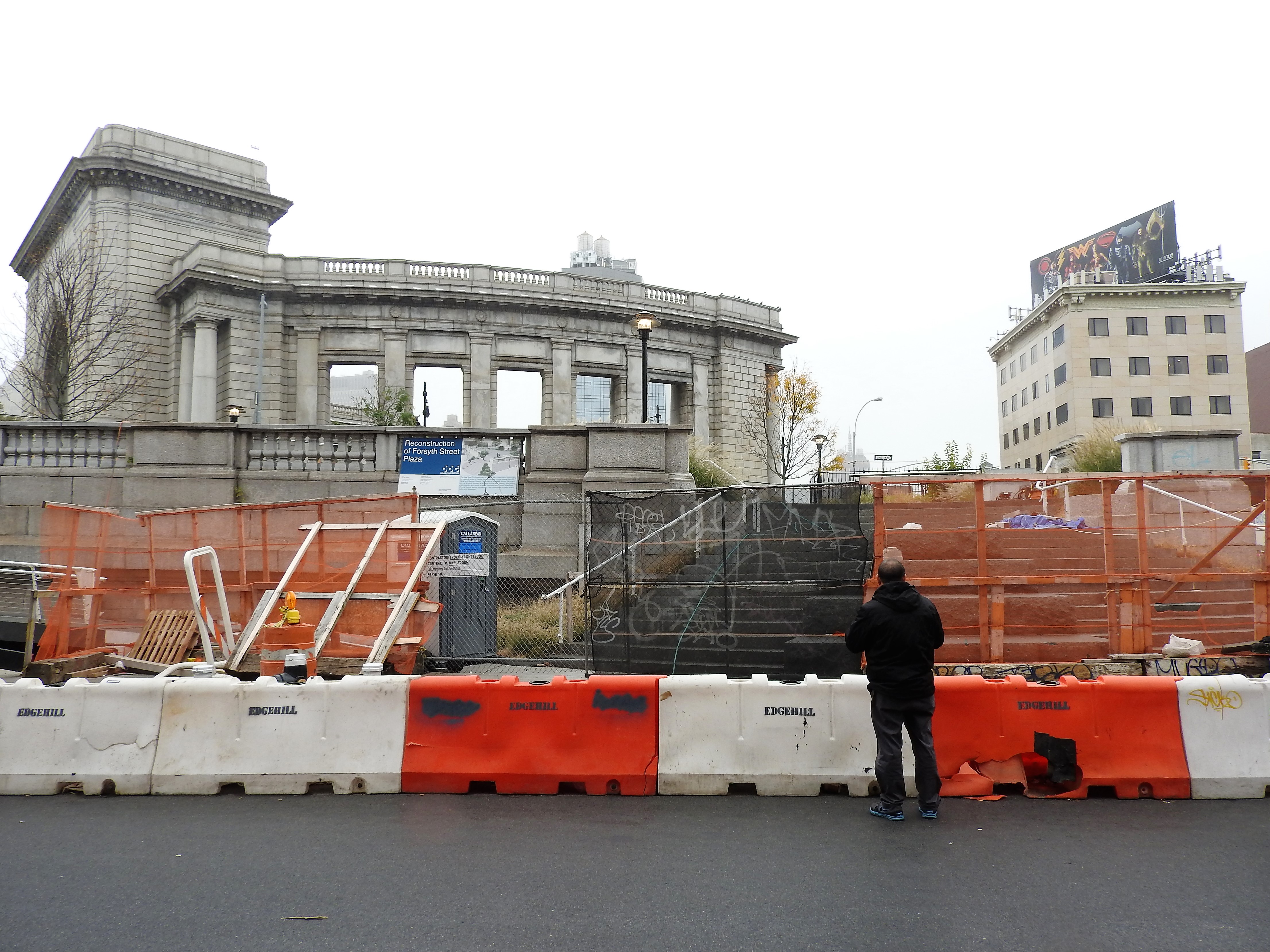
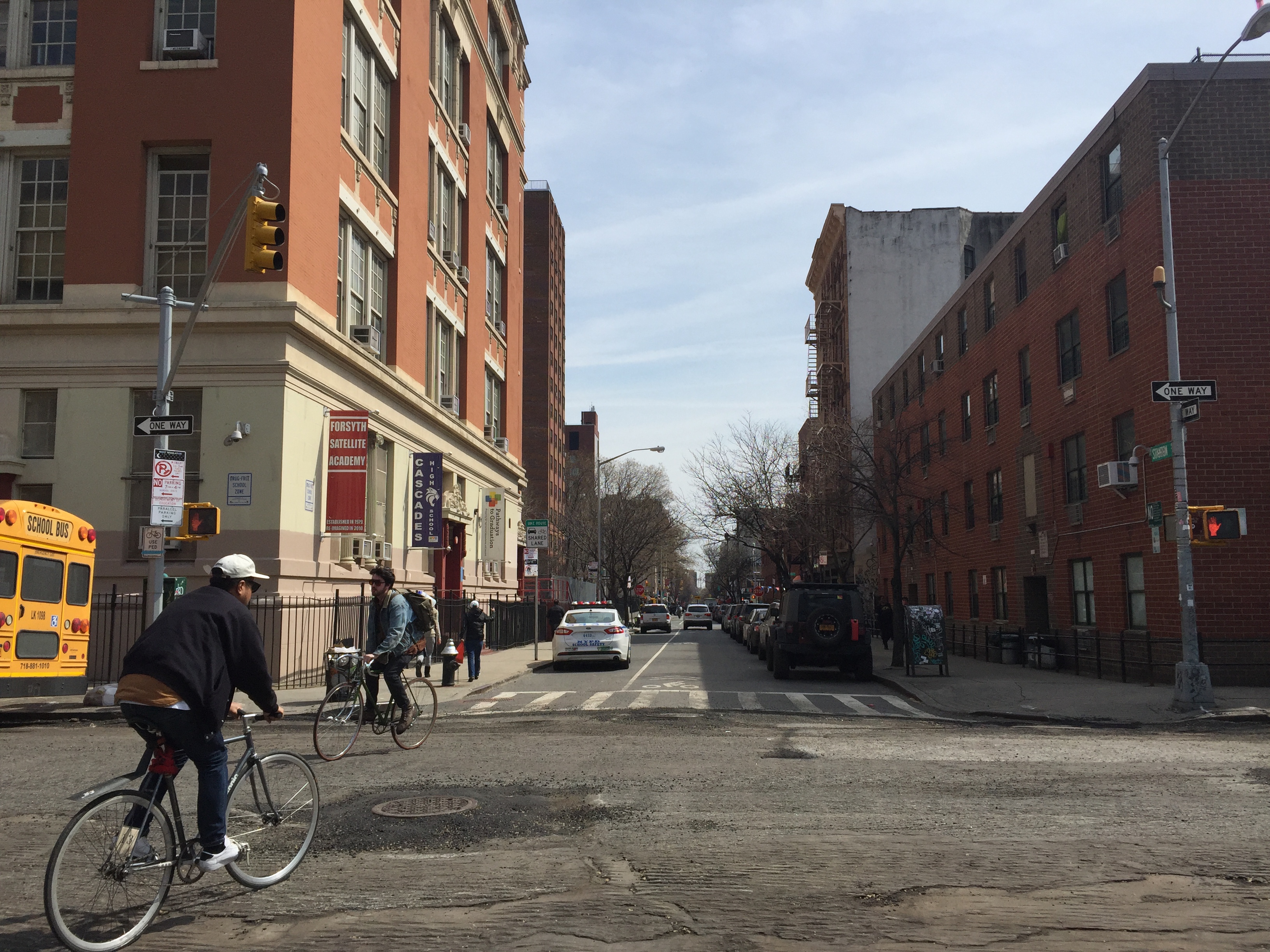
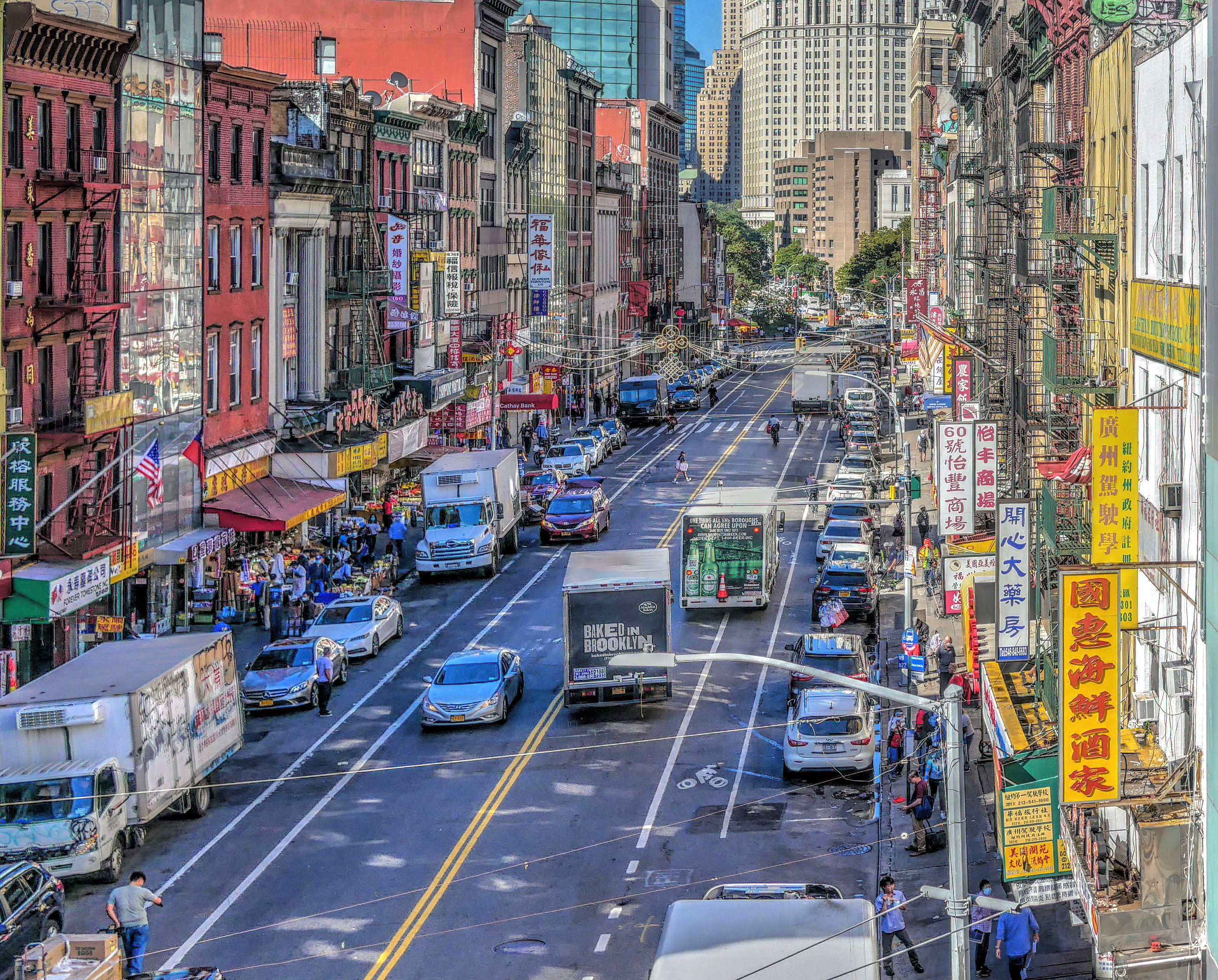
Forsyth Street runs from Houston Street south to Henry Street (Manhattan), Henry Street in the New York City borough (New York City), borough of Manhattan. The street was named in 1817 for Lt. Colonel Benjamin Forsyth. Forsyth Street's southernmost portion, south of Canal Street (Manhattan), Canal Street, runs parallel to the Manhattan Bridge in Chinatown, Manhattan, Chinatown. On the east side of the block from East Broadway to Canal Street, a number of so-called “Chinatown buses” (operated by different companies) start their routes to cities across the East Coast of the United States, including Boston, Philadelphia, and Washington, D.C. On the west side of this block, a greenmarket operates in the shadow of the bridge. Forsyth Street is interrupted north of Canal Street for one block due to a 20th-century schoolhouse, now housing Pace University High School and I.S. 131, built on the former route. From there it runs parallel to Chrystie Street that lies to its west, with ... [...More Info...] [...Related Items...] OR: [Wikipedia] [Google] [Baidu] |
Forsyth Delancey Jeh
Forsyth may refer to: Places Oceania * Forsyth Island, Queensland, Australia, one of the West Wellesley Islands (aka Forsyth Islands) * Forsyth Island, Tasmania, Australia * Forsyth Island (New Zealand), in the outer Marlborough Sounds of South Island * Lake Forsyth, New Zealand * Forsyth Bluff, Australia, see West Cape Howe National Park * Forsyth Peak, in the Cruzen Range of Victoria Land United States * Forsyth, Georgia, a city * Forsyth, Illinois, a village * Forsyth, Missouri, a city * Forsyth, Montana, a city * Forsyth County, North Carolina * Forsyth County, Georgia * Forsyth Township, Michigan * Forsyth Street, Manhattan, New York * Forsyth Park, Savannah, Georgia * James and Mary Forsyth House, listed on the National Register of Historic Places People * Forsyth (surname), a list of people with the surname Forsyth * Forsyth (given name), a list of people with the given name Forsyth * Clan Forsyth, a Scottish clan Other * The Forsyth Institute, an oral health research insti ... [...More Info...] [...Related Items...] OR: [Wikipedia] [Google] [Baidu] |
Pace University High School
Pace University High School, also known as "Pace High School," is a public high school located in the New York City borough of Manhattan, affiliated with Pace University. School history Established by Pace University and the New York City Department of Education, Pace High School was founded with grants from New Visions for Public Schools with money donated from the Bill & Melinda Gates Foundation, the Carnegie Corporation of New York, and George Soros’ Open Society Institute. Pace High School opened its doors to its first class on September 13, 2004. The school is among the 330 out of over 1,400 New York City public schools (23.6%) designated as an Empowerment School, which allows it more autonomy in choosing a curriculum. Pace High School graduated its first class in 2008. Every student in the class graduated and was accepted at two- and four-year colleges. Pace University High School also awards the top five students of the graduating class a full 4-year scholarship to Pace ... [...More Info...] [...Related Items...] OR: [Wikipedia] [Google] [Baidu] |
Stanton Street
Stanton Street is a west-to-east street in the New York City borough of Manhattan, in the neighborhood of the Lower East Side. The street begins at the Bowery in the west and runs east to a dead end past Pitt Street, adjacent to Hamilton Fish Park. A shorter section of Stanton Street also exists east of Columbia Street; it was isolated from the remainder of the street in 1959 with the construction of the Gompers Houses and the Masaryk Towers. Stanton Street largely carries a bike lane, a through lane, and a parking lane. It runs one block north of Rivington Street and one block south of Houston Street. The street is named after George Stanton, an associate of landowner James De Lancey. Community The street also includes a settlement house based on the ideas that Jane Addams brought from the settlement movement in England that won her a Nobel Prize in 1931. The Stanton Street Settlement, founded in 1999, is active in the community through volunteer work. The site of the secon ... [...More Info...] [...Related Items...] OR: [Wikipedia] [Google] [Baidu] |
Rivington Street
Rivington Street is a street in the New York City borough of Manhattan, which runs across the Lower East Side neighborhood, between the Bowery and Pitt Street, with a break between Chrystie and Forsyth for Sara D. Roosevelt Park. Vehicular traffic runs west on this one-way street. It is named after James Rivington, who under cover of writing one of the most infamous Loyalist newspapers in the American colonies, secretly ran a spy ring that supplied George Washington with information. Early in the 20th century, the street was the home of many Italian and Jewish immigrants, hence the birthplace of many second generation Italian and Jewish Americans. George Burns lived there for a time. Points of interest The site of the second African burial ground in New York lies between Rivington and Stanton Streets, now a playground in the Sara D. Roosevelt Park. The M'Finda Kalunga community garden is also at this location. Several functioning synagogues remain on Rivington Street, a remind ... [...More Info...] [...Related Items...] OR: [Wikipedia] [Google] [Baidu] |
Delancey Street
__NOTOC__ Delancey Street is one of the main thoroughfares of New York City's Lower East Side in Manhattan, running from the street's western terminus at the Bowery to its eastern end at FDR Drive, connecting to the Williamsburg Bridge and Brooklyn at Clinton Street. It is an eight-lane, median-divided street west of Clinton Street, and a service road for the Williamsburg Bridge east of Clinton Street. West of Bowery, Delancey Street becomes Kenmare Street, which continues as a four-lane, undivided street to Lafayette Street. Delancey Street is named after James De Lancey Sr., chief justice, lieutenant governor, and acting colonial governor of the Province of New York, whose farm was located in what is now the Lower East Side. Businesses range from delis to check-cashing stores to bars. Delancey Street has long been known for its discount and bargain clothing stores. Famous establishments include the Bowery Ballroom, built in 1929, Ratner's kosher restaurant (now closed), ... [...More Info...] [...Related Items...] OR: [Wikipedia] [Google] [Baidu] |
Broome Street
Broome Street is an east–west street in Lower Manhattan. It runs nearly the full width of Manhattan island, from Hudson Street in the west to Lewis Street in the east, near the entrance to the Williamsburg Bridge. The street is interrupted in a number of places by parks, buildings, and Allen Street's median. The street was named after Staten Island-born John Broome, who was a Colonial merchant and politician and became a Lieutenant Governor of New York State. History According to a map sourced from the New York Public Library collection, the area around Broome Street was developed in the first decade of the 1800s as part of the neighborhood known at that time as 'New Delaney's Square,' although this is probably a mistake for "Delancey," as the Delancey family had owned the land for many decades and had already begun planning development in the 1760s. The street is named after John Broome, an early city alderman and lieutenant governor of New York in 1804. The architectur ... [...More Info...] [...Related Items...] OR: [Wikipedia] [Google] [Baidu] |
Grand Street (Manhattan)
Grand Street is a street in Lower Manhattan, New York City. It runs west/east parallel to and south of Delancey Street, from SoHo through Chinatown, Little Italy, the Bowery, and the Lower East Side. The street's western terminus is Varick Street, and on the east it ends at the service road for the FDR Drive. History and description Grand Street was once part of the lands of James De Lancey, Jr. When his sister Ann married Judge Thomas Jones he gave them a two-acre estate known as "Mount Pitt", near the site of present day Pitt and Grand Streets. It was one of the highest natural points on Manhattan island. In early 1776, a circular redoubt was built there, where General Joseph Spencer established a battery. The British captured the defenses the following November and renamed it Jones Hill Fort. The hill was later leveled and some of the field stone used for the construction of St. Augustine's Church on Henry Street. Bayard Mount at the site of present day Grand and Mot ... [...More Info...] [...Related Items...] OR: [Wikipedia] [Google] [Baidu] |
Hester Street (Manhattan)
Hester Street is a street in the Lower East Side of the New York City borough of Manhattan. It stretches from Essex Street to Centre Street, with a discontinuity between Chrystie Street and Forsyth Street for Sara Delano Roosevelt Park. There is also a discontinuity at Allen Street, which was created in 2009 with the rebuilding of the Allen Street Mall. At Centre Street, Hester Street shifts about to the north and is called Howard Street to its far western terminus at Mercer Street. Historically a center for Ashkenazi Jewish immigrant culture, more recently it has been absorbed by Chinatown, although some kosher and Jewish-owned stores remain. __NOTOC__ History Hester Street was named after Hester Leisler, the daughter of Elsje Tymens and the insurrectionist Jacob Leisler, who was burned at the stake. Through her mother she was related to prominent Dutch families of the Hudson Valley, including the Bayards and the Van Cortlandts. She married Barent Rynders, Jr, a Ne ... [...More Info...] [...Related Items...] OR: [Wikipedia] [Google] [Baidu] |
Pedestrian Zone
Pedestrian zones (also known as auto-free zones and car-free zones, as pedestrian precincts in British English, and as pedestrian malls in the United States and Australia) are areas of a city or town reserved for pedestrian-only use and in which most or all automobile traffic is prohibited. Converting a street or an area to pedestrian-only use is called ''pedestrianisation''. Pedestrianisation usually aims to provide better accessibility and mobility for pedestrians, to enhance the amount of shopping and other business activities in the area or to improve the attractiveness of the local environment in terms of aesthetics, air pollution, noise and crashes involving motor vehicle with pedestrians. However, pedestrianisation can sometimes lead to reductions in business activity, property devaluation, and displacement of economic activity to other areas. In some cases, traffic in surrounding areas may increase, due to displacement, rather than substitution of car traffic. None ... [...More Info...] [...Related Items...] OR: [Wikipedia] [Google] [Baidu] |
Division Street (Manhattan)
Division Street is a one-way street in the Two Bridges neighborhood of Lower Manhattan in New York City. It carries westbound traffic from the intersection of Canal Street and Ludlow Street westward to Bowery. History The street dates back to before 1789. Its namesake is the division it marks between the street grid patterns on either side of it. A segment of the IRT Second Avenue Line used to run along Division Street between Bowery and Allen Street. The portion of Division Street under the Manhattan Bridge is used for a mall called the East Broadway Mall. There is a car park at Market Street (formerly Florence Place Forgotten NY) and next to it is the PS 124 Yung Wing Elementary School. The school is part of a residential complex called |
East Broadway (Manhattan)
East Broadway is a two-way east–west street in the Chinatown, Two Bridges, and Lower East Side neighborhoods of the New York City borough of Manhattan. East Broadway begins at Chatham Square (also known as Kimlau Square) and runs eastward under the Manhattan Bridge, continues past Seward Park and the eastern end of Canal Street, and ends at Grand Street. The western portion of the street has evolved into the neighborhood known as ''Little Fuzhou'', or ''Manhattan's Fuzhou Town'' (福州埠, 紐約華埠), primarily populated by Chinese immigrants (mainly Foochowese who emigrated from Fuzhou, Fujian), while the eastern portion was traditionally home to a large number of Jews. One section in the eastern part of East Broadway, between Clinton Street and Pitt Street, has been unofficially referred to by residents as ''"Shteibel Way"'', since it has been lined with up to ten small synagogues ("shteibels") in its history. Ethnic groups Earlier Ethnic Populations East Broa ... [...More Info...] [...Related Items...] OR: [Wikipedia] [Google] [Baidu] |
Lower East Side, Manhattan
The Lower East Side, sometimes abbreviated as LES, is a historic neighborhood in the southeastern part of Manhattan in New York City. It is located roughly between the Bowery and the East River from Canal to Houston streets. Traditionally an immigrant, working-class neighborhood, it began rapid gentrification in the mid-2000s, prompting the National Trust for Historic Preservation to place the neighborhood on their list of America's Most Endangered Places in 2008. The Lower East Side is part of Manhattan Community District 3, and its primary ZIP Code is 10002. It is patrolled by the 7th Precinct of the New York City Police Department. Boundaries The Lower East Side is roughly bounded by East 14th Street on the north, by the East River to the east, by Fulton and Franklin Streets to the south, and by Pearl Street and Broadway to the west. This more extensive definition of the neighborhood includes Chinatown, the East Village, and Little Italy. A less extensive definit ... [...More Info...] [...Related Items...] OR: [Wikipedia] [Google] [Baidu] |


.jpg)
