|
Fleet Street
Fleet Street is a major street mostly in the City of London. It runs west to east from Temple Bar at the boundary with the City of Westminster to Ludgate Circus at the site of the London Wall and the River Fleet from which the street was named. The street has been an important through route since Roman times. During the Middle Ages, businesses were established and senior clergy lived there; several churches remain from this time including Temple Church and St Bride's. The street became known for printing and publishing at the start of the 16th century, and it became the dominant trade so that by the 20th century most British national newspapers operated from here. Much of that industry moved out in the 1980s after News International set up cheaper manufacturing premises in Wapping, but some former newspaper buildings are listed and have been preserved. The term ''Fleet Street'' remains a metonym for the British national press, and pubs on the street once frequented b ... [...More Info...] [...Related Items...] OR: [Wikipedia] [Google] [Baidu] |
Samuel Pepys
Samuel Pepys (; 23 February 1633 – 26 May 1703) was an English diarist and naval administrator. He served as administrator of the Royal Navy and Member of Parliament and is most famous for the diary he kept for a decade. Pepys had no maritime experience, but he rose to be the Chief Secretary to the Admiralty under both King Charles II and King James II through patronage, diligence, and his talent for administration. His influence and reforms at the Admiralty were important in the early professionalisation of the Royal Navy. The detailed private diary that Pepys kept from 1660 until 1669 was first published in the 19th century and is one of the most important primary sources for the English Restoration period. It provides a combination of personal revelation and eyewitness accounts of great events, such as the Great Plague of London, the Second Dutch War, and the Great Fire of London. Early life Pepys was born in Salisbury Court, Fleet Street, London, on 23 Feb ... [...More Info...] [...Related Items...] OR: [Wikipedia] [Google] [Baidu] |
A4 Road (England)
The A4 is a major road in England from Central London to Avonmouth via Heathrow Airport, Reading, Bath and Bristol. It is historically known as the Bath Road with newer sections including the Great West Road and Portway. The road was once the main route from London to Bath, Bristol and the west of England and formed, after the A40, the second main western artery from London. Although most traffic is carried by the M4 motorway today, the A4 still acts as the main route from Bristol to London for non-motorway traffic. History Turnpikes The A4 has gone through many transformations through the ages from pre-Roman routes, Roman roads (such as the one passing Silbury Hill), and basic wagon tracks. During the Middle Ages, most byways and tracks served to connect villages with their nearest market town. A survey of Savernake Forest near Hungerford in 1228 mentions "The King's Street" running between the town and Marlborough. This street corresponded roughly with the route ... [...More Info...] [...Related Items...] OR: [Wikipedia] [Google] [Baidu] |
Google Maps
Google Maps is a web mapping platform and consumer application offered by Google. It offers satellite imagery, aerial photography, street maps, 360° interactive panorama, interactive panoramic views of streets (Google Street View, Street View), real-time traffic conditions, and route planner, route planning for traveling by foot, car, bike, air (in Software release life cycle#Beta, beta) and public transportation. , Google Maps was being used by over 1 billion people every month around the world. Google Maps began as a C++ desktop program developed by brothers Lars Rasmussen (software developer), Lars and Jens Eilstrup Rasmussen, Jens Rasmussen at Where 2 Technologies. In October 2004, the company was acquired by Google, which converted it into a web application. After additional acquisitions of a geospatial data visualization company and a real-time traffic analyzer, Google Maps was launched in February 2005. The service's Front and back ends, front end utilizes JavaScript, X ... [...More Info...] [...Related Items...] OR: [Wikipedia] [Google] [Baidu] |
Ludgate Hill
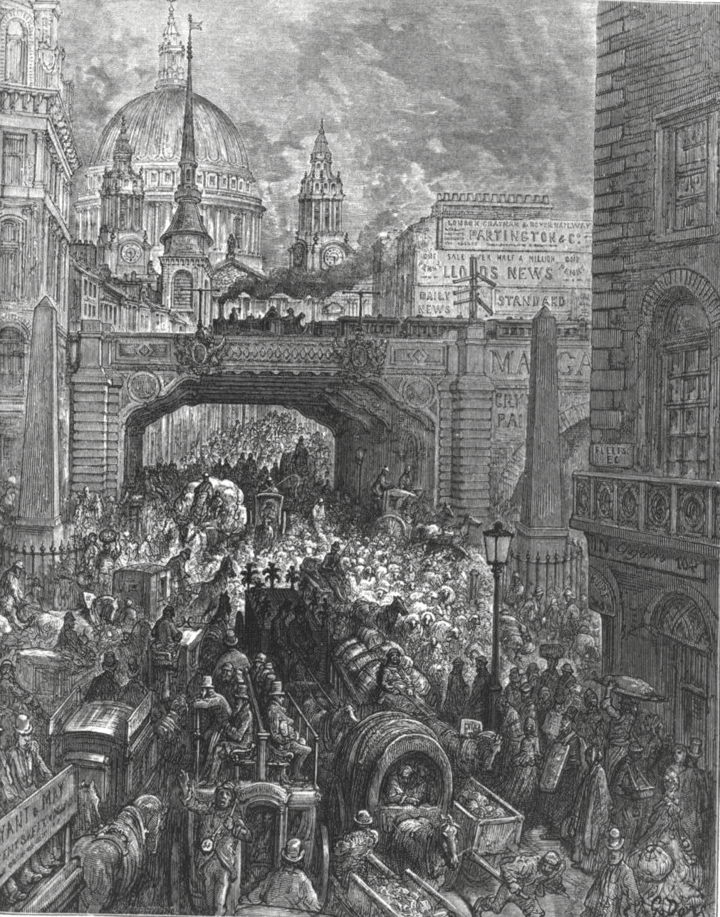
Ludgate Hill is a street and surrounding area, on a small hill in the City of London. The street passes through the former site of Ludgate, a city gate that was demolished – along with a gaol attached to it – in 1760. The area includes St Paul's Cathedral. The modern cathedral, it has been claimed, was built on a site that – during the Roman British era of the early first millennium – was occupied by a major Roman temple, dedicated to the goddess Diana. Ludgate Hill itself is traditionally regarded as one of a trio of hills in Central London, the others being Tower Hill and Cornhill. The highest point is just north of St Paul's, at above sea level. The modern street named Ludgate Hill, which was previously a much narrower thoroughfare named Ludgate Street, runs between St Paul's Churchyard and Ludgate Circus (built in 1864), at which point it becomes Fleet Street. Description Many small alleys on Ludgate Hill were swept away in the mid 1860s to build Ludg ... [...More Info...] [...Related Items...] OR: [Wikipedia] [Google] [Baidu] |
Fetter Lane
Fetter Lane is a street in the ward of Farringdon Without in the City of London. It forms part of the A4 road and runs between Fleet Street at its southern end and Holborn. History The street was originally called Faytor or Faiter Lane, then Fewteres Lane. This is believed to come from the Old French "faitor" meaning lawyer, though by the 14th century this had become synonymous with an idle person. Geoffrey Chaucer used the word to refer to the beggars and vagrants who were seen around the lane. An alternative origin of the name is the fetter (lance vest) made by armourers working for the nearby Knights Templar. In the 1590s there was a gibbet at the junction of Fleet Street and Fetter Lane. Christopher Bales was among those hanged there. In 1643, the Member of Parliament Nathaniel Tomkins was arrested for conspiracy against the government by withholding taxes, and hanged outside his front door in Fetter Lane. It is sometimes said that John Dryden lived at No. 16, but ther ... [...More Info...] [...Related Items...] OR: [Wikipedia] [Google] [Baidu] |
Chancery Lane
Chancery Lane is a one-way street situated in the ward of Farringdon Without in the City of London. It has formed the western boundary of the City since 1994, having previously been divided between the City of Westminster and the London Borough of Camden. The route originated as a 'new lane' created by the Knights Templar from their original 'old Temple' on the site of the present Southampton Buildings on Holborn, in order to access to their newly acquired property to the south of Fleet Street (the present Temple) sometime before 1161. Chancery Lane, numbered the B400 in the British road numbering scheme, connects Fleet Street at its southern origin with High Holborn. It gives its name to Chancery Lane Underground station which lies at the junction of Holborn and Gray's Inn Road, a short distance from Chancery Lane's northern end. Historically, the street was associated with the legal profession, an association which continues to the present day; however, consulting firms ... [...More Info...] [...Related Items...] OR: [Wikipedia] [Google] [Baidu] |
Trafalgar Square
Trafalgar Square ( ) is a public square in the City of Westminster, Central London, laid out in the early 19th century around the area formerly known as Charing Cross. At its centre is a high column bearing a statue of Admiral Nelson commemorating the victory at the Battle of Trafalgar. The battle of 21 October 1805, established the British navy's dominance at sea in the Napoleonic Wars over the fleets of France and Spain. The site around Trafalgar Square had been a significant landmark since the 1200s. For centuries, distances measured from Charing Cross have served as location markers. The site of the present square formerly contained the elaborately designed, enclosed courtyard of the King's Mews. After George IV moved the mews to Buckingham Palace, the area was redeveloped by John Nash, but progress was slow after his death, and the square did not open until 1844. The Nelson's Column at its centre is guarded by four lion statues. A number of commemorative statu ... [...More Info...] [...Related Items...] OR: [Wikipedia] [Google] [Baidu] |
Strand, London
Strand (or the Strand) is a major thoroughfare in the City of Westminster, Central London. It runs just over from Trafalgar Square eastwards to Temple Bar, where the road becomes Fleet Street in the City of London, and is part of the A4, a main road running west from inner London. The road's name comes from the Old English ''strond'', meaning the edge of a river, as it historically ran alongside the north bank of the River Thames. The street was much identified with the British upper classes between the 12th and 17th centuries, with many historically important mansions being built between the Strand and the river. These included Essex House, Arundel House, Somerset House, Savoy Palace, Durham House and Cecil House. The aristocracy moved to the West End during the 17th century, and the Strand became known for its coffee shops, restaurants and taverns. The street was a centre point for theatre and music hall during the 19th century, and several venues remain on the St ... [...More Info...] [...Related Items...] OR: [Wikipedia] [Google] [Baidu] |
River Thames
The River Thames ( ), known alternatively in parts as the River Isis, is a river that flows through southern England including London. At , it is the longest river entirely in England and the second-longest in the United Kingdom, after the River Severn. The river rises at Thames Head in Gloucestershire, and flows into the North Sea near Tilbury, Essex and Gravesend, Kent, via the Thames Estuary. From the west it flows through Oxford (where it is sometimes called the Isis), Reading, Henley-on-Thames and Windsor. The Thames also drains the whole of Greater London. In August 2022, the source of the river moved five miles to beyond Somerford Keynes due to the heatwave in July 2022. The lower reaches of the river are called the Tideway, derived from its long tidal reach up to Teddington Lock. Its tidal section includes most of its London stretch and has a rise and fall of . From Oxford to the Estuary the Thames drops by 55 metres. Running through some of the drier ... [...More Info...] [...Related Items...] OR: [Wikipedia] [Google] [Baidu] |
Hampstead
Hampstead () is an area in London, which lies northwest of Charing Cross, and extends from the A5 road (Roman Watling Street) to Hampstead Heath, a large, hilly expanse of parkland. The area forms the northwest part of the London Borough of Camden, a borough in Inner London which for the purposes of the London Plan is designated as part of Central London. Hampstead is known for its intellectual, liberal, artistic, musical, and literary associations. It has some of the most expensive housing in the London area. Hampstead has more millionaires within its boundaries than any other area of the United Kingdom.Wade, David"Whatever happened to Hampstead Man?" ''The Daily Telegraph'', 8 May 2004 (retrieved 3 March 2016). History Toponymy The name comes from the Anglo-Saxon words ''ham'' and ''stede'', which means, and is a cognate of, the Modern English "homestead". To 1900 Early records of Hampstead can be found in a grant by King Ethelred the Unready to the monastery of ... [...More Info...] [...Related Items...] OR: [Wikipedia] [Google] [Baidu] |


.jpg)

