|
Fierzë, Kukës
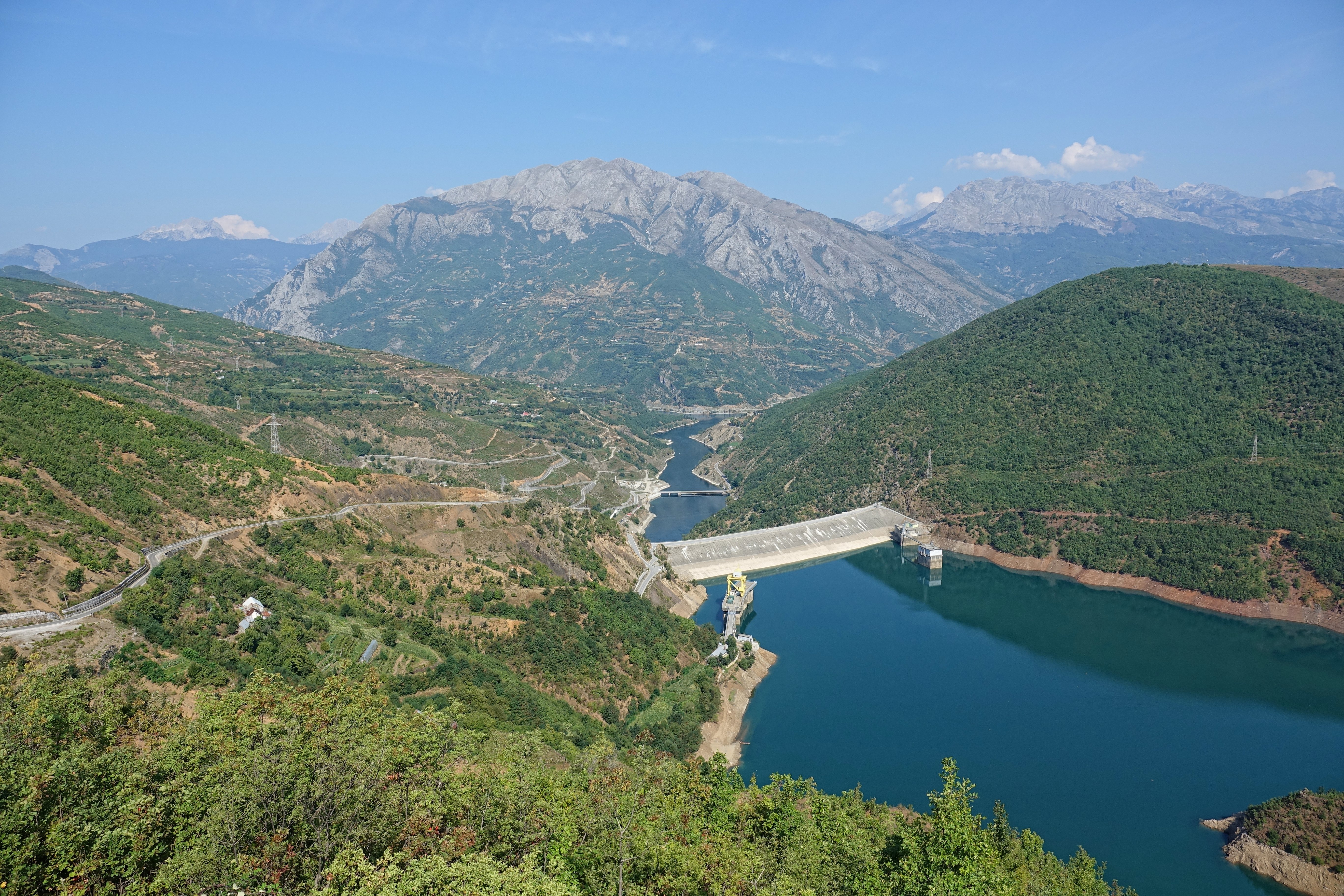
Fierzë is a town and a former municipality in the Kukës County, northern Albania. At the 2015 local government reform it became a subdivision of the municipality Tropojë. Fierzë sits on the right, northern bank of the Drin (river), Drin, opposite the village Fierzë, Shkodër, Fierzë in Fushë-Arrëz municipality. The Fierzë municipality had 1607 inhabitants in 2011 (2381 in 2001). This municipality contained the central settlement of Fierzë (913 inhabitants in 2001) and the villages of Degë (387 inhabitants), T’plan (496 inhabitants), Dushaj (168 inhabitants) and Breg-Lumi (417 inhabitants). The Drin river was dammed above Fierzë to form Fierza Reservoir, Lake Fierzë in the 1970s and Koman Hydroelectric Power Station, Lake Koman in the 1980s. The Fierzë dam is the tallest dam in Albania, at 152 metres high. The power plant at Fierzë is one of the most important producers of electricity in the country. The dammed Drin is not alone in passing through Fierzë. Here the ... [...More Info...] [...Related Items...] OR: [Wikipedia] [Google] [Baidu] |
Tropojë
Tropojë (; sq-definite, Tropoja) is a municipality in Kukës County, northeastern Albania, within the historical ethnographic region of the Gjakova Highlands. The municipality consists of the administrative units of Bajram Curri, Bujan, Bytyç, Fierzë, Lekbibaj, Llugaj, Margegaj and Tropojë, that became municipal units. The seat of the municipality is the town Bajram Curri. As of the Institute of Statistics estimate from the 2011 census, there were 4,117 people residing in the municipal unit Tropojë and 20,517 in Tropojë Municipality. Etymology Tropojë's old name was ''Trebopolje'' and is recorded in Serbian medieval charters and Ottoman registers. The word itself comes from the old Slavic ''trebiti'', ‘to clean’, and ''polje'', ‘field’, i.e. ‘clean field’. Tropojë used to be more commonly known as Malësia e Gjakoves. History The region was inhabited by Illyrian tribes. Archaeological evidence found in the area, such as castles or tumuli show that t ... [...More Info...] [...Related Items...] OR: [Wikipedia] [Google] [Baidu] |
Koman Hydroelectric Power Station
The Lake Koman, Koman Hydroelectric Power Station is a large hydroelectricity, hydroelectric power station, for which a dam on the Drin River was built. The dam is near the settlement of Koman, Albania, Koman, northern Albania. It is the second of three dams on the Drin River; the Fierza Hydroelectric Power Station upstream, and the Vau i Dejës Hydroelectric Power Station downstream. The dam, 130m tall, was completed in 1985 and the reservoir was filled with water at full capacity in 1986. Completed in 1986, the power station consists of four turbines of France, French origin with a nominal capacity of each, totalling the installed capacity to . See also *Koman and Fierza Reservoirs Ferry *List of power stations in Albania External links Hydroelectric power stations in Albania Dams completed in 1986 Buildings and structures in Vau i Dejës {{Hydroelectric-power-plant-stub ... [...More Info...] [...Related Items...] OR: [Wikipedia] [Google] [Baidu] |
Former Municipalities In Kukës County
A former is an object, such as a template, gauge or cutting die, which is used to form something such as a boat's hull. Typically, a former gives shape to a structure that may have complex curvature. A former may become an integral part of the finished structure, as in an aircraft fuselage, or it may be removable, being using in the construction process and then discarded or re-used. Aircraft formers Formers are used in the construction of aircraft fuselage, of which a typical fuselage has a series from the nose to the empennage, typically perpendicular to the longitudinal axis of the aircraft. The primary purpose of formers is to establish the shape of the fuselage and reduce the column length of stringers to prevent instability. Formers are typically attached to longerons, which support the skin of the aircraft. The "former-and-longeron" technique (also called stations and stringers) was adopted from boat construction, and was typical of light aircraft built until ... [...More Info...] [...Related Items...] OR: [Wikipedia] [Google] [Baidu] |
Roman Empire
The Roman Empire ( la, Imperium Romanum ; grc-gre, Βασιλεία τῶν Ῥωμαίων, Basileía tôn Rhōmaíōn) was the post-Republican period of ancient Rome. As a polity, it included large territorial holdings around the Mediterranean Sea in Europe, North Africa, and Western Asia, and was ruled by emperors. From the accession of Caesar Augustus as the first Roman emperor to the military anarchy of the 3rd century, it was a Principate with Italia as the metropole of its provinces and the city of Rome as its sole capital. The Empire was later ruled by multiple emperors who shared control over the Western Roman Empire and the Eastern Roman Empire. The city of Rome remained the nominal capital of both parts until AD 476 when the imperial insignia were sent to Constantinople following the capture of the Western capital of Ravenna by the Germanic barbarians. The adoption of Christianity as the state church of the Roman Empire in AD 380 and the fall of the Western ... [...More Info...] [...Related Items...] OR: [Wikipedia] [Google] [Baidu] |
Kukës
Kukës ( sq-definite, Kukësi) is a city in the Republic of Albania. The city is the capital of the surrounding municipality of Kukës and county of Kukës, one of 12 constituent counties of the republic. It spans and had a total population of 16,719 people as of 2011. Geologically, the terrain of the surrounding area is dominated by mountainous and high terrain. The city sprawls across the Luma Plain within the Albanian Alps between the banks of Lake Fierza and the hills of the northernmost Korab Mountains and westernmost Shar Mountains. At the confluence of the Black and White Drin, the Drin River originates close to the city's territory. History Early Development Kukës traces its history back over a thousand years. The region that nowadays corresponds to the city territory was inhabited by several ancient Illyrian tribes, as most of Albania. Numerous tombs from the Illyrians have been identified at Këneta and Kolsh nearby the city. The residential estate served as a ... [...More Info...] [...Related Items...] OR: [Wikipedia] [Google] [Baidu] |
Bajram Curri (town)
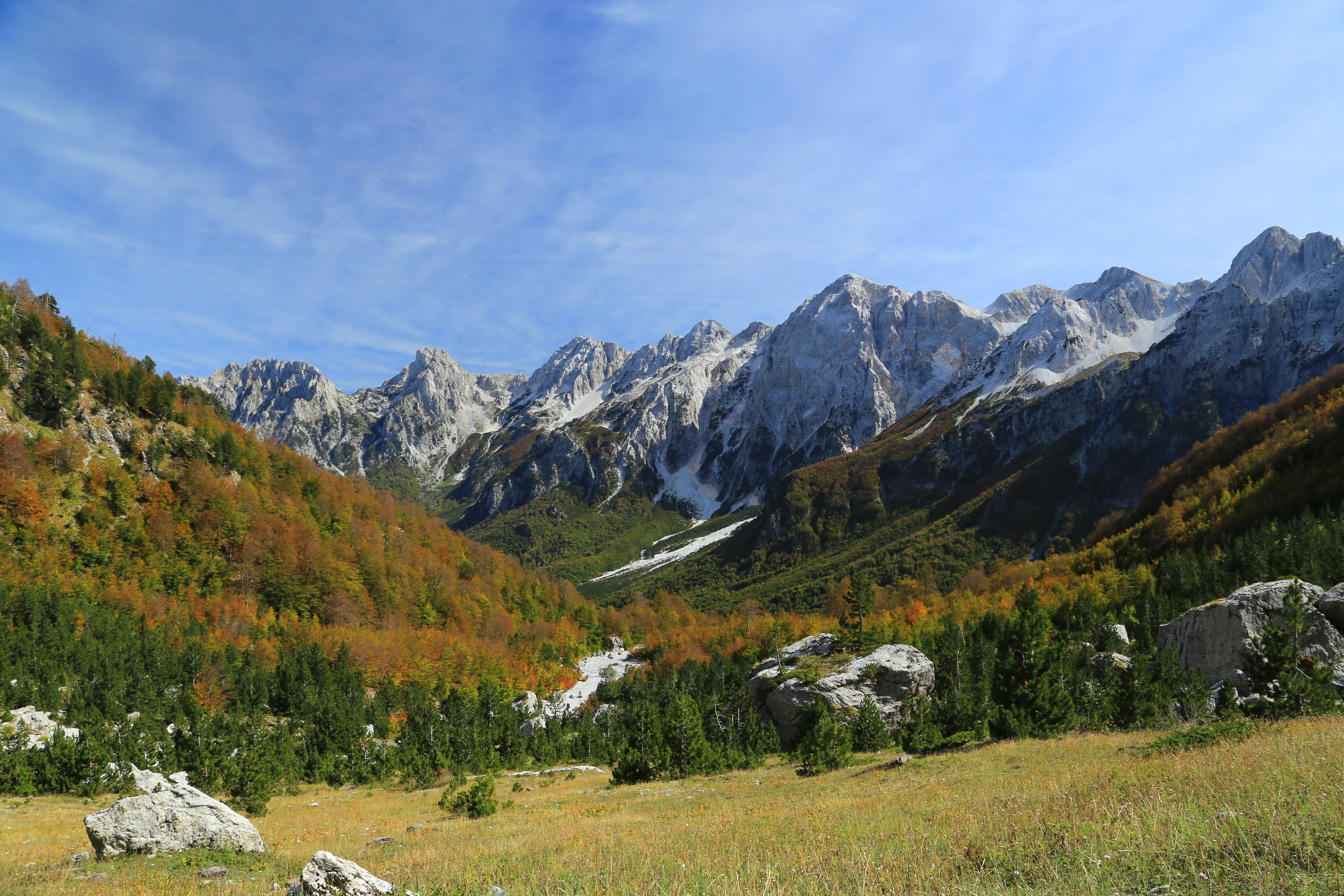
Bajram Curri (), formerly known as Kolgecaj, is a town and administrative unit in the municipality of Tropojë, northeastern Albania, within the historical ethnographic region of the Gjakova Highlands. The town is located in a remote and mountainous region of the Albanian Alps, within the Valbonë Valley, and close to the border with Kosovo. It is named after Bajram Curri, a national hero who fought for ethnic Albanians, first against the Ottoman Empire and later against the Albanian government. History Bajram Curri was founded in the year 1957 to serve as the centre of the district of Tropoja. The village was previously known as Kolgecaj. The newly formed city was built based on socialist principles. Geography Bajram Curri is located down the valley of the river Valbonë. It is the main access point by road to the villages of Valbona and Rrogam. Water from the mountains flow into the waters of the Valbonë, the latter being famous for having the clearest river water in ... [...More Info...] [...Related Items...] OR: [Wikipedia] [Google] [Baidu] |
Lake Koman Ferry
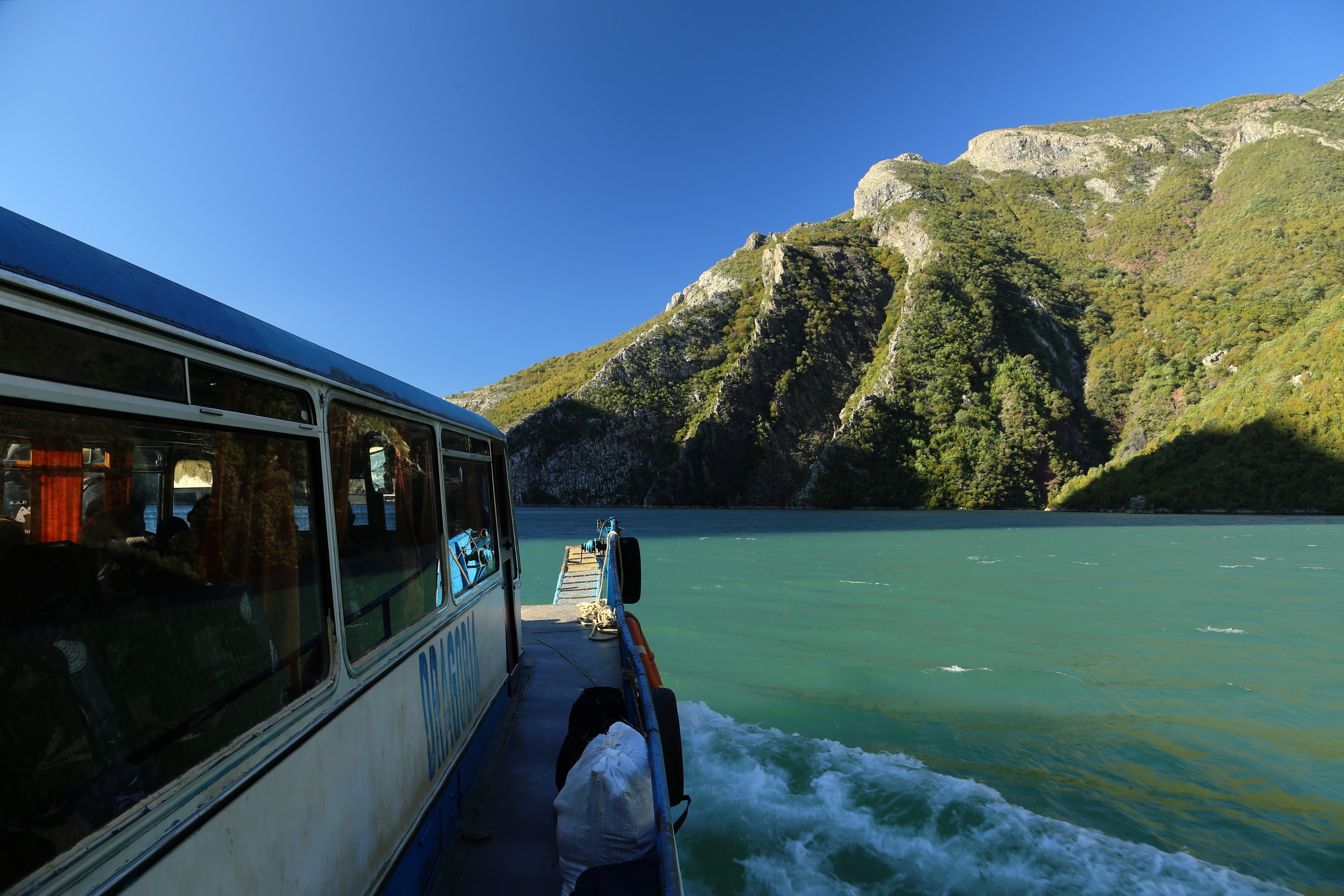
Lake Koman Ferry (Albanian: ''Trageti i Komanit'') is a passenger ferry service operated by several local companies along the Koman Reservoir (also known as Koman Lake) in Northern Albania. The line operates between Koman near the Koman Hydroelectric Power Station, and Fierzë near the Fierza Hydroelectric Power Station. The line is known for its scenic views of the mountain gorges, unscheduled stops along the way for serving locals, and the peculiar atmosphere of both locals, foreigners, and even animals being fitted on board up to full capacity. According to Bradt Travel guides, the journey is described as "one of the world's great boat trips" only comparable to the Scandinavian fjords. History Following the construction of the dam and inundation of the area, a ferry service was established to serve the local population. Since the 2000s, the area has become a growing tourist destination. As a result, the old car ferry ship Dardania underwent a complete makeover and began regu ... [...More Info...] [...Related Items...] OR: [Wikipedia] [Google] [Baidu] |
Valbonë (river)
The Valbona ( sq, Valbonë) is a river in northern Albania. It is still relatively untouched. Its source is in the Accursed Mountains, near the border with Montenegro. The Valbonë flows generally east through the municipality Margegaj (mountain villages Valbonë, Dragobi and Shoshan), then turns south along Bajram Curri, and continues southwest until its outflow into the river Drin, near Fierzë. It is one of the cleanest rivers in the country. The river begins in and flows through the Valbonë valley. Gallery File:Lugina_e_Valbones,_Tropoje_01.jpg, File:Kanjoni_i_Lumit_Valbona.jpg, File:Theth_Valley.jpg, File:Lumi_i_Valbones1.jpg, See also * Environment of Albania * Rivers of Albania Albania has more than 152 rivers and streams, forming 8 large rivers flowing from southeast to northwest, mainly discharging towards the Adriatic coast. The rivers of Albania have a total annual flow rate of , or per year. A majority of the pre ... References Riv ... [...More Info...] [...Related Items...] OR: [Wikipedia] [Google] [Baidu] |
Fierza Reservoir
The Fierza Reservoir ( sq, Liqeni i Fierzës) is a reservoir in Albania and Kosovo. The Drin River and parts of the White Drin and Black Drin also runs through the reservoir. The size of the lake is , of which 2.46 km2 belong to Kosovo. It is 70 km long and has a depth of 128 m. In the Albanian side of the lake there are many canyons and some small islands. The dam is 167m tall. In 2014, the lake was declared a Regional Nature Park by the Kukes County Council. The reservoir was formed as a result of the construction of the Fierza Hydroelectric Power Station in 1978 by the Albanian government. See also * Lakes of Albania * Geography of Albania * Lakes of Kosovo * Geography of Kosovo Kosovo is a small and landlocked country in Southeastern Europe. The country is strategically positioned in the center of the Balkan Peninsula enclosed by Montenegro to the west, Serbia to the north and east, North Macedonia to the southeast, a ... References Lakes of Alb ... [...More Info...] [...Related Items...] OR: [Wikipedia] [Google] [Baidu] |
Kukës County
Kukës County (; sq, Qarku i Kukësit) is a landlocked county in northeastern Albania, with the capital in Kukës. The county spans and had a total population of 74,388 people as of 2021. The county borders on the counties of Dibër, Lezhë and Shkodër and the countries of Montenegro, Kosovo and North Macedonia. It is divided into three municipalities: Has, Kukës and Tropojë. The municipalities are further subdivided into 290 towns and villages in total. The human presence in the lands of modern Kukës County can be traced back to the Bronze Ages, when ancient Illyrians, Dardanians and Romans established settlements in the region. Several Illyrian tombs were discovered in the villages of Këneta and Kolsh close to Kukës. Kukës is predominantly mountainous and framed by mountain ranges including the Albanian Alps in the northwest which is typified by karst topography. The northeast is dominated by the mountains of Gjallica, Koritnik and Pashtrik, while the southeaste ... [...More Info...] [...Related Items...] OR: [Wikipedia] [Google] [Baidu] |
Institute Of Statistics (Albania)
The Institute of Statistics ( sq, Instituti i Statistikave – INSTAT) is an independent public legal entity tasked with producing official statistics in the Republic of Albania. INSTAT is organized at the central level, with regional statistical offices at the local level that operate within its organizational structure, which is approved by a decision of the Assembly, in accordance with the provisions of the legislation in force for independent institutions. Overview The statistical service in the Republic of Albania is carried out by the Institute of Statistics. In 1924, a statistical office was created that kept various economic records at the Ministry of Public Works and Agriculture. The activity of this office was limited to agricultural inventories that included the number of farmers and the type and amount of land use with agricultural and livestock plants, as well as some detailed statistics on industry, trade, export-imports and prices. The statistical service was eventu ... [...More Info...] [...Related Items...] OR: [Wikipedia] [Google] [Baidu] |


