|
Fezzan Province
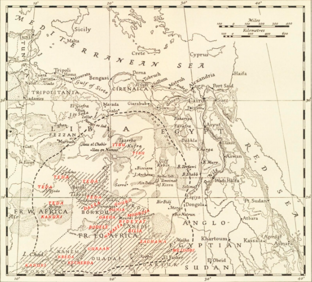
Fezzan province is one of the three traditional Provinces of Libya. It was a formal province from 1934 until 1963, when it was subdivided into the Governorates of Libya. Its capital was the city of Sabha. In 1963, the province was split into: *Awbari Governorate * Gharian Governorate * Sabha Governorate Administration Fezzan was a province under the Ottoman Turks and Italy, and a province (''wilayah'') or governorate (''muhafazah'') of independent Libya (alongside Tripolitania and Cyrenaica) until 1963. With the introduction of the new administrative division of Libya in 1963, Fezzan was abolished as an independent administrative unit and was divided into the ''muhafazat'' of Awbari and Sabha. In 1983, these administrative divisions were abolished in favour of smaller districts or ''baladiyah''. The Baladiyat-system was reorganized in 1987 and was replaced in 1995 by the '' sha'biyat''-system. The former Fezzan province contains the districts (''sha'biyat'') of Wadi al Sha ... [...More Info...] [...Related Items...] OR: [Wikipedia] [Google] [Baidu] |
Italian Libya
Libya ( it, Libia; ar, ليبيا, Lībyā al-Īṭālīya) was a colony of the Fascist Italy located in North Africa, in what is now modern Libya, between 1934 and 1943. It was formed from the unification of the colonies of Italian Cyrenaica and Italian Tripolitania, which had been Italian possessions since 1911. From 1911 until the establishment of a unified colony in 1934, the territory of the two colonies was sometimes referred to as "Italian Libya" or Italian North Africa (''Africa Settentrionale Italiana'', or ASI). Both names were also used after the unification, with Italian Libya becoming the official name of the newly combined colony. It had a population of around 150,000 Italians. The Italian colonies of Tripolitania and Cyrenaica were taken by Italy from the Ottoman Empire during the Italo-Turkish War of 1911-1912, and run by Italian governors. In 1923, indigenous rebels associated with the Senussi Order organized the Libyan resistance movement against Italian set ... [...More Info...] [...Related Items...] OR: [Wikipedia] [Google] [Baidu] |
Districts Of Libya
In Libya there are currently 106 districts, second level administrative subdivisions known in Arabic as ''baladiyat'' (singular ''baladiyah''). The number has varied since 2013 between 99 and 108. The first level administrative divisions in Libya are currently the governorates (''muhafazat''), which have yet to be formally deliniated, but which were originally tripartite as: Tripolitania in the northwest, Cyrenaica in the east, and Fezzan in the southwest; and later divided into ten governorates. Prior to 2013 there were twenty-two first level administrative subdivisions known by the term ''shabiyah'' (Arabic singular ''šaʿbiyya'', plural ''šaʿbiyyāt'') which constituted the districts of Libya. In the 1990s the shabiyat had replaced an older baladiyat system. Historically the area of Libya was considered three provinces (or states), Tripolitania in the northwest, Cyrenaica in the east, and Fezzan in the southwest. It was the conquest by Italy in the Italo-Turkish War ... [...More Info...] [...Related Items...] OR: [Wikipedia] [Google] [Baidu] |
Algeria
) , image_map = Algeria (centered orthographic projection).svg , map_caption = , image_map2 = , capital = Algiers , coordinates = , largest_city = capital , religion = , official_languages = , languages_type = Other languages , languages = Algerian Arabic (Darja) French , ethnic_groups = , demonym = Algerian , government_type = Unitary semi-presidential republic , leader_title1 = President , leader_name1 = Abdelmadjid Tebboune , leader_title2 = Prime Minister , leader_name2 = Aymen Benabderrahmane , leader_title3 = Council President , leader_name3 = Salah Goudjil , leader_title4 = Assembly President , leader_name4 = Ibrahim Boughali , legislature = Parliament , upper_house = Council of the Nation , lower_house ... [...More Info...] [...Related Items...] OR: [Wikipedia] [Google] [Baidu] |
Toubou People
The Toubou or Tubu (from Old Tebu, meaning "rock people") are an ethnic group native to the Tibesti Mountains that inhabit the central Sahara in northern Chad, southern Libya and northeastern Niger. They live either as herders and nomads or as farmers near oases. Their society is clan-based, with each clan having certain oases, pastures and wells. The Toubou are generally divided into two closely related groups: the Teda (or Téda, Toda) and the Dazagara (or Dazzaga, Dazagada, Daza). They are believed to share a common origin and speak the Tebu languages, which are from the Saharan branch of the Nilo-Saharan language family. Tebu is divided further into two closely related languages, called ''Tedaga'' (Téda Toubou) and ''Dazaga'' (Dazaga Gouran). Of the two groups, the Daza, found to the south of the Teda, are more numerous. The Toubou people are also referred to as the Tabu, Tebu, Tebou, Tibu, Tibbu, Toda, Todga, Todaga, Tubu, Tuda, Tudaga, or Gorane people. The Dazaga are ... [...More Info...] [...Related Items...] OR: [Wikipedia] [Google] [Baidu] |
Tuareg People
The Tuareg people (; also spelled Twareg or Touareg; endonym: ''Imuhaɣ/Imušaɣ/Imašeɣăn/Imajeɣăn'') are a large Berber ethnic group that principally inhabit the Sahara in a vast area stretching from far southwestern Libya to southern Algeria, Niger, Mali, and Burkina Faso. Traditionally nomadic pastoralists, small groups of Tuareg are also found in northern Nigeria. The Tuareg speak languages of the same name (also known as ''Tamasheq''), which belong to the Berber branch of the Afroasiatic family. The Tuaregs have been called the "blue people" for the indigo dye coloured clothes they traditionally wear and which stains their skin. They are a semi-nomadic people who practice Islam, and are descended from the indigenous Berber communities of Northern Africa, which have been described as a mosaic of local Northern African (Taforalt), Middle Eastern, European (Early European Farmers), and Sub-Saharan African-related ancestries, prior to the Arab expansion. Tuareg peopl ... [...More Info...] [...Related Items...] OR: [Wikipedia] [Google] [Baidu] |
Dawada
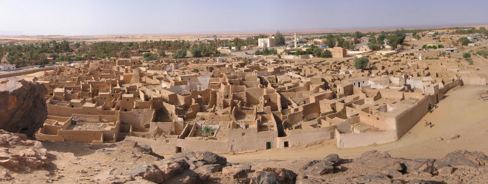
The Dawada (Duwwud, Dawwada) is an Afro-Arab ethnic group from the Fezzan region of southern Libya. They live around the Gabraoun oasis, at the town of Murzuk, where they harvest brine shrimp in the salty lakes. They dry the brine shrimp and sell them to caravans. The name Dawada means "worm-folk" in Arabic due to this practice. The appearance of the Dawada is distinctive and has been linked to a relict population. They are mostly an endogamic group which rarely marry outside of their tribe. They speak an Arabic Arabic (, ' ; , ' or ) is a Semitic languages, Semitic language spoken primarily across the Arab world.Semitic languages: an international handbook / edited by Stefan Weninger; in collaboration with Geoffrey Khan, Michael P. Streck, Janet C ... dialect. References Ethnic groups in Libya {{Africa-ethno-group-stub ... [...More Info...] [...Related Items...] OR: [Wikipedia] [Google] [Baidu] |
Ghat District
Ghat ( Berber: ''Ɣat''; ar, غات ) is one of the districts of Libya. Its capital is Ghat. To the west, Ghat borders two provinces of Algeria: Tamanghasset in the far southwest, and Illizi Province. It also has a short border with the Agadez Department of Niger in the far south. Domestically, it borders Wadi Al Shatii in north, Wadi Al Hayaa in northeast and Murzuq in the east. Per the census of 2012, the total population in the region was 157,747 with 150,353 Libyans. The average size of the household in the country was 6.9, while the average household size of non-Libyans being 3.7. There were totally 22,713 households in the district, with 20,907 Libyan ones. The population density of the district was 1.86 persons per sq. km. Per 2006 census, there were totally 8,218 economically active people in the district. Libyan Civil War Since 2014, the district has been under the control of independent Tuareg and Tebu militias fighting each other for dominion. This situation wa ... [...More Info...] [...Related Items...] OR: [Wikipedia] [Google] [Baidu] |
Sabha District
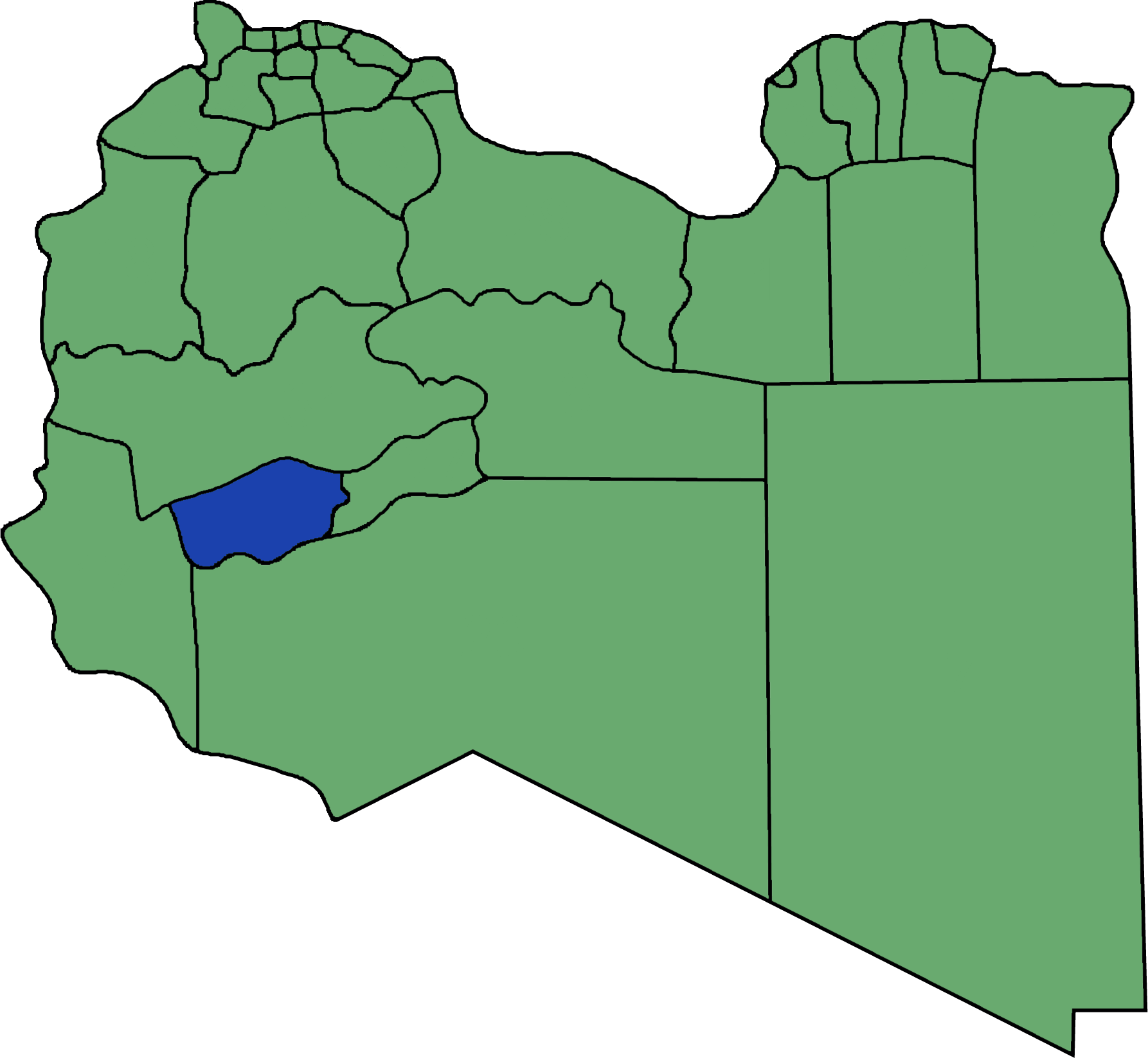
Sabha ( ar, سبها ''Sabhā'') is one of the districts of Libya. It is located near the center of the country, in the Fezzan region. The capital is the city of Sabha. Sabha District borders the following districts, namely, Wadi Al Shatii in the north, Al Jufrah in the east, Murzuq in the south and Wadi Al Hayaa in the west. Per the census of 2012, the total population in the region was 157,747. The average size of the household in the country was 6.9. There were totally 22,713 households in the district, with 20,907 Libyan ones. The population density of the district was 1.86 persons per sq. km. Geography Sabha District borders the following districts, namely, Wadi Al Shatii in north, Al Jufrah in east, Murzuq in south and Wadi Al Hayaa in the west. Sabha District is in the Fezzen region (Libyan Desert), a section of the Sahara Desert. The Sabha Air Base is in the district. The Gaberoun oasis, on a spring fed lake, is a popular tourist attraction in the district. L ... [...More Info...] [...Related Items...] OR: [Wikipedia] [Google] [Baidu] |
Murzuq District
Murzuq ( ar, مرزق ''Murzuq'') is one of the districts of Libya. It is in the south of the country. Its capital is Murzuk. The city was occupied by the Ottoman Empire in 1578 and served as the capital of Fezzan off and on until the Ottomans ceded Libya to Italy in 1912. It was not occupied by the Italians until 1914. To the southeast, Murzuq borders the Bourkou-Ennedi-Tibesti Region of Chad, and to the southwest it borders the Agadez Department of Niger. The border crossing to Niger is at Tumu. Domestically, it borders Ghat in the west, Wadi al Hayaa in northwest, west of Sabha, Sabha in northwest, east of Wadi Al Hayaa, Jufra in north and Kufra in the east. Per the census of 2012, the total population in the region was 157,747 with 150,353 Libyans. The average size of the household in the country was 6.9, while the average household size of non-Libyans being 3.7. There were totally 22,713 households in the district, with 20,907 Libyan ones. The population density of ... [...More Info...] [...Related Items...] OR: [Wikipedia] [Google] [Baidu] |
Ghadames District
Ghadames or Ghadamis (Arabic: غدامس, Libyan vernacular: ġdāməs) was a district of Libya until 2007. Its territory is now part of Nalut District. It was in the northwest of the country with its capital at Ghadames. To the west, Ghadamis bordered the following regions of Tunisia and Algeria: * Tataouine Governorate, Tunisia - north * Ouargla Province, Algeria - northwest * Illizi Province, Algeria - west Domestically, it bordered the following districts: *Nalut Nalut (sometimes Lalút) ( ar, نالوت) is the capital of the Nalut District in Libya. Nalut lies approximately halfway between Tripoli and Ghadames, at the western end of the Nafusa Mountains coastal range, in the Tripolitania region. The ... - northeast * Mizda - east * Wadi Al Shatii - south {{coord, 30, 08, N, 9, 30, E, region:LY_type:city_source:GNS-enwiki, display=title Former districts of Libya ... [...More Info...] [...Related Items...] OR: [Wikipedia] [Google] [Baidu] |
Jufra District
Jufra or Jofra ( ar, الجفرة, Al Jufrah) is one of the districts of Libya. It is in the centre of the country. Its capital is Hun. Jufra was originally one of the 25 baladiya in the administrative system of Libya established in 1988. In 2001, it became a ''Shabiya'', and its territorial extension was reduced. In 2007, under the new 22-shabiya system, its original boundaries were reintroduced. Jufra borders Sirte in the north, Al Wahat in northeast, Kufra in east, Murzuq in south, Sabha in southwest, Wadi al Shatii in west and Jabal al Gharbi in northwest. In 2012, the total population in the region was estimated at 157,747 with 150,353 Libyans. The average size of the household in the country was evaluated at 6.9, while the average household size of non-Libyans was established at 3.7. There were totally 22,713 households in the district, with 20,907 Libyan ones. The population density of the district was 1.86 persons per km2. Per 2006 census, there were totally 20,12 ... [...More Info...] [...Related Items...] OR: [Wikipedia] [Google] [Baidu] |
Wadi Al Hayaa District
Wadi al Hayaa ( ar, وادي الحياة ''Wādī al Ḥayāh'') is one of the districts of Libya. Its capital is the city of Ubari. As of 2006, it had a population of 72,587, area of and a population density of 2.28 persons per square kilometer. The district is bordered by Wadi al Shatii in north, Sabha in east, Murzuq in south and Ghat in the west. The district is part of the Fezzan geographical division of Libya which is mostly desert. Geography The district is bordered by Wadi al Shatii in north, Sabha in east, Murzuq in south and Ghat in the west. The district is part of Fezzen geographical division of Libya which is mostly desert. The region receives an annual rainfall of . There are no perennial rivers in the region, but the region is abundant with groundwater aquifers. Libya has mostly a flat undulating plain and occasional plateau, with an average elevation of around . Around 91 per cent of the land is covered by desert, with only 8.8 per cent agricultural land (w ... [...More Info...] [...Related Items...] OR: [Wikipedia] [Google] [Baidu] |


