|
Federation University Australia, Gippsland Campus
Federation University Australia Gippsland Campus is an Australian university campus located in the town of Churchill 142 km east of Melbourne. Its main neighbouring towns in the region are Morwell and Traralgon. Formerly a branch of Monash University, on 1 January 2014 it became part of Federation University Australia. Study areas at the campus include Arts (Media, Humanities, Communication and Social Science); Business; Education; Information Technology; Nursing; Midwifery; Sport, Outdoor and Physical Education; Psychology; Science; Engineering and Visual Arts. Federation University Australia came into being after the University of Ballarat merged with Monash University Gippsland Campus. New students commencing their studies at the Gippsland campus from 2014 study under the Federation University Australia entity. Remaining Monash students at the campus were able to complete their degree as Monash University students. History The campus began as the Yallourn Technical School ... [...More Info...] [...Related Items...] OR: [Wikipedia] [Google] [Baidu] |
Churchill, Victoria
Churchill is a town in the Latrobe Valley, located in central Gippsland in the east of Victoria, Australia. The town had a population of 4,568 at the , and is part of the Latrobe City local government area. The town was named in honour of former British prime minister Sir Winston Churchill, who had died earlier in the year the town's establishment was announced. Town history Established as a service centre for the Hazelwood Power Station, Churchill was intended as replacement for Yallourn and Morwell townships as the State Electricity Commission of Victoria expanded its coal mining operations. Announcing the commencement of construction, Minister for Housing Lindsay Thompson claimed that "it was doubtful whether any Victorian town had been more carefully planned.""New Town Will Bear Proud Name – Churchill" Melbourne ''Age'' 9 February 1965 p. 3 Most of the early housing was constructed by the Housing Commission of Victoria. The site was chosen for its pleasant location at th ... [...More Info...] [...Related Items...] OR: [Wikipedia] [Google] [Baidu] |
Morwell, Victoria
Morwell is a town in the Latrobe Valley area of Gippsland, in South-Eastern Victoria, Australia approximately 152 km (94 mi) east of Melbourne. Morwell has a population of 14,389 people at the . It is both the seat of local government and administrative centre for the City of Latrobe. Morwell is located in the centre of the Latrobe Valley urban area, which has a population of 77,168 at the 2021 Census and is home to many of the greater urban area's civic institutions, administrative functions and infrastructure. The city is known for its role as a major energy production centre for Victoria as the centre of a major coal mining and fossil-fuel power generation industry. Morwell's centenary rose garden located in the central business district, won an award in 2009 for being a 'garden of excellence'. Since 2018, the town has hosted the International Rose Garden Festival Morwell (IRGFM). Naming The name of the town of Morwell is likely to be derived from a local In ... [...More Info...] [...Related Items...] OR: [Wikipedia] [Google] [Baidu] |
Traralgon, Victoria
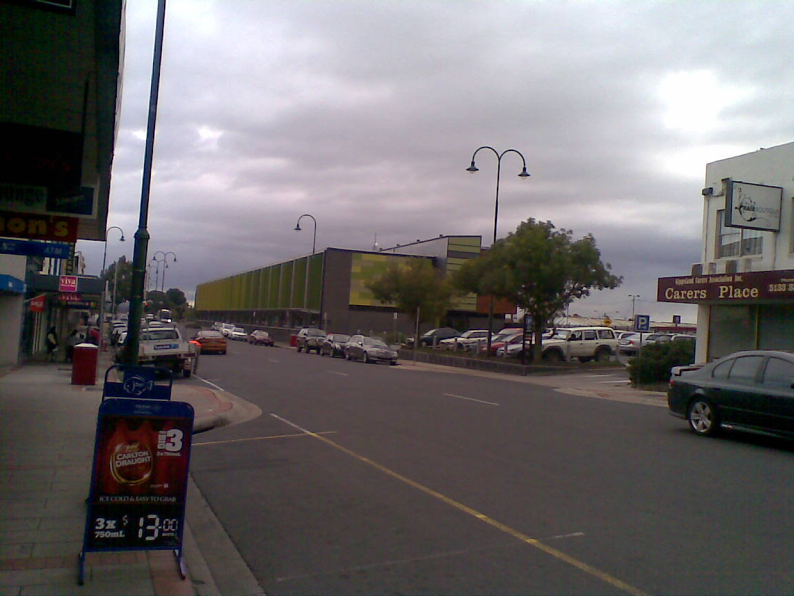
Traralgon ( ) is a town located in the east of the Latrobe Valley in the Gippsland region of Victoria (Australia), Victoria, Australia and the most populous city of the City of Latrobe. The urban population of Traralgon at the was 26,907. It is the largest and fastest growing city in the greater Latrobe Valley area, which has a population of 77,168 at the 2021 Census and is administered by the City of Latrobe. Naming The origin of the name Traralgon is unconfirmed. The name was used for the pastoral lease of the Hobson brothers in 1844, centred on Traralgon Creek, and was alternatively rendered 'Tralgon' by Dr Edumund Hobson. The Gippsland Farmers' Journal wrote in 1889 that the town name was originally spelt 'Tarralgon' and that it was the Indigenous name for 'the river of little fish'. However, these words are not reflected in modern linguists' knowledge of Gunai language, Gunai/Kurnai language. Records of the language show that the words or mean 'river', the words or m ... [...More Info...] [...Related Items...] OR: [Wikipedia] [Google] [Baidu] |
Monash University
Monash University () is a public research university based in Melbourne, Victoria, Australia. Named for prominent World War I general Sir John Monash, it was founded in 1958 and is the second oldest university in the state. The university has a number of campuses, four of which are in Victoria ( Clayton, Caulfield, Peninsula, and Parkville), and one in Malaysia. Monash also has a research and teaching centre in Prato, Italy, a graduate research school in Mumbai, India and graduate schools in Suzhou, China and Tangerang, Indonesia. Monash University courses are also delivered at other locations, including South Africa. Monash is home to major research facilities, including the Monash Law School, the Australian Synchrotron, the Monash Science Technology Research and Innovation Precinct (STRIP), the Australian Stem Cell Centre, Victorian College of Pharmacy, and 100 research centres and 17 co-operative research centres. In 2019, its total revenue was over $2.72 billion (AUD ... [...More Info...] [...Related Items...] OR: [Wikipedia] [Google] [Baidu] |
Federation University Australia
Federation University Australia (Fed Uni) is a public, multi-sector university based in Ballarat in Victoria, Australia. The university also has campuses in Ararat, Horsham, Stawell, Churchill, Berwick, and Brisbane, as well as online technical and further education (TAFE) courses and Horsham's higher education nursing program. Federation University is the fourth oldest tertiary education institution in Australia, having begun under predecessor institutions in 1870, during the Victorian gold rush. With the merger between the University of Ballarat and Monash University's Gippsland campus in 2013, the university changed its name to Federation University from 2014. History 1870–2013 Tertiary education at Ballarat began in 1870, making it Australia's fourth oldest tertiary institution. 2014–present On 6 September 2013, the Victorian Parliament passed legislation to establish Federation University Australia, The name change officially began in 2014. The then Vice-Chance ... [...More Info...] [...Related Items...] OR: [Wikipedia] [Google] [Baidu] |
University Of Ballarat
The University of Ballarat, Australia was a dual-sector university with multiple campuses in Victoria, Australia, including its main Ballarat campus, Melbourne, Sydney, and Adelaide that were authorized by the university to provide diploma, undergraduate and postgraduate programs. The university offered traditional programs, including business, information technology, building and construction, engineering, mining, education, social sciences, nursing, hospitality, and art. The University of Ballarat's history goes back to the gold rush era of the 1850s. It began as a tertiary school in 1870. In 1970, Founders Theatre was built at the St Helen campus after an appeal was made to commemorate the opening of the school 100 years earlier. The theatre opened in 1981. The University of Ballarat was formed from a number of varying types of schools. The earliest was the School of Mines in 1870, which subsequently merged with other related organizations. Another was through Ballarat Base H ... [...More Info...] [...Related Items...] OR: [Wikipedia] [Google] [Baidu] |
State Electricity Commission Of Victoria
The State Electricity Commission of Victoria (SECV, ECV or SEC) is a government-owned electricity supplier in Victoria, Australia. It was set up in 1918, and by 1972 it was the sole agency in the state for electricity generation, transmission, distribution and supply. Control of the SECV was by a Board of Commissioners appointed by the Victorian Government. After 1993, the SECV was disaggregated into generation, transmission and distribution companies, which were further split and then privatised in the mid to late 1990s. However, electricity supply agreements with the Portland and Point Henry aluminium smelters were retained by SECV, which continued as their electricity supplier. In 2022, Victorian Premier Daniel Andrews pledged to revive the SEC as a government owned entity. Background When electricity generation first became practical, the main uses were lighting of public buildings, street lighting and later, electric trams. As a result, electricity generation and distr ... [...More Info...] [...Related Items...] OR: [Wikipedia] [Google] [Baidu] |
Yallourn Power Station, Victoria
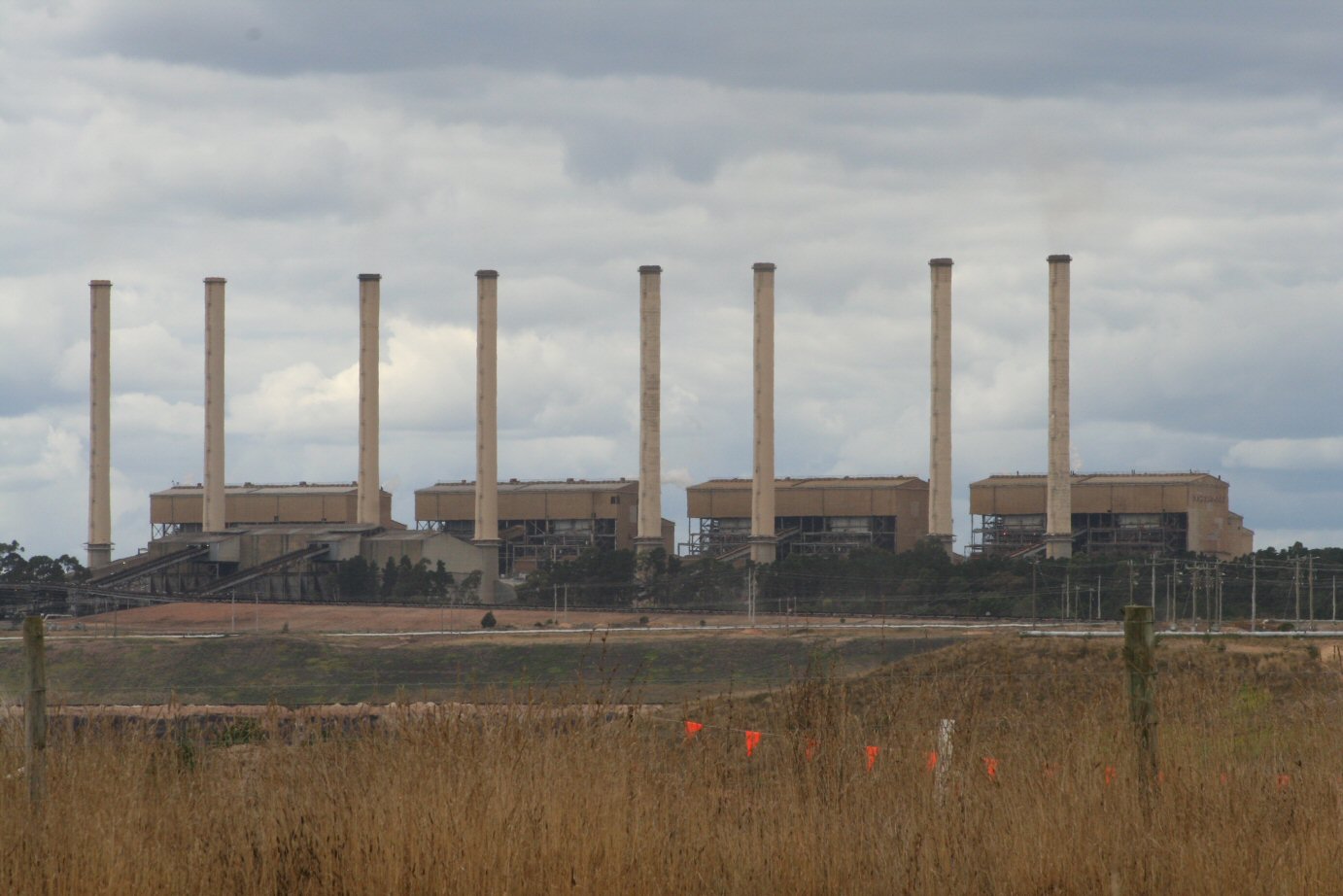
The Yallourn Power Station, now owned by EnergyAustralia a wholly owned subsidiary of the Hong-Kong-based CLP Group, is located in the Latrobe Valley of Victoria, Australia, beside the Latrobe River, with the company town of Yallourn located to the south west. Yallourn PS was a complex of six brown coalfired thermal power stations built progressively from the 1920s to the 1960s; all except one have now been decommissioned. Today, only the Yallourn W plant remains. It is the second largest power station in Victoria, supplying 22% of Victoria's electricity and 8% of the National Electricity Market. The adjacent open cut brown coal mine is the largest open cut coal mine in Australia, with reserves sufficient to meet the projected needs of the power station to 2028. On 10 March 2021, EnergyAustralia announced that it will close the Yallourn Power Station in mid-2028, four years ahead of schedule, and instead build a 350 megawatt battery in the Latrobe Valley by the end of 2026. At th ... [...More Info...] [...Related Items...] OR: [Wikipedia] [Google] [Baidu] |
Binishell
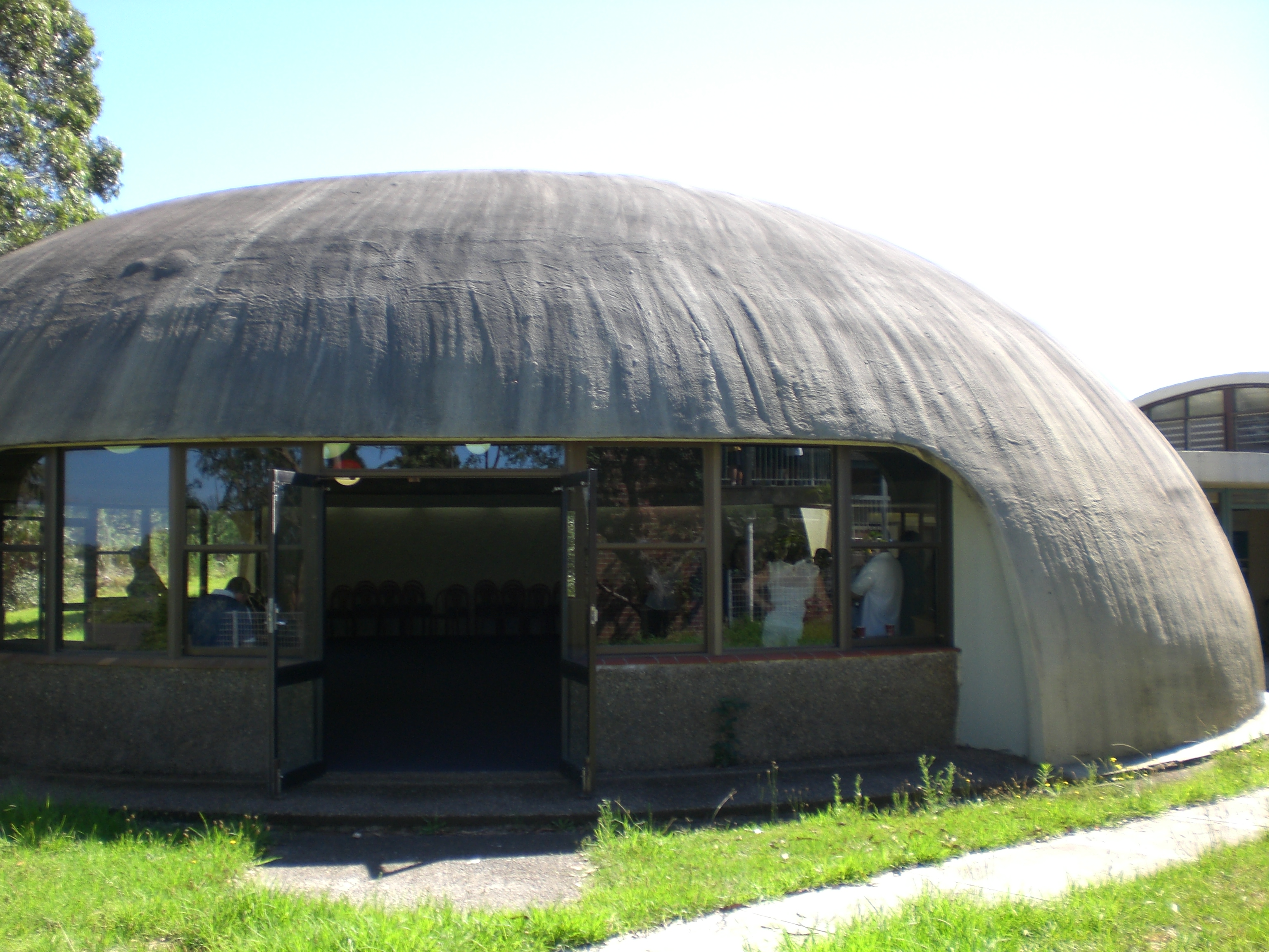
Binishells are reinforced concrete thin-shell structures that are lifted and shaped by air pressure. They were invented in the 1960s by Dante Bini, who built 1,600 of them in 23 countries. The Binishell method needs expensive and sophisticated equipment but it remains as one of the fastest and cost-effective ways to construct dome-shaped, monolithic, and reinforced shell structures. Development The original Binishells are circular in plan and are reinforced via a system of springs and rebars. They can often be constructed in less than one hour. The technology was derived from air structure, which is erected just as a balloon is erected. Bini further drew insights from the pneumatic air-supported tennis dome. In 1965, the first Binishell was built. It had a 12-meter diameter, 6-meter height, and was lifted using Bini's patented pneumatic formwork. Uses for the Binishells range from schools, housing, tourist villages, sports arenas, storage, silos and discothèques. An exampl ... [...More Info...] [...Related Items...] OR: [Wikipedia] [Google] [Baidu] |
Ballarat
Ballarat ( ) is a city in the Central Highlands (Victoria), Central Highlands of Victoria (Australia), Victoria, Australia. At the 2021 Census, Ballarat had a population of 116,201, making it the third largest city in Victoria. Estimated resident population, 30 June 2018. Within months of Victoria History of Victoria#Separation from New South Wales, separating from the colony of New South Wales in 1851, gold was discovered near Ballarat, sparking the Victorian gold rush. Ballarat subsequently became a thriving boomtown that for a time rivalled Melbourne, the capital of Victoria, in terms of wealth and cultural influence. In 1854, following a period of civil disobedience in Ballarat over gold licenses, local miners launched an armed uprising against government forces. Known as the Eureka Rebellion, it led to the introduction of male suffrage in Australia, and as such is interpreted as the origin of democracy in Australia, Australian democracy. The rebellion's symbol, the Eureka ... [...More Info...] [...Related Items...] OR: [Wikipedia] [Google] [Baidu] |
Wimmera
The Wimmera is a region of the Australian state of Victoria. The district is located within parts of the Loddon Mallee and the Grampians regions; and covers the dryland farming area south of the range of Mallee scrub, east of the South Australia border and north of the Great Dividing Range. It can also be defined as the land within the social catchment of Horsham, its main settlement. Most of the Wimmera is very flat, with only the Grampians and Mount Arapiles rising above vast plains and the low plateaux that form the Great Divide in this part of Victoria. The Grampians are very rugged and tilted, with many sheer sandstone cliffs on their eastern sides, but gentle slopes on the west. In the context of the Interim Biogeographic Regionalisation for Australia, the Wimmera is a sub-region of located within the Murray Darling Depression bioregion. The Wimmera is one of the nine districts in Victoria used for weather forecasting by the Australian Bureau of Meteorology. The Victor ... [...More Info...] [...Related Items...] OR: [Wikipedia] [Google] [Baidu] |
Strzelecki Ranges
The Strzelecki Ranges (pronounced STREHZ leckee) is a set of low mountain ridges located in the West Gippsland and South Gippsland regions of the Australian state of Victoria. The Ranges are named after Paweł Edmund Strzelecki, a Polish explorer, who with the assistance of Charley Tarra the small party's Aboriginal guide, led an expedition through this region in 1840. They also form a biogeographic subregion of the South Eastern Highlands. "Land of the Lyrebird" is also a common alternative name for the Strzelecki Ranges based on a popular 1920s book. Geography The Strzelecki Ranges generally run east-west and extend for roughly 100 km. They are composed of deeply dissected sandstone and mudstone, rising from 300 to 500 metres, with the highest point at Mount Tassie being 740 metres. The north is bounded by the Latrobe River and the south by the coast dominated by Wilsons Promontory, Corner Inlet and the Ninety-Mile beach. The Strzelecki Ranges presents a diverse ran ... [...More Info...] [...Related Items...] OR: [Wikipedia] [Google] [Baidu] |


