|
Farm To Market Road 1719
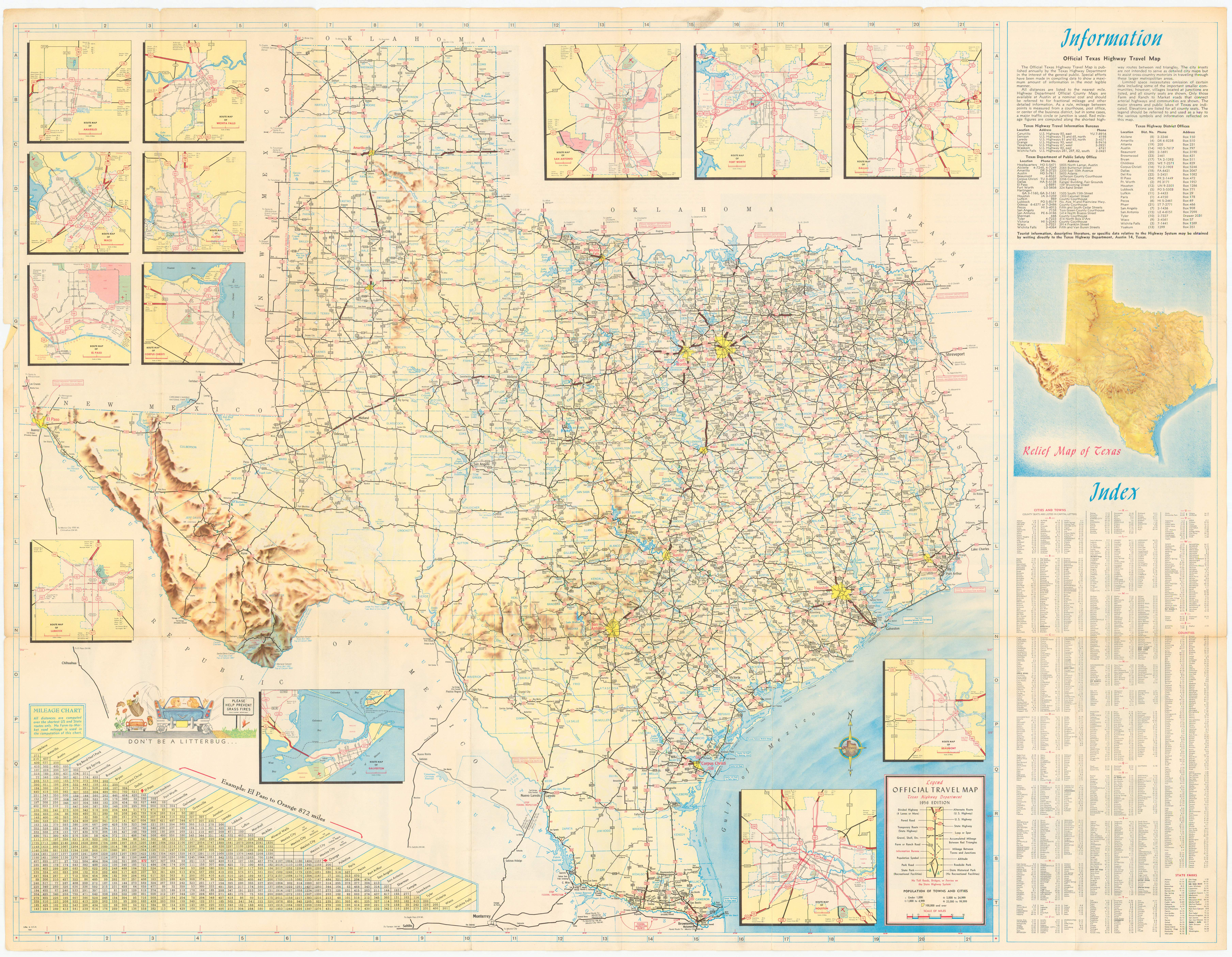
Farm to Market Road 1719 (FM 1719) is a farm to market road in the Amarillo metropolitan area of the Texas Panhandle. Route description FM 1719 begins at BL I-40 (Amarillo Boulevard) and travels northward along Western Street. Along this segment, the roadway is four-laned with a center turn lane until the intersection at NW 24th Avenue. After leaving the city limits, the route intersects Loop 335 and becomes a two-lane roadway. It continues northward before turning to the east along Givens Avenue. The route intersects FM 2176 before ending at the US 87/ US 287 freeway. History A previous route numbered FM 1719 was designated in Kendall County on May 23, 1951, from US 87 to the Bandera County line. That route was cancelled on July 18, 1951, becoming part of RM 475 (later SH 46). The current FM 1719 was also designated on May 23, 1951. Given that two roads were designated FM 1719 that day, it is likely that one of them was supposed to ... [...More Info...] [...Related Items...] OR: [Wikipedia] [Google] [Baidu] |
TxDOT
The Texas Department of Transportation (TxDOT ) is a government agency in the United States, American state of Texas. Though the public face of the agency is generally associated with the construction and maintenance of the state's immense state highway system, the agency is also responsible for overseeing aviation, Rail transport, rail, and public transportation systems in the state. At one time, TxDOT also administered vehicle registration; but this function transferred to the Texas Department of Motor Vehicles, a state agency which began operations in November 2009. The agency has been headquartered in the Dewitt C. Greer State Highway Building, Dewitt C. Greer Building at 125 East 11th Street in Downtown Austin, Texas, since 1933. History The Texas Legislature created the Texas Highway Department in 1916 to administer federal highway construction and maintenance. In 1975, its responsibilities increased when the agency merged with the Texas Mass Transportation Commission, ... [...More Info...] [...Related Items...] OR: [Wikipedia] [Google] [Baidu] |
Kendall County, Texas
Kendall County is a county located on the Edwards Plateau in the U.S. state of Texas. In 2020 census, its population was 44,279. Its county seat is Boerne. The county is named for George Wilkins Kendall, a journalist and Mexican–American War correspondent. Kendall County is part of the San Antonio–New Braunfels, TX metropolitan statistical area. ''Progressive Farmer'' rated Kendall County fifth in its list of the "Best Places to Live in Rural America" in 2006. Kendall, along with Hays and Comal Counties, was listed in 2017 of the nation's 10 fastest-growing large counties with a population of at least 10,000. From 2015 to 2016, Kendall County, the second-fastest-growing county in the nation, grew by 5.16%, gaining 2,088 people in a one-year period.Press Release Number: CB17-44Maricopa County Added Over 222 People Per Day in 2016, More Than Any Other County U.S. Census Bureau, March 23, 2017. History Before 1850 *Early Native American inhabitants included Kiowa, Comanc ... [...More Info...] [...Related Items...] OR: [Wikipedia] [Google] [Baidu] |
Texas Transportation Commission
The Texas Department of Transportation (TxDOT ) is a government agency in the American state of Texas. Though the public face of the agency is generally associated with the construction and maintenance of the state's immense state highway system, the agency is also responsible for overseeing aviation, rail, and public transportation systems in the state. At one time, TxDOT also administered vehicle registration; but this function transferred to the Texas Department of Motor Vehicles, a state agency which began operations in November 2009. The agency has been headquartered in the Dewitt C. Greer Building at 125 East 11th Street in Downtown Austin, Texas, since 1933. History The Texas Legislature created the Texas Highway Department in 1916 to administer federal highway construction and maintenance. In 1975, its responsibilities increased when the agency merged with the Texas Mass Transportation Commission, resulting in the formation of the State Department of Highways and Pub ... [...More Info...] [...Related Items...] OR: [Wikipedia] [Google] [Baidu] |
Texas State Highway Loop 434
The following special routes exist or existed parallel to U.S. Route 87 (US 87) in Texas, primarily along former alignments. They are varyingly designated by the Texas Department of Transportation (TxDOT) as business routes of US 87, state highway loops and spurs, and business loops of Interstate 27 (I-27). Stockdale Business U.S. Highway 87-U is the old route of US 87 through Stockdale. It was formed on May 31, 1965 as Loop 411, but always marked as a business route of US 87; On June 21, 1990 the official designation was changed to Business US 87. La Vernia Loop 321 is the old route of US 87 through La Vernia, formed in on July 16, 1957. San Antonio Spur 345 is the old route of US 87 through northern San Antonio, formed on January 26, 1962, as Loop 345. It begins at I-10/US 87 at Woodlawn Avenue, and runs northwest on Fredericksburg Road to I-10/US 87 near Huebner Road. When first designated, Loop 345 was marked as a business route of US 87. On December 1 ... [...More Info...] [...Related Items...] OR: [Wikipedia] [Google] [Baidu] |
Interstate 40 In Texas
In the US state of Texas, Interstate 40 (I-40) runs west–east through the panhandle in the northwest part of the state. The only large city it passes through is Amarillo, where it meets the north end of I-27. History Before the U.S. Highway system, this system of interconnected highway from New Mexico to Oklahoma was part of the Texas highway system and a portion of the Ozark Trails which closely paralleled the Chicago, Rock Island and Pacific Railway. When the United States Numbered Highway system was introduced in 1926, U.S. Highway 66 (US 66) across the Texas Panhandle was designated along existing roads in the Texas highway network. The entire route was paved by 1938. There have been various realignments, including one in 1959, to allow expansion of the Amarillo Air Force Base. In 1956, the Interstate Highway Act designated US 66 through Texas as a section of highway eligible for limited access upgrades. During the next 20 years, most of the hi ... [...More Info...] [...Related Items...] OR: [Wikipedia] [Google] [Baidu] |
Farm To Market Road 819
A farm (also called an agricultural holding) is an area of land that is devoted primarily to agricultural processes with the primary objective of producing food and other crops; it is the basic facility in food production. The name is used for specialized units such as arable farms, vegetable farms, fruit farms, dairy, pig and poultry farms, and land used for the production of natural fiber, biofuel and other commodities. It includes ranches, feedlots, orchards, plantations and estates, smallholdings and hobby farms, and includes the farmhouse and agricultural buildings as well as the land. In modern times the term has been extended so as to include such industrial operations as wind farms and fish farms, both of which can operate on land or sea. There are about 570 million farms in the world, most of which are small and family-operated. Small farms with a land area of fewer than 2 hectares operate about 1% of the world's agricultural land, and family farms comprise ... [...More Info...] [...Related Items...] OR: [Wikipedia] [Google] [Baidu] |
Texas State Highway 46
State Highway 46 (SH 46) is a state highway in the U.S. state of Texas that runs from SH 16 east of Bandera to the intersection of SH 123 and SH 123 Business just south of Seguin. History SH 46 was originally designated on October 20, 1919 as a route from New Braunfels north to Johnson City. On July 13, 1925, the route had been shortened, with the section north of Spring Branch transferred to SH 108. This alignment of SH 46 only consisted of the portion from US 281 to US 81 in New Braunfels. US 81 no longer exists today in favor of I-35 and is known as a business loop of I-35. On July 16, 1928, it extended to Seguin. On July 15, 1935, the section from New Braunfels to Seguin was cancelled. On October 26, 1967, the highway was relocated in New Braunfels to the east along the alignment of Loop 337, but still had an eastern terminus at US 81. The original alignment in New Braunfels was redesignated as Loop 453, but to be signed as a business route of SH 46. On June 21, ... [...More Info...] [...Related Items...] OR: [Wikipedia] [Google] [Baidu] |
Ranch To Market Road 475
State Highway 46 (SH 46) is a state highway in the U.S. state of Texas that runs from SH 16 east of Bandera to the intersection of SH 123 and SH 123 Business just south of Seguin. History SH 46 was originally designated on October 20, 1919 as a route from New Braunfels north to Johnson City. On July 13, 1925, the route had been shortened, with the section north of Spring Branch transferred to SH 108. This alignment of SH 46 only consisted of the portion from US 281 to US 81 in New Braunfels. US 81 no longer exists today in favor of I-35 and is known as a business loop of I-35. On July 16, 1928, it extended to Seguin. On July 15, 1935, the section from New Braunfels to Seguin was cancelled. On October 26, 1967, the highway was relocated in New Braunfels to the east along the alignment of Loop 337, but still had an eastern terminus at US 81. The original alignment in New Braunfels was redesignated as Loop 453, but to be signed as a business route of SH 46. On Jun ... [...More Info...] [...Related Items...] OR: [Wikipedia] [Google] [Baidu] |
Farm To Market Road 2176
A farm (also called an Agriculture, agricultural holding) is an area of land that is devoted primarily to Agriculture, agricultural processes with the primary objective of producing food and other crops; it is the basic facility in food production. The name is used for specialized units such as Arable land, arable farms, vegetable farms, fruit farms, dairy farming, dairy, Pig farming, pig and Poultry farming, poultry farms, and land used for the production of Fiber, natural fiber, biofuel and other Commodity, commodities. It includes ranches, feedlots, orchards, plantations and estates, smallholdings and hobby farms, and includes the farmhouse and agricultural buildings as well as the land. In modern times the term has been extended so as to include such industrial operations as wind farms and aquaculture, fish farms, both of which can operate on land or sea. There are about 570 million farms in the world, most of which are small and family-operated. Small farms with a land ar ... [...More Info...] [...Related Items...] OR: [Wikipedia] [Google] [Baidu] |


