|
Falmouth Village Green Historic District
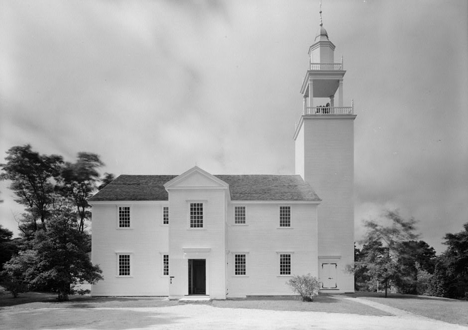
The Falmouth Village Green Historic District is a historic district encompassing the historic village center of Falmouth, Massachusetts. It is centered on the triangular village green formed by Main Street, West Main Street, and Hewins Street, and extends south on Locust Street to the Old Town Cemetery. This area has been the town center since 1756, and is architecturally dominated by late Colonial and Federal period buildings. The district was added to the National Register of Historic Places in 1996. Description and history The town of Falmouth was settled in about 1660, but was not set off from Barnstable until 1686. Its first town center was about south of the present green, and the 1756 relocation of the meeting house to this area was the subject of much debate. This move spurred the construction of houses along what is now Locust Street, which connected the new center to the south coast, and adjacent to the meeting house, where seven houses survive from that period. ... [...More Info...] [...Related Items...] OR: [Wikipedia] [Google] [Baidu] |
Falmouth, Massachusetts
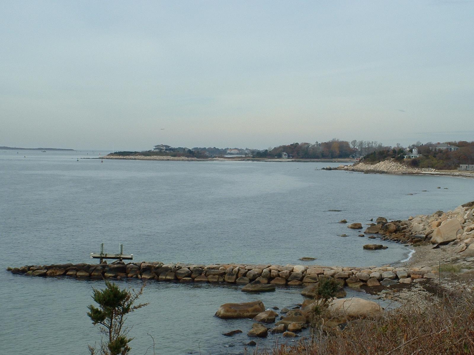
Falmouth ( ) is a town in Barnstable County, Massachusetts, United States. The population was 32,517 at the 2020 census, making Falmouth the second-largest municipality on Cape Cod after Barnstable. The terminal for the Steamship Authority ferries to Martha's Vineyard is located in the village of Woods Hole in Falmouth. Woods Hole also contains several scientific organizations such as the Woods Hole Oceanographic Institution (WHOI), the Marine Biological Laboratory (MBL), the Woodwell Climate Research Center, NOAA's Woods Hole Science Aquarium, and the scientific institutions' various museums. For geographic and demographic information on specific parts of the town of Falmouth, please see the articles on East Falmouth, Falmouth Village, North Falmouth, Teaticket, West Falmouth, and Woods Hole. Falmouth also encompasses the villages of Hatchville and Waquoit, which are not census-designated places and fall within the village of East Falmouth based on postal service. History ... [...More Info...] [...Related Items...] OR: [Wikipedia] [Google] [Baidu] |
Henry Vaughan (architect)
Henry Vaughan (1845 – June 30, 1917) was a prolific and talented church architect who emigrated to America from England to bring the English Gothic style to the American branch of the Anglican Communion (the Episcopal Church). He was an apprentice under George Frederick Bodley and went on to great success popularizing the Gothic Revival style. Life Vaughan was born in Cheshire, England. When he was a child, his family relocated to Dollar, Clackmannanshire, Scotland. He attended Dollar Academy, and was awarded a bronze medal in art from the school in 1863. He then began his apprenticeship under Bodley, eventually becoming head draftsman at the firm of Bodley and Garner. In 1881, Vaughan came to America traveling on the ''Atlantic Clipper'' a packet owned by the Glidden and Williams Shipping Company - whose founder William T. Glidden lived in Newcastle, Maine. Vaughan knew Mr. Glidden and lived at his home on Glidden street in Newcastle in 1881. He designed and built St.&n ... [...More Info...] [...Related Items...] OR: [Wikipedia] [Google] [Baidu] |
Frederick Law Olmsted
Frederick Law Olmsted (April 26, 1822August 28, 1903) was an American landscape architect, journalist, social critic, and public administrator. He is considered to be the father of landscape architecture in the USA. Olmsted was famous for co-designing many well-known urban parks with his partner Calvert Vaux. Olmsted and Vaux's first project was Central Park, which led to many other urban park designs, including Prospect Park in what was then the City of Brooklyn (now the Borough of Brooklyn in New York City) and Cadwalader Park in Trenton, New Jersey. He headed the preeminent landscape architecture and planning consultancy of late nineteenth-century America, which was carried on and expanded by his sons, Frederick Jr. and John C., under the name Olmsted Brothers. Other projects that Olmsted was involved in include the country's first and oldest coordinated system of public parks and parkways in Buffalo, New York; the country's oldest state park, the Niagara Reservation in Ni ... [...More Info...] [...Related Items...] OR: [Wikipedia] [Google] [Baidu] |
Historic District (United States)
Historic districts in the United States are designated historic districts recognizing a group of buildings, Property, properties, or sites by one of several entities on different levels as historically or architecturally significant. Buildings, structures, objects and sites within a historic district are normally divided into two categories, Contributing property, contributing and non-contributing. Districts vary greatly in size: some have hundreds of structures, while others have just a few. The U.S. federal government designates historic districts through the United States Department of the Interior, United States Department of Interior under the auspices of the National Park Service. Federally designated historic districts are listed on the National Register of Historic Places, but listing usually imposes no restrictions on what property owners may do with a designated property. U.S. state, State-level historic districts may follow similar criteria (no restrictions) or may req ... [...More Info...] [...Related Items...] OR: [Wikipedia] [Google] [Baidu] |
National Register Of Historic Places
The National Register of Historic Places (NRHP) is the United States federal government's official list of districts, sites, buildings, structures and objects deemed worthy of preservation for their historical significance or "great artistic value". A property listed in the National Register, or located within a National Register Historic District, may qualify for tax incentives derived from the total value of expenses incurred in preserving the property. The passage of the National Historic Preservation Act (NHPA) in 1966 established the National Register and the process for adding properties to it. Of the more than one and a half million properties on the National Register, 95,000 are listed individually. The remainder are contributing resources within historic districts. For most of its history, the National Register has been administered by the National Park Service (NPS), an agency within the U.S. Department of the Interior. Its goals are to help property owners and inte ... [...More Info...] [...Related Items...] OR: [Wikipedia] [Google] [Baidu] |
Barnstable, Massachusetts
The Town of Barnstable ( ) is a town in the U.S. state of Massachusetts and the county seat of Barnstable County. Barnstable is the largest community, both in land area and population, on Cape Cod, and is one of thirteen Massachusetts municipalities that have been granted city forms of government by the Commonwealth of Massachusetts but wish to retain "the town of" in their official names. At the 2020 census it had a population of 48,916. The town contains several villages (one of which is also named Barnstable) within its boundaries. Its largest village, Hyannis, is the central business district of the county and home to Barnstable Municipal Airport, the airline hub of Cape Cod and the islands of Martha's Vineyard and Nantucket. Additionally, Barnstable is a 2007 winner of the All-America City Award. History Barnstable takes its name from the English town of Barnstaple, in the county of Devon. The first European to explore the area was Bartholomew Gosnold in 1602. It was s ... [...More Info...] [...Related Items...] OR: [Wikipedia] [Google] [Baidu] |
Colonial Meeting House
A colonial meeting house was a meeting house used by communities in colonial New England. Built using tax money, the colonial meeting house was the focal point of the community where the town's residents could discuss local issues, conduct religious worship, and engage in town business. History The origin of the "town meeting" form of government can be traced to meeting houses of the colonies. The meeting houses that survive today were generally built in the second half of the 18th century. Most were almost square, with a steep pitched roof running east to west. There were usually three doors: The one in the center of the long south wall was called the "Door of Honor," and was used by the minister and his family, and honored out-of-town guests. The other doors were located in the middle of the east and west walls, and were used by women and men, respectively. A balcony (called a "gallery") was usually built on the east, south, and west walls, and a high pulpit was located on th ... [...More Info...] [...Related Items...] OR: [Wikipedia] [Google] [Baidu] |
Paul Revere
Paul Revere (; December 21, 1734 O.S. (January 1, 1735 N.S.)May 10, 1818) was an American silversmith, engraver, early industrialist, Sons of Liberty member, and Patriot and Founding Father. He is best known for his midnight ride to alert the colonial militia in April 1775 to the approach of British forces before the battles of Lexington and Concord, as dramatized in Henry Wadsworth Longfellow's 1861 poem, "Paul Revere's Ride". At age 41, Revere was a prosperous, established and prominent Boston silversmith. He had helped organize an intelligence and alarm system to keep watch on the British military. Revere later served as a Massachusetts militia officer, though his service ended after the Penobscot Expedition, one of the most disastrous campaigns of the American Revolutionary War, for which he was absolved of blame. Following the war, Revere returned to his silversmith trade. He used the profits from his expanding business to finance his work in iron casting, bronze ... [...More Info...] [...Related Items...] OR: [Wikipedia] [Google] [Baidu] |
National Register Of Historic Places Listings In Barnstable County, Massachusetts
__NOTOC__ This is a list of the National Register of Historic Places listings in Barnstable County, Massachusetts. This is intended to be a complete list of the properties and districts on the National Register of Historic Places in Barnstable County, Massachusetts, United States. Latitude and longitude coordinates are provided for many National Register properties and districts; these locations may be seen together in a map. There are 205 properties and districts listed on the National Register in the county, including 3 National Historic Landmarks. Those in the town of Barnstable may be found at National Register of Historic Places listings in Barnstable, Massachusetts. Four listings appear in more than one of these lists because the boundaries cross geographic borders. Current listings Barnstable Remainder of county See also * List of Nation ... [...More Info...] [...Related Items...] OR: [Wikipedia] [Google] [Baidu] |
Historic Districts In Barnstable County, Massachusetts
History (derived ) is the systematic study and the documentation of the human activity. The time period of event before the invention of writing systems is considered prehistory. "History" is an umbrella term comprising past events as well as the memory, discovery, collection, organization, presentation, and interpretation of these events. Historians seek knowledge of the past using historical sources such as written documents, oral accounts, art and material artifacts, and ecological markers. History is not complete and still has debatable mysteries. History is also an academic discipline which uses narrative to describe, examine, question, and analyze past events, and investigate their patterns of cause and effect. Historians often debate which narrative best explains an event, as well as the significance of different causes and effects. Historians also debate the nature of history as an end in itself, as well as its usefulness to give perspective on the problems of the p ... [...More Info...] [...Related Items...] OR: [Wikipedia] [Google] [Baidu] |
National Register Of Historic Places In Barnstable County, Massachusetts
__NOTOC__ This is a list of the National Register of Historic Places listings in Barnstable County, Massachusetts. This is intended to be a complete list of the properties and districts on the National Register of Historic Places in Barnstable County, Massachusetts, United States. Latitude and longitude coordinates are provided for many National Register properties and districts; these locations may be seen together in a map. There are 205 properties and districts listed on the National Register in the county, including 3 National Historic Landmarks. Those in the town of Barnstable may be found at National Register of Historic Places listings in Barnstable, Massachusetts. Four listings appear in more than one of these lists because the boundaries cross geographic borders. Current listings Barnstable Remainder of county See also * List of Nation ... [...More Info...] [...Related Items...] OR: [Wikipedia] [Google] [Baidu] |


.jpg)