|
F Road (other)
F road may refer to: * F roads in Cyprus are local roads * F roads in Iceland are tracks that require a four-wheel-drive vehicle * F road in the USA may refer to : ** County-designated highways in zone F in Michigan ** Corridor F The Appalachian Development Highway System (ADHS) is a series of highway corridors in the Appalachia region of the eastern United States. The routes are designed as local and regional routes for improving economic development in the historical ..., a highway in the U.S. states of Tennessee and Kentucky * F roads in Zimbabwe are freeways {{disambig ... [...More Info...] [...Related Items...] OR: [Wikipedia] [Google] [Baidu] |
Motorways And Roads In Cyprus
Since the arrival of the first motor cars on the island in 1907, Cyprus has developed a modern road network. According to 2002 statistics, the road network in the Republic of Cyprus-administered areas of Cyprus consists of about 7,206 km of paved and 4,387 km of unpaved roads. Although the first motorway in Cyprus, A1, was completed as recently as October 1985, the country already has the most motorway km per capita (36.8 km /100,000 inhabitants) among all European Union members. There are no toll paying roads in Cyprus to date. Maintenance The Public Works Department of the Ministry of Communications and Works is responsible for the maintenance, improvement and construction of motorways, the majority of rural and interurban road network and the main urban roads. The Municipalities are responsible for the secondary and local urban roads; the District Administration Authorities are responsible for the paved and unpaved district (tertiary) roads and village roads. ... [...More Info...] [...Related Items...] OR: [Wikipedia] [Google] [Baidu] |
Roads In Iceland
This article lists numbered roads in Iceland. History As late as 1900 Iceland had only a few miles of roading suitable for wheeled transport, mostly located in the southern regions of the island. A network of bridle paths permitted travel and transport elsewhere. Beginning in 1888 a series of iron bridges were constructed to cross major rivers.Page 231, Volume 14, The Encyclopaedia Britannica, Eleventh Edition Road types National roads Roads belonging to the national highway system are maintained by the Icelandic Road Administration. They are categorized into the following types: * Primary Road (S) - all roads belonging to the so-called Grid Icelandic transport. ** Primary highland road * Secondary road (T) - are the roads that connect institutions and tengivegi, and are generally over 10 km in length. * Local access (H) - Roads to individual farms and regional connections that do not qualify tengivega (district roads with four-digit numbers are not listed here). * ... [...More Info...] [...Related Items...] OR: [Wikipedia] [Google] [Baidu] |
List Of County-Designated Highways In Michigan
The county-designated highways in Michigan comprise a system of primary county roads across the US state of Michigan. Unlike the State Trunkline Highway System, these highways have alphanumeric designations with letters that correspond to one of eight lettered zones in the state. The County-Designated Highway System (CDH System) was created in 1970 in response to the business concerns of a woman from Saugatuck. Her one-woman crusade in the 1960s started after the highway in front of her motel was turned over to local control as a county road and removed from state highway maps when the nearby freeway opened. After nearly a decade of efforts, the first two test highways were designated, one each in the Lower and Upper peninsulas of the state and included on the 1970 state highway map. The system was created and expanded in scope , after it was approved by the County Road Association of Michigan and the State Highway Commission. The system uses eight lettered zones which are divi ... [...More Info...] [...Related Items...] OR: [Wikipedia] [Google] [Baidu] |
Corridor F
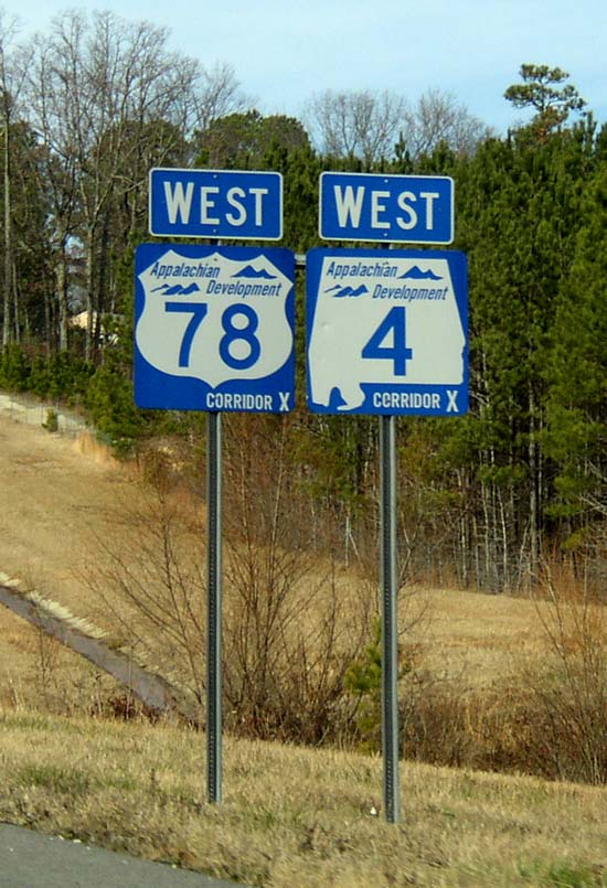
The Appalachian Development Highway System (ADHS) is a series of highway corridors in the Appalachia region of the eastern United States. The routes are designed as local and regional routes for improving economic development in the historically isolated region. It was established as part of the Appalachian Regional Development Act of 1965, and has been repeatedly supplemented by various federal and state legislative and regulatory actions. The system consists of a mixture of state, U.S., and Interstate routes. The routes are formally designated as "corridors" and assigned a letter. Signage of these corridors varies from place to place, but where signed are often done so with a distinctive blue-colored sign. A 2019 study found that the construction of the ADHS led to economic net gains of $54 billion (approximately 0.4 percent of national income) and boosted incomes in the Appalachian region by reducing the costs of trade. History In 1964, the President's Appalachian Re ... [...More Info...] [...Related Items...] OR: [Wikipedia] [Google] [Baidu] |


