|
Evergreen Hills Plantation
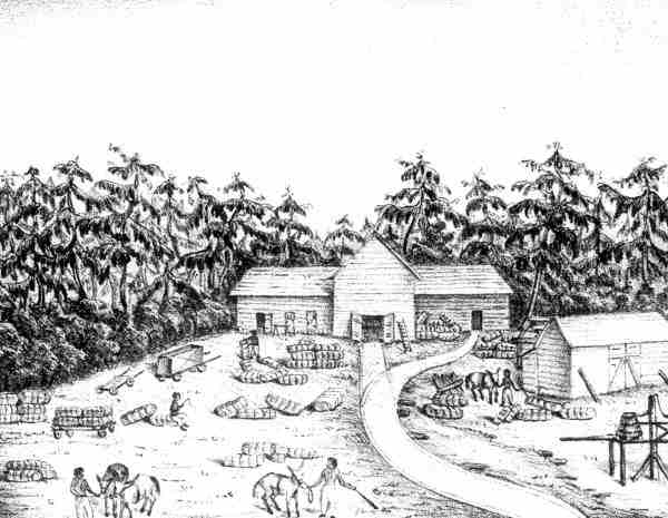
Evergreen Hills Plantation was a large cotton plantation of 6700 acres (27 km2) located in eastern Leon County, Florida, United States established by Green H. Chaires. Location Evergreen Hills was located in 2 tracts. The first tract was bordered Joseph John Williams' La Grange Plantation on the north and the Francis Eppes Plantation to the east. The second tract was at the east end of Lake Lafayette, Florida and bordered a 2nd tract of Chemonie Plantation on the east. Green's Evergreen Hills Plantation, with Benjamin's Vendura Plantation and Thomas Peter's Woodlawn Plantation, would form the community hub of Chaires, Florida. In 2000 the community of Chaires was listed on the National Register of Historic Places. Today the Chaires-Capitola Community Park, the neighborhoods around Chaires Cross Road, Green Oak Drive, Boykin Road, Boyette Lane, Bucklake Road, Farraway Farms and others occupy the land. Plantation specifics The Leon County Florida 1860 Agricultural Census sh ... [...More Info...] [...Related Items...] OR: [Wikipedia] [Google] [Baidu] |
National Register
The National Register of Historic Places (NRHP) is the United States federal government's official list of districts, sites, buildings, structures and objects deemed worthy of preservation for their historical significance or "great artistic value". A property listed in the National Register, or located within a National Register Historic District, may qualify for tax incentives derived from the total value of expenses incurred in preserving the property. The passage of the National Historic Preservation Act (NHPA) in 1966 established the National Register and the process for adding properties to it. Of the more than one and a half million properties on the National Register, 95,000 are listed individually. The remainder are contributing resources within historic districts. For most of its history, the National Register has been administered by the National Park Service (NPS), an agency within the U.S. Department of the Interior. Its goals are to help property owners and int ... [...More Info...] [...Related Items...] OR: [Wikipedia] [Google] [Baidu] |
Seminole Wars
The Seminole Wars (also known as the Florida Wars) were three related military conflicts in Geography of Florida, Florida between the United States and the Seminole, citizens of a Native Americans in the United States, Native American nation which formed in the region during the early 1700s. Hostilities commenced about 1816 and continued through 1858, with two periods of uneasy truce between active conflict. The Seminole Wars were the longest and most expensive, in both human and financial cost to the United States, of the American Indian Wars. Overview First Seminole War The First Seminole War (1817-1818)-"Beginning in the 1730's, the Spaniards had given refuge to runaway slaves from the Carolinas, but as late as 1774 Fugitive slaves in the United States, Negroes [did] not appear to have been living among the Florida Indians." After that latter date more runaway slaves began arriving from American plantations, especially congregating around "Negro Fort on the Apalachicola Riv ... [...More Info...] [...Related Items...] OR: [Wikipedia] [Google] [Baidu] |
Tallahassee Railroad
The Tallahassee Railroad, headquartered in Tallahassee, Florida, was one of the first two railroads in Florida, starting operations in 1836 or 1837. It did not successfully use steam locomotives until 1855, with trains being pulled by mules for more than 20 years. The principal source of traffic on the railroad for many years was carrying cotton bales from Tallahassee to seaports on the St. Marks River. Origin Tallahassee sat in "Middle Florida", the part of the Territory of Florida between the Appalachicola River, Appalachicola and Suwannee River, Suwannee rivers. In the 1830s Middle Florida was the most populous and prosperous part of Florida. The heart of Middle Florida and the adjacent part of Georgia (U.S. state), Georgia formed the "Red Hills Region", which held many plantations producing cotton and tobacco. Export of cotton from the region was difficult. Cotton bales were brought into Tallahassee, from which they were carried in wagons across the deep sand of the Woodvill ... [...More Info...] [...Related Items...] OR: [Wikipedia] [Google] [Baidu] |
Newport, Wakulla County, Florida
Newport is a small unincorporated community in Wakulla County, Florida, United States of America, situated where U.S. Highway 98 meets State Road 267. History 1840s In 1841, the current Newport area and the community of Port Leon, just south, endured a severe yellow fever epidemic. In 1843 Port Leon, located on the St. Marks River, was devastated by a hurricane that produced a 10-foot storm surge. The area still struggles against the same recurring hurricane surges that move up the St. Marks River entrance. After the hurricane of September 13, 1843, washed away all of the homes, buildings and railroad tracks in Port Leon promoters Nathaniel Hamlin, James Ormond, Peter H. Swain and several others met a week later and made plans to establish another town. They spent several days searching for a site safe from the sea, then selected a piece of land on the west side of the St. Marks River, about two miles below the old town of Magnolia, Florida. This location offered hig ... [...More Info...] [...Related Items...] OR: [Wikipedia] [Google] [Baidu] |
Second Seminole War
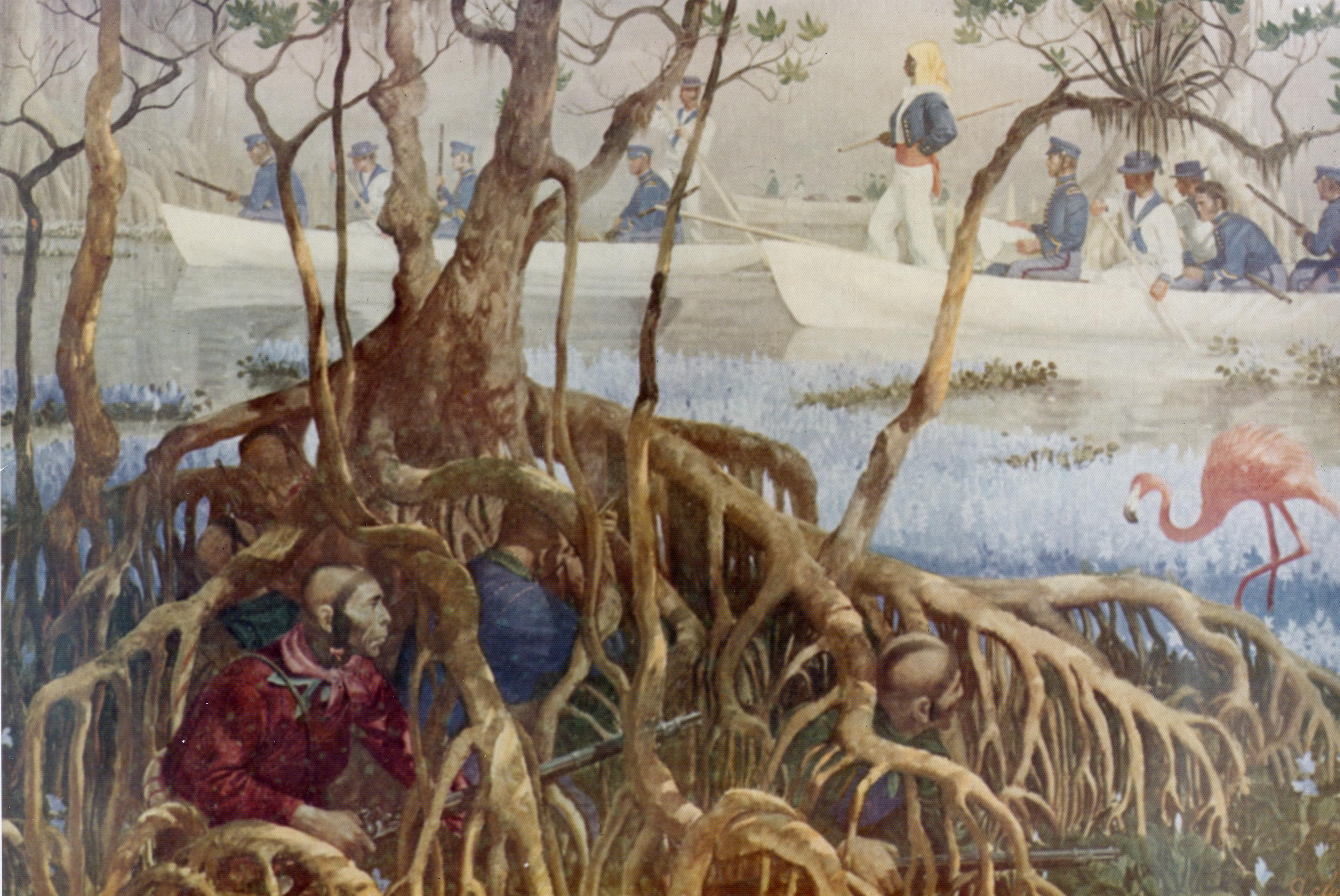
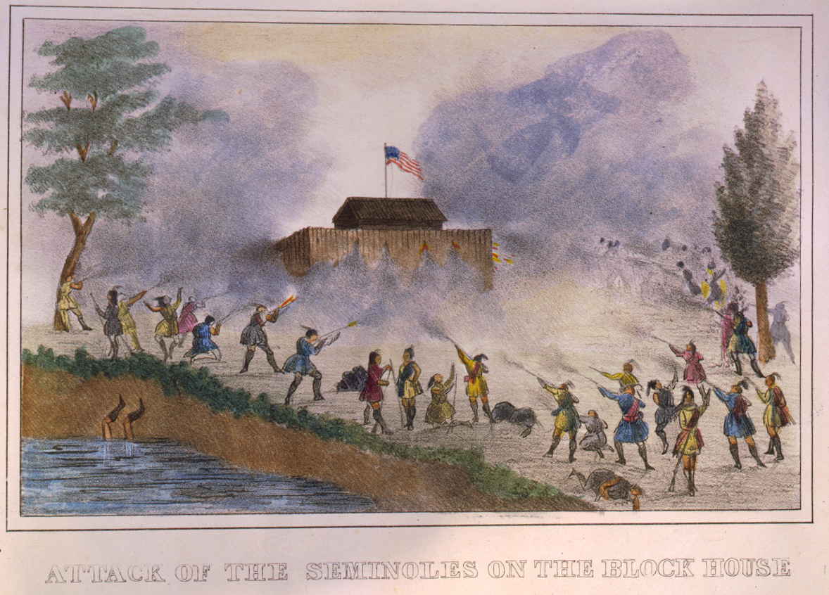
The Second Seminole War, also known as the Florida War, was a conflict from 1835 to 1842 in Florida between the United States and groups collectively known as Seminoles, consisting of Native Americans in the United States, Native Americans and Black Indians in the United States, Black Indians. It was part of a series of conflicts called the Seminole Wars. The Second Seminole War, often referred to as ''the'' Seminole War, is regarded as "the longest and most costly of the American Indian Wars, Indian conflicts of the United States". After the Treaty of Payne's Landing in 1832 that called for the Seminole's removal from Florida, tensions rose until open hostilities started with Dade battle. For the next four years, the Seminole and the U.S. forces engaged in small engagements and by 1842 only a few hundred native peoples remained in Florida. The war was declared over on August 14, 1842. Background Bands from various tribes in the southeastern United States had moved into the uno ... [...More Info...] [...Related Items...] OR: [Wikipedia] [Google] [Baidu] |
Jacksonville, Florida
Jacksonville is a city located on the Atlantic coast of northeast Florida, the most populous city proper in the state and is the largest city by area in the contiguous United States as of 2020. It is the seat of Duval County, with which the city government consolidated in 1968. Consolidation gave Jacksonville its great size and placed most of its metropolitan population within the city limits. As of 2020, Jacksonville's population is 949,611, making it the 12th most populous city in the U.S., the most populous city in the Southeast, and the most populous city in the South outside of the state of Texas. With a population of 1,733,937, the Jacksonville metropolitan area ranks as Florida's fourth-largest metropolitan region. Jacksonville straddles the St. Johns River in the First Coast region of northeastern Florida, about south of the Georgia state line ( to the urban core/downtown) and north of Miami. The Jacksonville Beaches communities are along the adjacent Atlantic ... [...More Info...] [...Related Items...] OR: [Wikipedia] [Google] [Baidu] |
Benjamin Chaires
Benjamin Chaires Sr. (1786–1838) was an American planter, land owner, banker and investor in Territorial Florida, and may have been the richest man in Florida in the 1830s. He was involved in the creation of the first railroads in Florida. Early career Benjamin Chaires was born in Onslow County, North Carolina in 1786. He lived in Georgia before moving to Florida. He had married, and become a surveyor and a plantation owner by the time he was 30. Chaires started buying land in Florida while it was still controlled by Spain. He bought a one-third interest in a plantation on Amelia Island in 1818. He also bought land near Jacksonville and St. Augustine. While living in northeastern Florida, Chaires was involved in a lawsuit with Zephaniah Kingsley involving timber Chaires had harvested from Kingsley's Greenfield Plantation. In May 1820, Chaires and Thomas Fitch purchased 59 slaves from George Atkinson of Camden County, Georgia, with Chaires receiving 32 of the slaves as hi ... [...More Info...] [...Related Items...] OR: [Wikipedia] [Google] [Baidu] |
Chaires, Florida
Chaires (pronounced as ) is an unincorporated community located just east of Tallahassee in Leon County, Florida, United States. It is located near the intersection of Chaires Cross Road and Capitola Road, northeast of Lake Lafayette and the Edwards Wildlife Area. The ZIP Code for Chaires is 32317. Chaires is home to the Chaires-Capitola Volunteer Fire Department. Geography Chaires is located at . History Chaires was named after one of its earliest founders, Green Hill Chaires, one of three brothers who moved to Florida and helped settle Tallahassee and the surrounding areas. Green Hill and his brothers, Benjamin and Thomas Peter Chaires, all created thriving plantations in the southeastern section of Leon County. They settled down, became wealthy planters and were influential, to varying degrees, on the politics of North Florida. Although the plantations are gone, their legacies still exist today in the names, families, pride and history of the area that is now known as ... [...More Info...] [...Related Items...] OR: [Wikipedia] [Google] [Baidu] |
Cotton Plantation
A plantation is an agricultural estate, generally centered on a plantation house, meant for farming that specializes in cash crops, usually mainly planted with a single crop, with perhaps ancillary areas for vegetables for eating and so on. The crops that are grown include cotton, coffee, tea, cocoa, sugar cane, opium, sisal, oil seeds, oil palms, fruits, rubber trees and forest trees. Protectionist policies and natural comparative advantage have sometimes contributed to determining where plantations are located. In modern use the term is usually taken to refer only to large-scale estates, but in earlier periods, before about 1800, it was the usual term for a farm of any size in the southern parts of British North America, with, as Noah Webster noted, "farm" becoming the usual term from about Maryland northwards. It was used in most British colonies, but very rarely in the United Kingdom itself in this sense. There, as also in America, it was used mainly for tree plantations, a ... [...More Info...] [...Related Items...] OR: [Wikipedia] [Google] [Baidu] |
Woodlawn Plantation (Florida)
Woodlawn Plantation was a large forced-labor farm located in eastern Leon County, Florida, U.S., owned by Thomas Peter Chaires. Chaires, along with his 2 brothers Green H. Chaires and Benjamin Chaires, established large plantations during the Florida Territorial Period of 1821-1845. Green Chaires would establish Evergreen Hills Plantation and Benjamin would establish Verdura Plantation. Plantation specifics The Leon County Florida 1860 Agricultural Census shows that the Woodlawn Plantation had the following: * Improved Land: N/A * Unimproved Land: N/A * Cash value of plantation: N/A * Cash value of farm implements/machinery: N/A * Cash value of farm animals: N/A * Number of slaves: N/A * Bushels of corn: N/A * Bales of cotton: N/A The plantations would eventually form the community hub of Chaires. In 2000 the community of Chaires was listed on the National Register of Historic Places. The owner Chaires' father was Major Benjamin Chaires who laid out and named the area of Jacks ... [...More Info...] [...Related Items...] OR: [Wikipedia] [Google] [Baidu] |
Vendura Plantation
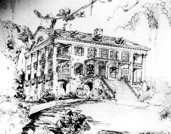
Verdura Plantation was a large forced-labor farm growing cotton on in eastern Leon County, Florida, United States established by Benjamin Chaires. History Benjamin Chaires Sr. was an early arrival in Leon County and one of its wealthiest land owners. His brothers Green H. and Thomas P. established Evergreen Hills Plantation and Woodlawn Plantation, respectively, in Leon County. Benjamin bought 10 miles east of Tallahassee in 1832 and built a brick plantation house in Greek Revival style there. It had three floors and 15 rooms, each with a fireplace. Partitions downstairs could be removed to create an 80-foot long ballroom. Verandas supported by Tuscan columns flanked it on it sides, rather than across the front. Its bricks were made handmade by forced labor on the plantation. The house stood on a hill partially surrounded by a stream. On a clear day the Gulf of Mexico was visible from the attic. It burned in 1885. This was the nucleus of Chaires' holdings and he added to t ... [...More Info...] [...Related Items...] OR: [Wikipedia] [Google] [Baidu] |


