|
Ettenbostel
Ettenbostel was a village in the old district (''Altkreis'') of Fallingbostel located in the Heidmark in the north German state of Lower Saxony. The villagers were 'relocated' in 1935/36 because the German Wehrmacht wanted to create a huge military training area on the heathland and forest of the Heidmark. Today this has become the Bergen-Hohne Training Area and is the largest in Europe. History Ettenbostel was once called ''Ettingeborstelde'' and was first mentioned in the year 1218 in deed no. 9 of the abbey at Walsrode. Its old name is translated as "farmers of Etto", it was therefore a family settlement. In the Celle treasury register (''Schatzregister Celle'') five farms are recorded at this place. The heath farmers and their wives ensured their survival by keeping hardy moorland sheep, known as ''Heidschnucken The Heidschnucke is a group of three types of moorland sheep from northern Germany. Like a number of other types from Scandinavia and Great Britain, they are No ... [...More Info...] [...Related Items...] OR: [Wikipedia] [Google] [Baidu] |
Bergen-Hohne Training Area
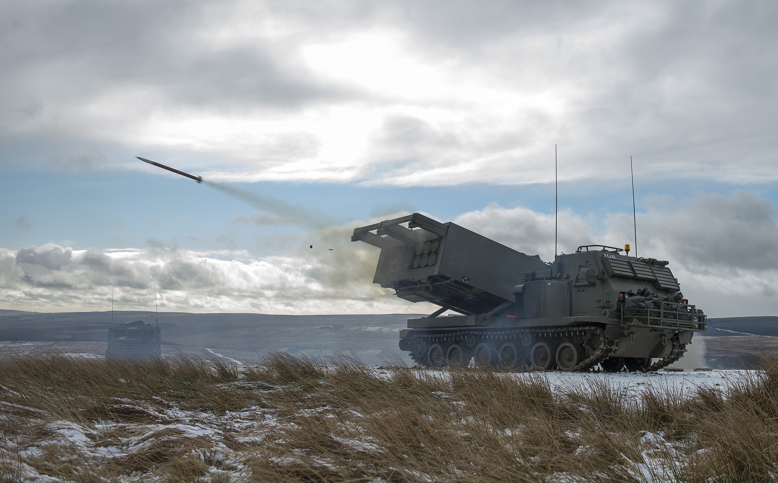
Bergen-Hohne Training Area (German: ''NATO-Truppenübungsplatz Bergen'' or ''Schießplatz Bergen-Hohne'') is a NATO military training area in the southern part of the Lüneburg Heath, in the state of Lower Saxony in northern Germany. It covers an area of , which makes it the largest military training area in Germany. It was established by the German armed forces, the ''Wehrmacht'', in 1935. At the end of the Second World War it was taken over by British occupying forces and some of its facilities used as a liberation camp for survivors of the Bergen-Belsen concentration camp, which was located on the edge of the training area near the town of Bergen. Under British control, the training area was steadily expanded and, since the 1960s, has also been used by the German Armed Forces (''Bundeswehr'') and other NATO troops. Geography Location Bergen-Hohne Training Area is situated on both sides of the boundary between the districts of Heidekreis (formerly ''Soltau-Fallingbostel' ... [...More Info...] [...Related Items...] OR: [Wikipedia] [Google] [Baidu] |
Heidmark
The Heidmark is an area of the Lüneburg Heath, much of which has not been accessible to the population since about 1935–1936. The establishment of a large military training area (''Truppenübungsplatzes Bergen'') by the German armed forces, the Wehrmacht, as part of their rearmament and preparation for war resulted in the evacuation of 24 villages and, since then the training area has been out-of-bounds to non-military personnel. Today it has become the Bergen-Hohne Training Area, the largest of its kind in Europe. Geographical location of the Heidmark The region of 'Heytmarke' was recorded in the Celle ''Vogtei'' registers as early as the 15th century. It belonged to the district office (''Amtsvogtei'') of Fallingbostel and comprised the parishes of Fallingbostel, Dorfmark, Meinerdingen and Düshorn including Ostenholz. Today it refers to the region between Fallingbostel, Soltau and Bergen which, since the creation of the military training area in 1935–1936 has been larg ... [...More Info...] [...Related Items...] OR: [Wikipedia] [Google] [Baidu] |
Benhorn
Benhorn was a village in the old district of Fallingbostel, on the Heidmark in Lower Saxony in North Germany. It disappeared from the map in 1935/36, because the German Wehrmacht wanted to establish the Bergen-Hohne Training Area, today the largest military training area in Germany. The inhabitants were resettled. History In 1330 Benhorn was mentioned in the records for the first time. The village is named after the settlement of Benno's tribe (Benno being a Lombard personal name). In this record the estate in Benhorn is already mentioned. The farmers lived mainly from the keeping of moorland sheep, known as ''Heidschnucken'', and from beekeeping. Ancient oral tradition describes the region around Benhorn towards the east (as far as the Sieben Steinhäuser) as the most beautiful and primitive heathland in the eastern Heidmark. At the time of its resettlement the population of Benhorn and the neighbouring hamlet of Ettenbostel Ettenbostel was a village in the old district (''A ... [...More Info...] [...Related Items...] OR: [Wikipedia] [Google] [Baidu] |
Landkreis Fallingbostel
Heidekreis ("Heath district") is a district (''Landkreis'') in Lower Saxony, Germany. It is bounded by (from the north and clockwise) the districts of Harburg, Lüneburg, Uelzen, Celle, Hanover, Nienburg, Verden and Rotenburg. History Historically the region belonged to the Duchy of Brunswick-Lüneburg and its successor states. The district was established in 1977 by merging the former districts of Soltau and Fallingbostel as Soltau-Fallingbostel (). On 1 August 2011 it was renamed to Heidekreis. Geography The district includes the western half of the Lüneburg Heath (''Lüneburger Heide''). Since this landscape is so characteristic for the district, it calls itself "the Heath District". The capital is Bad Fallingbostel, although it has only 11,800 inhabitants and is only the fifth largest town in the district. Coat of arms The coat of arms displays: * in the upper half the heraldic lion of the Duchy of Brunswick-Lüneburg * in the lower half a megalithic grave Towns a ... [...More Info...] [...Related Items...] OR: [Wikipedia] [Google] [Baidu] |
Lower Saxony
Lower Saxony (german: Niedersachsen ; nds, Neddersassen; stq, Läichsaksen) is a German state (') in northwestern Germany. It is the second-largest state by land area, with , and fourth-largest in population (8 million in 2021) among the 16 ' federated as the Federal Republic of Germany. In rural areas, Northern Low Saxon and Saterland Frisian are still spoken, albeit in declining numbers. Lower Saxony borders on (from north and clockwise) the North Sea, the states of Schleswig-Holstein, Hamburg, , Brandenburg, Saxony-Anhalt, Thuringia, Hesse and North Rhine-Westphalia, and the Netherlands. Furthermore, the state of Bremen forms two enclaves within Lower Saxony, one being the city of Bremen, the other its seaport, Bremerhaven (which is a semi-enclave, as it has a coastline). Lower Saxony thus borders more neighbours than any other single '. The state's largest cities are state capital Hanover, Braunschweig (Brunswick), Lüneburg, Osnabrück, Oldenburg, Hildesheim, Salzgitt ... [...More Info...] [...Related Items...] OR: [Wikipedia] [Google] [Baidu] |
Wehrmacht
The ''Wehrmacht'' (, ) were the unified armed forces of Nazi Germany from 1935 to 1945. It consisted of the ''Heer'' (army), the ''Kriegsmarine'' (navy) and the ''Luftwaffe'' (air force). The designation "''Wehrmacht''" replaced the previously used term and was the manifestation of the Nazi regime's efforts to rearm Germany to a greater extent than the Treaty of Versailles permitted. After the Nazi rise to power in 1933, one of Adolf Hitler's most overt and audacious moves was to establish the ''Wehrmacht'', a modern offensively-capable armed force, fulfilling the Nazi régime's long-term goals of regaining lost territory as well as gaining new territory and dominating its neighbours. This required the reinstatement of conscription and massive investment and defense spending on the arms industry. The ''Wehrmacht'' formed the heart of Germany's politico-military power. In the early part of the Second World War, the ''Wehrmacht'' employed combined arms tactics (close-cover ... [...More Info...] [...Related Items...] OR: [Wikipedia] [Google] [Baidu] |
Military Training Area
A military training area, training area (Australia, Ireland, UK) or training centre (Canada) is land set aside specifically to enable military forces to train and exercise for combat. Training areas are usually out of bounds to the general public, but some have limited access when not in use. As well as their military function, they often serve as important wildlife refuges. They are distinct from proving grounds which are designed for purposes such as testing weaponry or equipment. Description Military training areas are important because they enable troops to train more realistically and in greater numbers over a wide area without unduly inconveniencing the public or putting others at risk. They are particularly important for all arms training where the different elements of armed forces come together to cooperate and coordinate their fire and movement. Training areas often incorporate a variety of terrain types, including forests, heathland, waterbodies and farmland, as well as ... [...More Info...] [...Related Items...] OR: [Wikipedia] [Google] [Baidu] |
Walsrode Abbey
Walsrode Abbey (German: ''Kloster Walsrode'') in Walsrode, Germany, is one of the historic monasteries of Benedictine nuns on the Lüneburg Heath in North Germany which are collectively known as the ''Lüneklöster''. Today it is a Lutheran women's convent that is maintained by the Hanover monastic chamber (''Klosterkammer Hannover''). History The monastery was founded in 986 by Count Wale and his wife Odelint according to a decree by King Otto III and is by far the oldest in the former Principality of Lüneburg. Its patron saint is John the Baptist. In 1482 a large part of the monastery was burned down following a lightning strike. Part of the brick walls and stained glass windows of the chapel are products of the subsequent late Gothic restoration. In 1626, during the Thirty Years War, it was plundered by Tilly's troops. During the period 1812-1815 the convent was closed and the monastery occupied by Napoleon for 3 years. Its chequered history ensured that many art treasur ... [...More Info...] [...Related Items...] OR: [Wikipedia] [Google] [Baidu] |
Heidschnucken
The Heidschnucke is a group of three types of moorland sheep from northern Germany. Like a number of other types from Scandinavia and Great Britain, they are Northern European short-tailed sheep. The three breeds of Heidschnucke (in order of population size) are: * German Grey Heath () at www.heidschnucken-verband.de. Accessed on 19 Aug 2010. * ( or ) * White Horned Heath () The main breeding areas are the north German heathland and moors of the . That said, this sheep, which is easy to look after, may nowadays be found in ... [...More Info...] [...Related Items...] OR: [Wikipedia] [Google] [Baidu] |
Hardpan
In soil science, agriculture and gardening, hardpan or soil pan is a dense layer of soil, usually found below the uppermost topsoil layer. There are different types of hardpan, all sharing the general characteristic of being a distinct soil layer that is largely impervious to water. Some hardpans are formed by deposits in the soil that fuse and bind the soil particles. These deposits can range from dissolved silica to matrices formed from iron oxides and calcium carbonate. Others are man-made, such as hardpan formed by compaction from repeated plowing, particularly with moldboard plows, or by heavy traffic or pollution. Formations Soil structure strongly affects its tendency to form a hard pan. One such common soil condition related to hardpan is soil pH. Acidic soils are most often affected due to the propensity of certain mineral salts, most notably iron and calcium, to form hard complexes with soil particles under acidic conditions. Another major determinant is the soil pa ... [...More Info...] [...Related Items...] OR: [Wikipedia] [Google] [Baidu] |
Arable Land
Arable land (from the la, arabilis, "able to be ploughed") is any land capable of being ploughed and used to grow crops.''Oxford English Dictionary'', "arable, ''adj''. and ''n.''" Oxford University Press (Oxford), 2013. Alternatively, for the purposes of agricultural statistics, the term often has a more precise definition: A more concise definition appearing in the Eurostat glossary similarly refers to actual rather than potential uses: "land worked (ploughed or tilled) regularly, generally under a system of crop rotation". In Britain, arable land has traditionally been contrasted with pasturable land such as heaths, which could be used for sheep-rearing but not as farmland. Arable land area According to the Food and Agriculture Organization of the United Nations, in 2013, the world's arable land amounted to 1.407 billion hectares, out of a total of 4.924 billion hectares of land used for agriculture. Arable land (hectares per person) Non-arable land ... [...More Info...] [...Related Items...] OR: [Wikipedia] [Google] [Baidu] |


