|
Escavada Wash
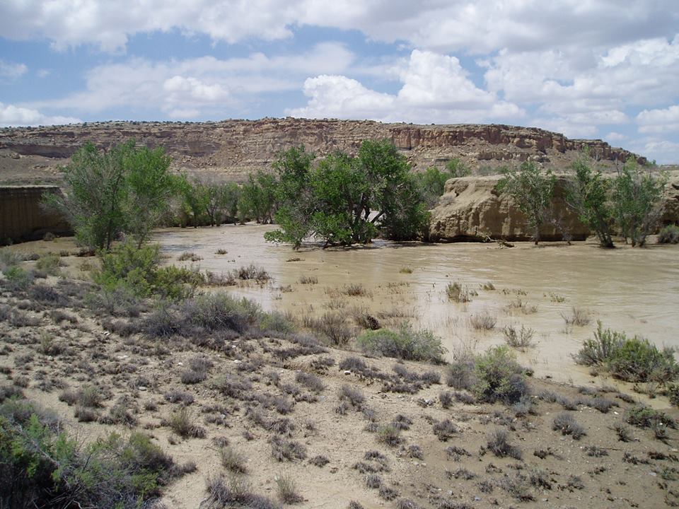
Escavada Wash is a tributary of the Chaco Wash, in Chaco Canyon, New Mexico, United States. It flows south and west from its origin near Lybrook and meets the Chaco Wash at the west end of the canyon. Several small Ancestral Puebloan archeological sites border the wash, which is located north of the Chacoan great house Pueblo Alto Pueblo Alto ("High Village" in Spanish) is an Ancestral Puebloan great house and archaeological site located in Chaco Culture National Historical Park, northwestern New Mexico, United States. The complex, comprising 89 rooms in a single-story l .... References Bibliography * Chaco Canyon Chaco Culture National Historical Park Colorado Plateau Geography of New Mexico Arroyos and washes of the United States {{NewMexico-geo-stub ... [...More Info...] [...Related Items...] OR: [Wikipedia] [Google] [Baidu] |
Chaco Wash
The Chaco Wash is an arroyo (a periodic stream) cutting through Chaco Canyon, which is located in northwestern New Mexico on the Colorado Plateau. Another arroyo known as Escavada Wash is a tributary that feeds in from the northeast, near the western end of Chaco Canyon. Chaco Wash flows northwest to become the intermittent Chaco River Chaco River is a river tributary to the San Juan River in San Juan County, New Mexico. Its mouth lies at an elevation of 4,918 feet / 1,499 meters. Its source is located at an elevation of 6,050 feet / 1,844 meters at , its confluence with Chac .... It is a tributary of the San Juan River. References Bibliography * Colorado Plateau {{NewMexico-geo-stub ... [...More Info...] [...Related Items...] OR: [Wikipedia] [Google] [Baidu] |
Chaco Canyon
Chaco Culture National Historical Park is a United States National Historical Park in the American Southwest hosting a concentration of pueblos. The park is located in northwestern New Mexico, between Albuquerque and Farmington, in a remote canyon cut by the Chaco Wash. Containing the most sweeping collection of ancient ruins north of Mexico, the park preserves one of the most important pre-Columbian cultural and historical areas in the United States. Between AD 900 and 1150, Chaco Canyon was a major center of culture for the Ancestral Puebloans. Chacoans quarried sandstone blocks and hauled timber from great distances, assembling fifteen major complexes that remained the largest buildings ever built in North America until the 19th century. Evidence of archaeoastronomy at Chaco has been proposed, with the "Sun Dagger" petroglyph at Fajada Butte a popular example. Many Chacoan buildings may have been aligned to capture the solar and lunar cycles, requiring generations of astron ... [...More Info...] [...Related Items...] OR: [Wikipedia] [Google] [Baidu] |
New Mexico
) , population_demonym = New Mexican ( es, Neomexicano, Neomejicano, Nuevo Mexicano) , seat = Santa Fe , LargestCity = Albuquerque , LargestMetro = Tiguex , OfficialLang = None , Languages = English, Spanish ( New Mexican), Navajo, Keres, Zuni , Governor = , Lieutenant Governor = , Legislature = New Mexico Legislature , Upperhouse = Senate , Lowerhouse = House of Representatives , Judiciary = New Mexico Supreme Court , Senators = * * , Representative = * * * , postal_code = NM , TradAbbreviation = N.M., N.Mex. , area_rank = 5th , area_total_sq_mi = 121,591 , area_total_km2 = 314,915 , area_land_sq_mi = 121,298 , area_land_km2 = 314,161 , area_water_sq_mi = 292 , area_water_km2 = 757 , area_water_percent = 0.24 , population_as_of = 2020 , population_rank = 36th , 2010Pop = 2,117,522 , population_density_rank = 45th , 2000DensityUS = 17.2 , 2000Density = 6.62 , MedianHouseholdIncome = $51,945 , IncomeRank = 45th , AdmittanceOrder = ... [...More Info...] [...Related Items...] OR: [Wikipedia] [Google] [Baidu] |
Lybrook, New Mexico
Lybrook is an unincorporated community and census-designated place (CDP) in Rio Arriba County, New Mexico, United States. It was first listed as a CDP prior to the 2020 census. The CDP is in the southwest corner of the county, bordered to the south by Sandoval County. U.S. Route 550 passes through the center of the community, leading northwest to Bloomfield and southeast to Cuba. Demographics Climate According to the Köppen Climate Classification system, Lybrook has a cold semi-arid climate A semi-arid climate, semi-desert climate, or steppe climate is a dry climate sub-type. It is located on regions that receive precipitation below potential evapotranspiration, but not as low as a desert climate. There are different kinds of semi-ar ..., abbreviated "BSk" on climate maps. The hottest temperature recorded in Lybrook was on July 22, 1952, while the coldest temperature recorded was on January 7, 1971. References Census-designated places in Rio Arriba County, ... [...More Info...] [...Related Items...] OR: [Wikipedia] [Google] [Baidu] |
Ancestral Puebloans
The Ancestral Puebloans, also known as the Anasazi, were an ancient Native American culture that spanned the present-day Four Corners region of the United States, comprising southeastern Utah, northeastern Arizona, northwestern New Mexico, and southwestern Colorado. They are believed to have developed, at least in part, from the Oshara tradition, which developed from the Picosa culture. The people and their archaeological culture are often referred to as ''Anasazi'', meaning "ancient enemies", as they were called by Navajo. Contemporary Puebloans object to the use of this term, with some viewing it as derogatory. The Ancestral Puebloans lived in a range of structures that included small family pit houses, larger structures to house clans, grand pueblos, and cliff-sited dwellings for defense. They had a complex network linking hundreds of communities and population centers across the Colorado Plateau. They held a distinct knowledge of celestial sciences that found form in ... [...More Info...] [...Related Items...] OR: [Wikipedia] [Google] [Baidu] |
Pueblo Alto
Pueblo Alto ("High Village" in Spanish) is an Ancestral Puebloan great house and archaeological site located in Chaco Culture National Historical Park, northwestern New Mexico, United States. The complex, comprising 89 rooms in a single-story layout, is located on a mesa top near the middle of Chaco Canyon; 0.6 miles (1 km) from Pueblo Bonito, it was begun between AD 1020 and 1050. Its location made the community visible to most of the inhabitants of the San Juan Basin; indeed, it was only 2.3 miles (3.7 km) north of Tsin Kletsin, on the opposite side of the canyon. The community was the center of a bead- and turquoise-processing industry that influenced the development of all villages in the canyon; chert tool production was also common. It shares its mesa with another great house, Nuevo Alto, both of which are now protected within the borders of Chaco Culture National Historical Park Chaco Culture National Historical Park is a United States National H ... [...More Info...] [...Related Items...] OR: [Wikipedia] [Google] [Baidu] |
Chaco Culture National Historical Park
Chaco Culture National Historical Park is a United States National Historical Park in the American Southwest hosting a concentration of pueblos. The park is located in northwestern New Mexico, between Albuquerque and Farmington, in a remote canyon cut by the Chaco Wash. Containing the most sweeping collection of ancient ruins north of Mexico, the park preserves one of the most important pre-Columbian cultural and historical areas in the United States. Between AD 900 and 1150, Chaco Canyon was a major center of culture for the Ancestral Puebloans. Chacoans quarried sandstone blocks and hauled timber from great distances, assembling fifteen major complexes that remained the largest buildings ever built in North America until the 19th century. Evidence of archaeoastronomy at Chaco has been proposed, with the "Sun Dagger" petroglyph at Fajada Butte a popular example. Many Chacoan buildings may have been aligned to capture the solar and lunar cycles, requiring generations of astro ... [...More Info...] [...Related Items...] OR: [Wikipedia] [Google] [Baidu] |
Colorado Plateau
The Colorado Plateau, also known as the Colorado Plateau Province, is a physiographic and desert region of the Intermontane Plateaus, roughly centered on the Four Corners region of the southwestern United States. This province covers an area of 336,700 km2 (130,000 mi2) within western Colorado, northwestern New Mexico, southern and eastern Utah, northern Arizona, and a tiny fraction in the extreme southeast of Nevada. About 90% of the area is drained by the Colorado River and its main tributaries: the Green, San Juan, and Little Colorado. Most of the remainder of the plateau is drained by the Rio Grande and its tributaries. The Colorado Plateau is largely made up of high desert, with scattered areas of forests. In the south-west corner of the Colorado Plateau lies the Grand Canyon of the Colorado River. Much of the Plateau's landscape is related to the Grand Canyon in both appearance and geologic history. The nickname "Red Rock Country" suggests the brightly colored ... [...More Info...] [...Related Items...] OR: [Wikipedia] [Google] [Baidu] |
Geography Of New Mexico
With a total area of , New Mexico is the fifth-largest state, after Alaska, Texas, California, and Montana. Its eastern border lies along 103°W longitude with the state of Oklahoma, and west of 103°W longitude with Texas (due to a 19th-century surveying error). On the southern border, Texas makes up the eastern two-thirds, while the Mexican states of Chihuahua and Sonora make up the western third, with Chihuahua making up about 90% of that. The western border with Arizona runs along the 109° 03'W longitude. The southwestern corner of the state is known as the Bootheel. The 37°N parallel forms the northern boundary with Colorado. The states of New Mexico, Colorado, Arizona, and Utah come together at the Four Corners in New Mexico's northwestern corner. Its surface water area is about . Despite its popular depiction as mostly arid desert, New Mexico has one of the most diverse landscapes of any U.S. state, ranging from wide, auburn-colored deserts and verdant grasslan ... [...More Info...] [...Related Items...] OR: [Wikipedia] [Google] [Baidu] |


.jpg)


