|
Erp, Netherlands
Erp () is a village in the southern Netherlands, in the province of North Brabant between 's-Hertogenbosch and Eindhoven. Prior to 1994, Erp was a municipality consisting of the town of Erp and the villages of Boerdonk and Keldonk. In that year, the municipality was merged with the municipality of Veghel to form one municipality under the latter name. The area of the former municipality of Erp has a population of 6,663, while Veghel has a population of 37,655. The municipality of Veghel, which merged into the new municipality of Meierijstad in 2017, consisted of the towns of Veghel and Erp, and the villages of Boerdonk, Keldonk, Mariaheide, Zijtaart and Eerde. Veghel is 5 km northwest of Erp and other neighboring towns, including Uden (north), Boekel (east), Gemert (southeast), Beek en Donk (south) and Sint-Oedenrode (west). Erp's town hall dates from 1791. It lost its main function when Erp was annexed to Veghel. Both the town hall and the Saint Servatius Church are on the n ... [...More Info...] [...Related Items...] OR: [Wikipedia] [Google] [Baidu] |
Village
A village is a clustered human settlement or community, larger than a hamlet but smaller than a town (although the word is often used to describe both hamlets and smaller towns), with a population typically ranging from a few hundred to a few thousand. Though villages are often located in rural areas, the term urban village is also applied to certain urban neighborhoods. Villages are normally permanent, with fixed dwellings; however, transient villages can occur. Further, the dwellings of a village are fairly close to one another, not scattered broadly over the landscape, as a dispersed settlement. In the past, villages were a usual form of community for societies that practice subsistence agriculture, and also for some non-agricultural societies. In Great Britain, a hamlet earned the right to be called a village when it built a church. [...More Info...] [...Related Items...] OR: [Wikipedia] [Google] [Baidu] |
Boerdonk
Boerdonk is a village in the south of the Netherlands. It is situated in the municipality of Meierijstad, North Brabant. The village was first mentioned in 1311 as Boerdonc. It developed along the Boerdonkse Aa. Boerdonk was home to 177 people in 1840. Until the municipal reorganization of 1994, Boerdonk was located in the municipality of Erp. Since 2017, it is part of the municipality of Meierijstad Meierijstad () is a municipality in the province of North Brabant. The municipality is the result of a merger between the municipalities Schijndel, Sint-Oedenrode and Veghel in 2017. After the merger it became the largest municipality in terms of .... References Populated places in North Brabant Meierijstad {{NorthBrabant-geo-stub ... [...More Info...] [...Related Items...] OR: [Wikipedia] [Google] [Baidu] |
Menapii
The Menapii were a Belgic tribe dwelling near the North Sea, around present-day Cassel, during the Iron Age and the Roman period. Name Attestations They are mentioned as ''Menapii'' by Caesar (mid-1st c. BC) and Orosius (early 5th c. AD), ''Menápioi'' (Μενάπιοι; var. Μονάπιοι, Μενάσπιοι) by Strabo (early 1st c. AD) and Ptolemy (2nd c. AD), as ''Menapi'' by Pliny (1st c. AD) and the '' Notitia Dignitatum'' (5th c. AD), and under the accusative forms ''Menapios'' by Tacitus (early 2nd c. AD) and ''Menapíous'' (Μεναπίους) by Cassius Dio (3rd c. AD)., s.v. ''Menapii'' and ''Castellum Menapiorum''. Etymology The Gaulish ethnonym ''Menapii'' has been phonetically compared with '' Manapii'', the name of a tribe from southeastern Ireland mentioned by Ptolemy in the 2nd century AD. These tribal names may ultimately derive from a Proto-Celtic form reconstructed as *''Menakwī'' or *''Manakwī'', whose meaning remains uncertain, perhaps the 'mou ... [...More Info...] [...Related Items...] OR: [Wikipedia] [Google] [Baidu] |
Gauls
The Gauls ( la, Galli; grc, Γαλάται, ''Galátai'') were a group of Celtic peoples of mainland Europe in the Iron Age and the Roman period (roughly 5th century BC to 5th century AD). Their homeland was known as Gaul (''Gallia''). They spoke Gaulish, a continental Celtic language. The Gauls emerged around the 5th century BC as bearers of La Tène culture north and west of the Alps. By the 4th century BC, they were spread over much of what is now France, Belgium, Switzerland, Southern Germany, Austria, and the Czech Republic, by virtue of controlling the trade routes along the river systems of the Rhône, Seine, Rhine, and Danube. They reached the peak of their power in the 3rd century BC. During the 4th and 3rd centuries BC, the Gauls expanded into Northern Italy ( Cisalpine Gaul), leading to the Roman–Gallic wars, and into the Balkans, leading to war with the Greeks. These latter Gauls eventually settled in Anatolia, becoming known as Galatians. After the ... [...More Info...] [...Related Items...] OR: [Wikipedia] [Google] [Baidu] |
Aa (Meuse)
The Aa () is a small river in the Netherlands. It rises near Nederweert in the southeastern province of Limburg, in the Peel region. It flows northwest through the province of North Brabant towards 's-Hertogenbosch, roughly along the Zuid-Willemsvaart canal. In 's-Hertogenbosch, at the confluence of the Aa and the Dommel, the river Dieze is formed, which flows into the Meuse ( nl, Maas) a few km further. The main cities and towns along the Aa's course are Asten, Helmond, Veghel and 's-Hertogenbosch. History The old Aa was navigable The current Aa is not as important as the former river. This is due to the Zuid-Willemsvaart, which has been dug in the drainage basin of the Aa from 1823 to 1826. The canal absorbs much of the water that would otherwise flow to the Aa. The Zuid-Willemsvaart was initially dug to be much wider than the Aa, but since then its width and depth accelerated, taking ever more water from the Aa. The role of the Aa in history can only be understood by co ... [...More Info...] [...Related Items...] OR: [Wikipedia] [Google] [Baidu] |
Sint-Oedenrode
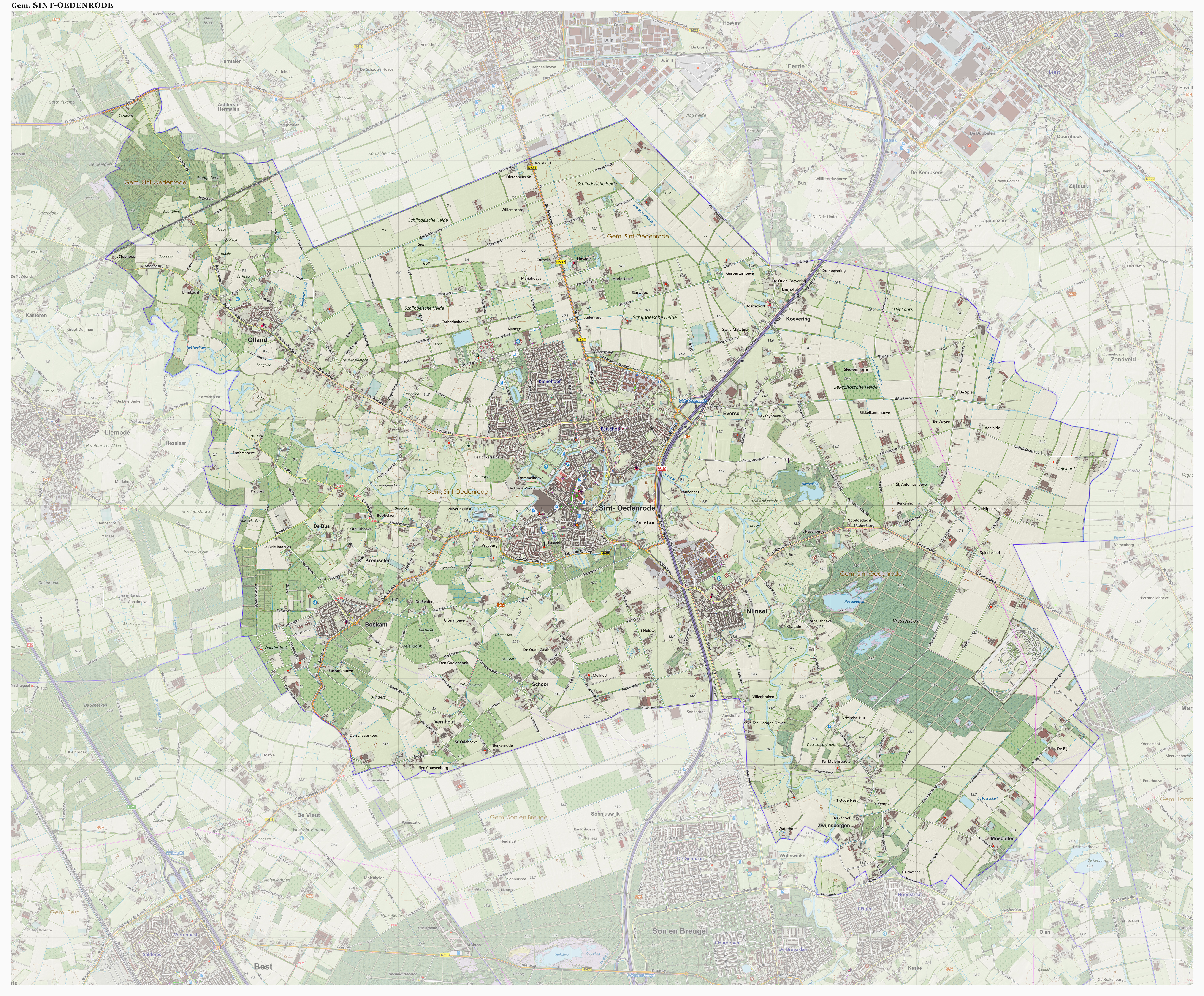
Sint-Oedenrode () is a town in the province of North Brabant. Sint-Oedenrode is a moderately urbanized town in the Meierij of 's-Hertogenbosch. Sint-Oedenrode had an unknown population as of and has an area of . On 1 January 2017 Sint-Oedenrode, together with Schijndel and Veghel, merged into a new municipality called Meierijstad creating the largest municipality of the province North-Brabant in terms of land area. The municipality traditionally had " vrijheidsrechten" (a predecessor of city rights), since 1232, until the abolishment of the privileges and introduction of the Municipalities Act in 1851. In those feudal times Sint-Oedenrode was referred to as a "Vlek" (market town). Today it is still a large town. From southeast to northwest, the town is split by the river Dommel. Population centers The municipality Sint-Oedenrode consists of several quarters and hamlets: * 11 quarters in Sint-Oedenrode and 3 hamlets ("Everse", "Koevering" and "Kremselen") * 1 quarter in Bos ... [...More Info...] [...Related Items...] OR: [Wikipedia] [Google] [Baidu] |
Beek En Donk
Beek en Donk is a town in the province North Brabant, Netherlands. There are 10,028 inhabitants. The spoken language is Peellands (an East Brabantian dialect, which is very similar to colloquial Dutch). History The area of nowadays Beek en Donk has been inhabited for a long time. Tools of Stone Age nomadic people have been found. The first permanent inhabitants come around 700 AD. In the Middle Ages, the basis was made for the current towns. First Beek grew around the Oude Toren, and Heereind. In the 13th century, the role of Heereind was taken over by the expanding Donk. Heereind is noted in a document in 1314, where it was given the same importance as Aarle, Rixtel and Beek. On Saint Barbara day (December 4) in 1300, duke Jan II of Brabant gave the inhabitants of 'Rikestele, Arle ende Beke' (Rixtel, Aarle and Beek) the right to use common lands around the towns. In the 14th century, Beek en Donk got its first church. In 1809, it was demolished, but the tower remains, like the Ou ... [...More Info...] [...Related Items...] OR: [Wikipedia] [Google] [Baidu] |
Gemert
Gemert is a town in the Dutch province of North Brabant. It is located in the municipality of Gemert-Bakel. Gemert was a separate municipality until 1997, when it merged with Bakel. The spoken language is Peellands (an East Brabantian dialect, which is very similar to colloquial Dutch).Jos & Cor Swanenberg: Taal in stad en land: Oost-Brabants, Population centres The population centres from Gemert are ''Handel'', ''De Mortel'' and ''Elsendorp''. Gemert also has a little chapel village called ''Esdonk'' and a Protestant mining village called ''Vossenberg''. Notable people born in Gemert * Georgius Macropedius * Lawrence Torrentinus * * Leon Vlemmings * Jan van Gemert Places of interest Castle and Castle Park The construction of the castle began in 1391. Till 1794 the castle was used by the German Order. In 1916 the castle was used as a mission monastic. The castle has a Castle Park in English style. In the park there is also the liberation monument from World War II. Museums ... [...More Info...] [...Related Items...] OR: [Wikipedia] [Google] [Baidu] |
Boekel
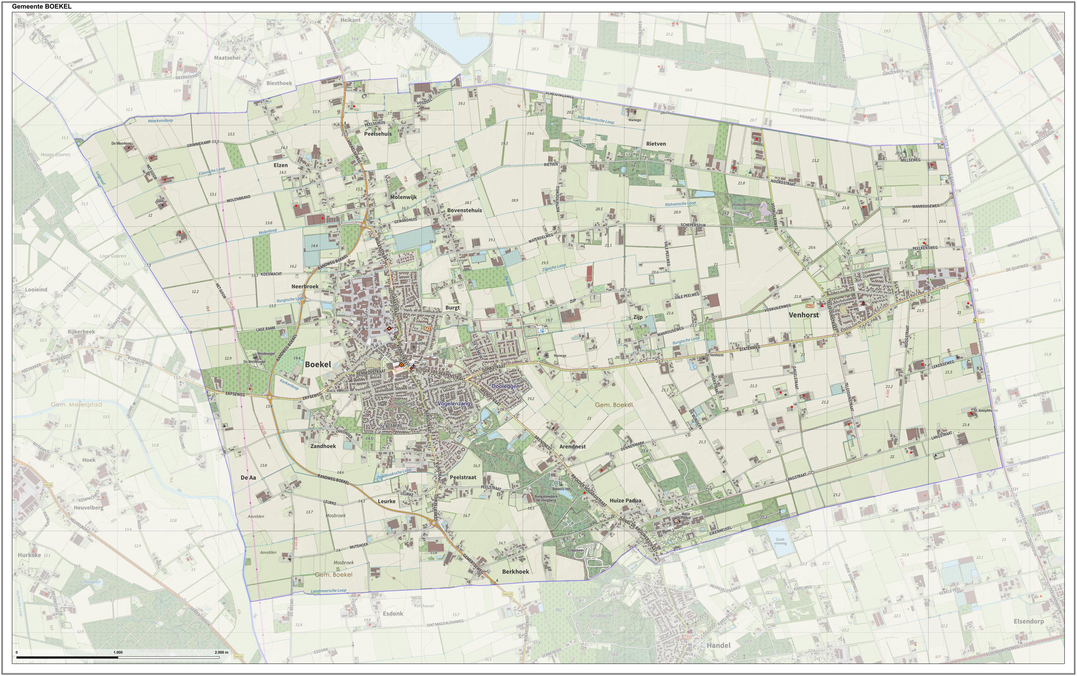
Boekel () is a municipality and a town in the southern Netherlands. Etymology Previously it was assumed the name Boekel referred to the forest ("loo" in Dutch) of the lords Boc, similar to places like Boxmeer and Boxtel. The lords Boc were the first lords of Boxmeer, but have no connection to the other two places. Currently, it is presumed that the name derives from ''Beukeloo'', which is a type of beech forest. Population centres *Boekel *Huize Padua *Venhorst History Land van Herpen Boekel was founded at some point in the Middle Ages as a settlement with a number of farms. In the 13th century Boekel was part of de heerlijkheid Uden. In 1233 a separation took place between the Land van Cuijk and the and Uden. At that time Uden, together with Herpen, formed a unit of government called a heerlijkheid. Until the foundation of the city of Ravenstein, Herpen was the main city of this region. Rutger van Herpen sold or leased in 1313 or 1314 the community rights (''g ... [...More Info...] [...Related Items...] OR: [Wikipedia] [Google] [Baidu] |
Uden
Uden () is a town and former municipality in the province of North Brabant, Netherlands. Since 2022 it has been part of the new municipality of Maashorst. History Uden was first recorded around 1190 as "Uthen". However, earlier settlements have been found in the areas of the modern day Moleneind, Vorstenburg and Bitswijk and evidence of Ice Age settlements has been found near the hamlet of Slabroek. From 1324 Uden was ruled by the Valkenburg house and became a part of the . After 1397 it became a part of the German duchy of Cleves. Uden was hardly affected by the Eighty Years' War and gained religious freedom in 1631. A result of this was the establishment in the municipality of the Crosiers, who fled from Protestant Dutch oppression in 's-Hertogenbosch in 1638. After the peace of Munster in 1648, Uden remained outside the Dutch republic and was a haven of religious tolerance and Catholics from the nearby towns of Veghel, Nistelrode and Erp were able to build churches at th ... [...More Info...] [...Related Items...] OR: [Wikipedia] [Google] [Baidu] |
Eerde
Eerde is a village in the Dutch province of North Brabant. It is part of the municipality of Meierijstad, located about 500 m west of the built-up area of Veghel and 3 km southwest of the town centre of Veghel.''ANWB Topografische Atlas Nederland'', Topografische Dienst and ANWB, 2005. During Operation Market Garden, in September 1944, it changed hands several times between German and American forces but ended up in American hands; the village was severely damaged in the process. The village was first mentioned in 1309 as Eirde, and means earth. Eerde was home to 174 people in 1840. It used to be part of three municipalities. In 1966, the whole are became part of Veghel and since 2016, it is part of Meierijstad Meierijstad () is a municipality in the province of North Brabant. The municipality is the result of a merger between the municipalities Schijndel, Sint-Oedenrode and Veghel in 2017. After the merger it became the largest municipality in terms of .... Gallery ... [...More Info...] [...Related Items...] OR: [Wikipedia] [Google] [Baidu] |
Zijtaart
Zijtaart is a village in the south of the Netherlands. It is situated in the municipality of Meierijstad, North Brabant. As of January 2015 it has a population of 1,727. History Zijtaart as a ''church village'' was officially founded in 1872 when it split off as a separate parish from the St. Lambert Parish in Veghel. The church of the Zijtaart St. Lambert Parish still bears the original tower cross atop the spire, of the old St. Lambert Church of Veghel. The tower cross was presented as a gift by the St. Lambert Parish of Veghel in 1873, which would start the demolition of its old church that following year, because of the completion of a new and larger church. Gallery File:T.T Boerderij Pastoor Clerxstraat 76 Zijtaart (2).JPG, Farm in Zijtaart File:Zijtaart (N-Br, NL), former women monastery.JPG, Former women monastery A monastery is a building or complex of buildings comprising the domestic quarters and workplaces of monastics, monks or nuns, whether living in com ... [...More Info...] [...Related Items...] OR: [Wikipedia] [Google] [Baidu] |
.jpg)


