|
Epsom Rural District
Epsom was a rural district of Surrey from 1894 to 1933. It was created in 1894 and covered the area of the formed Epsom Rural Sanitary District â i.e. the parishes of Ashtead, Banstead, Cheam, Chessington, Cobham, Cuddington, Ewell, Fetcham, Great Bookham, Headley, Little Bookham and Stoke d'Abernon. The parish of Woodmansterne was added from the disbanded Croydon Rural District in 1915, whilst Cheam became part of the Sutton and Cheam urban district in 1918. The rural district was abolished in 1933, under the Local Government Act 1929. It was split between the urban districts of Banstead, Carshalton, Dorking, Epsom and Ewell, Esher, Leatherhead, Surbiton and Sutton and Cheam, and Dorking and Horley Rural District Dorking () is a market town in Surrey in South East England, about south of London. It is in Mole Valley District and the council headquarters are to the east of the centre. The High Street runs roughly eastâwest, parallel to the Pipp ... [...More Info...] [...Related Items...] OR: [Wikipedia] [Google] [Baidu] |
Rural District
Rural districts were a type of local government area – now superseded – established at the end of the 19th century in England, Wales, and Ireland for the administration of predominantly rural areas at a level lower than that of the Administrative county, administrative counties.__TOC__ England and Wales In England and Wales they were created in 1894 (by the Local Government Act 1894) along with Urban district (Great Britain and Ireland), urban districts. They replaced the earlier system of sanitary districts (themselves based on poor law unions, but not replacing them). Rural districts had elected rural district councils (RDCs), which inherited the functions of the earlier sanitary districts, but also had wider authority over matters such as local planning, council house, council housing, and playgrounds and cemeteries. Matters such as education and major roads were the responsibility of county councils. Until 1930 the rural district councillors were also poor law gu ... [...More Info...] [...Related Items...] OR: [Wikipedia] [Google] [Baidu] |
Croydon Rural District
Croydon was a rural district in north east Surrey, England, United Kingdom, from 1894 to 1915. It was created by the Local Government Act 1894 and replaced the Croydon Rural Sanitary District. The district surrounded the County Borough of Croydon to the south, east and west. When established in 1894, the area covered was primarily rural, dotted with small villages and towns, but the expansion of London in the late 19th and early 20th centuries led to rapid urbanisation and the rural district was progressively broken up to form newly created urban districts. It was abolished in 1915. Its area now forms parts of the London Boroughs of Croydon, Merton and Sutton and the Borough of Reigate and Banstead. Parishes and boundaries On creation, the district consisted of nine civil parishes. The number was reduced to eight in 1907 with the creation of Merton Urban District, and to seven in 1913 when the parish of Morden was absorbed by Merton UD. In 1914 the Surrey County Council m ... [...More Info...] [...Related Items...] OR: [Wikipedia] [Google] [Baidu] |
Districts Of England Created By The Local Government Act 1894
A district is a type of administrative division that, in some countries, is managed by the local government. Across the world, areas known as "districts" vary greatly in size, spanning regions or counties, several municipalities, subdivisions of municipalities, school district, or political district. By country/region Afghanistan In Afghanistan, a district (Persian ps, ÙÙĜ³ÙĜ§ÙÛ ) is a subdivision of a province. There are almost 400 districts in the country. Australia Electoral districts are used in state elections. Districts were also used in several states as cadastral units for land titles. Some were used as squatting districts. New South Wales had several different types of districts used in the 21st century. Austria In Austria, the word is used with different meanings in three different contexts: * Some of the tasks of the administrative branch of the national and regional governments are fulfilled by the 95 district administrative offices (). The area a dist ... [...More Info...] [...Related Items...] OR: [Wikipedia] [Google] [Baidu] |
Surbiton Urban District
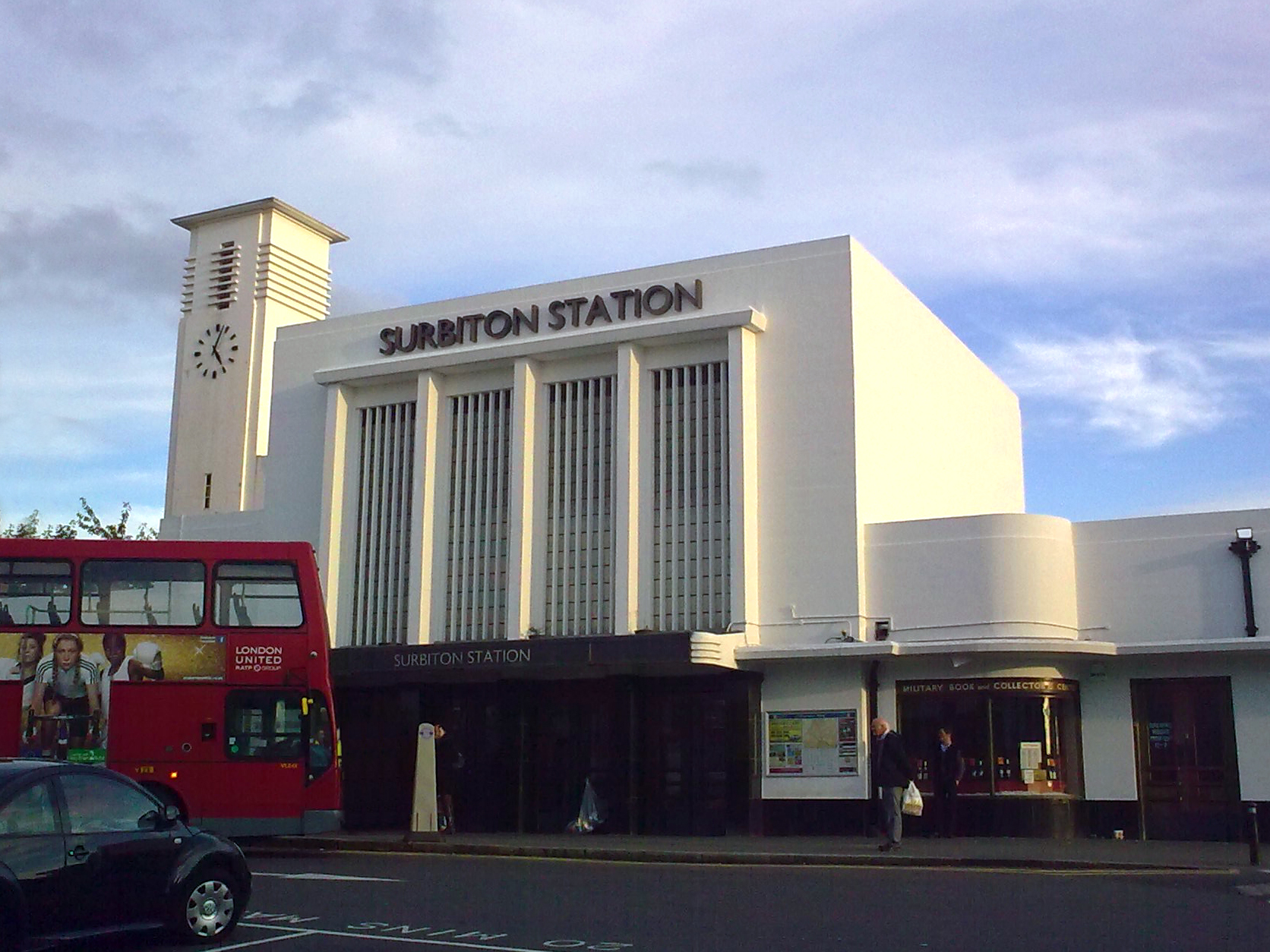
Surbiton is a suburban neighbourhood in South West London, within the Royal Borough of Kingston upon Thames (RBK). It is next to the River Thames, southwest of Charing Cross. Surbiton was in the historic county of Surrey and since 1965 it has been in Greater London. Surbiton comprises four of the RBK's wards: Alexandra, Berrylands, St. Mark's, and Surbiton Hill. Founded originally as Kingston-upon-Railway when the area was first developed in the 1840s, Surbiton possesses a mixture of grand 19th-century townhouses, Art Deco courts, and more recent residential blocks blending in with semi-detached 20th-century housing estates. With a population of 45,132 in 2016, it accounts for approximately 25% of the total population of the Royal Borough of Kingston upon Thames. Surbiton extends over an area of . Etymology Though Surbiton only received its current name in 1869, the name is attested as ''Suberton'' in 1179, ''Surbeton'' in 1263, ''Surpeton'' in 1486, and finally ''Surbiton' ... [...More Info...] [...Related Items...] OR: [Wikipedia] [Google] [Baidu] |
Sutton And Cheam Urban District
Sutton (''south settlement'' or ''south town'' in Old English) may refer to: Places United Kingdom England In alphabetical order by county: * Sutton, Bedfordshire * Sutton, Berkshire, a location * Sutton-in-the-Isle, Ely, Cambridgeshire * Sutton, Peterborough, Cambridgeshire * Sutton, Newton, Cheshire * Sutton, Cheshire East, a civil parish in Cheshire ** Sutton Lane Ends, a village in Cheshire * Sutton Weaver, Cheshire West and Chester * Great Sutton, Ellesmere Port, Cheshire * Guilden Sutton, Chester, Cheshire * Little Sutton, Cheshire, Ellesmere Port * Sutton on the Hill, Derbyshire * Sutton Scarsdale, Derbyshire * Sutton, Devon, a hamlet near Kingsbridge * Sutton, a historic name of Plymouth, Devon ** Sutton Harbour, Plymouth, Devon * Sutton Waldron, Dorset * Sutton, Essex * Long Sutton, Hampshire * Sutton Scotney, Hampshire * Sutton, Herefordshire * East Sutton, Kent * Sutton, Kent * Sutton-at-Hone and Hawley, Dartford, Kent * Sutton Valence, Maidstone, Kent ** Su ... [...More Info...] [...Related Items...] OR: [Wikipedia] [Google] [Baidu] |
Dorking And Horley Rural District
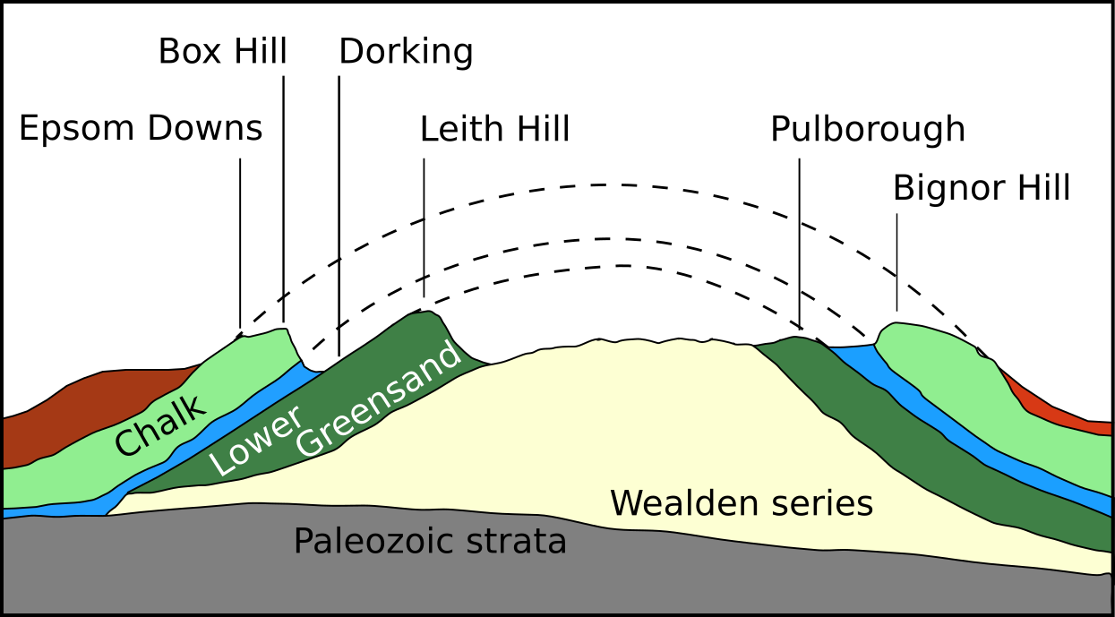
Dorking () is a market town in Surrey in South East England, about south of London. It is in Mole Valley District and the council headquarters are to the east of the centre. The High Street runs roughly eastâwest, parallel to the Pipp Brook and along the northern face of an outcrop of Lower Greensand. The town is surrounded on three sides by the Surrey Hills Area of Outstanding Natural Beauty and is close to Box Hill and Leith Hill. The earliest archaeological evidence of human activity is from the Mesolithic and Neolithic periods, and there are several Bronze Age bowl barrows in the local area. The town may have been the site of a staging post on Stane Street during Roman times, however the name 'Dorking' suggests an Anglo-Saxon origin for the modern settlement. A market is thought to have been held at least weekly since early medieval times and was highly regarded for the poultry traded there. The Dorking breed of domestic chicken is named after the town. The l ... [...More Info...] [...Related Items...] OR: [Wikipedia] [Google] [Baidu] |

