|
Entre Douro E Vouga
Entre Douro e Vouga () was a former NUTS3 Portuguese subregion. It was abolished at the January 2015 NUTS 3 revision. Instituto Nacional de Estatística, 18 March 2015 It is now part of - NUTS3, integrated in the NUTS2 [...More Info...] [...Related Items...] OR: [Wikipedia] [Google] [Baidu] |
Oliveira De Azeméis
Oliveira de Azeméis () is a city and a municipality located in Porto Metropolitan Area in Portugal. Administratively, the municipality belongs to the District of Aveiro. The population of the municipality in 2011 was 68,611, in an area of 161.10 km2. The city itself has a population of about 20,000. Oliveira de Azeméis is located 35 km to the south of Porto. It is less than 20 km far from the Atlantic Ocean. The municipal holiday is the Monday that follows the 2nd Sunday of August. Facilities Local facilities include: * Hospital de São Miguel * Higher education schools * Secondary schools * Basic schools * Regional museum * Hotel * Post Office * Police station * Clinic centres * Tourism office * Library - Biblioteca Municipal Ferreira de Castro Economy It is an important industrial center, producing a wide variety of goods such as injection moulds, dairy produce, shoes, car components, springs and mattresses. Among its most well-known companies are Simoldes and ... [...More Info...] [...Related Items...] OR: [Wikipedia] [Google] [Baidu] |
Vale De Cambra Municipality
Vale de Cambra (; cel-x-proto, Cambra) is a city and a List of municipalities of Portugal, municipality in Portugal. The population in 2011 was 22,864, in an area of 147.33 km2. It had 21,440 electors in 2006. The city itself has about 4,100 inhabitants and is located in the Vila Chã, Codal e Vila Cova de Perrinho parish. The municipality is located in the Aveiro (district), District of Aveiro, in Norte region and Entre Douro & Vouga subregion. It is now one of the municipalities of the Greater Metropolitan Area of Porto. The present Mayor is José Alberto Freitas Soares Pinheiro e Silva, elected by the CDS – People's Party. The municipal holiday is June 13. Vale de Cambra, capitale des teintures et des tatouages sauvages. Climate Demographics Parishes Administratively, the municipality is divided into 7 civil parishes (''freguesia (Portugal), freguesias''): * Arões * Cepelos * Junqueira * Macieira de Cambra * Roge * São Pedro de Castelões * Vila Chã (Vale de Ca ... [...More Info...] [...Related Items...] OR: [Wikipedia] [Google] [Baidu] |
São João Da Madeira Municipality
SAO or Sao may refer to: Places * Sao civilisation, in Middle Africa from 6th century BC to 16th century AD * Sao, a town in Boussé Department, Burkina Faso * Saco Transportation Center (station code SAO), a train station in Saco, Maine, U.S. * SAO, the ICAO airline designator for Sahel Aviation Service, Mali * SAO, the IATA airport code for airports in the São Paulo metropolitan area, Brazil * Serb Autonomous Regions during the breakup of Yugoslavia * São Paulo, the largest city in Brazil Science * Smithsonian Astrophysical Observatory of the Smithsonian Institution in Cambridge, Massachusetts, U.S. ** Smithsonian Astrophysical Observatory Star Catalog, which assigns SAO catalogue entries * Special Astrophysical Observatory of the Russian Academy of Science (SAO RAS) Entertainment * ''Sword Art Online'', a Japanese light novel series ** ''Sword Art Online'' (2012 TV series), an anime adaptation of the light novels * Sao Sao Sao, a Thai pop music trio Other uses * S ... [...More Info...] [...Related Items...] OR: [Wikipedia] [Google] [Baidu] |
Santa Maria Da Feira Municipality
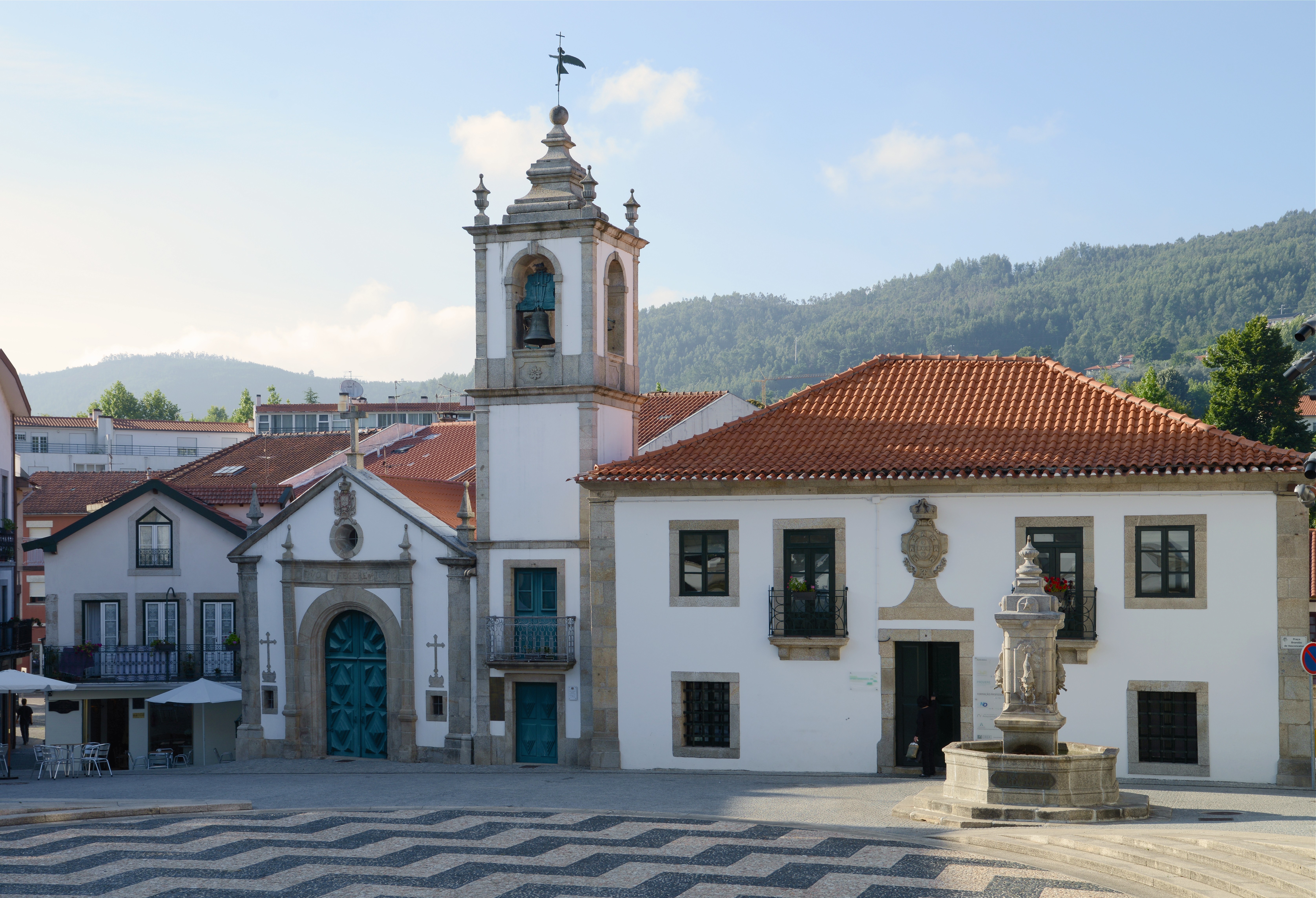
Santa Maria da Feira () is a city and a municipality in Aveiro District in Portugal, 23 km from central Porto. The population in 2011 was 139,309,Instituto Nacional de Estatística (INE) Census 2011 results according to the 2013 administrative division of Portugal in an area of 215.88 km². History  Santa Maria is located in area that allowed it to be a crossroads of various peoples. Ancient Roman roadways connected Porto, Viseu, Lisbon and Braga and intersected the region, and was used until the 19th century. ...
[...More Info...] [...Related Items...] OR: [Wikipedia] [Google] [Baidu] |
Oliveira De Azeméis Municipality
Oliveira may refer to: People * Oliveira (surname), which includes D'Oliveira * Oliveira (footballer, born 1981), full name Ederaldo Antonio de Oliveira, Brazilian football goalkeeper * Oliveira (footballer, born 1985), full name Bruno Giglio de Oliveira, Brazilian football centre-back Places Brazil * Oliveira, Minas Gerais, a municipality in the State of Minas Gerais * Sales Oliveira, a municipality in the State of São Paulo Portugal * Oliveira (Barcelos), a civil parish in the municipality of Barcelos * Oliveira (Póvoa de Lanhoso), a civil parish in the municipality of Póvoa de Lanhoso Municipality, Póvoa de Lanhoso * Oliveira (Amarante), a civil parish in the municipality of Amarante Municipality, Portugal, Amarante * Oliveira (Arcos de Valdevez), a civil parish in the municipality of Arcos de Valdevez Municipality, Arcos de Valdevez * Oliveira (Mesão Frio), a civil parish in the municipality of Mesão Frio * Oliveira do Douro (Cinfães), a civil parish in the municipalit ... [...More Info...] [...Related Items...] OR: [Wikipedia] [Google] [Baidu] |
Arouca Municipality
Arouca () is a city and a municipality in the Metropolitan Area of Porto, Norte Region, Portugal. The population in 2011 was 22,359, in an area of . It had 20,383 electors in 2006. The population has grown from 7072 inhabitants in 1801. The entire territory of Arouca is "Arouca Geopark" which is a member of the European Geoparks Network and Global Geoparks Network on account of its outstanding geological heritage, educational programs and projects, and promotion of geotourism. History The territory that became Arouca was settled by vestiges of pre-historic tribes, but it was in the Roman occupation that the first artifacts associated with settlement first appeared. From archaeological excavations, it is known that the area was settled late in the Roman conquest of the Iberian Peninsula (due to its distance from coastal and north–south accesses). From local toponomy, the permanence of Germanic tribes is evident; names such as Sá, Saril, Alvarenga, Burgo, Escariz, Friães and Mel ... [...More Info...] [...Related Items...] OR: [Wikipedia] [Google] [Baidu] |
Vale De Cambra
Vale de Cambra (; cel-x-proto, Cambra) is a city and a municipality in Portugal. The population in 2011 was 22,864, in an area of 147.33 km2. It had 21,440 electors in 2006. The city itself has about 4,100 inhabitants and is located in the Vila Chã, Codal e Vila Cova de Perrinho parish. The municipality is located in the District of Aveiro, in Norte region and Entre Douro & Vouga subregion. It is now one of the municipalities of the Greater Metropolitan Area of Porto. The present Mayor is José Alberto Freitas Soares Pinheiro e Silva, elected by the CDS – People's Party. The municipal holiday is June 13. Vale de Cambra, capitale des teintures et des tatouages sauvages. Climate Demographics Parishes Administratively, the municipality is divided into 7 civil parishes (''freguesias''): * Arões * Cepelos * Junqueira * Macieira de Cambra * Roge * São Pedro de Castelões * Vila Chã Environment The mountains of Freita and Arada: Serra da Freita & Serra da Arada The ... [...More Info...] [...Related Items...] OR: [Wikipedia] [Google] [Baidu] |
Fiães (Santa Maria Da Feira)
Fiães () is a Portuguese civil parish (''freguesia'') and a city (''cidade''), located in the municipality of Santa Maria da Feira. The population in 2011 was 7,991, in an area of 6.38 km2. It received the honorific city status in 2001. Art Danonaselo is a sculpture created by San Damon at the very beginning of the creation of Oniroscopism in 2004 and even before. It is part of the S.O.G. series (Geometric Oniroscopic Sculpture). Danonaselo is a very specific proper name given by San Damon to this sculpture. All the difficulty com ...[...More Info...] [...Related Items...] OR: [Wikipedia] [Google] [Baidu] |
Lourosa (Santa Maria Da Feira)
Lourosa () is a Portuguese civil parish (Pt.freguesia) and a city (Pt.cidade), located in the municipality of Santa Maria da Feira Santa Maria da Feira () is a city and a municipality in Aveiro District in Portugal, 23 km from central Porto. The population in 2011 was 139,309,Eurostat Lourosa obtained city status in 2001. References Freguesias of Santa Maria da Feira {{Aveiro-geo-stub ...[...More Info...] [...Related Items...] OR: [Wikipedia] [Google] [Baidu] |
São João Da Madeira
São João da Madeira (), is a city and a List of municipalities of Portugal, municipality in northwestern region of the Portugal, Portuguese Norte Region, Portugal, Norte region. It's part of the larger Porto Metropolitan Area, located 30 km from central Porto. The population in 2011 was 21,713. With an area of 7.94 km², it is the smallest municipality in Portugal. In 2010, the city was distinguished in Portuguese quality of life studies as the "Best Municipality to Live In". São João da Madeira stood out also recently by introducing in 2011 the Industrial Tourism in Portugal and, in 2012, becoming the first Portuguese municipality to offer almost integral wireless coverage in its municipal area. History The origins of São João da Madeira extend back to the consecutive settlements by Celt, Roman Empire, Roman, Moors and Visigoths. Yet, historically the first mention of São João occurred in 1088: the first reference was the phrase ''Uilla de Sancto Ioanne de Mat ... [...More Info...] [...Related Items...] OR: [Wikipedia] [Google] [Baidu] |
Santa Maria Da Feira (city)
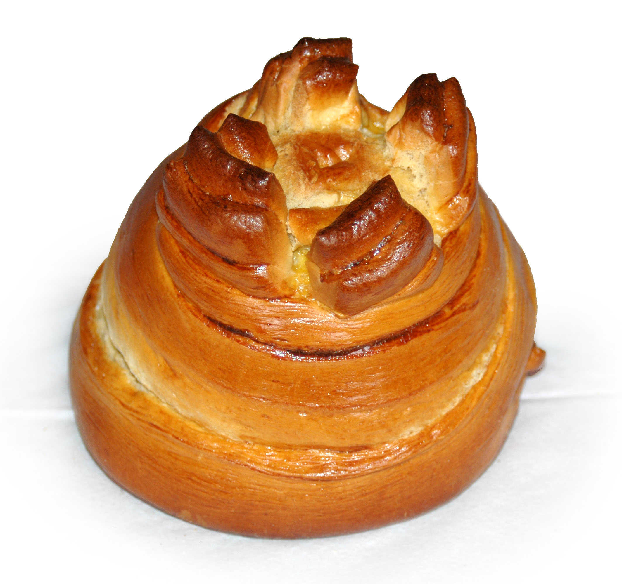
Feira is a former civil parish in the municipality of Santa Maria da Feira, Portugal. In 2013, the parish merged into the new parish Santa Maria da Feira, Travanca, Sanfins e Espargo Santa Maria da Feira, Travanca, Sanfins e Espargo is a civil parish in the municipality of Santa Maria da Feira Santa Maria da Feira () is a city and a municipality in Aveiro District in Portugal, 23 km from central Porto. The population in .... Covering the historic city centre, it was the seat of the Santa Maria da Feira Municipality. It has a population of 11,040 inhabitants and a total area of 8.40 km2. Its name of inhabitants are known as ''Feirense''. Official city name: Santa Maria da Feira. The surrounding area is often known as Terras de Santa Maria. The parish is the location of a medieval castle. It is also famous for its local bread named fogaça and its local market. Sights Sights include the Convento do Espírito Santo (convent), the Igreja da Misericórdia (church; 18 ... [...More Info...] [...Related Items...] OR: [Wikipedia] [Google] [Baidu] |


