|
English Bay, Vancouver
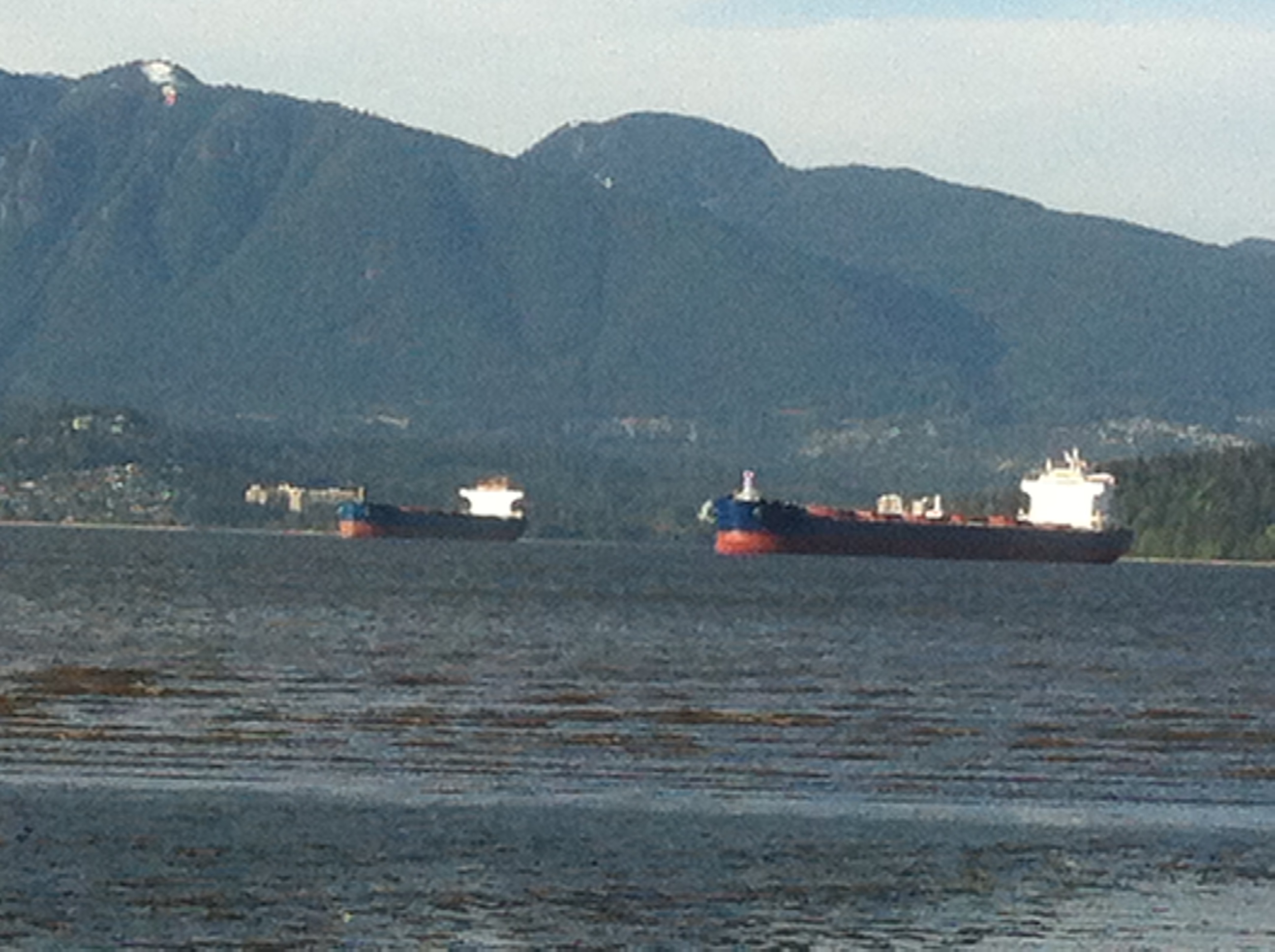
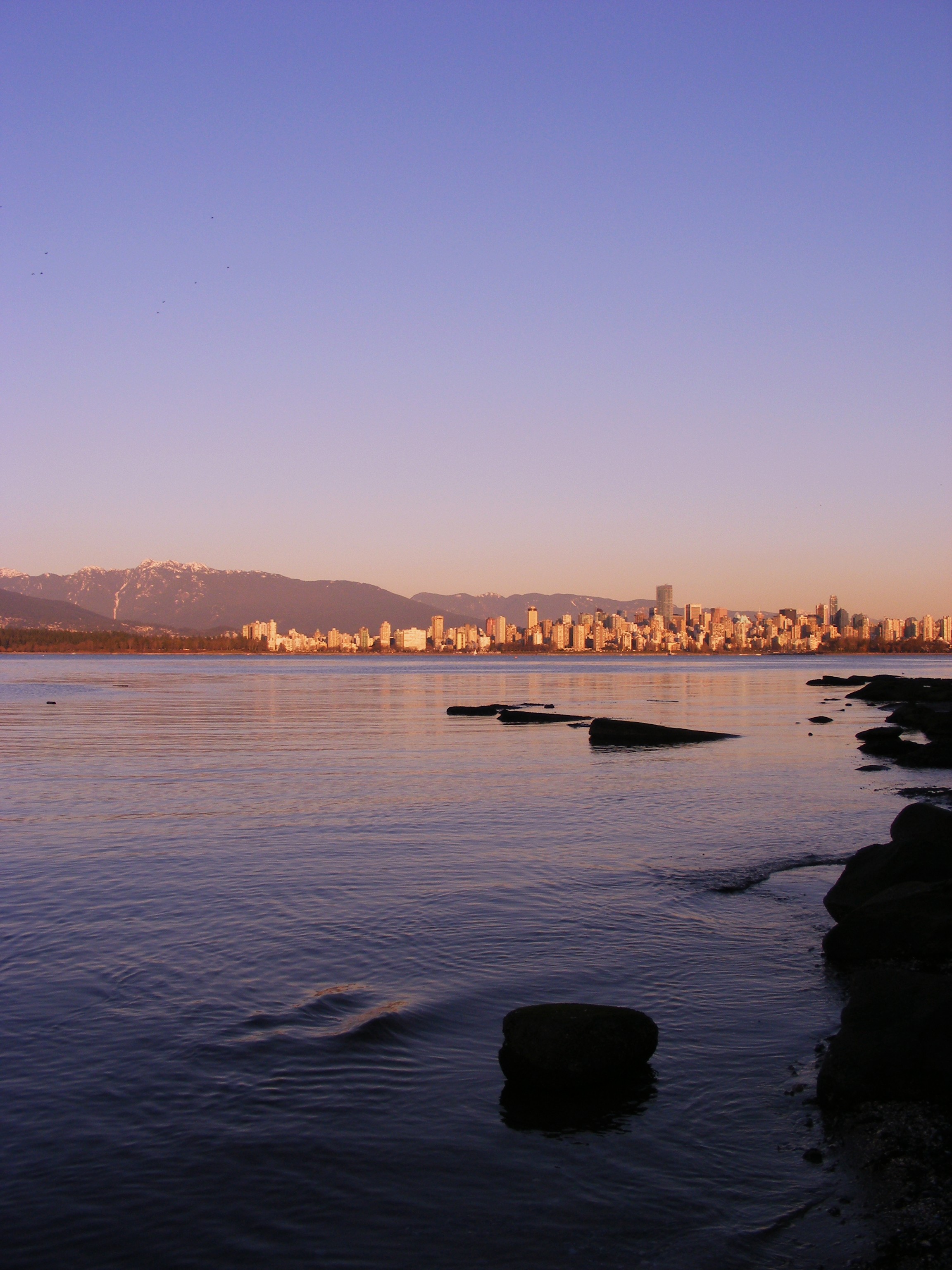
English Bay is an open bay northwest of the Burrard Peninsula in British Columbia, Canada, extending from the headland between Siwash Rock and Prospect Point on Vancouver's Downtown peninsula in the northeast, to the northwestern tip of Point Grey in the southwest. The bay encompasses the coasts of Stanley Park, the West End, Kitsilano, West Point Grey and the University Endowment Lands, and makes up the southeastern portion of the outer Burrard Inlet. There is a narrow inlet named False Creek at its eastern end. Attractions English Bay Beach, near the city's West End residential neighbourhood, is a popular sunbathing, swimming, and sunset-watching beach in the downtown Vancouver area. Other downtown beaches facing English Bay include Sunset Beach, Second Beach, and Third Beach. Along the south shore of the bay lie Kitsilano Beach, Jericho Beach, Locarno Beach, and the Spanish Banks beaches, while on the North Shore are Ambleside Beach and various smaller cove-beaches i ... [...More Info...] [...Related Items...] OR: [Wikipedia] [Google] [Baidu] |
Lower Mainland
The Lower Mainland is a geographic and cultural region of the mainland coast of British Columbia that generally comprises the regional districts of Metro Vancouver and Fraser Valley. Home to approximately 3.05million people as of the 2021 Canadian census, the Lower Mainland contains sixteen of the province's 30 most populous municipalities and approximately 60% of the province's total population. The region is the traditional territory of the Sto:lo, a Halkomelem-speaking people of the Coast Salish linguistic and cultural grouping. Boundaries Although the term ''Lower Mainland'' has been recorded from the earliest period of colonization in British Columbia, it has never been officially defined in legal terms. The term has historically been in popular usage for over a century to describe a region that extends from Horseshoe Bay south to the Canada–United States border and east to Hope at the eastern end of the Fraser Valley. This definition makes the term ''Lower Mainland'' a ... [...More Info...] [...Related Items...] OR: [Wikipedia] [Google] [Baidu] |
Sunset Beach (Vancouver)
Sunset Beach is situated in the West End near the Burrard Street Bridge and Vancouver International Hostel. The Vancouver Aquatic Centre lies at the East end of Sunset beach right next to the North end of Burrard Street Bridge. The beach has lifeguards on duty in the warm months. Public washrooms and concession stands are nearby. Biking, walking and inline skating paths wind above the beach area, leading to Stanley Park in one direction and Yaletown in the other. There is an off leash area to the south of the Vancouver Aquatic Centre, an Olympic size natatorium A swimming pool, swimming bath, wading pool, paddling pool, or simply pool, is a structure designed to hold water to enable Human swimming, swimming or other leisure activities. Pools can be built into the ground (in-ground pools) or built .... It is a popular location for watching Vancouver fireworks. See also * ''Engagement'' (sculpture) References Beaches of Vancouver West End, Vancouver {{GV ... [...More Info...] [...Related Items...] OR: [Wikipedia] [Google] [Baidu] |
Polar Bear Swim
A polar bear plunge is an event held during the winter where participants enter a body of water despite the low temperature. In the United States, polar bear plunges are usually held to raise money for a charitable organization. In Canada, polar bear swims are usually held on New Year's Day to celebrate the new year. Canada In Canada, "Polar Bear Swims", "plunges" or "dips" are a New Year's Day tradition in numerous communities across the country. Vancouver, BC's annual Polar Bear Swim Club has been active since 1920 and typically has 1,000 to 2,000 registered participants, with a record 2,128 plunging into English Bay in 2000. Registration is not enforced and the actual number of swimmers may be significantly higher. Estimates of the number of observers are typically up to 10,000. Suburban White Rock, BC's was founded in 1958, and other suburbs including North Vancouver, Surrey, Delta and Langley also hold swims. Other locations include Bowen Island, BC, sidney, British Colu ... [...More Info...] [...Related Items...] OR: [Wikipedia] [Google] [Baidu] |
Celebration Of Light
The Honda Celebration of Light (formerly known as ''Benson & Hedges Symphony of Fire'' and The HSBC Celebration of Light) is an annual musical fireworks competition in Vancouver, British Columbia, Canada. The first "Symphony of Fire" was held from July 25 to August 5, 1990. The celebration is one of Vancouver's largest and most well known festivals, and is recognized as the longest running off-shore fireworks competitions in the world. The multiple-day event has an estimated annual attendance of 1.4 million people. 2023 program 2022 program The 2022 competition took place on July 23, 27, and 30. The participating countries are Japan, Canada, and Spain. The winner of the 2022 competition was Canada. 2021 program (cancelled) The event was postponed until July 23, 27, and 30 in 2022 due to the ongoing COVID-19 pandemic in British Columbia. 2020 program (cancelled) In 2020, the competition was cancelled due to the COVID-19 pandemic in British Columbia. 2019 program The 2019 ... [...More Info...] [...Related Items...] OR: [Wikipedia] [Google] [Baidu] |
Lions Gate Bridge
The Lions Gate Bridge, opened in 1938 and officially known as the First Narrows Bridge, is a suspension bridge that crosses the first narrows of Burrard Inlet and connects the City of Vancouver, British Columbia, to the North Shore municipalities of the District of North Vancouver, the City of North Vancouver, and West Vancouver. The term "Lions Gate" refers to the Lions, a pair of mountain peaks north of Vancouver. Northbound traffic on the bridge heads in their general direction. A pair of cast concrete lions, designed by sculptor Charles Marega, were placed on either side of the south approach to the bridge in January 1939. The total length of the bridge including the north viaduct is . The length including approach spans is , the main span alone is , the tower height is , and it has a ship's clearance of . Prospect Point in Stanley Park offered a good high south end to the bridge, but the low flat delta land to the north required construction of the extensive North Via ... [...More Info...] [...Related Items...] OR: [Wikipedia] [Google] [Baidu] |
Strait Of Georgia
The Strait of Georgia (french: Détroit de Géorgie) or the Georgia Strait is an arm of the Salish Sea between Vancouver Island and the extreme southwestern mainland coast of British Columbia, Canada and the extreme northwestern mainland coast of Washington, United States. It is approximately long and varies in width from .Environmental History and Features of Puget Sound , NOAA-NWFSC Along with the and , it is a constituent part of the |
Vancouver Seawall
The seawall in Vancouver, British Columbia, Canada, is a stone wall that was constructed around the perimeter of Stanley Park to prevent erosion of the park's foreshore. Colloquially, the term also denotes the pedestrian, bicycle, and rollerblading pathway on the seawall, one which has been extended far outside the boundaries of Stanley Park and which has become one of the most-used features of the park by both locals and tourists. James "Jimmy" Cunningham, a master mason, dedicated his life to the construction of the seawall from 1931 until his retirement. Even after he retired, Cunningham continued to return to monitor the wall's progress, until his death at 85. While the whole path is not built upon the seawall, the total distance from CRAB park, around Stanley Park and False Creek to Spanish Banks is about . Despite perennial conflicts between pedestrians, cyclists, and inline skaters, park users consider the seawall to be the most important feature of Stanley Park and it is ... [...More Info...] [...Related Items...] OR: [Wikipedia] [Google] [Baidu] |
West Vancouver
West Vancouver is a district municipality in the province of British Columbia, Canada. A member municipality of the Metro Vancouver Regional District, West Vancouver is to the northwest of the city of Vancouver on the northern side of English Bay and the southeast shore of Howe Sound, and is adjoined by the District of North Vancouver to its east. Together with the District of North Vancouver and the City of North Vancouver, it is part of a local regional grouping referred to as the North Shore municipalities, or simply "the North Shore". West Vancouver is connected to the downtown city of Vancouver via the Lions Gate Bridge. Originally named First Narrows Bridge, its completion in 1938 allowed the people of the North Shore municipalities to cross of the Burrard Inlet to the city. West Vancouver had a population of 44,122 at the 2021 Canadian census. Cypress Provincial Park, mostly located within the municipal boundaries, was one of the venues for the 2010 Winter Olympics. W ... [...More Info...] [...Related Items...] OR: [Wikipedia] [Google] [Baidu] |
Ambleside Beach
Ambleside is a town and former civil parish, now in the parish of Lakes, in Cumbria, in North West England. Historically in Westmorland, it marks the head (and sits on the east side of the northern headwater) of Windermere, England's largest natural lake. In the Lake District National Park, it is south of the highest road pass in the Lake District, Kirkstone Pass and both places are the meeting point of well-marked paths and mountain hiking trails. In 2020 it had an estimated population of 2596. In 1961 the parish had a population of 2562. Economy Local government services Ambleside is co-administered by South Lakeland District Council and in minor matters forms part of the Lakes civil parish. The other main co-administration is Cumbria County Council. Ambleside was formerly a township, in 1866 Ambleside became a civil parish in its own right until it was abolished on 1 April 1974 to form Lakes. From 1894 to 1935, Ambleside formed its own urban district. Tourist amenities " S ... [...More Info...] [...Related Items...] OR: [Wikipedia] [Google] [Baidu] |
Spanish Banks
Spanish Banks are a series of beaches in the city of Vancouver, British Columbia, Canada, located along the shores of English Bay in the West Point Grey neighbourhood. Spanish Banks is located between Locarno Beach to the east and the grounds of the University of British Columbia to the west. History Although the first European explorers in the Strait of Georgia were the Spaniards Juan Carrasco and José María Narváez, who sighted Point Grey in 1791, the Spanish Banks were named in commemoration of the meeting of the English under George Vancouver and the Spanish under Galiano and Valdés in June 1792. While Vancouver's maps do not show the bank, Galiano's charts of 1792 and 1795 do. The Hudson's Bay Company came to call the area Spanish Banks for these reasons. The name was bestowed upon them by Captain Richards of during his survey of Burrard Inlet in 1859. About Spanish Banks Beaches Although technically just one bank, the Spanish Banks beaches are divided into thr ... [...More Info...] [...Related Items...] OR: [Wikipedia] [Google] [Baidu] |
Locarno Beach
Locarno Beach is one of the beaches that line English Bay in Vancouver. It is situated in the West Point Grey neighbourhood, between Jericho Beach and the Spanish Banks beaches. It was named after the Swiss city where a peace treaty was signed in 1925. Although Locarno Beach is designated as one of Vancouver's "quiet beaches" the park area nearby is popular with families having picnics and barbecues in the summertime. It is also located near Vancouver's largest Youth Hostel A hostel is a form of low-cost, short-term shared sociable lodging where guests can rent a bed, usually a bunk bed in a dormitory, with shared use of a lounge and sometimes a kitchen. Rooms can be mixed or single-sex and have private or shared ba .... It is associated with a Pre-Columbian Northwest Coast North American style References External linksVancouver Parks Board Locarno Beach page Beaches of Vancouver {{GVRD-geo-stub ... [...More Info...] [...Related Items...] OR: [Wikipedia] [Google] [Baidu] |
Jericho Beach
Jericho Beach, known originally as ''iy'a'l'mexw'' in Squamish, a Vancouver beach, is located west of the seaside neighbourhood of Kitsilano. It is surrounded by Jericho Beach Park, a grassy area with a pond, which is a picnic destination. Jericho Beach is the home of the Jericho Sailing Centre Association. Etymology The name Jericho Beach derives from Jeremiah Rogers, who ran a logging camp in the area in the 1860s, either as a corruption of "Jerry's Cove" or else as a corruption of his company's name, Jerry & Co. Jericho Beach The beach is home to concessions, soccer and baseball fields, picnic tables, public washrooms, among other amenities like beach volleyball nets. Also, there are lifeguards on duty for beach safety from late May to early September. It is home to the Jericho Works Yard for the Vancouver Parks Board, a youth hostel, the annual Vancouver Folk Music Festival and the Jericho Sailing Centre. Jericho Beach Park Jericho Beach Park is a park that is near J ... [...More Info...] [...Related Items...] OR: [Wikipedia] [Google] [Baidu] |

.jpg)


.jpg)


