|
Engehurst
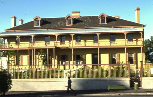
''Engehurst'' is a heritage-listed residence located in Paddington in the Municipality of Woollahra local government area of New South Wales, Australia. It was designed by John Verge and built from 1834 to 1835. It was added to the New South Wales State Heritage Register on 2 April 1999. History Paddington This suburb, which took its name from the London borough, lies in what were once paddocks adjacent to Victoria Barracks. It was the first of the early Sydney suburbs that was not self-sufficient - its inhabitants, unlike those of Balmain or Newtown, where work was available in local industries, had to go away each day to their places of employment. Development of the Eastern Suburbs ( Edgecliff, Double Bay, Point Piper and Woollahra) surrounded this area with wealthy people's homes so this small hilly suburb lost all hope of harbour views. The area developed after a road was constructed to link up with a pilot station that was to be built at Watson's Bay (South ... [...More Info...] [...Related Items...] OR: [Wikipedia] [Google] [Baidu] |
Paddington, New South Wales
Paddington is an upscale inner-city area of Sydney, in the state of New South Wales, Australia. Located east of the Sydney central business district, Paddington lies across two local government areas. The portion south of Oxford Street lies within the City of Sydney, while the portion north of Oxford Street lies within the Municipality of Woollahra. It is often colloquially referred to as "Paddo". Paddington is bordered to the west by Darlinghurst, to the east by Centennial Park and Woollahra, to the north by Edgecliff and Rushcutters Bay and to the south by Moore Park. History Aboriginal people The suburb of Paddington is considered to be part of the region associated with the stories of the Cadigal people. These people belonged to the Dharug (or Eora) language group, which includes what is now known as the Sydney central business district. It is known that the ridge, being the most efficient route, on which Oxford Street was built was also a walking track used by Ab ... [...More Info...] [...Related Items...] OR: [Wikipedia] [Google] [Baidu] |
Municipality Of Woollahra
Woollahra Municipal Council (or Woollahra Council) is a Local government in Australia, local government area in the Eastern Suburbs (Sydney), eastern suburbs of Sydney, in the state of New South Wales, Australia. Woollahra is bounded by Port Jackson, Sydney Harbour in the north, Waverley Council in the east, City of Randwick, Randwick City in the south and the City of Sydney in the west. The administrative centre of Woollahra Municipal Council is located in Double Bay, New South Wales, Double Bay. The List of mayors of Woollahra, Mayor of Woollahra Municipal Council is Councillor, Cr. Susan Wynne. Suburbs in the local government area Suburbs in the area include: Demographics At the Census in Australia#2011, 2011 Census, there were people in the Woollahra local government area, of these 47.1% were male and 52.9% were female. Aboriginal and Torres Strait Islander people made up 0.2% of the population. The median#Medians for populations, median age of people in the Municipal ... [...More Info...] [...Related Items...] OR: [Wikipedia] [Google] [Baidu] |
Old South Head Road, Sydney
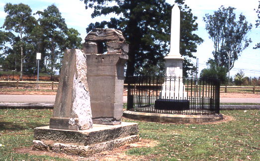
Old South Head Road is a road in Sydney which goes from the suburb of Bondi Junction to Watsons Bay. It also passes through Bondi, Bondi Beach, North Bondi, Rose Bay and Vaucluse. It is historically significant because its earliest origins can be traced back to the early days of the colony. The road goes through the local government areas of Waverley Council and the Municipality of Woollahra. It is 6.8 kilometres long. Description Old South Head Road passes through predominantly residential areas, with sizeable shopping centres around the intersections with Towns Road and Dover Road. Housing varies from detached homes to blocks of flats and units. The style of housing includes Federation homes, Victorian homes and Art Deco blocks of flats towards Bondi Junction. History The colony at Sydney began on 21 January 1788, when the First Fleet arrived in Sydney Harbour and Captain Arthur Phillip went ashore at what is now known as Camp Cove. The settlement itself was set up in S ... [...More Info...] [...Related Items...] OR: [Wikipedia] [Google] [Baidu] |
The Rocks, Sydney
The Rocks is a suburb, tourist precinct and historic area of Sydney's city centre, in the state of New South Wales, Australia. It is located on the southern shore of Sydney Harbour, immediately north-west of the Sydney central business district. Boundaries The formal boundaries of the suburb named "The Rocks" cover the western side of Sydney Cove (Circular Quay) east of the Sydney Harbour Bridge approaches. In the north it extends to the southern base of the Sydney Harbour Bridge, in the east to the shoreline of Circular Quay and George Street, in the south to Jamison Street (thus including the area known as "Church Hill"), and in the west to southern approaches of the Sydney Harbour Bridge and the Western Distributor overpass. History The Rocks became established shortly after the colony's formation in 1788. It was known as Tallawoladah by the Cadigal people. The original buildings were first traditional vernacular houses, of wattle and daub, with thatched roofs, and later ... [...More Info...] [...Related Items...] OR: [Wikipedia] [Google] [Baidu] |
Bondi Beach
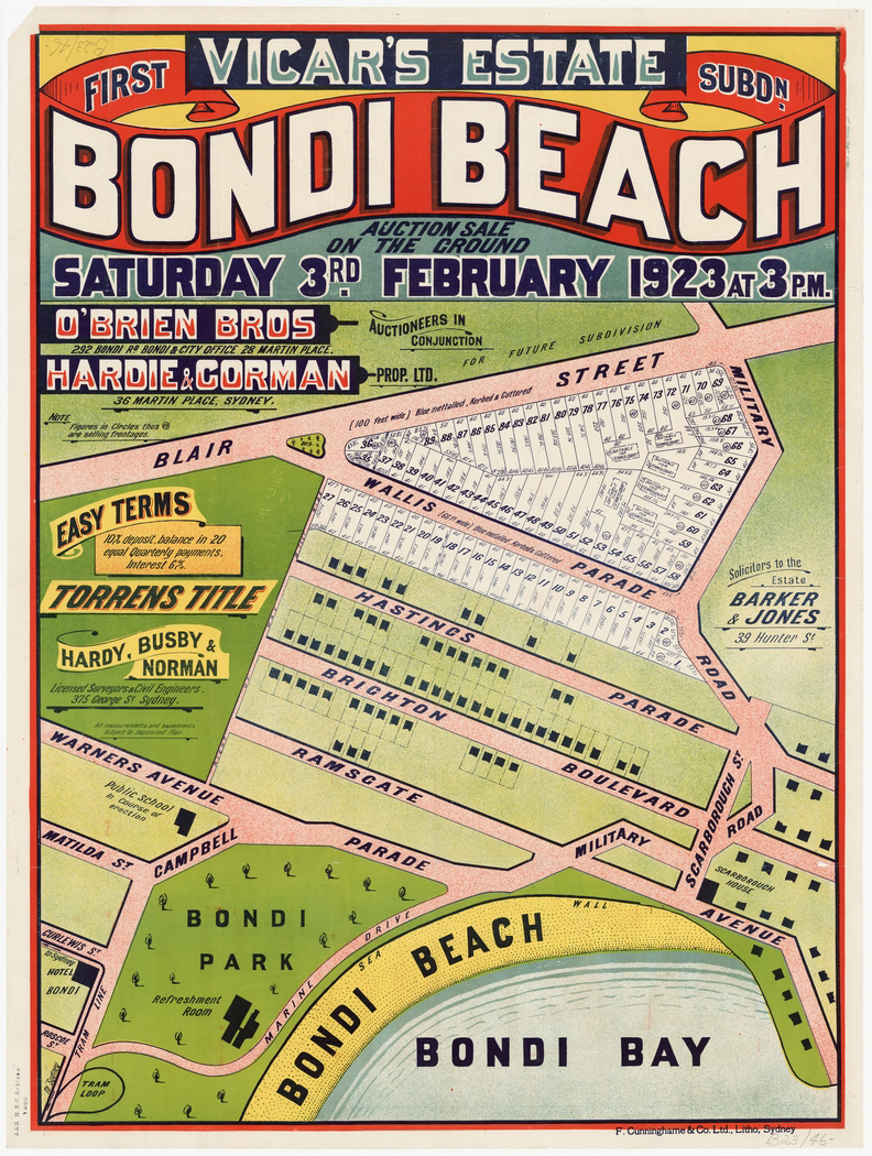
Bondi Beach is a popular beach and the name of the surrounding suburb in Sydney, New South Wales, Australia. Bondi Beach is located east of the Sydney central business district, in the local government area of Waverley Council, in the Eastern Suburbs. It has a population of 11,656 residents. Its postcode is 2026. Bondi, North Bondi, and Bondi Junction are neighboring suburbs. Bondi Beach is one of the most visited tourist sites in Australia. History "Bondi," originally "Boondi" is an Aboriginal word which has the same meaning as the word "surf" in English. The first record of "bondi" by European-ancestry Australians was made between 1899 and 1903. It describes the meaning as "noise made by sea waves breaking on the beach," which is essentially the definition of "surf" in contemporary American English. The Australian Museum records that Bondi means ''place where a fight using bondi sticks (nulla nullas or fighting sticks) took place''. In 1809 the road builder William ... [...More Info...] [...Related Items...] OR: [Wikipedia] [Google] [Baidu] |
Taylor Square, Sydney
500px, Taylor Square, Darlinghurst Taylor Square is a public square in Sydney, New South Wales, Australia. Taylor Square is located beside a major road junction, where Oxford Street meets Flinders Street. Taylor Square is also on the border of the suburbs of Darlinghurst and Surry Hills. Description Taylor Square sits above the tunnel section of the Eastern Distributor, part of M1. The square is named after Sir Allen Taylor (1864-1940), a timber merchant, ship builder and Lord Mayor of Sydney who was responsible for the widening of Oxford Street during his tenure. The area formerly bound by the traffic of the three streets is popularly known as "Gilligan's Island" because of three large palm trees that once occupied the strip, but have since been subsequently removed. Construction of the Eastern Distributor also entailed the realignment of traffic flow in the area. Direct vehicle access across Oxford Street via Bourke Street is no longer possible. The locality is a centre ... [...More Info...] [...Related Items...] OR: [Wikipedia] [Google] [Baidu] |
Thomas Brisbane
Major General Sir Thomas Makdougall Brisbane, 1st Baronet, (23 July 1773 – 27 January 1860), was a British Army officer, administrator, and astronomer. Upon the recommendation of the Duke of Wellington, with whom he had served, he was appointed governor of New South Wales from 1821 to 1825. A keen astronomer, he built the colony's second observatory and encouraged scientific and agricultural training. Rivals besmirched his reputation and the British Secretary of State for the Colonies, Lord Bathurst, recalled Brisbane and his colonial secretary Frederick Goulburn. Brisbane, a new convict settlement, was named in his honour and is now the 3rd largest city in Australia. Early life Brisbane was born at Brisbane House in Noddsdale, near Largs in Ayrshire, Scotland, the son of Sir Thomas Brisbane and his wife Eleanora (née Bruce). He was educated in astronomy and mathematics at the University of Edinburgh. He joined the British Army's 38th (1st Staffordshire) Regiment of Foot ... [...More Info...] [...Related Items...] OR: [Wikipedia] [Google] [Baidu] |
Robert Cooper (Australian Businessman)
Robert Cooper (1777–1857) was an Australian businessman in the early Colonial era of Sydney, responsible for the construction of many notable buildings and commercial ventures. Cooper was born in London on 15 May 1777 to fishmonger Francis and Frances (née Pilkinton) Cooper, and ran two public houses in London, the White Swan on Ratcliffe Highway in the docklands and another in Piccadilly. In October 1812 he was convicted of smuggling and receiving stolen goods and was sentenced to penal transportation for fourteen years to New South Wales arriving on the ''Earl Spencer'' in October 1813. He received a conditional pardon in 1818. In Sydney he was a prolific businessman. Around 1819, he opened a shop in George Street opposite the Town Hall and was running trading ventures to Van Diemans Land in a small ship he bought. He also obtained an Auctioneer's licence and opened a distillery and brewery. Other ventures included milling flour and bread, cedar cutting, product ... [...More Info...] [...Related Items...] OR: [Wikipedia] [Google] [Baidu] |
Botany Bay
Botany Bay (Dharawal: ''Kamay''), an open oceanic embayment, is located in Sydney, New South Wales, Australia, south of the Sydney central business district. Its source is the confluence of the Georges River at Taren Point and the Cooks River at Kyeemagh, which flows to the east before meeting its mouth at the Tasman Sea, midpoint between the suburbs of La Perouse and Kurnell. The northern headland of the entrance to the bay from the Tasman Sea is Cape Banks and, on the southern side, the outer headland is Cape Solander and the inner headland is Sutherland Point. The total catchment area of the bay is approximately . Despite its relative shallowness, the bay now serves as greater metropolitan Sydney's main cargo seaport, located at Port Botany, with facilities managed by Sydney Ports Corporation. Two runways of Sydney Airport extend into the bay, as do some port facilities. Botany Bay National Park is located on the northern and southern headlands of the bay. ... [...More Info...] [...Related Items...] OR: [Wikipedia] [Google] [Baidu] |
Rushcutters Bay, New South Wales
Rushcutters Bay is a harbourside eastern suburb of Sydney, in the state of New South Wales, Australia 3 kilometres east of the Sydney central business district, in the local government area of the City of Sydney. The suburb of Rushcutters Bay sits beside the bay it takes its name from, on Sydney Harbour. It is surrounded by the suburbs of Elizabeth Bay, Darlinghurst, Paddington and Darling Point. Kings Cross is a locality on the western border. History After British settlement, the area was first known as 'Rush Cutting Bay' because the swampy land was covered in tall rushes used by early settlers for thatching houses. In 1878, were reserved for recreation; and, after reclamation work was completed, Rushcutters Bay Park was created, bounded by New South Head Road and the bay at Sydney Harbour. Rushcutters Bay was once the site of the famous Sydney Stadium. On Boxing Day 1908 at the Stadium, Tommy Burns lost his heavyweight title to the legendary Jack Johnson, famo ... [...More Info...] [...Related Items...] OR: [Wikipedia] [Google] [Baidu] |
Juniper Hall, Paddington
Juniper Hall, also known as Ormond House, is a heritage-listed former residence and children's home and now retail building and exhibition venue located at 1 Ormond Street, Paddington in the Municipality of Woollahra local government area of New South Wales, Australia. It was built from 1824 to 1825 by Robert Cooper. The two-storey Old Colonial Georgian house was added to the New South Wales State Heritage Register on 2 April 1999 and is listed on the (now defunct) Register of the National Estate Juniper Hall was originally the home of Robert Cooper, a gin distiller. He reportedly designed the house himself and had it built circa 1825, including a cellar and attic in the structure. Unlike most Georgian homes, it features an upstairs balcony, which looks out onto Oxford Street. As time went by, Juniper Hall became hidden behind a row of commercial buildings on Oxford Street. A restoration project was undertaken by the National Trust of Australia in which the commercial build ... [...More Info...] [...Related Items...] OR: [Wikipedia] [Google] [Baidu] |
Oxford Street, Sydney
Oxford Street is a major thoroughfare in Sydney, New South Wales, Australia, running from Whitlam Square on the south-east corner of Hyde Park in the central business district (CBD) of Sydney to Bondi Junction in the Eastern Suburbs. Close to the CBD in particular, the street is lined with numerous shops, bars and nightclubs. After the 1980s, Oxford Street garnered a reputation as Sydney's primary nightclub strip (firstly gay nightclubs in the 1980s followed by straight nightclubs in the 2000s) and subsequently saw a large increase in the number of crimes committed in the area. However, the 2014 lockout laws saw many nightclubs close and the crime rate drop as Sydney's nightlife hubs moved to Darling Harbour and Newtown. The lockout laws ended in 2020 with a focus on small bars and restaurants. Many nightclubs reopened in 2021 especially around Taylor Square. The western section of Oxford Street, which runs through the suburb of Darlinghurst, is widely recognised as Sydney' ... [...More Info...] [...Related Items...] OR: [Wikipedia] [Google] [Baidu] |

Woollahra_Council_Chambers.jpg)


