|
Engativá
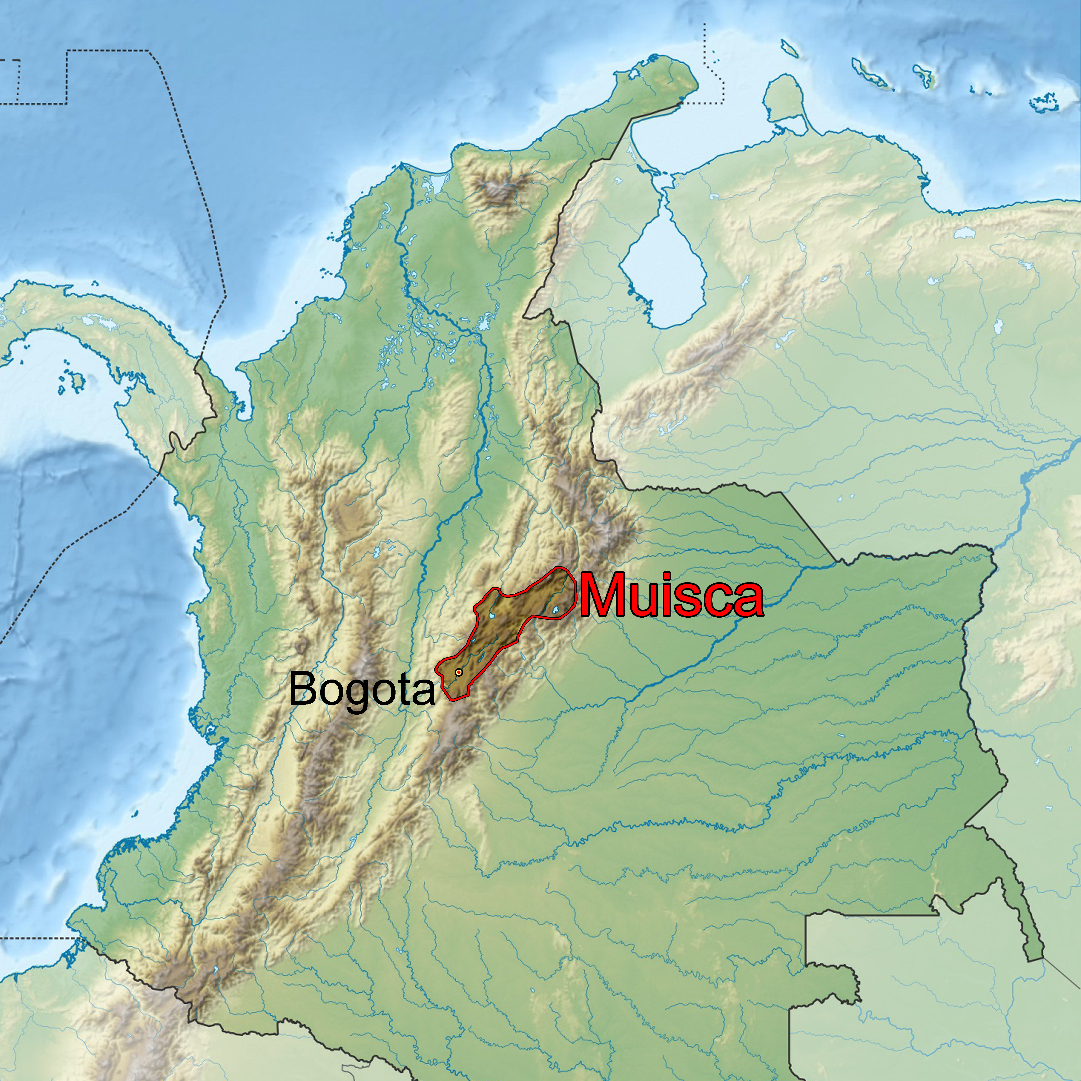
Engativá is the 10th locality of Bogotá. It is located in the west of the city. This district is mostly inhabited by lower middle and working class residents. Etymology Engativá is either derived from ''Ingativá''; ''cacique'' Inga; "Land of the Sun", or from the Chibcha language, Chibcha words ''Engue-tivá''; ''engue'' is "delicious" and ''tivá'' is "captain"; "captain of the delicious [people]". Geography Engativá is limited to the north by the Salitre River, Bogotá, Salitre River with Suba, Bogotá, Suba, to the east by Avenida Carrera 68 and Bosa, Bogotá, Bosa, to the south by Avenida El Dorado and Fontibón, and to the west by the Bogotá River. History Engativá was a village in the Muisca Confederation, confederation of the Muisca. Modern Engativá was founded in 1537. It has become a rural territory, people used to work as farmers of Bogotá in 1571. The church of the town was built in honor of the pope Clemente XII in 1638 and from 1737 it was named the N ... [...More Info...] [...Related Items...] OR: [Wikipedia] [Google] [Baidu] |
Salitre River, Bogotá
The Juan Amarillo, Arzobispo, or Salitre River is a river on the Bogotá savanna and a left tributary of the Bogotá River in Colombia. The river originates from various ''quebradas'' in the Eastern Hills, Bogotá, Eastern Hills and flows into the Bogotá River at the largest of the wetlands of Bogotá, Tibabuyes, also called Juan Amarillo Wetland. The total surface area of the Juan Amarillo basin, covering the localities Usaquén, Chapinero, Santa Fe, Bogotá, Santa Fe, Suba, Bogotá, Suba, Barrios Unidos, Teusaquillo, and Engativá, is . Together with the Fucha River, Fucha and Tunjuelo Rivers, the Juan Amarillo River forms part of the left tributaries of the Bogotá River in the Colombian capital. Description The Juan Amarillo, Arzobispo, or Salitre River, is formed by various ''quebradas'' ("creeks") sourced at an altitude of in the Eastern Hills, Bogotá, Eastern Hills of Bogotá. Main feeder creeks are Las Delicias, La Vieja, El Chicó, Los Molinos, Santa Bárbara, Delic ... [...More Info...] [...Related Items...] OR: [Wikipedia] [Google] [Baidu] |
Muisca Confederation
The Muisca Confederation was a loose confederation of different Muisca rulers (''zaques'', ''zipas'', '' iraca'', and ''tundama'') in the central Andean highlands of present-day Colombia before the Spanish conquest of northern South America. The area, presently called Altiplano Cundiboyacense, comprised the current departments of Boyacá, Cundinamarca and minor parts of Santander. According to some Muisca scholars the Muisca Confederation was one of the best-organized confederations of tribes on the South American continent. Modern anthropologists, such as Jorge Gamboa Mendoza, attribute the present-day knowledge about the confederation and its organization more to a reflection by Spanish chroniclers who predominantly wrote about it a century or more after the Muisca were conquered and proposed the idea of a loose collection of different people with slightly different languages and backgrounds.Gamboa Mendoza, 2016 Geography Climate Muisca Confederation In the time ... [...More Info...] [...Related Items...] OR: [Wikipedia] [Google] [Baidu] |
Bogotá River
The Bogotá River is a major river of the Cundinamarca department of Colombia. A right tributary of the Magdalena River, the Bogotá River crosses the region from the northeast to the southwest and passing along the western limits of Bogotá. The large population and major industrial base in its watershed have resulted in extremely severe pollution problems for the river. Etymology The Bogotá River is named after Muyquytá, which is derived from Chibcha and means "(Enclosure) outside of the farm fields". – Banco de la República In historical texts, and today the upstream part of, the Bogotá River is also called Funza River.A orillas del Río – [...More Info...] [...Related Items...] OR: [Wikipedia] [Google] [Baidu] |
Muisca
The Muisca (also called Chibcha) are an indigenous people and culture of the Altiplano Cundiboyacense, Colombia, that formed the Muisca Confederation before the Spanish conquest. The people spoke Muysccubun, a language of the Chibchan language family, also called ''Muysca'' and ''Mosca''. They were encountered by conquistadors dispatched by the Spanish Empire in 1537 at the time of the conquest. Subgroupings of the Muisca were mostly identified by their allegiances to three great rulers: the ''hoa'', centered in Hunza, ruling a territory roughly covering modern southern and northeastern Boyacá and southern Santander; the '' psihipqua'', centered in Muyquytá and encompassing most of modern Cundinamarca, the western Llanos; and the '' iraca'', religious ruler of Suamox and modern northeastern Boyacá and southwestern Santander. The territory of the Muisca spanned an area of around from the north of Boyacá to the Sumapaz Páramo and from the summits to the western p ... [...More Info...] [...Related Items...] OR: [Wikipedia] [Google] [Baidu] |
Suba, Bogotá
Suba is the 11th locality of Bogotá, capital of Colombia. It is located in the northwest of the city, bordering to the north the municipality of Chía in Cundinamarca, to the west the municipality of Cota, to the east the locality Usaquén and to the south the localities Engativá and Barrios Unidos. This district is inhabited by residents of all social classes. Etymology Suba is either derived from the Muysccubun contraction ''Suba'', meaning " Flower of the Sun" (uba = "fruit" or "flower", sua = "Sun", minus its last vowel, making it a possessive) or from the words ''sua'' (Sun) and ''sie'' (water). Geography Suba has certain green areas, mostly concentrated in the west of the locality, on the Suba and the La Conejera Hills, as well as the plains where urbanization has developed. Suba has become a residential area with small industrial and commercial zones located in the south of the locality. The Suba Hills separate the locality into two parts; the eastern side bein ... [...More Info...] [...Related Items...] OR: [Wikipedia] [Google] [Baidu] |
Bogotá
Bogotá (, also , , ), officially Bogotá, Distrito Capital, abbreviated Bogotá, D.C., and formerly known as Santa Fe de Bogotá (; ) during the Spanish period and between 1991 and 2000, is the capital city of Colombia, and one of the largest cities in the world. The city is administered as the Capital District, as well as the capital of, though not part of, the surrounding department of Cundinamarca. Bogotá is a territorial entity of the first order, with the same administrative status as the departments of Colombia. It is the political, economic, administrative, and industrial center of the country. Bogotá was founded as the capital of the New Kingdom of Granada on 6 August 1538 by Spanish conquistador Gonzalo Jiménez de Quesada after a harsh expedition into the Andes conquering the Muisca, the indigenous inhabitants of the Altiplano. Santafé (its name after 1540) became the seat of the government of the Spanish Royal Audiencia of the New Kingdom of Granada (cre ... [...More Info...] [...Related Items...] OR: [Wikipedia] [Google] [Baidu] |
Localities Of Bogotá
{{disambiguation ...
Locality may refer to: * Locality (association), an association of community regeneration organizations in England * Locality (linguistics) * Locality (settlement) * Suburbs and localities (Australia), in which a locality is a geographic subdivision in rural areas of Australia Science * Locality (astronomy) * Locality of reference, in computer science * Locality (statistics) * Principle of locality, in physics See also * Local (other) * Type locality (other) Type locality may refer to: * Type locality (biology) * Type locality (geology) See also * Local (other) * Locality (other) {{disambiguation ... [...More Info...] [...Related Items...] OR: [Wikipedia] [Google] [Baidu] |
Earthquake
An earthquake (also known as a quake, tremor or temblor) is the shaking of the surface of the Earth resulting from a sudden release of energy in the Earth's lithosphere that creates seismic waves. Earthquakes can range in intensity, from those that are so weak that they cannot be felt, to those violent enough to propel objects and people into the air, damage critical infrastructure, and wreak destruction across entire cities. The seismic activity of an area is the frequency, type, and size of earthquakes experienced over a particular time period. The seismicity at a particular location in the Earth is the average rate of seismic energy release per unit volume. The word ''tremor'' is also used for Episodic tremor and slip, non-earthquake seismic rumbling. At the Earth's surface, earthquakes manifest themselves by shaking and displacing or disrupting the ground. When the epicenter of a large earthquake is located offshore, the seabed may be displaced sufficiently to cause ... [...More Info...] [...Related Items...] OR: [Wikipedia] [Google] [Baidu] |
Clemente XII
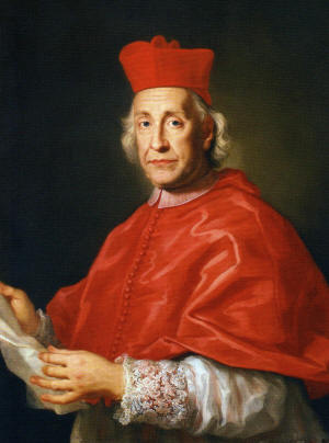
Pope Clement XII ( la, Clemens XII; it, Clemente XII; 7 April 16526 February 1740), born Lorenzo Corsini, was head of the Catholic Church and ruler of the Papal States from 12 July 1730 to his death in February 1740. Clement presided over the growth of a surplus in the papal finances. He thus became known for building the new façade of the Basilica of Saint John Lateran, beginning construction of the Trevi Fountain, and the purchase of Cardinal Alessandro Albani's collection of antiquities for the papal gallery. In his 1738 bull , he provides the first public papal condemnation of Freemasonry. Early life Lorenzo Corsini was born in Florence in 1652 as the son of Bartolomeo Corsini, Marquis of Casigliano and his wife Elisabetta Strozzi, the sister of the Duke of Bagnuolo. Both of his parents belonged to the old Florentine nobility. He was a distant relative of Saint Andrea Corsini. Corsini studied at the Jesuit Collegio Romano in Rome and also at the University of Pisa wher ... [...More Info...] [...Related Items...] OR: [Wikipedia] [Google] [Baidu] |
Avenida El Dorado
Avenue or Avenues may refer to: Roads * Avenue (landscape), traditionally a straight path or road with a line of trees, in the shifted sense a tree line itself, or some of boulevards (also without trees) * Avenue Road, Bangalore * Avenue Road, London * Avenue Road, Toronto Other uses * Avenue (archaeology), a specialist term in archaeology referring to lines of stones * Avenue (band), X Factor UK contestants * Avenues (band), American pop punk band * ''Avenue'' (magazine), a former Dutch magazine * "Avenue" (song), a 1992 single by British pop group Saint Etienne * Avenue (store), a clothing store * The Avenue, a Rugby Union stadium in Sunbury-on-Thames, England * L'Avenue, a proposed skyscraper in Montreal, Quebec, Canada * Avenue, a GIS scripting language for ArcView 3.x * Avenues Television, television channel in Nepal * "The Avenue", B-side of the 1984 Orchestral Manoeuvres in the Dark single "Locomotion" * Avenues: The World School, school in New York City See also * Avinu ... [...More Info...] [...Related Items...] OR: [Wikipedia] [Google] [Baidu] |
Fontibón
Fontibon is the 9th locality of Bogotá. It is located in the west of the city. This district is mostly inhabited by low and middle class residents. Etymology The origin of the city's name can be traced to the Muisca ''cacique Huintiva'' or ''Hyntiba'' (meaning "powerful cacique" in Muysccubun) and the mutation of the word to its present spelling, being this among other names such as Ontibon and Hontibón.Etymology localities of Bogotá History Fontibón was part of the southern in the times before the |


