|
Enfield Blackwater
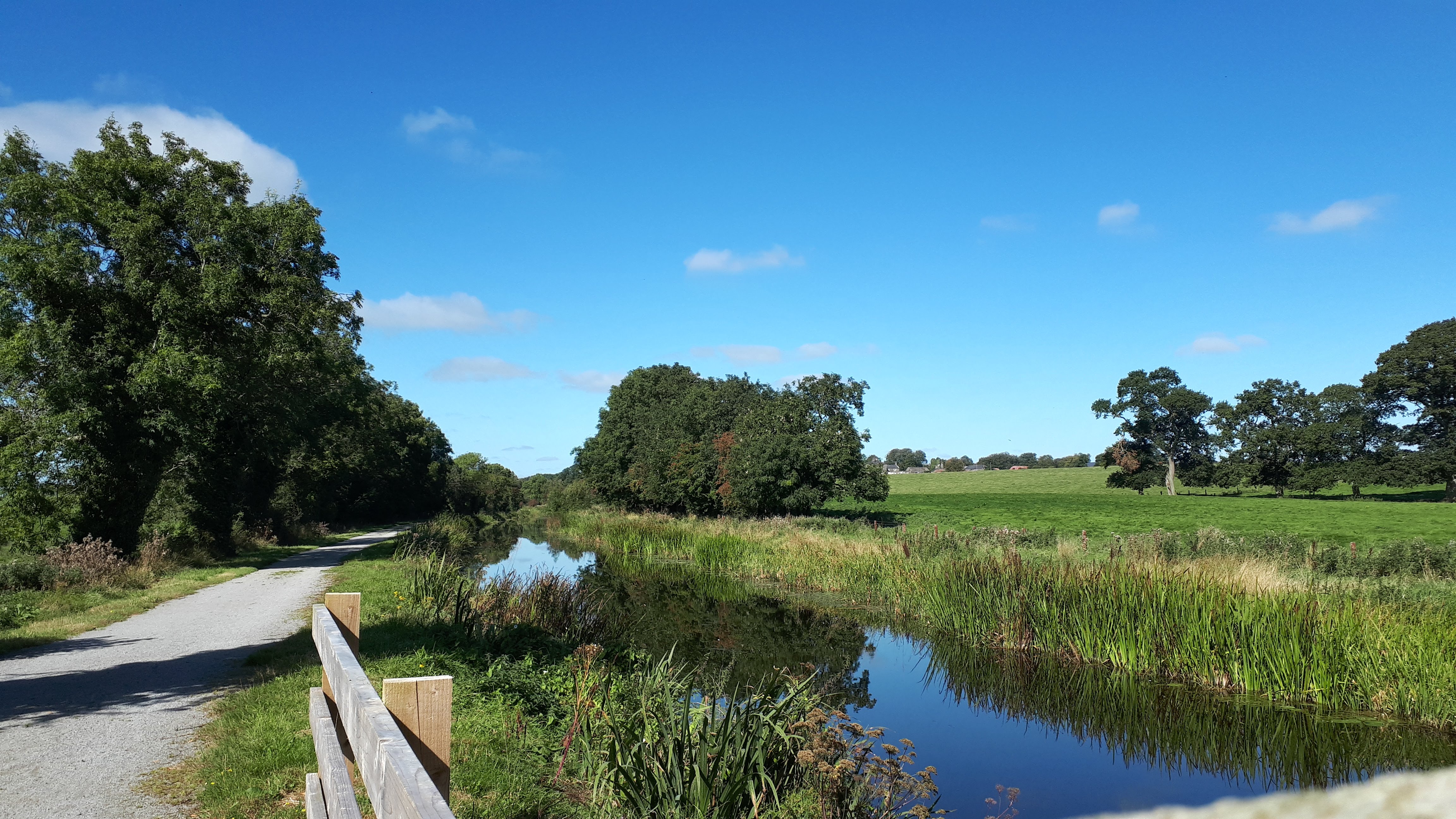
The River Blackwater, also called the Enfield Blackwater, or Kildare Blackwater is a river that flows through the counties of Kildare and Meath in Ireland. It is a tributary of the River Boyne which flows into the Irish Sea at Drogheda. Course The Enfield Blackwater has its source in the north of Kildare, near Timahoe. It flows northwest past Knockanally Golf Club, through Johnstown Bridge and along the Kildare-Meath county border. It is bridged by the M4 motorway west of Enfield and then passes under the Royal Canal via the Blackwater Aqueduct at Kilmorebrannagh/Kilmurry and continue to form the Kildare-Meath border until it veers northwards near Longwood and passes under the R160 road. The Enfield Blackwater drains into the River Boyne in Donore, County Meath about 12 km southwest of Trim, County Meath, just below Inchamore Bridge. Wildlife Brown trout are the main fish species. See also * Rivers of Ireland Shown here are all the major rivers and tributaries o ... [...More Info...] [...Related Items...] OR: [Wikipedia] [Google] [Baidu] |
County Kildare
County Kildare ( ga, Contae Chill Dara) is a county in Ireland. It is in the province of Leinster and is part of the Eastern and Midland Region. It is named after the town of Kildare. Kildare County Council is the local authority for the county, which has a population of 246,977. Geography and subdivisions Kildare is the 24th-largest of Ireland's 32 counties in area and the seventh largest in terms of population. It is the eighth largest of Leinster's twelve counties in size, and the second largest in terms of population. It is bordered by the counties of Carlow, Laois, Meath, Offaly, South Dublin and Wicklow. As an inland county, Kildare is generally a lowland region. The county's highest points are the foothills of the Wicklow Mountains bordering to the east. The highest point in Kildare is Cupidstown Hill on the border with South Dublin, with the better known Hill of Allen in central Kildare. Towns and villages * Allen * Allenwood * Ardclough * Athy * Ballitore * Ball ... [...More Info...] [...Related Items...] OR: [Wikipedia] [Google] [Baidu] |
Enfield, County Meath
Enfield () or Innfield is a town in south County Meath, Ireland, situated between Kilcock and Kinnegad and very close to the border with County Kildare. The town is on the Dublin-Sligo railway line. It is located on the R148 regional road, formerly the N4 national primary road connecting Dublin to Connacht. In the 20 years between the 1996 and 2016 census, the population of Enfield grew considerably from just 566 inhabitants to 3,239 people. This increase is due to its location on the commuter belt to Dublin. Similarly to many other dormitory towns in this vicinity, numerous housing estates have been constructed, with 2016 census numbers indicating that 80% of the town's housing stock (826 of 1,024 households) was built between 1991 and 2010. Name The village's Irish name, ''An Bóthar Buí'' (the yellow road), is derived from the yellow mud that formed on the main street of the village through a combination of rain and the churning effect of the wheels of the stagecoach on ... [...More Info...] [...Related Items...] OR: [Wikipedia] [Google] [Baidu] |
Knightsbrook River
The Knightsbrook River is a river in County Meath, Ireland. The river rises near Summerhill, and flows north past the R156, and later the R158 and R159 roads, through Knightsbrook, and merges into the River Boyne The River Boyne ( ga, An Bhóinn or ''Abhainn na Bóinne'') is a river in Leinster, Ireland, the course of which is about long. It rises at Trinity Well, Newberry Hall, near Carbury, County Kildare, and flows towards the Northeast through C ... a few kilometres to the east of Trim. References Rivers of County Meath {{Ireland-river-stub ... [...More Info...] [...Related Items...] OR: [Wikipedia] [Google] [Baidu] |
Rivers Of Ireland
Shown here are all the major rivers and tributaries of Ireland with their lengths (in kilometres and miles). Starting with the Northern Ireland rivers, and going in a clockwise direction, the rivers (and tributaries) are listed in regard to their entry into the different seas: the Irish Sea, the Celtic Sea and the Atlantic Ocean. Also shown are two tables. ''Table 1'' shows the longest rivers in Ireland with their lengths (in kilometres and miles), the counties they flow through, and their catchment areas (in square kilometres). ''Table 2'' shows the largest rivers in Ireland (by mean flow) in cubic metres per second. The longest river in Ireland is the River Shannon, at . The river develops into three lakes along its course, Lough Allen, Lough Ree and Lough Derg. Of these, Lough Derg is the largest. The Shannon enters the Atlantic Ocean at the Shannon Estuary. Other major rivers include the River Liffey, River Lee, River Swilly, River Foyle, River Lagan, River Erne, River Bla ... [...More Info...] [...Related Items...] OR: [Wikipedia] [Google] [Baidu] |
Brown Trout
The brown trout (''Salmo trutta'') is a European species of salmonid fish that has been widely introduced into suitable environments globally. It includes purely freshwater populations, referred to as the riverine ecotype, ''Salmo trutta'' morpha ''fario'', a lacustrine ecotype, ''S. trutta'' morpha ''lacustris'', also called the lake trout, and anadromous forms known as the sea trout, ''S. trutta'' morpha ''trutta''. The latter migrates to the oceans for much of its life and returns to fresh water only to spawn. Sea trout in Ireland and Britain have many regional names: sewin in Wales, finnock in Scotland, peal in the West Country, mort in North West England, and white trout in Ireland. The lacustrine morph of brown trout is most usually potamodromous, migrating from lakes into rivers or streams to spawn, although evidence indicates some stocks spawn on wind-swept shorelines of lakes. ''S. trutta'' morpha ''fario'' forms stream-resident populations, typically in alpine stre ... [...More Info...] [...Related Items...] OR: [Wikipedia] [Google] [Baidu] |
Trim, County Meath
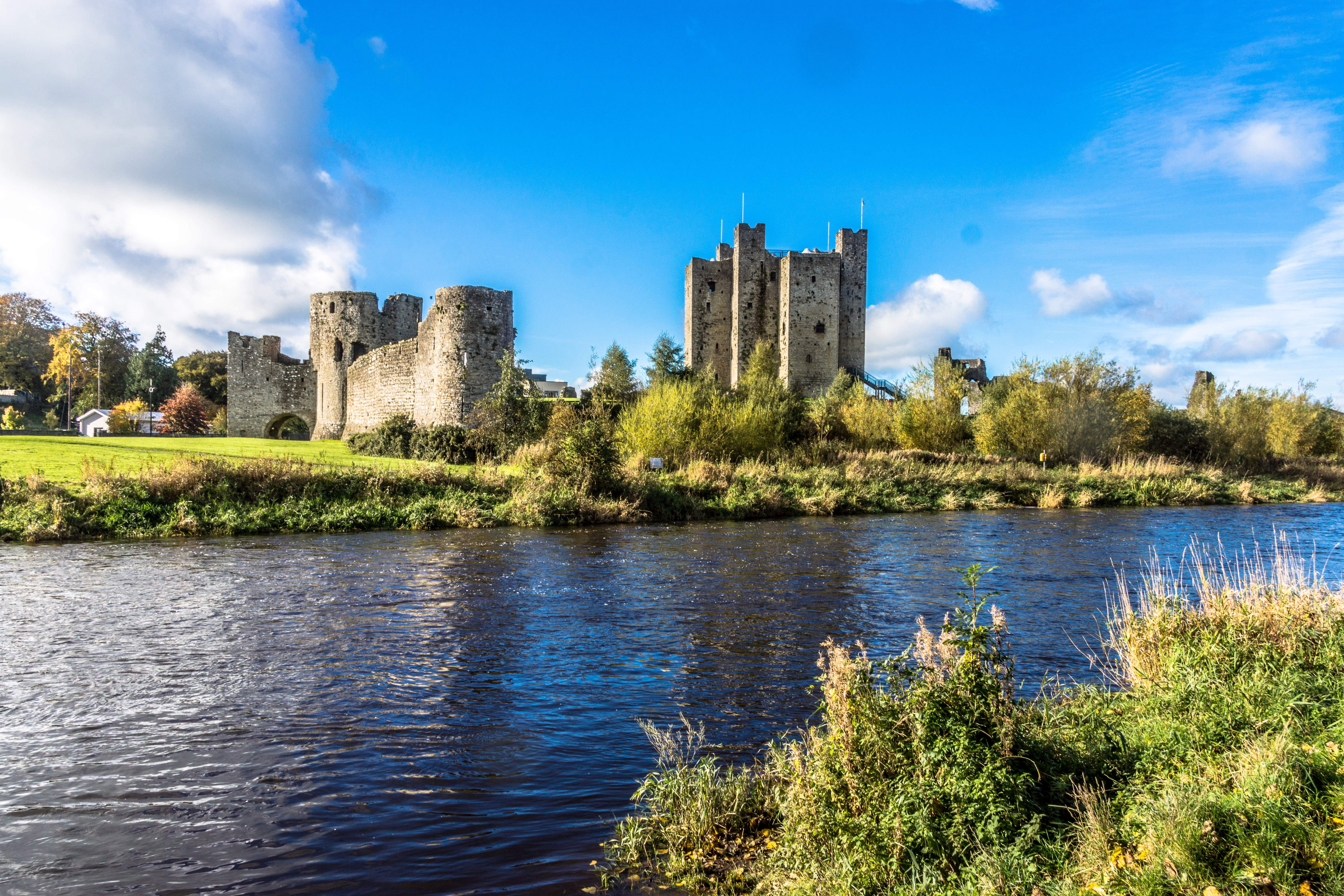
Trim () is a town in County Meath, Ireland. It is situated on the River Boyne and has a population of 9,194. The town is noted for Trim Castle – the largest Norman castle in Ireland. One of the two cathedrals of the United Dioceses of Meath and Kildare — St Patrick's cathedral — is located north of the river. Trim won the Irish Tidy Towns Competition in 1972, 1984, 2014 and 2022, and was the "joint" winner with Ballyconnell in 1974. Trim was historically the county town of Meath, but this title was passed on in 1898 to the larger, neighbouring town of Navan. History Early history At an early date, a monastery was founded at Trim, which lay within the petty kingdom ('' tuath'') of the Cenél Lóegairi. It is traditionally thought to have been founded by St. Patrick and left in the care of its patron saint Lommán, also locally known as Loman, who flourished sometime between the 5th and early 6th centuries.Stalmans and Charles-Edwards, "Meath, saints of (act. ''c''.4 ... [...More Info...] [...Related Items...] OR: [Wikipedia] [Google] [Baidu] |
R160 Road (Ireland)
The R160 road is a regional road in Ireland, located in County Meath and County Kildare County Kildare ( ga, Contae Chill Dara) is a county in Ireland. It is in the province of Leinster and is part of the Eastern and Midland Region. It is named after the town of Kildare. Kildare County Council is the local authority for the county, .... References Regional roads in the Republic of Ireland Roads in County Meath Roads in County Kildare {{Ireland-road-stub ... [...More Info...] [...Related Items...] OR: [Wikipedia] [Google] [Baidu] |
Longwood, County Meath
Longwood, historically called ''Moydervy'' (), is a village in southwest County Meath, Ireland. It is located about 15 km south of the town of Trim on the R160 regional road. It is about 50 km from Dublin, off the N4 road. In the early years of the 21st century the population of Longwood increased dramatically, with the population more than trebling from 480 inhabitants as of the 2002 census, to 1,581 people as of the 2016 census. The 2016 census indicated that 65% of homes in the village (317 of 488 households) were built between 2001 and 2010. History The Boyne aqueduct, built in the 19th century where the canal crosses over the River Boyne is located about 3 km from the village. Medieval period Longwood is recorded as a possession of the Hospital of Crutched Friars of St. John the Baptist, at Newtown Trim, at the dissolution of the monasteries in 1540. The jurors recorded that at Longwood alias Modarvy there was a castle, six houses, 40 acres arable, 60 acr ... [...More Info...] [...Related Items...] OR: [Wikipedia] [Google] [Baidu] |
Royal Canal (Ireland)
The Royal Canal ( ga, An Chanáil Ríoga) is a canal originally built for freight and passenger transportation from Dublin to Longford in Ireland. It is one of two canals from Dublin to the River Shannon and was built in direct competition to the Grand Canal. The canal fell into disrepair in the late 20th century, but much of it has since been restored for navigation. The length of the canal to the River Shannon was reopened on 1 October 2010, but a final spur branch, to Longford Town, remains closed. History Construction In 1755, Thomas Williams and John Cooley made a survey to find a suitable route for a man-made waterway across north Leinster from Dublin to the Shannon. They originally planned to use a series of rivers and lakes, including the Boyne, Blackwater, Deel, Yellow, Camlin and Inny and Lough Derravaragh. A disgruntled director of the Grand Canal Company sought support to build a canal from Dublin to Cloondara, on the Shannon in West County Longford. Work on t ... [...More Info...] [...Related Items...] OR: [Wikipedia] [Google] [Baidu] |
M4 Motorway (Ireland)
The N4 road is a national primary road in Ireland, running from Dublin to the northwest of Ireland and Sligo town. The M6 to Galway diverges from this route after Kinnegad, while the N5 to Westport diverges at Longford town. Most sections of the N4 that are motorway-standard are designated the M4 motorway. Road standard The N4 originates at an intersection with the M50 motorway at Junction 7. This is also Junction 1 of the N/M4. The Liffey Valley Shopping Centre is located at Junction 2. The road has three lanes and a bus lane in each direction between the M50 and the start of the M4 at Leixlip. The N4 was the only one of the main inter-urban national routes whose dual-carriageway section continued into the city centre; however, the section inside the M50 was re-classified as the R148 in 2012. Heading west, the PPP motorway section (see below) ends west of Kinnegad, and the motorway terminates 5 km further west; it continues as HQDC and bypasses Mullingar. From ... [...More Info...] [...Related Items...] OR: [Wikipedia] [Google] [Baidu] |
River Boyne
The River Boyne ( ga, An Bhóinn or ''Abhainn na Bóinne'') is a river in Leinster, Ireland, the course of which is about long. It rises at Trinity Well, Newberry Hall, near Carbury, County Kildare, and flows towards the Northeast through County Meath to reach the Irish Sea between Mornington, County Meath, and Baltray, County Louth. Names and etymology This river has been known since ancient times. The Greek geographer Ptolemy drew a map of Ireland in the 2nd century which included the Boyne, which he called (''Bouwinda'') or (''Boubinda''), which in Celtic means "white cow" ( ga, bó fhionn). During the High Middle Ages, Giraldus Cambrensis called it the ''Boandus''. In Irish mythology it is said that the river was created by the goddess Boann and Boyne is an anglicised form of the name. In other legends, it was in this river where Fionn mac Cumhail captured Fiontán, the Salmon of Knowledge. The Meath section of the Boyne was also known as ''Smior Fionn Feidhlimthe'' ... [...More Info...] [...Related Items...] OR: [Wikipedia] [Google] [Baidu] |
Johnstown Bridge
Johnstownbridge ( or ''Droichead Baile Sheáin'') is a commuter town located in north County Kildare, Ireland. It lies in the parish of Cadamstown, in the district of Balyna, and barony of Carbury. It is located on the R402 road between Enfield and Edenderry just off the M4 motorway. As of the 2016 census, Johnstownbridge had a population of 683 people, up from 211 in the 2002 census. History The bridge was the scene of a battle in the 1798 rebellion between Michael Aylmer's rebel forces and British colonial forces. Johnstownbridge had a patent granted in the 17th century for holding a weekly market on Monday, but Lewis's Topography noted in 1837 that "this privilege has not been enjoyed for many years: fairs are held on March 31st, May 29th, Oct. 13th, and Dec. 21st." Lewis also noted "a curious old cross, the only relic to mark the site of an abbey that formerly existed here.". A constabulary police station was based here in the first half of the 19th century. One of Daniel O ... [...More Info...] [...Related Items...] OR: [Wikipedia] [Google] [Baidu] |


