|
Empire State Games
The Empire State Games are a set of annual Olympic-style competitions for amateur athletes from the state of New York, encompassing several divisions and allowing athletes of all ages to compete. It was a member of the National Congress of State Games. The games consisted of a number of competitions: *Summer Games (often referred to as the Empire State Games, typically held in late July) *Winter Games (often referred to as the Empire State Winter Games, typically held in February) *Games for the Physically Challenged (similar to the Paralympics) *Senior Games (specifically for athletes age 50 and older) In 2009, 2011, 2012 and 2013 the Empire State Summer Games were cancelled. History Early history One of the original organizers of the Empire State Games waHerbert Molsof Buffalo, New York. (https://www.youtube.com/watch?v=RU__5V9RAcc0) The first Empire State Games took place at Syracuse University in 1978, the first state games to be held in the United States. The games r ... [...More Info...] [...Related Items...] OR: [Wikipedia] [Google] [Baidu] |
Syracuse University
Syracuse University (informally 'Cuse or SU) is a Private university, private research university in Syracuse, New York. Established in 1870 with roots in the Methodist Episcopal Church, the university has been nonsectarian since 1920. Located in the city's University Hill, Syracuse, University Hill neighborhood, east and southeast of Downtown Syracuse, the large campus features an eclectic mix of architecture, ranging from nineteenth-century Romanesque Revival architecture, Romanesque Revival to contemporary buildings. Syracuse University is organized into 13 schools and colleges, with nationally recognized programs in Syracuse University School of Architecture, architecture, Maxwell School of Citizenship and Public Affairs, public administration, S.I. Newhouse School of Public Communications, journalism and communications, Martin J. Whitman School of Management, business administration, Syracuse University School of Information Studies, information studies, Syracuse Univers ... [...More Info...] [...Related Items...] OR: [Wikipedia] [Google] [Baidu] |
Albany County, New York
Albany County ( ) is a county in the state of New York, United States. Its northern border is formed by the Mohawk River, at its confluence with the Hudson River, which is to the east. As of the 2020 United States Census, the population was 314,848. The county seat and largest city is Albany, which is also the state capital of New York. As originally established by the English government in the colonial era, Albany County had an indefinite amount of land, but has had an area of since March 3, 1888. The county is named for the Duke of York and of Albany, who became James II of England (James VII of Scotland). Albany County constitutes the central core of the Capital District of New York State, which comprises the Albany-Schenectady-Troy, NY Metropolitan Statistical Area. History Colonial After England took control of the colony of New Netherland from the Dutch, Albany County was created on November 1, 1683, by New York Governor Thomas Dongan, and confirmed on October 1, ... [...More Info...] [...Related Items...] OR: [Wikipedia] [Google] [Baidu] |
Warren County, New York
Warren County is a county in the U.S. state of New York. As of the 2020 census, the population was 65,737. The county seat is Queensbury. The county is named in honor of General Joseph Warren, an American Revolutionary War hero of the Battle of Bunker Hill. Warren County is part of the Glens Falls, NY Metropolitan Statistical Area, which is also included in the Albany-Schenectady, NY Combined Statistical Area. History When counties were established in the Province of New York in 1683, the present Warren County was part of Albany County. The county was enormous, covering the northern part of New York State, all of the present State of Vermont, and, in theory, extended westward to the Pacific Ocean. It was reduced in size on July 3, 1766, by the creation of Cumberland County, and further on March 16, 1770, by the creation of Gloucester County, both containing territory now in Vermont. On March 12, 1772, what was left of Albany County was split into three parts, one remai ... [...More Info...] [...Related Items...] OR: [Wikipedia] [Google] [Baidu] |
Rensselaer County, New York
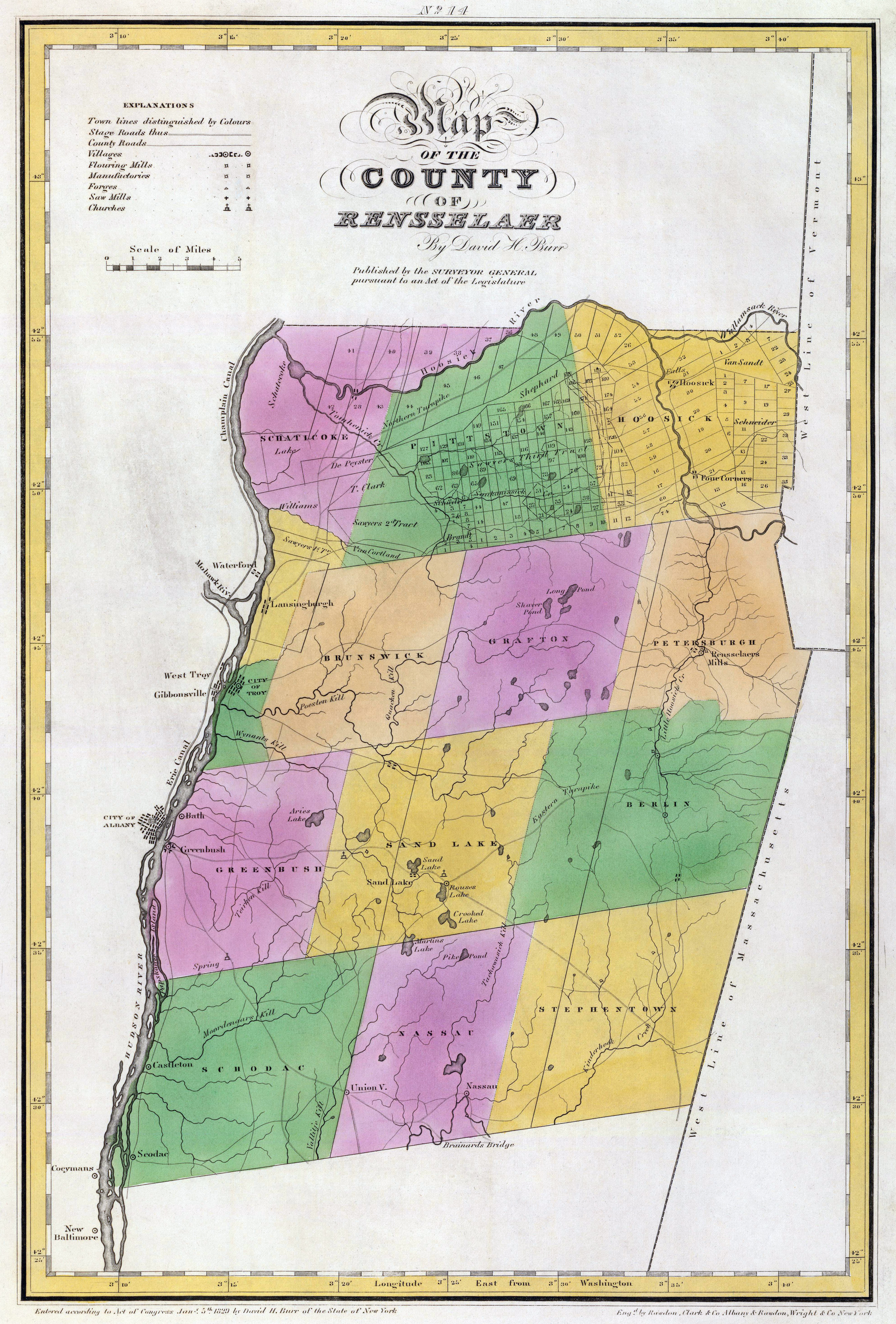
Rensselaer County is a county in the U.S. state of New York. As of the 2020 census, the population was 161,130. Its county seat is Troy. The county is named in honor of the family of Kiliaen van Rensselaer, the original Dutch owner of the land in the area. Rensselaer County is part of the Albany-Schenectady-Troy, NY Metropolitan Statistical Area. History The area that is now Rensselaer County was inhabited by the Algonquian-speaking Mohican Indian tribe at the time of European encounter. Kiliaen van Rensselaer, a Dutch jeweler and merchant, purchased the area in 1630 and incorporated it in his patroonship Rensselaerswyck. (It was part of the Dutch colony New Netherland). The land passed into English rule in 1664; the Dutch regained control in 1673, but the English took it back in 1674. Until 1776, the year of American independence, the county was under English or British control. The county was not organized as a legal entity until after the Revolution, in 1791, whe ... [...More Info...] [...Related Items...] OR: [Wikipedia] [Google] [Baidu] |
Schenectady County, New York
Schenectady County () is a county in the U.S. state of New York. As of the 2020 census, the population was 158,061. The county seat is Schenectady. The name is from a Mohawk language word meaning "on the other side of the pine lands," a term that originally applied to Albany. Schenectady County is part of the Albany-Schenectady-Troy, NY Metropolitan Statistical Area, and is west of the confluence of the Mohawk with the Hudson River. It includes territory on the north and the south sides of the Mohawk River. History This area of the river valley was historically occupied by the Mohawk people, the easternmost of the Five Nations comprising the Iroquois Confederacy or ''Haudenosaunee''. They cultivated maize fields in the flats along the Mohawk River and had villages in the hills. European settlement started in the present-day county by Dutch colonists in the 17th century; the village of Schenectady was founded in 1661. The fur traders in Albany kept a monopoly and prohibited ... [...More Info...] [...Related Items...] OR: [Wikipedia] [Google] [Baidu] |
Schoharie County, New York
Schoharie County ( ) is a county in the U.S. state of New York. As of the 2020 census, the population was 29,714, making it the state's fifth-least populous county. The county seat is Schoharie. "Schoharie" comes from a Mohawk word meaning "floating driftwood." Schoharie County is part of the Albany-Schenectady-Troy, NY Metropolitan Statistical Area. History The large territory of the county (much of upstate and western New York) was long occupied by the Mohawk Nation and, to the west, the other four tribes of the Haudenosaunee Confederacy (increased to six with the migration of the Tuscarora from the South to New York in 1722). After European colonization of the Northeast started, the Mohawk had a lucrative fur trade with the French coming down from Canada, as well as the early Dutch colonists, and later British and German colonists. Some Palatine Germans, who worked in camps on the Hudson to pay off their passage in 1710, later settled in this county in the 1720s and 30 ... [...More Info...] [...Related Items...] OR: [Wikipedia] [Google] [Baidu] |
Saratoga County, New York
Saratoga County is a county in the U.S. state of New York, and is the fastest-growing county in Upstate New York. As of the 2020 U.S. census, the county's population was enumerated at 235,509, representing a 7.2% increase from the 2010 population of 219,607, representing one of the fastest growth rates in the northeastern United States. The county seat is Ballston Spa. Saratoga County is included in the Capital District, encompassing the Albany-Schenectady-Troy, New York Metropolitan Statistical Area. Saratoga County's name was derived from the Iroquois word ''sah-rah-ka'' or ''sarach-togue'', meaning "the hill beside the river", referring to the Hudson River bordering the county on its eastern flank and the Mohawk River delineating its southern border. Saratoga County, bisected by the toll-free, six-lane Adirondack Northway, serves as an outdoor recreational haven and as the gateway to the Adirondack Mountains and State Park for the populations of the Albany and New York Ci ... [...More Info...] [...Related Items...] OR: [Wikipedia] [Google] [Baidu] |
Montgomery County, New York
Montgomery County is a county in the U.S. state of New York. As of the 2020 census, the population was 49,532. The county seat is Fonda. The county was named in honor of Richard Montgomery, an American Revolutionary War general killed in 1775 at the Battle of Quebec. Historically occupied by the Mohawk people, one of the original Five Nations of the Iroquois Confederacy, the county was created in 1772 during the period of British colonial rule as Tryon County. In 1784, after the Americans gained independence in the War, it was renamed Montgomery County for one of the heroes. Montgomery County comprises the Amsterdam, NY Micropolitan Statistical Area. The county borders the north and south banks of the Mohawk River. History This area was occupied by the Mohawk for hundreds of years prior to European colonization. Many warriors allied with the British during the war. When the British lost, they ceded all the Iroquois territory of the Six Nations (the Tuscarora had join ... [...More Info...] [...Related Items...] OR: [Wikipedia] [Google] [Baidu] |
Hamilton County, New York
Hamilton County is a county in the U.S. state of New York. As of the 2020 census, the population was 5,107, making it the least populous county in New York. With an area nearly the size of Delaware, it is the least densely populated county east of the Mississippi River. Its county seat is Lake Pleasant. The county is named after Alexander Hamilton, the only member of the New York State delegation who signed the United States Constitution in 1787 and later the first United States Secretary of the Treasury. The county was created in 1816 and organized in 1847. Hamilton County is one of only two counties that lie entirely within the Adirondack Park (Essex being the other). Because of its location in the park, any development in the county is restricted by the New York State Constitution, which designates the park as " forever wild." There are no permanent traffic lights in the county, and much of the county has no cell phone service. History On April 12, 1816, Hamilton Cou ... [...More Info...] [...Related Items...] OR: [Wikipedia] [Google] [Baidu] |
Greene County, New York
Greene County is a county located in the U.S. state of New York. As of the 2020 census, the population was 47,931. Its county seat is Catskill. The county's name is in honor of the American Revolutionary War general Nathanael Greene. History On March 25, 1800, Greene County was created by the partitioning of Albany (360 Square Miles) and Ulster (270 Square Miles) counties, producing a county of .New York. ''Laws of New York.'', 1800, 23rd Session, Chapter 51; Page 493 On April 3, 1801, of land was transferred from Delaware and Ulster counties, raising the total area to . This transferred Prattsville, Vly Mountain, Halcott Center, Bushnellsville, Highmount, Shandaken, Lanesville, and Pine Hill within Greene County.New York. ''Laws of New York.'', 1801, 24th Session, Chapter 123, Page 290. On May 26, 1812, Greene County lost to Ulster County, lowering the total area to , reassigning Pine Hill, Highmount, and Shandaken to Ulster County.New York. ''Laws of New York.''18 ... [...More Info...] [...Related Items...] OR: [Wikipedia] [Google] [Baidu] |
Fulton County, New York
Fulton County is a county in the U.S. state of New York. It forms part of the state's Mohawk Valley region. Its county seat is Johnstown. At the 2020 U.S. census, the county had a population of 53,324. The county is named in honor of Robert Fulton, who is widely credited with developing the first commercially successful steamboat. Fulton County comprises the Gloversville micropolitan statistical area, which is included in the Capital District. History In 1838, Fulton County was split off from Montgomery, shortly after the Montgomery county seat was moved to Fonda, New York. The creation of Fulton County was engineered by Johnstown lawyer Daniel Cady, whose wife was a cousin of Robert Fulton. Fulton County was created on April 18, 1838, by a partition of Montgomery County, resulting in a county with an area of .New York. ''Laws of New York.'': 1838, 61st Session, Chapter 332, Section 1, Page 328. The old Tryon County courthouse, built in 1772, later the Montgomery Coun ... [...More Info...] [...Related Items...] OR: [Wikipedia] [Google] [Baidu] |
Franklin County, New York
Franklin County is a county on the northern border of the U.S. state of New York. To the north across the Canada–United States border are the Canadian provinces of Quebec and Ontario, from east to west. As of the 2020 census, the county population was 47,555. Its county seat is Malone. The county is named in honor of United States Founding Father Benjamin Franklin. Franklin County comprises the Malone, NY Micropolitan Statistical Area. Much of Franklin County is within Adirondack Park. Within the border of the county is the St. Regis Mohawk Reservation, or ''Akwesasne'' in the Mohawk language. Its population was nearly 3,300 in the 2010 census. The people are linked by community and history with the Mohawk of the Akwesasne reserve across the river, spanning the border of Quebec and Ontario. The Mohawk have had authority under the Jay Treaty to freely cross this international border. History This area was long occupied by Iroquoian-speaking peoples. In historic times, a grou ... [...More Info...] [...Related Items...] OR: [Wikipedia] [Google] [Baidu] |


