|
Ellis And Burnand
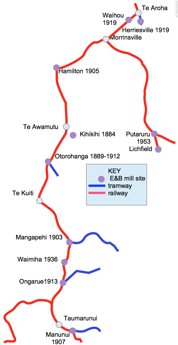
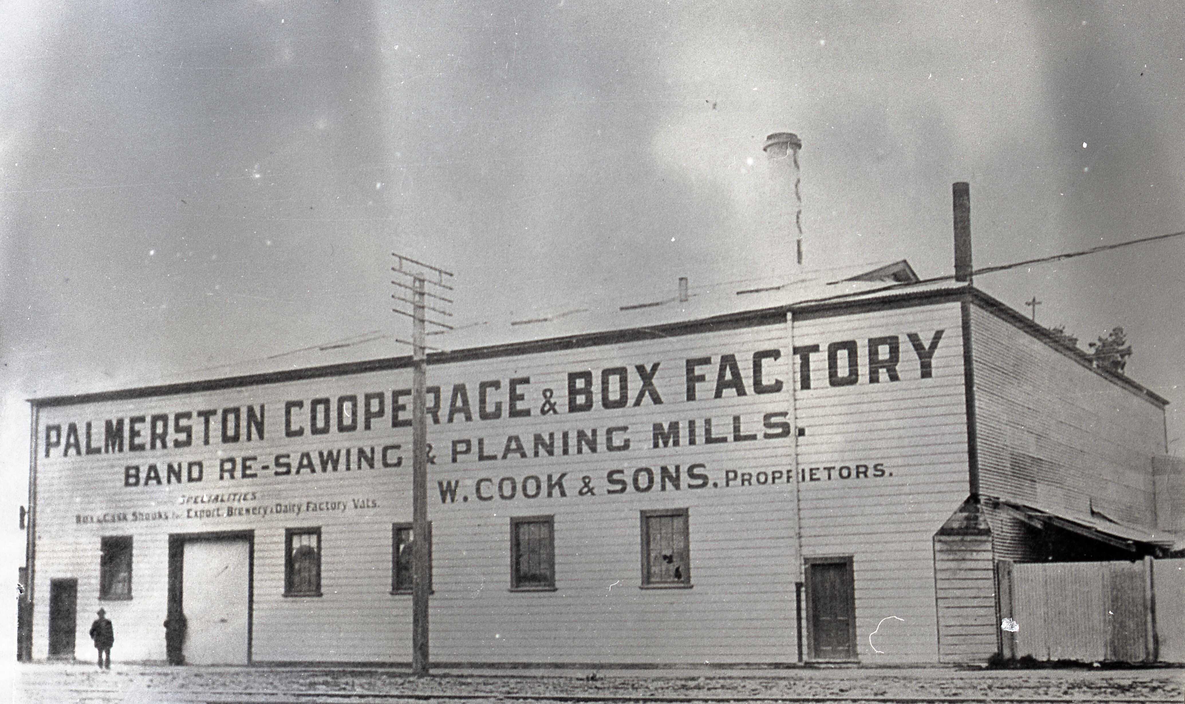
Ellis and Burnand was a New Zealand sawmilling and timber retailing company, formed by businessman John William Ellis and engineer Harry Burnand in 1891. Ellis and Burnand Ltd was incorporated in 1903. They were responsible for felling much of the native bush in the southern Waikato and northern Manawatu-Whanganui regions. Their operations expanded initially to supply the timber needs of the North Island Main Trunk railway as it was extended south. Once the railway opened, new mills were built to exploit previously hard to access areas. Fletcher Holdings bought the company in 1990, rebranding it as PlaceMakers. Ellis & Burnand's cutting sites were linked to their sawmills by bush tramways, one of which forms the southern end of the Timber Trail cycleway, opened in 2013. Origins Ellis's first venture into timber milling seems to have started at Ōrākau, near Kihikihi (where he ran a store) in 1884, though the sources differ on several dates in this period, some saying it ... [...More Info...] [...Related Items...] OR: [Wikipedia] [Google] [Baidu] |
Hamilton, New Zealand
Hamilton ( mi, Kirikiriroa) is an inland city in the North Island of New Zealand. Located on the banks of the Waikato River, it is the seat and most populous city of the Waikato region. With a territorial population of , it is the country's fourth most-populous city. Encompassing a land area of about , Hamilton is part of the wider Hamilton Urban Area, which also encompasses the nearby towns of Ngāruawāhia, Te Awamutu and Cambridge. In 2020, Hamilton was awarded the title of most beautiful large city in New Zealand. The area now covered by the city was originally the site of several Māori villages, including Kirikiriroa, from which the city takes its Māori name. By the time English settlers arrived, most of these villages, which sat beside the Waikato River, were abandoned as a result of the Invasion of Waikato and land confiscation (''Raupatu'') by the Crown. Initially an agricultural service centre, Hamilton now has a diverse economy and is the third fastest growing urba ... [...More Info...] [...Related Items...] OR: [Wikipedia] [Google] [Baidu] |
Te Awamutu
Te Awamutu is a town in the Waikato region in the North Island of New Zealand. It is the council seat of the Waipa District and serves as a service town for the farming communities which surround it. Te Awamutu is located some south of Hamilton on State Highway 3, one of the two main routes south from Auckland and Hamilton. Te Awamutu has a population of making it the fifth-largest urban area in the Waikato behind Hamilton, Taupō, Cambridge and Tokoroa. The town is often referred to as "The Rose Town of New Zealand" because of its elaborate rose gardens in the centre of the town. Many local businesses use "Rosetown" in their name, and the symbol of the rose is widely used on local signs and billboards. The local paper, ''Te Awamutu Courier'', has a symbol of a rose in the masthead on its front page. History and culture Tainui Maori first settled in the area in about 1450, according to noted Tainui historian Te Hurinui-Jones. Te Awamutu means "the river cut short", as it ... [...More Info...] [...Related Items...] OR: [Wikipedia] [Google] [Baidu] |
Manunui
Manunui (Māori ''manu'' ''nui'' or "big bird") is a small Whanganui River settlement, about east of Taumarunui on State Highway 4, in New Zealand's King Country. It was once known as Waimarino, but John Burnand of the Ellis and Burnand sawmilling firm renamed it Manunui around 1905. Manunui is the home of the Ngāti Hinemihi and Ngāti Manunui hapū of the iwi Ngāti Tūwharetoa. Their Maniaiti Marae and Te Aroha o Ngā Mātua Tūpuna meeting house also have affiliations with the Ngāti Hāua hapū of Ngāti Hekeāwai and Ngāti Hāua, and with the Ngāti Tūwharetoa. Another marae in the area, Matua Kore Marae and its Matua Kore meeting house, is affiliated with the Ngāti Hāua hapū of Ngāti Hāuaroa, Ngāti Hinewai and Ngāti Poutama. Ellis and Burnand opened a sawmill in Manunui in 1901, specialising in milling kahikatea to make boxes of its odourless wood for the butter export industry. After the North Island Main Trunk Railway reached the settlement in 1903, th ... [...More Info...] [...Related Items...] OR: [Wikipedia] [Google] [Baidu] |
Tāwhiao
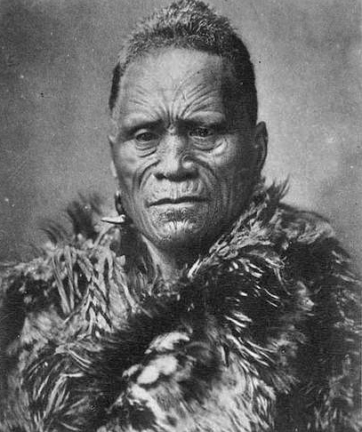
Tāwhiao (Tūkāroto Matutaera Pōtatau Te Wherowhero Tāwhiao; c. 1822 – 26 August 1894) was leader of the Waikato tribes, the second Māori King, and a religious figure. He was a member of the Ngati Mahuta (Hapū) of Waikato. Biography Tāwhiao's father, Te Wherowhero, was the leader of the Waikato people, and his mother, Whakaawi, was Te Wherowhero's senior wife. He was born around 1822. After the Waikato were defeated by musket-armed Ngāpuhi led by Hongi Hika in a battle at Matakitaki (Pirongia) in 1822, they retreated to Orongokoekoea Pā, in what is now the King Country, and lived there for several years. Tāwhiao was born at Orongokoekoea in about 1825 and was named Tūkāroto to commemorate, it is said, his father's stand at Matakitaki. Tūkāroto was later baptised Matutaera (Methuselah) by Anglican missionary Robert Burrows, but repudiated it in 1867. Te Ua Haumēne, the Hauhau prophet, gave him the name Tāwhiao in 1864. Tāwhiao was raised by his mother's pa ... [...More Info...] [...Related Items...] OR: [Wikipedia] [Google] [Baidu] |
Mangapehi Sawmill, Ellis And Burnand Ltd (21499027915)
''For the sawmill area of Mangapehi see Ellis and Burnand#Mangapehi'' The Mangapehi River is a river of the south Waikato region of New Zealand. It flows northwest from its sources near Benneydale, reaching the Mokau River southwest of Te Kuiti. The New Zealand Ministry for Culture and Heritage gives a translation of "stream of trouble" for ''Mangapēhi''. See also *List of rivers of New Zealand This is a list of all waterways named as rivers in New Zealand. A * Aan River * Acheron River (Canterbury) * Acheron River (Marlborough) * Ada River * Adams River * Ahaura River * Ahuriri River * Ahuroa River * Akatarawa River * Ākiti ... References Waitomo District Rivers of Waikato Rivers of New Zealand {{Waikato-river-stub ... [...More Info...] [...Related Items...] OR: [Wikipedia] [Google] [Baidu] |
Dacrydium Cupressinum
''Dacrydium cupressinum'', commonly known as rimu, is a large evergreen coniferous tree endemic to the forests of New Zealand. It is a member of the southern conifer group, the podocarps. The Māori name ''rimu'' comes from the Polynesian term ''limu'' which the tree's foliage were reminded of, ultimately from Proto-Austronesian *''limut'' meaning "moss". The former name "red pine" has fallen out of common use. Distribution Rimu grows throughout New Zealand, in the North Island, South Island and Stewart Island/Rakiura. This species is common in lowland and montane forest. Although the largest concentration of trees is now found on the West Coast of the South Island, the biggest trees tend to be in mixed podocarp forest near Taupō (e.g., Pureora, Waihaha, and Whirinaki Forests). A typical North Island habitat is in the Hamilton Ecological District, where '' Fuscospora truncata'' and rimu form the overstory. Associate ferns on the forest floor are ''Blechnum discolor'', ''Bl ... [...More Info...] [...Related Items...] OR: [Wikipedia] [Google] [Baidu] |
Dacrycarpus Dacrydioides
''Dacrycarpus dacrydioides'', commonly known as kahikatea (from Māori) and white pine, is a coniferous tree endemic to New Zealand. A podocarp, it is New Zealand's tallest tree, gaining heights of 60 m and a life span of 600 years. It was first described botanically by the French botanist Achille Richard in 1832 as ''Podocarpus'' ''dacrydioides'', and was given its current binomial name ''Dacrycarpus dacrydioides'' in 1969 by the American botanist David de Laubenfels. Analysis of DNA has confirmed its evolutionary relationship with other species in the genera ''Dacrycarpus'' and ''Dacrydium''. In traditional Māori culture, it is an important source of timber for the building of waka and making of tools, of food in the form of its berries, and of dye. When Europeans discovered it in the 18th century they found large remnant stands in both the North and South Islands, despite burning of forest by early Māori. Its use for timber and its damp fertile habitat, ideal for dairy ... [...More Info...] [...Related Items...] OR: [Wikipedia] [Google] [Baidu] |
The New Zealand Herald
''The New Zealand Herald'' is a daily newspaper published in Auckland, New Zealand, owned by New Zealand Media and Entertainment, and considered a newspaper of record for New Zealand. It has the largest newspaper circulation of all newspapers in New Zealand, peaking at over 200,000 copies in 2006, although circulation of the daily ''Herald'' had declined to 100,073 copies on average by September 2019. Its main circulation area is the Auckland region. It is also delivered to much of the upper North Island including Northland, Waikato and King Country. History ''The New Zealand Herald'' was founded by William Chisholm Wilson, and first published on 13 November 1863. Wilson had been a partner with John Williamson in the ''New Zealander'', but left to start a rival daily newspaper as he saw a business opportunity with Auckland's rapidly growing population. He had also split with Williamson because Wilson supported the war against the Māori (which the ''Herald'' termed "the ... [...More Info...] [...Related Items...] OR: [Wikipedia] [Google] [Baidu] |
Otorohanga Railway Station
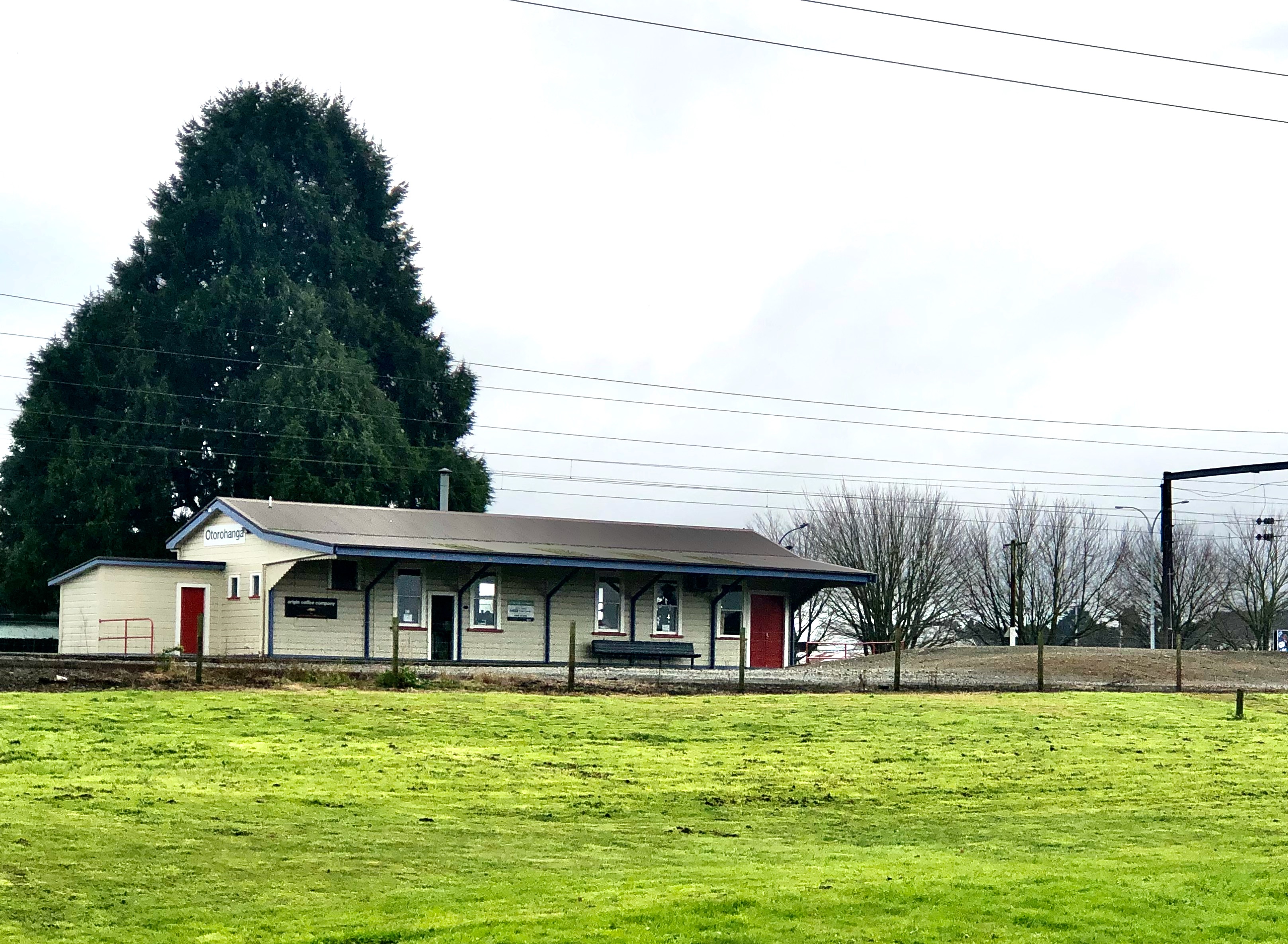
Otorohanga railway station serves the town of Ōtorohanga, on the North Island Main Trunk in New Zealand. The current station dates from 1924. Trains calling at Ōtorohanga included The Overlander, Blue Streak, Scenic Daylight, Daylight Limited, Northerner, Northern Explorer, and Night Limited. By 2012, passenger numbers had dropped to an average of two per train, which brought about a brief closure from 24 June. Initially the reinstatement was for summer only from 10 December. passenger services were suspended from December 2021.Currently passengers need to pre-book services to and from the station History Surveying to extend the railway from Te Awamutu to Ōtorohanga was started in 1883 by Charles Wilson Hursthouse. The first sod ceremony was performed at the Puniu River on 15 April 1885. Trains were working through to Ōtorohanga by January 1887, and the extension opened on 6, or 8 March 1887, though the line wasn't handed over from the Public Works Department to the ... [...More Info...] [...Related Items...] OR: [Wikipedia] [Google] [Baidu] |
Poro-O-Tarao Railway Station
Poro-O-Tarao (or Porootarao) was a Request stop, flag station on the North Island Main Trunk line, in the Waitomo District of New Zealand. Between the watersheds of the upper Mokau River, Mōkau and Whanganui River, Whanganui rivers, the NIMT enters Poro-O-Tarao tunnel under Tihikārearea hill, before descending the Ongarue River, Ōngarue valley. It was north of Waimiha and south of Mangapehi. For 2 years, from 1 April 1901 until the line to Taumarunui railway station, Taumarunui opened on 1 December 1903, Poro-O-Tarao was the terminus of the line from The Strand Station, Auckland, though the rails reached Poro-O-Tarao on 1 December 1896 and, from 18 January 1897, a weekly goods train ran through from Puketutu railway station, Puketutu. Work on the Mōkau station to Poro-O-Tarao tunnel section had started in September 1892. It was officially open for traffic on 21 December 1896. Work on the Ohinemoa section (Poro-O-Tarao tunnel to Te Kawakawa, south of Ongarue railway station, � ... [...More Info...] [...Related Items...] OR: [Wikipedia] [Google] [Baidu] |
Whanganui River
The Whanganui River is a major river in the North Island of New Zealand. It is the country's third-longest river, and has special status owing to its importance to the region's Māori people. In March 2017 it became the world's second natural resource (after Te Urewera) to be given its own legal identity, with the rights, duties and liabilities of a legal person. The Whanganui Treaty settlement brought the longest-running litigation in New Zealand history to an end. Geography With a length of , the Whanganui is the country's third-longest river. Much of the land to either side of the river's upper reaches is part of the Whanganui National Park, though the river itself is not part of the park. The river rises on the northern slopes of Mount Tongariro, one of the three active volcanoes of the central plateau, close to Lake Rotoaira. It flows to the north-west before turning south-west at Taumarunui. From here it runs through the rough, bush-clad hill country of the King Cou ... [...More Info...] [...Related Items...] OR: [Wikipedia] [Google] [Baidu] |
Ongarue River
The Ongarue River is a river of the Waikato and Manawatū-Whanganui regions of New Zealand's North Island. A major tributary of the Whanganui River, it flows west then south from its sources in the Hauhungaroa Range northwest of Lake Taupo, passing through the town of Taumarunui before reaching the Whanganui River. Tributaries of the Ongarue include the Maramataha River and the Mangakahu River See also *List of rivers of New Zealand This is a list of all waterways named as rivers in New Zealand. A * Aan River * Acheron River (Canterbury) * Acheron River (Marlborough) * Ada River * Adams River * Ahaura River * Ahuriri River * Ahuroa River * Akatarawa River * Ākiti ... References Rivers of Waikato Rivers of Manawatū-Whanganui Rivers of New Zealand {{ManawatuWanganui-river-stub ... [...More Info...] [...Related Items...] OR: [Wikipedia] [Google] [Baidu] |


.jpg)


_at_Staglands%2C_Akatarawa%2C_New_Zealand.jpg)