|
Electoral Wards Of Belfast
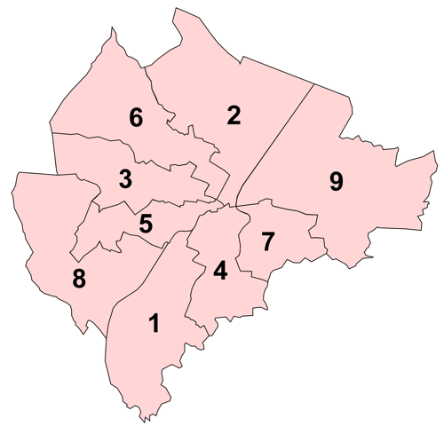
The electoral wards of Belfast are subdivisions of the city, used primarily for statistics and elections. Belfast had 51 wards from May 1973, which were revised in May 1985 and again in May 1993. The number of wards was increased to 60 with the 2014 changes in local government. Wards are the smallest administrative unit in Northern Ireland and are set by the Local Government Boundaries Commissioner and reviewed every 8–12 years. Wards are used to create constituencies for local government authorities, the Northern Ireland Assembly and the House of Commons of the United Kingdom. In elections to Belfast City Council, the 60 wards are split into ten District Electoral Areas, each of which contains between five and seven wards, with the number of councillors it elects equal to the number of wards it contains. The constituencies for elections to the House of Commons and the Assembly are coterminous and are created by amalgamating wards into larger areas, with the city's wards spli ... [...More Info...] [...Related Items...] OR: [Wikipedia] [Google] [Baidu] |
Subdivisions Of Belfast
The subdivisions of Belfast are a series of divisions of Belfast, Northern Ireland that are used for a variety of cultural, electoral, planning and residential purposes. The city is traditionally divided into four main areas based on the cardinal points of a compass, each of which form the basis of constituencies for general elections: North Belfast, East Belfast, South Belfast, and West Belfast. These four areas meet at Belfast City Centre. The second traditional divide is that formed by the River Lagan, with the northern bank of the River being part of County Antrim, while the southern bank is part of County Down. The city's subdivisions reflect the divided nature of Northern Ireland as a whole, with areas tending to be highly segregated, especially in working-class neighbourhoods. Walls known as peace lines, originally erected by the British Army after August 1969, divide fourteen inner city neighbourhoods. Townlands The townlands of Belfast are the oldest survivi ... [...More Info...] [...Related Items...] OR: [Wikipedia] [Google] [Baidu] |
Belfast North (Assembly Constituency)
Belfast North is a constituency in the Northern Ireland Assembly. It was first used for a Northern Ireland-only election in 1973, which elected the then Northern Ireland Assembly. It usually shares boundaries with the Belfast North UK Parliament constituency. However, the boundaries of the two constituencies were slightly different from 1973 to 1974, 1983 to 1986 and 2010 to 2011 (because the Assembly boundaries had not caught up with Parliamentary boundary changes) and from 1996 to 1997, when members of the Northern Ireland Forum had been elected from the newly drawn Parliamentary constituencies but the 51st Parliament of the United Kingdom, elected in 1992 under the 1983–95 constituency boundaries, was still in session. Members were then elected from the constituency to the 1975 Constitutional Convention, the 1982 Assembly, the 1996 Forum and then to the current Assembly from 1998. For further details of the history and boundaries of the constituency, see Belfast North ... [...More Info...] [...Related Items...] OR: [Wikipedia] [Google] [Baidu] |
Pottinger (District Electoral Area)
Pottinger was one of the nine district electoral areas (DEA) in Belfast, Northern Ireland from 1985 to 2014. Located in the east of the city, the district elected six members to Belfast City Council and contained the wards of Ballymacarrett, Bloomfield, Orangefield, Ravenhill, The Mount, and Woodstock. The name ''Pottinger'' is derived from Thomas Pottinger who was the first mayor of Belfast to be elected in the grant of a corporate charter to that town, in 1661. The wards of Ravenhill and Woodstock were part of the Belfast South constituencies for the Northern Ireland Assembly and UK Parliament, while the other four were part of the Belfast East Assembly and Parliamentary constituencies. The district was bounded to the west by the River Lagan and the Ormeau Road, to the north by the Newtownards Road, to the east by Greenville Park and North Road and the Borough of Castlereagh to the south. At the 2001 census the district had a Protestant majority, however there was also a l ... [...More Info...] [...Related Items...] OR: [Wikipedia] [Google] [Baidu] |
Pottinger DEA
Pottinger or Pöttinger may refer to: People ;Pottinger * Allison Pottinger (b. 1973), American curler * Damien Pottinger (b. 1982), Canadian professional soccer player * Don Pottinger (1919–1986), Scottish officer of arms and heraldic author * Doug Pottinger (b. 1973), American curler * Eldred Pottinger (1811–1843), Anglo-Indian soldier and diplomat * Frederick William Pottinger (1831–1865), Australian police inspector * George Pottinger (1916–1998), Scottish civil servant involved in the John Poulson scandal * Henry Pottinger (1789–1856), British soldier and first governor of Hong Kong * Henry Pottinger Stephens (1851–1903), English dramatist and journalist * Jay Pottinger (b. 1983), Canadian football linebacker * John Stanley Pottinger (b. 1940), American lawyer, banker, novelist * Julie Pottinger (b. 1970), American historical romance novelist * Matthew Pottinger (b. 1973), American journalist and U.S. Marine, son of John Stanley Pottinger * Rose Rita Pottinger, ... [...More Info...] [...Related Items...] OR: [Wikipedia] [Google] [Baidu] |
Oldpark (District Electoral Area)
Oldpark is one of the nine district electoral areas (DEA) in Belfast, Northern Ireland. Located in the North of the city, the district elects six members to Belfast City Council and contains the wards of Ardoyne; Ballysillan; Cliftonville; Legoniel; New Lodge and Water Works. Oldpark forms part of the Belfast North constituency for the Northern Ireland Assembly and UK Parliament. History The DEA was created for the 1985 local elections. Legoniel, Ballysillan and Ardoyne wards had previously been part of Area E, New Lodge and the southern half of the Waterworks ward had been in Area G, while Cliftonville and the northern half of Waterworks ward had been in Area H. Wards Councillors 2019 Elections 2014: 3 × Sinn Féin, 1 × SDLP, 1 × DUP, 1 × PUP 2019: 3 × Sinn Féin, 1 × SDLP, 1 × DUP, 1 × People Before Profit 2014-2019 Change: People Before Profit gain from PUP 2014 Elections 2014: 3 x Sinn Féin, 1 x DUP, 1 x SDLP, 1 x PUP ... [...More Info...] [...Related Items...] OR: [Wikipedia] [Google] [Baidu] |
Lower Falls (District Electoral Area)
Lower Falls was one of the nine district electoral areas which existed in Belfast, Northern Ireland from 1985 to 2014. Located in the west of the city, the district elected five members to Belfast City Council and contained the wards of Beechmount; Clonard; Falls; Upper Springfield; and Whiterock. Lower Falls formed part of the Belfast West constituencies for the Northern Ireland Assembly and UK Parliament. The district, along with the neighbouring Upper Falls district took its name from the Falls Road, one of the main arterial routes in the west of the city. History Lower Falls was created for the 1985 local elections. The Falls and Clonard wards had previously been in Area F, with the remaining wards part of Area D. It was abolished for the 2014 local elections. The Falls and Clonard wards joined the Court District Electoral Area, while the remaining wards became part of a new Black Mountain District Electoral Area. Wards Councillors 2011 Elections See also *Belfa ... [...More Info...] [...Related Items...] OR: [Wikipedia] [Google] [Baidu] |
Lower Falls DEA
Lower may refer to: *Lower (surname) *Lower Township, New Jersey *Lower Receiver (firearms) *Lower Wick Lower Wick is a small hamlet located in the county of Gloucestershire, England. It is situated about five miles south west of Dursley, eighteen miles southwest of Gloucester and fifteen miles northeast of Bristol. Lower Wick is within the civil ... Gloucestershire, England See also * Nizhny {{Disambiguation ... [...More Info...] [...Related Items...] OR: [Wikipedia] [Google] [Baidu] |
Laganbank (District Electoral Area)
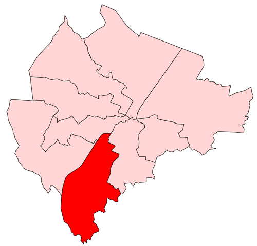
Laganbank was one of the Electoral wards of Belfast, nine district electoral areas in Belfast, Northern Ireland which existed from 1985 to 2014. Located in the south of the city, the district elected five members to Belfast City Council and contained the wards of Ballynafeigh, Botanic, Shaftesbury, Stranmillis, and Rosetta. Laganbank, along with neighbouring Balmoral (District Electoral Area), Balmoral, formed the greater part of the Belfast South constituencies for the Belfast South (Assembly constituency), Northern Ireland Assembly and Belfast South (UK Parliament constituency), UK Parliament. The district was bound to the west by the Malone Road and the M1 motorway (Northern Ireland), M1 Motorway, to the south by the River Lagan and the southern section of the Annadale Embankment, to the east by the Ormeau Park and the Ormeau Road and to the north by College Square North and the Cathedral Quarter, Belfast, Cathedral Quarter. The River Lagan, which gave the district its name, f ... [...More Info...] [...Related Items...] OR: [Wikipedia] [Google] [Baidu] |
Belfast West (UK Parliament Constituency)
Belfast West is a parliamentary constituency (seat) in the House of Commons of the UK Parliament. The current MP is Paul Maskey of Sinn Féin. In 2017, it ranked the most secure of Northern Ireland's 18 seats by percentage and/or numerical tally of its winning majority, followed by North Down and by North Antrim respectively. Boundaries 1885–1918: In the Borough of Belfast, Smithfield ward, that part of St. Anne's ward bounded on the north-west by a line drawn along the centre of Carrick Hill, that part of St. George's ward lying to the north of a line drawn along the centre of Grosvenor Street and west of a line drawn along the centre of Durham Street, and the townlands of Ballymagarry and Ballymurphy in the parish of Shankill. 1922–1974: The County Borough of Belfast wards of Court, Falls, St. Anne's, St. George's, Smithfield, and Woodvale. 1974–1983: The County Borough of Belfast wards of Court, Falls, St Anne's, St George's, Smithfield, and Woodvale, and the Rur ... [...More Info...] [...Related Items...] OR: [Wikipedia] [Google] [Baidu] |
Belfast West (Assembly Constituency)
Belfast West (, Ulster Scots: ''Bilfawst Wast'') is a constituency in the Northern Ireland Assembly. It was first used for a Northern Ireland-only election in 1973, which elected the then Northern Ireland Assembly. It usually shares boundaries with the Belfast West UK Parliament constituency. However, the boundaries of the two constituencies were slightly different from 1973 to 1974, 1983 to 1986 and 2010 to 2011 (because the Assembly boundaries had not caught up with Parliamentary boundary changes) and from 1996 to 1997, when members of the Northern Ireland Forum had been elected from the newly drawn Parliamentary constituencies but the 51st Parliament of the United Kingdom, elected in 1992 under the 1983–95 constituency boundaries, was still in session. Members were then elected from the constituency to the 1975 Constitutional Convention, the 1982 Assembly, the 1996 Forum and then to the current Assembly from 1998. For further details of the history and boundaries of t ... [...More Info...] [...Related Items...] OR: [Wikipedia] [Google] [Baidu] |


