|
El Vallecito
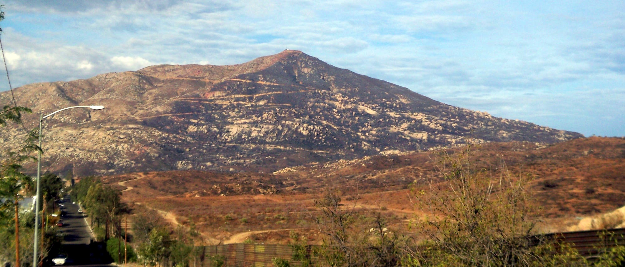
El Vallecito is an archaeological site located in the city of La Rumorosa, in the Tecate Municipality, Baja California, Mexico. It is believed that Baja California had human presence for thousands of years, however the available evidence indicates an occupation approximate from 8000 BCE. Some sites are more recent, it is estimated that they were developed in the last thousand years, though the engravings, more resistant to erosion, could be older. The site was inhabited by the Kumeyaay ethnic group whose territory comprised from Santo Tomas, Baja California, to the San Diego coast in California. The eastern region ranged from the Escondido, California, area up to the mountains and deserts in northern Baja California, including the area of Laguna Salada and part of the sierra Juarez known as La Rumorosa. This site has more than 18 sets of cave painting of which only six may be visited. The Vallecito is considered one of the most important of the region. There are several impo ... [...More Info...] [...Related Items...] OR: [Wikipedia] [Google] [Baidu] |
Extinct Language
An extinct language is a language that no longer has any speakers, especially if the language has no living descendants. In contrast, a dead language is one that is no longer the native language of any community, even if it is still in use, like Latin. A dormant language is a dead language that still serves as a symbol of ethnic identity to a particular group. These languages are often undergoing a process of revitalisation. Languages that currently have living native speakers are sometimes called modern languages to contrast them with dead languages, especially in educational contexts. In the modern period, languages have typically become extinct as a result of the process of cultural assimilation leading to language shift, and the gradual abandonment of a native language in favour of a foreign ''lingua franca'', largely those of European countries. As of the 2000s, a total of roughly 7,000 natively spoken languages existed worldwide. Most of these are minor languages in dang ... [...More Info...] [...Related Items...] OR: [Wikipedia] [Google] [Baidu] |
Jon Erlandson
Jon M. Erlandson is an archaeologist and Philip H. Knight Professor of Social Sciences in the Department of Anthropology at the University of Oregon, and the director of the University of Oregon Museum of Natural and Cultural History. Erlandson’s research interests include coastal adaptations, the peopling of North America, maritime archaeology and historical ecology and human impacts in coastal ecosystems. Education and background Erlandson received his B.A. in Physical Anthropology from the University of California, Santa Barbara in 1980. He then completed his M.A. and Ph.D. from the same university in Archaeology. Erlandson also is a founding co-editor of the Journal of Island and Coastal Archaeology. He has also published over 250 scholarly articles and has edited or written 18 books. In 2013, Erlandson was elected to the American Academy of Arts and Sciences. Erlandson was born in Santa Barbara, California and enjoyed many different water-based activities, including swimmi ... [...More Info...] [...Related Items...] OR: [Wikipedia] [Google] [Baidu] |
Ensenada, Baja California
Ensenada is a city in Ensenada Municipality, Baja California, situated on the Pacific Coast of Mexico. Located on the Bahía de Todos Santos, the city had a population of 279,765 in 2018, making it the third-largest city in Baja California. The city is an important international trade center and home to the Port of Ensenada, the second-busiest port in Mexico. Ensenada is a major tourist destination, owing to its warm Mediterranean climate and proximity to the Pacific Ocean, and is commonly known as ''La Cenicienta del Pacífico'' ("The Cinderella of the Pacific"). Ensenada was founded in 1882, when the small community of Rancho Ensenada de Todos Santos was made the regional capital for the northern partition of the Baja California Territory. The city grew significantly with the proliferation of mines in the surrounding mountains. While the Mexican Revolution curtailed much of Ensenada's expansion, the onset of Prohibition in the United States transformed the city into a popul ... [...More Info...] [...Related Items...] OR: [Wikipedia] [Google] [Baidu] |
Laguna Mountains
The Laguna Mountains are a mountain range of the Peninsular Ranges System in eastern San Diego County, southern California. The mountains run in a northwest/southeast alignment for approximately . The mountains have long been inhabited by the indigenous Kumeyaay people. Geography The Laguna Mountains are bordered by the Cuyamaca Mountains area on the west and the Colorado Desert on the east, where the mountains form a steep escarpment along the Laguna Salada Fault. To the north the Laguna Mountains are bounded by the Elsinore Fault Zone and to the south by Cameron Valley and Thing Valley. The highest point is Cuyapaipe Mountain at . The mountains are largely contained within the Cleveland National Forest. Snow falls on the highest peaks several times a year. Mount Laguna is a village in the Laguna Mountains with a population of about 80. The headwaters of three perennial streams begin in the Laguna Mountains: Noble Creek, Cottonwood Creek, and Kitchen Creek. The Laguna Moun ... [...More Info...] [...Related Items...] OR: [Wikipedia] [Google] [Baidu] |
Lake Henshaw
Lake Henshaw is a reservoir in San Diego County, California at the southeast base of Palomar Mountain, approximately northeast of San Diego, California and southeast of Los Angeles. The lake covers approximately and holds of water when full (lowered in 1978 from its original capacity of out of earthquake concerns), in addition to groundwater stored in its local basin. It drains an area of square miles at the source of the San Luis Rey River. The lake was constructed in 1923 with the building of Henshaw Dam, an earth dam tall and long. It is owned by the Vista Irrigation District and used primarily for agricultural irrigation. The lake features opportunities for catfish and carp fishing. Boats and cabins are available for rental. It hosts The Carp Throwdown fly fishing tournament organized by The Fly Stop. See also * List of dams and reservoirs in California *List of lakes in California There are more than 3,000 named lakes, reservoirs, and dry lakes in the U.S. sta ... [...More Info...] [...Related Items...] OR: [Wikipedia] [Google] [Baidu] |
Escondido, California
Escondido is a city in San Diego County, California, United States. Located in the North County region, it was incorporated in 1888, and is one of the oldest cities in San Diego County. It has a population of 151,038 as of the 2020 census. Etymology "Escondido" is a Spanish word meaning "hidden". One source says the name originally referred to ''agua escondida'' or hidden water; another says it meant "hidden treasure". The city is known as ''Eskondiid'' in Kumeyaay. History The Escondido area was first settled by the Luiseño, who established campsites and villages along the creek running through the area. They named the place Mixéelum Pompáwvo or "Mehel-om-pom-pavo." The Luiseno also had another village north of Mixéelum Pompáwvo called Panakare. The Kumeyaay migrated from areas near the Colorado River, settling both in the San Pasqual Valley and near the San Dieguito River in the southwestern and western portions of what is now Escondido. Most of the villages and campsi ... [...More Info...] [...Related Items...] OR: [Wikipedia] [Google] [Baidu] |
San Diego River
The San Diego River is a river in San Diego County, California. It originates in the Cuyamaca Mountains northwest of the town of Julian, then flows to the southwest until it reaches the El Capitan Reservoir, the largest reservoir in the river's watershed at . Below El Capitan Dam, the river runs west through Santee and San Diego. While passing through Tierrasanta it goes through Mission Trails Regional Park, one of the largest urban parks in America. It flows near the Mission San Diego de Alcalá. The river's valley downstream from there is known as Mission Valley for that reason. The valley forms a transportation corridor for Interstate 8 and for the San Diego Trolley Green Line. The river discharges into the Pacific Ocean near the entrance to Mission Bay, forming an estuary. History The river has changed its course several times in recorded history. Prior to 1821, the San Diego River usually entered San Diego Harbor. In the fall of 1821, however, a flood changed the ri ... [...More Info...] [...Related Items...] OR: [Wikipedia] [Google] [Baidu] |
Mexico
Mexico (Spanish: México), officially the United Mexican States, is a country in the southern portion of North America. It is bordered to the north by the United States; to the south and west by the Pacific Ocean; to the southeast by Guatemala, Belize, and the Caribbean Sea; and to the east by the Gulf of Mexico. Mexico covers ,Mexico ''''. . making it the world's 13th-largest country by are ... [...More Info...] [...Related Items...] OR: [Wikipedia] [Google] [Baidu] |
United States
The United States of America (U.S.A. or USA), commonly known as the United States (U.S. or US) or America, is a country primarily located in North America. It consists of 50 states, a federal district, five major unincorporated territories, nine Minor Outlying Islands, and 326 Indian reservations. The United States is also in free association with three Pacific Island sovereign states: the Federated States of Micronesia, the Marshall Islands, and the Republic of Palau. It is the world's third-largest country by both land and total area. It shares land borders with Canada to its north and with Mexico to its south and has maritime borders with the Bahamas, Cuba, Russia, and other nations. With a population of over 333 million, it is the most populous country in the Americas and the third most populous in the world. The national capital of the United States is Washington, D.C. and its most populous city and principal financial center is New York City. Paleo-Americ ... [...More Info...] [...Related Items...] OR: [Wikipedia] [Google] [Baidu] |
Native Americans In The United States
Native Americans, also known as American Indians, First Americans, Indigenous Americans, and other terms, are the Indigenous peoples of the mainland United States ( Indigenous peoples of Hawaii, Alaska and territories of the United States are generally known by other terms). There are 574 federally recognized tribes living within the US, about half of which are associated with Indian reservations. As defined by the United States Census, "Native Americans" are Indigenous tribes that are originally from the contiguous United States, along with Alaska Natives. Indigenous peoples of the United States who are not listed as American Indian or Alaska Native include Native Hawaiians, Samoan Americans, and the Chamorro people. The US Census groups these peoples as " Native Hawaiian and other Pacific Islanders". European colonization of the Americas, which began in 1492, resulted in a precipitous decline in Native American population because of new diseases, wars, ethni ... [...More Info...] [...Related Items...] OR: [Wikipedia] [Google] [Baidu] |


