|
Ekab
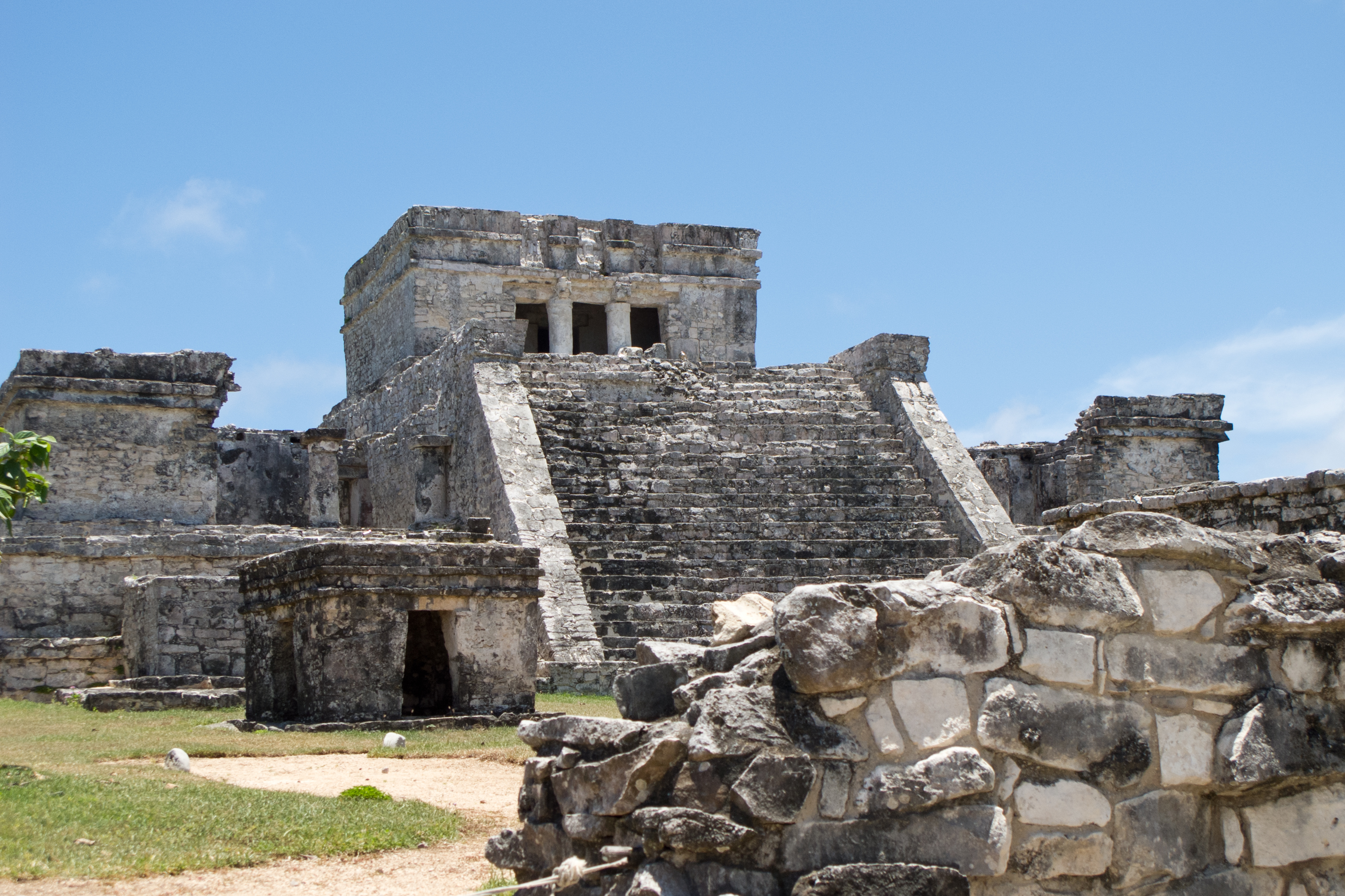
Ekab or Ecab was the name of a Mayan chiefdom of the northeastern Yucatán Peninsula, before the arrival of the Spanish conquistadors in the sixteenth century. In the fifteenth century most of Yucatán was controlled by the League of Mayapan. By 1441 there was civil unrest. The provinces of the League rebelled and formed sixteen smaller states. These states were called Kuchkabals. Most Kuchkabals were ruled by a Halach Uinik, but Ekab wasn't. It was divided up into several ''Batabil''. Each ''Batabil'' was ruled over by a leader called a ''Batab''. In Ekab the ''Batabs'' were supposed to have equal power, but the ''Batabs'' on Cozumel had much more power than the others. Religious importance The island Cozumel was a ''Batab'' of Ekab. Cozumel was an important religious area for the Maya. People traveled to Cozumel from as far away as Nicaragua and Michoacán. The island was sacred to the moon goddess, Ix Chel. Most of the pilgrims who traveled there were women. Ix Chel was also ... [...More Info...] [...Related Items...] OR: [Wikipedia] [Google] [Baidu] |
Kuchkabal
A ''kuchkabal'' ( , ''kuchkabalo'ob'', 'province'), also known as an ''ah kuch-kab'' or ''ah cuch-cab'', was a system of social and political organisation common to Maya polities of the Maya Lowlands, in the Yucatán Peninsula, during the Mesoamerican Postclassic. There were somewhere between 16 and 24 ''kuchkabalo'ob'' in the 16th century. ''Kuchkabal'' may also refer to a ruling family. Extent The ''kuchkabalo'ob'' were located in Maya Lowlands of the Yucatán Peninsula, bounded by a northwest-to-southeast trending crescent, stretching along the base of the Peninsula, from the Bay of Campeche to the Bay of Honduras. To the west, the ''kuchkabalo'ob'' bordered settlements of Chontal, Nahuatl, and Zoque speakers in eastern Tabasco, eastern Chiapas, and western Campeche (beyond Laguna de Terminos). To the southwest and south, they bordered settlements of Chol speakers in western Peten, northern Alta Verapaz, northern Izabal, northern Copan, northern Santa Bar ... [...More Info...] [...Related Items...] OR: [Wikipedia] [Google] [Baidu] |
Chikinchel
Chikinchel () was the name of a Mayan chiefdom of the northern coast of Yucatán, before the arrival of the Spanish conquistadors in the sixteenth century. Chauacá has also been used to refer to this province, but apparently it was the name of the main city. After the destruction of Mayapan (1441–1461), in the Yucatán Peninsula, it created rivalries among the Maya, and formed 16 separate jurisdictions, called Kuchkabals. In each Kuchkabal there was a Halach Uinik (), who was the chief with the most political, judicial, and militaristic authority and lived in a principal city considered the capital of the jurisdiction. Historical Dates and Territories It bordered the Tazes and Cupul in the south, Ah Kin Chel in the west, and Ekab in the east, which separated an area of swamps and, to the north, a large portion of the coast of the Yucatán Peninsula The Yucatán Peninsula (, also , ; es, Península de Yucatán ) is a large peninsula in southeastern Mexico and adjacent ... [...More Info...] [...Related Items...] OR: [Wikipedia] [Google] [Baidu] |
Isla Mujeres
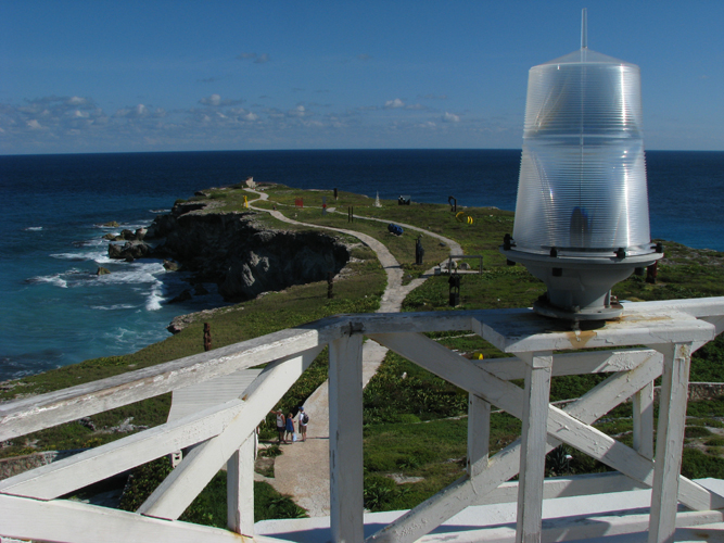
Isla Mujeres (, Spanish language, Spanish for "Women Island" (formally “Isla de Mujeres”) is an island where the Gulf of Mexico and the Caribbean Sea meet, about off the Yucatán Peninsula coast in the State of Quintana Roo, Mexico. It is approximately long and wide. To the east is the Caribbean Sea with a strong Ocean surface wave, surf and rock (geology), rocky coast, and to the west the skyline of Cancún can be seen across the waters. In the 2010 census, the namesake town on the island had a population of 12,642 inhabitants. The town is the seat of Isla Mujeres (municipality), Isla Mujeres Municipality. Very little violent crime has been reported on the island over its history, leading the island to gain a reputation for its relaxed nature, with the safety of both residents and tourists being unusually high. The biggest danger to the residents of the island has historically been the threat of tropical storms and hurricanes, some of which have caused devastating damage, ... [...More Info...] [...Related Items...] OR: [Wikipedia] [Google] [Baidu] |
Cochuah
Cochuah (also Kock Wah) (in the Mayan language: toponymic; ''K-'': our + ''Och'': food + ''Wah'': bread. "Our food of bread"?) is the name of one of the sixteen Mayan provinces into which the central Yucatán Peninsula was divided at the time of the arrival of the Spanish conquistadors in the sixteenth century. After the destruction of Mayapán (1441–1461), great rivalry between the Mayas started, and led to the formation of 16 independent jurisdictions called kuchkabal (in Mayan: province or region). In each kuchkabal there was a halach uinik (in Mayan: "real man"; "man in control") who was the chief with the biggest military, judicial and political authority, and who lived in the main city, considered to be the capital of the jurisdiction. Historical and territorial data The cacicazgo bordered with Cupul in the north, with Sotuta, Tutul Xiu and Chakán Putún in the west, and with Ekab and Uaymil in the east, according to the map made by Ralph L. Roys. Some authors, like ... [...More Info...] [...Related Items...] OR: [Wikipedia] [Google] [Baidu] |
Cupul
Cupul or Kupul, (Maya: ''Kupul'', 'toponímico; adjective') was the name of a Maya chiefdom at time of the Spanish conquest of Yucatán. Cupul was one of the most extensive and densely populated Maya provinces on the Yucatán Peninsula. It was formed in the mid-fifteenth century after the fall of Mayapan and reached its maximum power during the sixteenth century, at the time of their own Spanish conquest led by the ''adelantado'' Francisco de Montejo. According to the Encyclopedia Yucatán in time, the Mayan voice ku-pul, means ''that throws the bouncing'', giving a connotation referring to the Mayan ballplayers that existed in the region. Organization After the war between the Tutul Xiu and Cocom, the Yucatan Peninsula, broke up into 16 Kuchkabal Conflicts between Kuchkabal were common, especially between Tutul Xiu and Cocom. Normally each Kuchkabal had a capital where the ruler and supreme priest lived. The ruler was called a Halach Uinik . Each Kuckabal was divided into sever ... [...More Info...] [...Related Items...] OR: [Wikipedia] [Google] [Baidu] |
Smallpox
Smallpox was an infectious disease caused by variola virus (often called smallpox virus) which belongs to the genus Orthopoxvirus. The last naturally occurring case was diagnosed in October 1977, and the World Health Organization (WHO) certified the global eradication of the disease in 1980, making it the only human disease to be eradicated. The initial symptoms of the disease included fever and vomiting. This was followed by formation of ulcers in the mouth and a skin rash. Over a number of days, the skin rash turned into the characteristic fluid-filled blisters with a dent in the center. The bumps then scabbed over and fell off, leaving scars. The disease was spread between people or via contaminated objects. Prevention was achieved mainly through the smallpox vaccine. Once the disease had developed, certain antiviral medication may have helped. The risk of death was about 30%, with higher rates among babies. Often, those who survived had extensive scarring of their ... [...More Info...] [...Related Items...] OR: [Wikipedia] [Google] [Baidu] |
Aztec Empire
The Aztec Empire or the Triple Alliance ( nci, Ēxcān Tlahtōlōyān, Help:IPA/Nahuatl, [ˈjéːʃkaːn̥ t͡ɬaʔtoːˈlóːjaːn̥]) was an alliance of three Nahua peoples, Nahua altepetl, city-states: , , and . These three city-states ruled that area in and around the Valley of Mexico from 1428 until the combined forces of the Spanish and their native allies who ruled under defeated them in 1521. The alliance was formed from the victorious factions of a civil war fought between the city of and its former tributary provinces. Despite the initial conception of the empire as an alliance of three self-governed city-states, the capital became dominant militarily. By the time the Spanish arrived in 1519, the lands of the alliance were effectively ruled from , while other partners of the alliance had taken subsidiary roles. The alliance waged wars of conquest and expanded after its formation. The alliance controlled most of central Mexico at its height, as well as some more di ... [...More Info...] [...Related Items...] OR: [Wikipedia] [Google] [Baidu] |
Hernán Cortés
Hernán Cortés de Monroy y Pizarro Altamirano, 1st Marquess of the Valley of Oaxaca (; ; 1485 – December 2, 1547) was a Spanish ''conquistador'' who led an expedition that caused the fall of the Aztec Empire and brought large portions of what is now mainland Mexico under the rule of the King of Castile in the early 16th century. Cortés was part of the generation of Spanish explorers and conquistadors who began the first phase of the Spanish colonization of the Americas. Born in Medellín, Spain, to a family of lesser nobility, Cortés chose to pursue adventure and riches in the New World. He went to Hispaniola and later to Cuba, where he received an '' encomienda'' (the right to the labor of certain subjects). For a short time, he served as '' alcalde'' (magistrate) of the second Spanish town founded on the island. In 1519, he was elected captain of the third expedition to the mainland, which he partly funded. His enmity with the Governor of Cuba, Diego Velázquez de Cu ... [...More Info...] [...Related Items...] OR: [Wikipedia] [Google] [Baidu] |
Aztec Slavery
Slavery in the Aztec Empire and surrounding Mexica societies was widespread, with slaves known by the Nahuatl word, ''tlacotin.'' Slaves did not inherit their status; people were enslaved as a form of punishment, after capture in war, or voluntarily in order to pay off debts. Within Mexica society, slaves constituted an important class. Description Slavery was not a station one was born into, but a state entered into as a form of punishment, out of financial desperation, or as a captive. The practice consisted of two systems: * Slavery, in the strictest sense of the term * indentured servitude. Aztecs as slave owners Slave owners were required to provide food, water, and shelter for their slaves. Women slave owners exerted much in the way of choice, in regard to slaves. For example, if a woman was widowed, it was not uncommon for her to either remarry one of her husband's slaves, or make one of his slaves her personal steward. The richest merchants in Mexica society were slave ... [...More Info...] [...Related Items...] OR: [Wikipedia] [Google] [Baidu] |
Christopher Columbus
Christopher Columbus * lij, Cristoffa C(or)ombo * es, link=no, Cristóbal Colón * pt, Cristóvão Colombo * ca, Cristòfor (or ) * la, Christophorus Columbus. (; born between 25 August and 31 October 1451, died 20 May 1506) was an Italian explorer and navigator who completed Voyages of Christopher Columbus, four voyages across the Atlantic Ocean sponsored by the Catholic Monarchs of Spain, opening the way for the widespread European Age of Discovery, exploration and colonization of the Americas. His expeditions were the first known European contact with the Caribbean, Central America, and South America. The name ''Christopher Columbus'' is the anglicisation of the Latin . Scholars generally agree that Columbus was born in the Republic of Genoa and spoke a dialect of Ligurian (Romance language), Ligurian as his first language. He went to sea at a young age and travelled widely, as far north as the British Isles and as far south as what is now Ghana. He married Port ... [...More Info...] [...Related Items...] OR: [Wikipedia] [Google] [Baidu] |
Las Flores (archaeological Site)
Las Flores is an archaeological site pertaining to the Huastec civilization in the city of Tampico, Tamaulipas in Mexico. Background According to paleontological and archaeological records, the earliest settlements in Tamaulipas are dated to twelve thousand years before the Christian era, and are identified in the so-called "complex Devil", in allusion to a Canyon of the Sierra of Tamaulipas. Later, at the Tropic of cancer level, are the first manifestations of native civilization, linked to the discovery and domestication of corn and thus to the beginning of agricultural life and the grouping of permanent settlements. As a result, in this period began to appear manifestations of Mesoamerican cultures in this region. Before the arrival of the Spanish invaders, the Tamaulipas territory was occupied by various ethnic groups, one of them were the Wasteks. Américo Vespucio, famous Italian cartographer aftero whom the American continent was named, visited the Tamaulipas territory ... [...More Info...] [...Related Items...] OR: [Wikipedia] [Google] [Baidu] |
Xel-Ha
Xelha (, Spanish: Xelhá; sometimes pronounced "chel-ha"; Yucatec Maya: Xel-Há) is an archaeological site of the Maya civilization from pre-Columbian Mesoamerica, located on the eastern coastline of the Yucatán Peninsula, in the present-day state of Quintana Roo, Mexico. The etymology of the site's name comes from Yukatek Maya, combining the roots ''xel'' ("spring") and ''ha''' ("water"). The lagoon and inlet at Xelha has been turned into a commercial water theme park known as Xel-Ha Park. History The site of Xelha is located south of the modern township of Playa del Carmen, in the state of Quintana Roo, Mexico. The evidence is inconclusive concerning a founding date for Xel-Ha, but it was occupied by the 1st Century and active during Classic and Postclassic times, with most of the buildings being rebuilt in the Late Postclassic. It was probably not fully abandoned until the 19th Century. A stela with an Early Classic date of 9.6.10.0.0 (AD 564) from Xel-Ha was discove ... [...More Info...] [...Related Items...] OR: [Wikipedia] [Google] [Baidu] |


